The best hikes from bus stations around Regentalaue zwischen Cham und Pösing
4.5
(2707)
11,088
hikers
437
hikes
Hiking around Regentalaue zwischen Cham und Pösing offers routes through a unique floodplain landscape shaped by the Regen river. This area features a mosaic of ponds, wetlands, oxbow lakes, and riparian forests. The terrain is generally low-gradient, with subtle undulations and depressions, providing accessible paths for exploration. The region is recognized for its rich biodiversity, serving as a vital habitat for numerous bird species and diverse flora.
Best bus station hiking trails around Regentalaue zwischen Cham und Pösing
- The most…
Last updated: July 12, 2026
4.6
(21)
111
hikers
6.88km
01:45
10m
10m
Easy hike. Great for any fitness level. Easily-accessible paths. Suitable for all skill levels.
4.6
(43)
136
hikers
5.40km
01:23
20m
20m
Easy hike. Great for any fitness level. Easily-accessible paths. Suitable for all skill levels.

Sign up for free
4.4
(11)
42
hikers
6.55km
01:41
30m
30m
Easy hike. Great for any fitness level. Easily-accessible paths. Suitable for all skill levels.
4.3
(4)
22
hikers
9.97km
02:40
110m
120m
Moderate hike. Good fitness required. Easily-accessible paths. Suitable for all skill levels.
4.7
(15)
25
hikers
Moderate hike. Good fitness required. Easily-accessible paths. Suitable for all skill levels.
Get access to more routes and recommendations from other explorers.
Sign up for free
Already have an account?
Our route recommendations are based on thousands of hikes, rides, and runs completed by other people on komoot.
Start today with a free account
Your next adventure awaits.
Login or Signup
Popular around Regentalaue zwischen Cham und Pösing
Other adventures around Regentalaue zwischen Cham und Pösing

Tips from the Community

countless castles already hang there
0
0
recently there is also an ice cream parlor
0
0
The church on the market square is of Romanesque origin. Its foundations in massive rubble masonry and also the substructures of the towers date back to the 13th century. The northern tower was not completed, but connected to the town hall. The recessed choir was built between 1394 and 1411. The Gothic, twice-stepped buttresses have been preserved. The nave originally had six bays. In 1894/95 it was extended by two bays to the west. The three doors were created around 1700. On the south side of the choir, a life-size painting by the local painter Georg Achtelstetter depicts the church patron James the Elder.
0
0

Blue bridge with many locks from "Liebenfen", water management with beer garden right next to it
0
0

A lovely spot for a short or even a longer break. The tree provides cooling shade when needed.
2
0

Pilgrimage Chapel Streicherröhren To trace the history of this pilgrimage chapel, we come across an old hand-drawn map from around 1570, which is located in the Bavarian State Archives in Munich. On this map, a small wayside shrine is marked on the road between Untertraubenbach and Roding—a shrine that may have been the origin of the Streicherröhren pilgrimage site. According to tradition, the origin of the pilgrimage itself is attributed to a miracle that is said to have occurred in 1661. While this cannot be historically verified, we do know that in 1715 there was a wooden chapel in Streicherröhren, which was already visited by many pilgrims, and that votive tablets had been placed there decades earlier. The small pilgrimage evidently enjoyed considerable popularity, which also explains why it subsequently attracted opponents, particularly in Roding, who, due to their own pilgrimage to Heilbrünnl, viewed the development of Streicherröhren with envy. The parish priest of Roding complained in Regensburg about the "unauthorized gatherings" and "superstition" and was thus able to obtain permission, with the consent of the local landowner, to discontinue the pilgrimage. On his own initiative, he sent men to Streicherröhren, had the chapel dismantled, and the offerings, the miraculous image, and the votive tablets brought back to Roding. With the permission of Elector Max Emmanuel of Bavaria, the chapel was rebuilt, and a new miraculous image was presented in 1718. When the pilgrimage declined towards the end of the 18th century, a miraculous healing, confirmed by both ecclesiastical and secular authorities, helped to revive it. The chapel was renovated, and the miraculous image, previously painted on glass, was replaced with one on wood. During the 19th century, the chapel acquired its present form: Framed within a simple fieldstone structure, the miraculous image, a simple depiction of the Virgin Mary with the Christ Child as Queen, was placed behind a simple iron grille. Donated votive tablets and images, as well as candles and inscriptions inside the chapel, show us that Streicherröhren is still visited by many people seeking help and solace. Source: Excerpts from www.bayerischer-wald.de
3
0
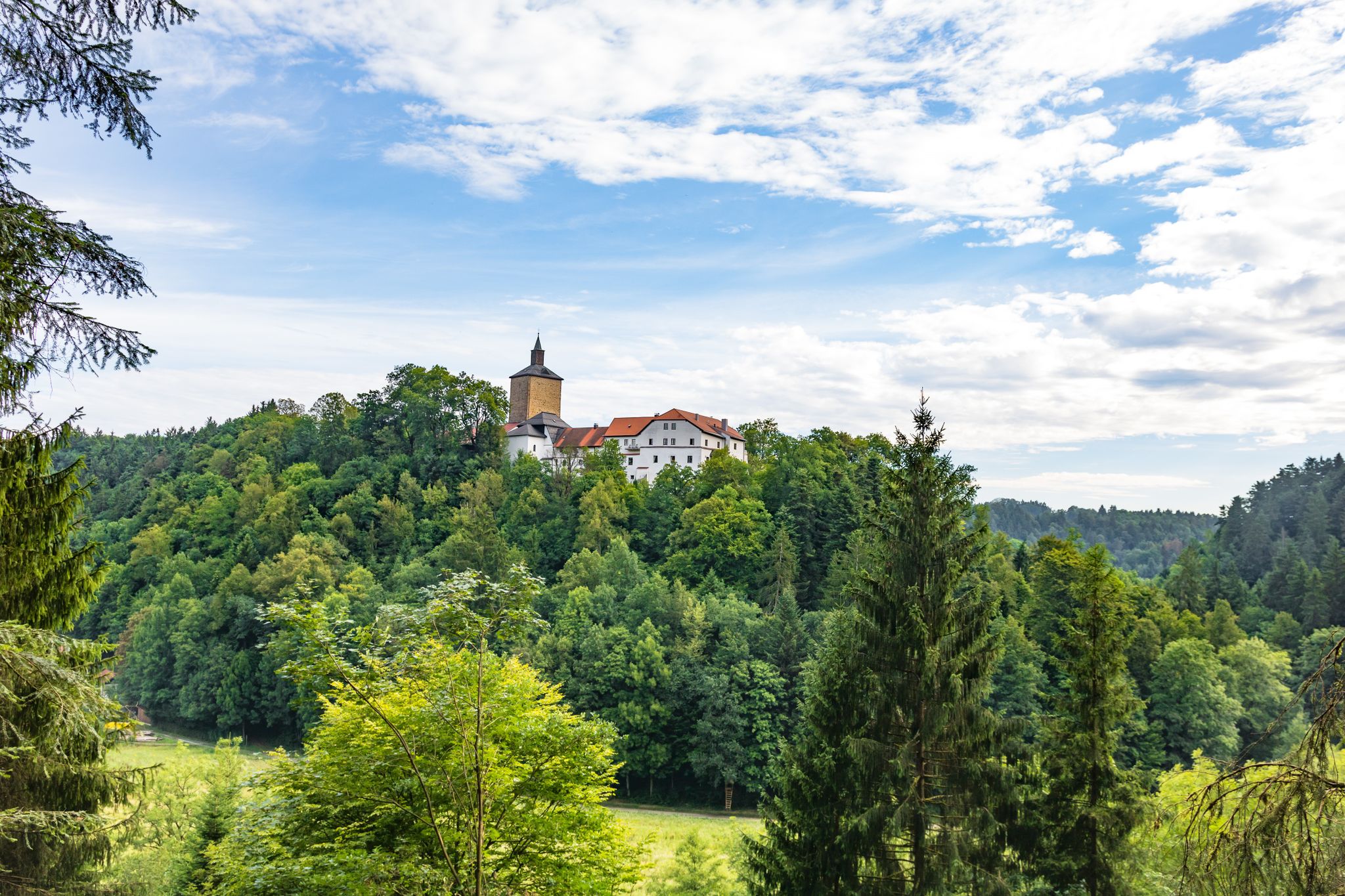
Wetterfeld Castle Ruins As early as 1118, Gottfried von Wetterfeld appears as an influential ministerialis (unfree knight) of the Diepoldings, the powerful Margraves of Cham and Vohburg. He seems to have maintained good relations with many monasteries, especially Reichenbach Abbey—no wonder, since Abbot Reginboto was his brother. Numerous donations to various monasteries by Gottfried are documented, a widespread practice among knights to secure their salvation. In a donation from 1155, Heinrich is even mentioned as an imperial ministerialis, which demonstrates the family's rapid political rise. In 1179, Karl and Heinrich "de Weterinfeld" appear, after which the family disappears from the historical record. It is not until 1268 that we hear of a Deinhardus, who is now subject to the Bavarian dukes; perhaps they lost their independence with the inheritance of the Hohenstaufen dynasty. From 1283 onward, the Wittelsbachs sent judges to Wetterfeld. Ducal ministeriales from the surrounding area succeeded in office: Hauzendorfer, Katzdorfer, Zenger, and others. In 1322, it was pledged to the Chamerau family. In 1329, Wetterfeld came under the control of the Palatine line of the Wittelsbachs, who also appointed judges. In 1410, it passed to the sub-principality of Neumarkt-Neunburg, with the Degenberger, Nothaft, and Zenger families, among others, serving as administrators. During the Hussite raids of 1428 and 1433, the castle was destroyed and subsequently rebuilt. A unique feature of Wetterfeld is the four "castle guards"—four legally independent building complexes within the castle, which were granted separately—making the ownership situation quite complex. In 1621, during the Thirty Years' War, the Upper Palatinate, including Wetterfeld, came under the rule of Duke Maximilian of Bavaria. Later in the war, Wetterfeld was destroyed twice by the Swedes and subsequently rebuilt. But the castle and its buildings continued to deteriorate, and the administrators increasingly relocated their offices outside the castle. In 1812, the administrative office was moved to Roding, the castle grounds were subdivided, and private houses were built over. Wetterfeld is a moated castle—a branch of the Regen River bordered the complex to the northeast. The still clearly visible, deep, walled moat could be filled with sluice gates in case of attack. Essentially, only the large gate tower, built of rubble stone with corner quoins, remains. Its upper, habitable floors make it a variation of the late medieval residential tower. Source: www.burgenseite.de
1
0
Frequently Asked Questions
How many bus station hiking trails are there in Regentalaue zwischen Cham und Pösing?
There are over 440 hiking routes in the Regentalaue region that are accessible from bus stations. This includes a wide variety of trails, with more than 270 classified as easy.
Are there easy hiking routes accessible by bus in Regentalaue?
Yes, the Regentalaue is known for its clear, easily accessible, and family-friendly trails. Many of the 270+ easy routes can be reached via public transport. For example, the Laichstätt – Rötelseeweiher Nature Reserve loop from Michelsdorf is an easy 6.8 km hike, perfect for a relaxed outing.
What is the best time of year to hike in Regentalaue zwischen Cham und Pösing?
The Regentalaue is beautiful year-round, but spring and autumn offer particularly pleasant conditions. However, it's important to note that during the breeding season from March to June, some paths may be temporarily closed to protect sensitive wildlife. Always check local signage and stay on designated paths.
Are there circular walks available from bus stations in the Regentalaue?
Yes, many of the trails accessible by bus are circular routes, allowing you to start and end your hike at the same point. An example is the St. James Parish Church, Cham – Cham Market Square loop from Cham, which is an easy 5.4 km circular hike.
Are the bus-accessible trails in Regentalaue suitable for families?
Absolutely. The Regentalaue offers many family-friendly hiking trails, characterized by their low gradient and easy accessibility. These routes often pass by interesting natural features and historical landmarks, making them engaging for all ages. The nature trails, especially, are designed for educational family outings.
Can I bring my dog on bus-accessible hikes in Regentalaue?
Yes, you can bring your dog on most trails. However, to ensure the protection of the sensitive wildlife, especially during the breeding season (March to June), it is crucial to keep dogs on a leash at all times and remain on designated paths.
What kind of wildlife can I expect to see on hikes from bus stops in Regentalaue?
The Regentalaue is a 'treasure chest of biodiversity,' making it an excellent spot for wildlife observation. You might spot numerous waterfowl and meadow bird species, including rare birds like the Great Snipe, Curlew, and Lapwing. The area is also home to a wide variety of amphibians and insects, particularly around the many small water bodies.
Are there any interesting landmarks or viewpoints along the bus-accessible trails?
Yes, several trails offer access to notable landmarks and viewpoints. You can visit the Untertraubenbach Observation Tower, which provides panoramic views of the floodplain. Historical sites like the Catholic Church of St. Martin in Untertraubenbach and the Siebenfelder-Gewölbebrücke are also often encountered on routes.
What are the unique natural features of the Regentalaue that I can explore on these trails?
The Regentalaue is characterized by its dynamic riverine landscape, featuring a mosaic of ponds, wetlands, oxbow lakes, and silting zones. You can explore the Rötelseeweiher Nature Reserve, a system of ponds vital for aquatic diversity, and experience the unique floodplain grasslands with their subtle undulations and depressions.
How long are typical hikes accessible from bus stations in Regentalaue?
Hikes accessible from bus stations in the Regentalaue vary in length. Many popular routes range from 5 to 10 kilometers. For instance, the Cham Market Square – Biertor, Cham loop from Cham is about 6.5 km, while the Rötelseeweiher Nature Reserve – Leichstätt loop from Michelsdorf is a moderate 9.8 km.
What do other hikers enjoy the most about hiking in Regentalaue zwischen Cham und Pösing?
The area is highly rated by the komoot community, with an average score of 4.5 stars. Reviewers often praise the serene natural beauty, the rich biodiversity, and the well-maintained, accessible trails that make exploring the unique floodplain landscape a delight.
Are there nature trails for learning about the local environment?
Yes, the Regentalaue features dedicated nature trails designed to educate visitors about its nationally important meadow breeder area. A newer trail with a bird observation station was established at the Großer Rötelseeweiher, offering excellent opportunities to learn about and observe the diverse birdlife.
Most popular routes around Regentalaue zwischen Cham und Pösing
Most popular attractions around Regentalaue zwischen Cham und Pösing

Get inspired with the komoot mobile app


Explore more
Browse the best Hikes in other regions.
