The best traffic-free bike rides in the Mollogon Rim
4.8
(4)
56
riders
9
rides
Gravel biking in the Mollogon Rim offers diverse terrain across a dramatic 200-mile escarpment. This region features significant elevation changes, ranging from 5,000 to 8,000 feet, providing both challenging climbs and panoramic views. Extensive Ponderosa pine forests offer shaded routes, while the landscape transitions from higher elevations to the White Mountains and Sonoran Desert, presenting a variety of riding surfaces including dirt roads and rugged trails. The area also includes pristine mountain lakes and geological formations, creating varied backdrops for…
Last updated: July 12, 2026
16
riders
Moderate gravel ride. Good fitness required. Mostly paved surfaces. Suitable for all skill levels.
4.8
(4)
15
riders
18.3km
01:33
130m
130m
Hard gravel ride. Great for any fitness level. You may need to push your bike for some segments of this route.

Sign up for free
7
riders
Moderate gravel ride. Good fitness required. Mostly paved surfaces. Suitable for all skill levels.
6
riders
Moderate gravel ride. Good fitness required. Mostly paved surfaces. Suitable for all skill levels.
3
riders
75.4km
05:53
750m
760m
Hard gravel ride. Very good fitness required. Mostly paved surfaces. Suitable for all skill levels.
Get access to more routes and recommendations from other explorers.
Sign up for free
Already have an account?
Our route recommendations are based on thousands of hikes, rides, and runs completed by other people on komoot.
Start today with a free account
Your next adventure awaits.
Login or Signup
Popular around Mollogon Rim

Grand Enchantment Trail — Slot canyons, spruce peaks & desert solitude

Arizona Trail — A beautiful 800-mile struggle

Bikepack in America's southwest – deserts, cacti and Anasazi culture

The Arizona Trail — From Mexico to Utah in 43 days

Highline National Recreation Trail – The High Road around the Mogollon Rim

Historic Route 66 – curiosities, selfie spots and diners

MTB in cactus country – technical delicacies around Phoenix
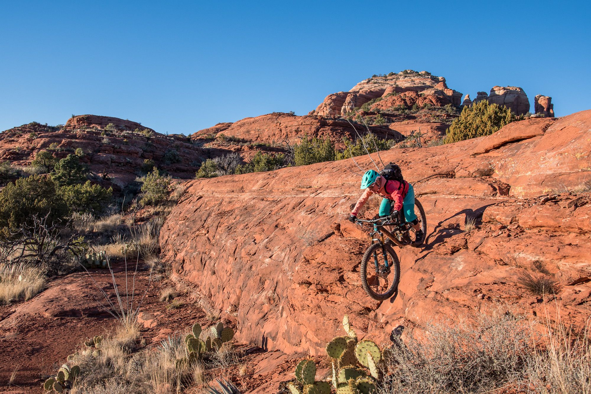
Shred the Red – Mountain biking in Sedona’s MTB hotspot

Traffic-free bike rides in the Mollogon Rim

Traffic-free bike rides in the Mollogon Rim
Other adventures in the Mollogon Rim


Tips from the Community

Fun and smooth, the trail has lots of grip and generally rolls really fast. Perfect for almost all levels of riders with a few little rocky challenges to keep you on your toes.
0
0
The trail is fast rolling and generally you will find plenty of grip everywhere!
0
0

Maverick Trail is one of the smoother paths in the trail system and has a lot of open straightaways where you can pick up speed. Make sure to control your bike before you get to the few turns and blind bends because this trail is also open to foot traffic.
1
0

This is a fairly easy trail situated in the Granite Mountain Preserve. Along the way, you'll have the opportunity to appreciate desert vegetation, including cacti and wildflowers.
0
0

The Latigo Trail is a relatively flat easy trail with a few little hills and bumps to keep things interesting. However, the incredible desert scenery will keep you interested as you ride under the blue skies.
1
0

Reaching the top of South Cat Peak above Apache Junction treats mountain bikers to serene desert panoramas after a moderate ride up the trail. Challenge yourself pedaling over rocky inclines before stopping at a peaceful summit bench to soak in 360 degree views. It's an easy trail most of the way with rewarding vistas at the top.
0
0

The Levee Trail follows the south side of the Pass Mountain Diversion Channel. It is a long, flat gravel ride with great views and gives the rider a feeling of the wilderness around Phoenix.
1
0
Here is a great view of Superstition Mountain. Look for the mountain's two major peaks: Superstition Peak or "Peak 5057" at an elevation of 5,059 feet (1,542 m) Flatiron Peak or "Peak 5024" at an elevation of 5,024 feet (1,531 m)
0
0
Frequently Asked Questions
How many no-traffic gravel bike trails are available in the Mogollon Rim?
The Mogollon Rim offers a selection of 8 dedicated no-traffic gravel bike trails, ranging from easy to difficult. These routes are designed to provide a serene riding experience away from vehicular traffic.
What kind of terrain can I expect on these no-traffic gravel trails?
You'll encounter a diverse range of surfaces, from well-maintained dirt roads and rugged, rocky trails to some smoother sections. The region is characterized by extensive Ponderosa pine forests, providing shaded routes, and dramatic elevation changes with panoramic views. Forest Road 300, also known as Rim Road, is a prominent example of a dirt road offering iconic gravel riding.
What is the best time of year for gravel biking in the Mogollon Rim?
The Mogollon Rim offers a cooler escape from the Arizona desert heat, making spring and fall ideal for gravel biking. Summer can also be pleasant due to the higher elevation and pine forests, but it's wise to check for monsoon season weather patterns. Winter riding is possible but requires checking trail conditions for snow and ice.
How challenging are the no-traffic gravel bike trails in the Mogollon Rim?
The trails cater to various skill levels. Out of the 8 available routes, 2 are rated as easy, 3 as moderate, and 3 as difficult. For instance, the Balanced Rock – Balanced Rock loop from Fraesfield Mountain Trailhead is an easy option, while the Double Springs Campground – Old Railroad Track loop from Kachina Village presents a more difficult challenge.
Are there family-friendly no-traffic gravel routes in the Mogollon Rim?
Yes, there are options suitable for families. The easier routes, such as the Balanced Rock – Balanced Rock loop from Fraesfield Mountain Trailhead, offer less elevation gain and shorter distances, making them more accessible for riders of varying ages and abilities.
What kind of views or natural features can I expect on these trails?
Prepare for breathtaking vistas and diverse natural beauty. You'll encounter dramatic 2,000-foot-high cliff faces, expansive pine forests, and pristine mountain lakes like Woods Canyon Lake. Geological wonders, including limestone and sandstone cliffs, provide unique backdrops for your rides. Many routes offer panoramic views that stretch for miles.
Are there any specific landmarks or attractions along these routes?
While riding, you might pass by or be near several notable attractions. Keep an eye out for natural monuments like Coffee Pot Rock or viewpoints such as Baby Bell Rock. The region also features unique caves like Subway Cave and Ruins — Boynton Canyon, though these might require a short detour from the main gravel paths.
Where can I park my car to access these no-traffic gravel trails?
Many of the trailheads for these routes offer designated parking areas. For example, the Balanced Rock loop starts from Fraesfield Mountain Trailhead, which typically has parking facilities. It's always recommended to check specific route details for precise parking information.
Is public transport an option to reach the no-traffic gravel biking areas?
Public transport options directly to the more remote gravel biking trailheads in the Mogollon Rim are generally limited. Most visitors access these areas by car, especially given the expansive and natural setting of the region. Planning for personal vehicle transport is usually the most practical approach.
What do other gravel bikers enjoy the most about gravel biking in the Mogollon Rim?
The area is highly rated by the komoot community, with an average score of 4.75 stars. Reviewers often praise the stunning panoramic views, the peacefulness of riding away from traffic, and the diverse terrain that keeps rides interesting. The cooler temperatures provided by the extensive pine forests are also frequently highlighted as a major benefit.
Are there any circular no-traffic gravel routes available?
Yes, several routes are designed as loops, allowing you to start and end at the same point. Examples include the Levee Trail – County Line Trail loop from Usery Mountain Regional Park and the View of Red Mountain loop from Schlechts Butte, providing convenient options for your ride.
Can I bring my dog on these gravel trails?
Many outdoor areas in the Mogollon Rim are dog-friendly, especially on forest roads and designated trails. However, it's crucial to check specific trail regulations and local signage for any restrictions, particularly within certain parks or protected areas. Always keep your dog leashed and practice Leave No Trace principles.
Most popular routes in the Mollogon Rim
Most popular attractions in the Mollogon Rim

Get inspired with the komoot mobile app


Explore more
Browse the best Gravel rides in other regions.
