The best hikes from bus stations in the Mollogon Rim
4.7
(1487)
17,848
hikers
10
hikes
Bus station hiking trails in the Mollogon Rim offer access to a diverse landscape characterized by a dramatic escarpment, extensive Ponderosa pine forests, and numerous cool mountain lakes. This region marks the southern edge of the Colorado Plateau, featuring panoramic cliffs that provide expansive views. The terrain includes sedimentary, volcanic, and metamorphic rock formations, with elevations that transition from desert to higher plateaus.
Best bus station hiking trails in the Mollogon Rim
- The most popular bus station hiking route is…
Last updated: July 8, 2026
11
hikers
Easy hike. Great for any fitness level. Easily-accessible paths. Suitable for all skill levels.
9
hikers
Moderate hike. Good fitness required. Easily-accessible paths. Suitable for all skill levels.

Sign up for free
5.0
(1)
6
hikers
9.31km
02:31
130m
130m
Moderate hike. Good fitness required. Easily-accessible paths. Suitable for all skill levels.
7
hikers
7.43km
02:04
140m
140m
Moderate hike. Good fitness required. Easily-accessible paths. Suitable for all skill levels.
10
hikers
14.5km
04:13
270m
270m
Hard hike. Good fitness required. Sure-footedness, sturdy shoes and alpine experience required.
Get access to more routes and recommendations from other explorers.
Sign up for free
Already have an account?
Our route recommendations are based on thousands of hikes, rides, and runs completed by other people on komoot.
Start today with a free account
Your next adventure awaits.
Login or Signup
Popular around Mollogon Rim

Grand Enchantment Trail — Slot canyons, spruce peaks & desert solitude

The Arizona Trail — From Mexico to Utah in 43 days

Highline National Recreation Trail – The High Road around the Mogollon Rim

Historic Route 66 – curiosities, selfie spots and diners

Arizona Trail — A beautiful 800-mile struggle

Bikepack in America's southwest – deserts, cacti and Anasazi culture

MTB in cactus country – technical delicacies around Phoenix
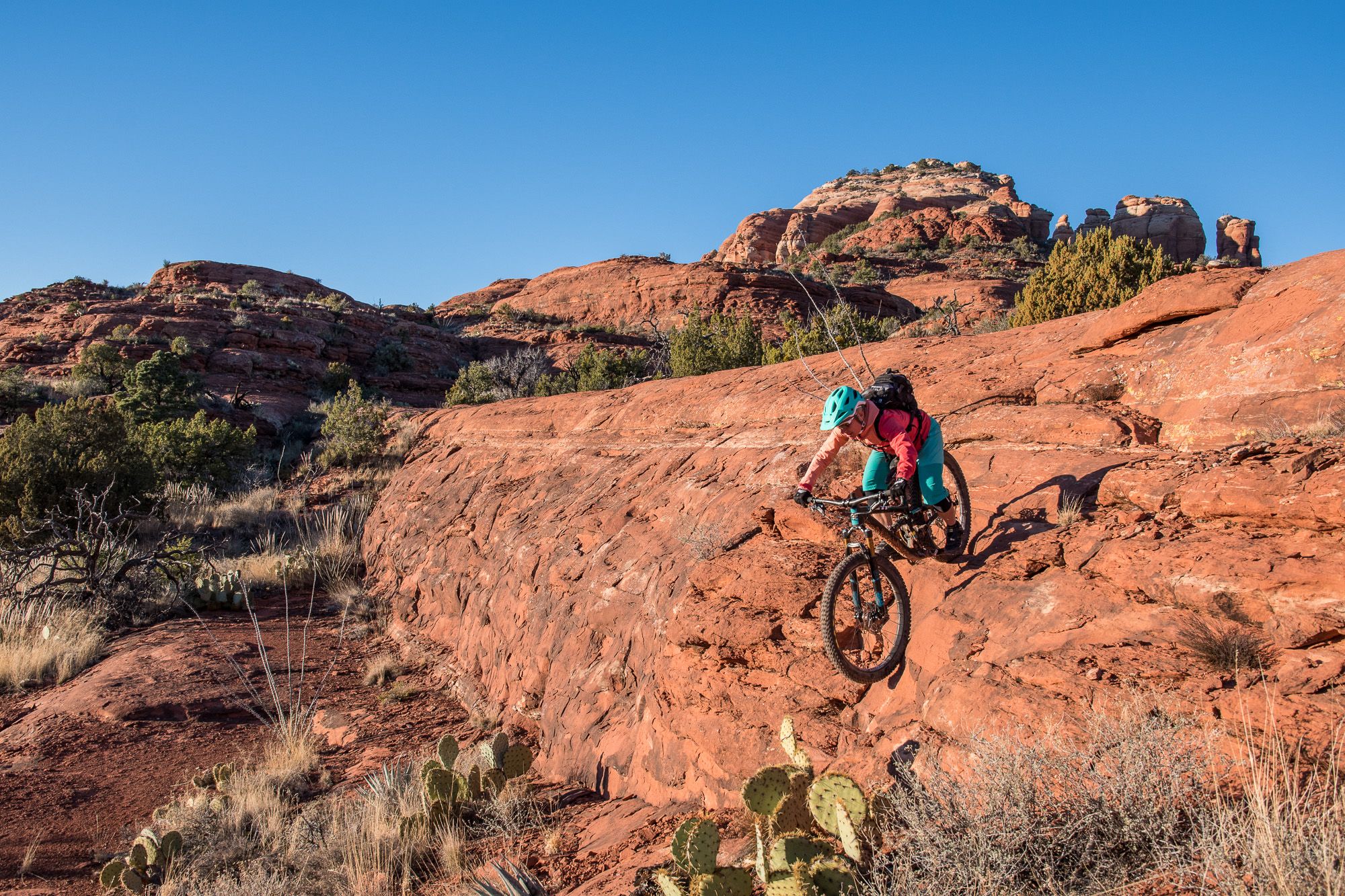
Shred the Red – Mountain biking in Sedona’s MTB hotspot
Other adventures in the Mollogon Rim


Tips from the Community

Spectacular views requiring only a brief hike either from Chapel Rd or Little Horse trailhead parking areas. Visit early though due to limited parking.
1
0

I recommend doing this summit to watch the sunrise, enjoying a 360-degree panorama. About thirty minutes from the Surgarloaf trailhead, bring a headlamp and go up when it is dark, because the show starts at first light, symphonies of color. A must do if you are staying in Sedona.
0
0

The Sunrise Trail is the most popular path within Posse Grounds Park and is a common trail for local hikers and trail runners. As the name suggests it's a great trail for viewing the sunrise, and it's pretty flat so it's a fairly easy trail to run for trail running beginners and veterans alike.
0
0
If passing by this area on your run, be sure to pause and check out this huge depression in the earth! There are no guardrails from the drop off areas so be sure to use caution and not get too close.
0
0
The trail up Sugarloaf Summit is one of the most popular trails in Sedona. The views from the top stretch out over Sedona and the Munds Mountain Wilderness off in the distance.
0
0

Rejoining the trail from this spur, hikers can get a full view of the rock formation that Snoopy Rock is a part of.
0
0
Hikers can see various angles of Snoopy Rock from this trail. This rock gets its name from its resemblance to Snoopy, the dog from the Peanuts, when he lays on his dog house. There are a few different spurs to climb the rock from this area of the trail.
0
0
In this spot and along various points in the trail, hikers get different points of view of East Twin Butte and other red rock formations and mountains. This area is very popular for jeep tours, so make sure to stay aware of your surroundings as you take in the views.
0
0
Frequently Asked Questions
How many bus station hiking trails are available in the Mogollon Rim region?
There are 11 hiking routes accessible from bus stations in the Mogollon Rim. These trails offer a range of experiences, from easy strolls to more challenging treks, allowing you to explore the region's stunning landscapes without needing a car.
What types of landscapes can I expect to see on bus-accessible hikes in the Mogollon Rim?
The Mogollon Rim is known for its dramatic and diverse landscapes. You can expect to encounter panoramic cliffs with breathtaking vistas, dense Ponderosa pine forests, and cool mountain streams. The region marks the southern edge of the Colorado Plateau, offering unique geological formations and diverse ecosystems.
Are there any easy, family-friendly hikes accessible by bus in the Mogollon Rim?
Yes, there are easy routes perfect for families. For instance, the Views of the entire Snoopy formation – Views of Snoopy Rock loop from Sedona is an easy 3.1 km hike, offering scenic views without significant elevation gain. These trails are generally well-suited for all ages and fitness levels.
Can I find circular hiking routes from bus stations in the Mogollon Rim?
Absolutely. Many of the bus-accessible trails are circular, allowing you to start and end at the same point. An example is the Huckaby Trail – Huckaby Trail loop from Sedona, a moderate 8.8 km loop that provides a varied hiking experience.
What are some notable natural features or landmarks I might see on these trails?
The Mogollon Rim offers many natural wonders. On your hikes, you might encounter impressive geological formations like the Devil's Kitchen Sinkhole, which is part of the Teacup Trail loop. The region itself, the Mogollon Rim, is a significant natural monument with stunning viewpoints.
Are there any caves or historical sites accessible near bus-friendly hiking routes?
Yes, the region is rich in both natural caves and historical significance. You can explore highlights such as the Soldier Pass Cave or the Subway Cave and Ruins — Boynton Canyon. Additionally, the Tonto National Monument offers a glimpse into ancient Native American history.
What is the best time of year to hike the bus-accessible trails in the Mogollon Rim?
The Mogollon Rim is particularly appealing during Arizona's hot summers due to its lush and cool environment provided by dense pine forests and mountain lakes. Spring and fall also offer pleasant temperatures and vibrant scenery, making them excellent seasons for hiking.
What kind of wildlife might I see while hiking in the Mogollon Rim?
The diverse ecosystems of the Mogollon Rim support a variety of wildlife. Hikers often have the chance to spot elk, mule deer, and wild turkey. Birdwatchers might also be lucky enough to see bald eagles, especially near the region's lakes and streams.
Are there any challenging long-distance hikes accessible from bus stops?
For experienced hikers seeking a challenge, the region offers more demanding routes. The View of Painted Dome – Merry-Go-Round loop from Sedona is a difficult 26.2 km hike with significant elevation gain, providing a strenuous but rewarding experience with expansive views.
What do other hikers enjoy most about the bus-accessible trails in the Mogollon Rim?
The bus-accessible trails in the Mogollon Rim are highly rated by the komoot community, with an average score of 4.7 stars from over 1500 ratings. Reviewers often praise the stunning panoramic views, the refreshing shade of the pine forests, and the accessibility of these diverse routes via public transport.
Are there any trails that lead to prominent viewpoints or summits?
Yes, several trails offer fantastic viewpoints. For example, the Sugarloaf Summit loop from Rodeo & Shelby (Safeway) is a moderate 7.1 km hike that takes you to a summit with rewarding panoramic vistas of the surrounding landscape.
Most popular routes in the Mollogon Rim
Most popular attractions in the Mollogon Rim

Get inspired with the komoot mobile app


Explore more
Browse the best Hikes in other regions.
