The 20 Most Amazing Peaks around Pragelato
Best mountain peaks around Pragelato are situated in the Italian Alps, offering a diverse range of experiences. The region is characterized by its majestic peaks, many exceeding 2,800 meters in elevation. This area provides opportunities for challenging hikes, historical exploration, and extensive skiing. Pragelato's mountainous landscape contributes to its reputation as a significant outdoor destination.
Best mountain peaks around Pragelato
- The most popular mountain peaks is Fort Gran Serin, a historical site that was a former military fortress built…
Last updated: August 16, 2026
Blegier Pass
Highlight • Mountain Pass
Translated by Google •
Tip by

Testa dell'Assietta Monument
Highlight • Monument
Translated by Google •
Tip by

Sign up now to discover places like this
Get recommendations on the best single tracks, peaks, & plenty of other exciting outdoor places.
Sign up for free
Fort Gran Serin
Highlight • Historical Site
Translated by Google •
Tip by

Col Basset
Highlight • Mountain Pass
Translated by Google •
Tip by

Monte Albergian Summit
Highlight • Summit
Translated by Google •
Tip by

Sign up for free to discover even more peaks around Pragelato.
Sign up for free
Already have an account?
Start today with a free account
Your next adventure awaits.
Login or Signup


Tips from the Community

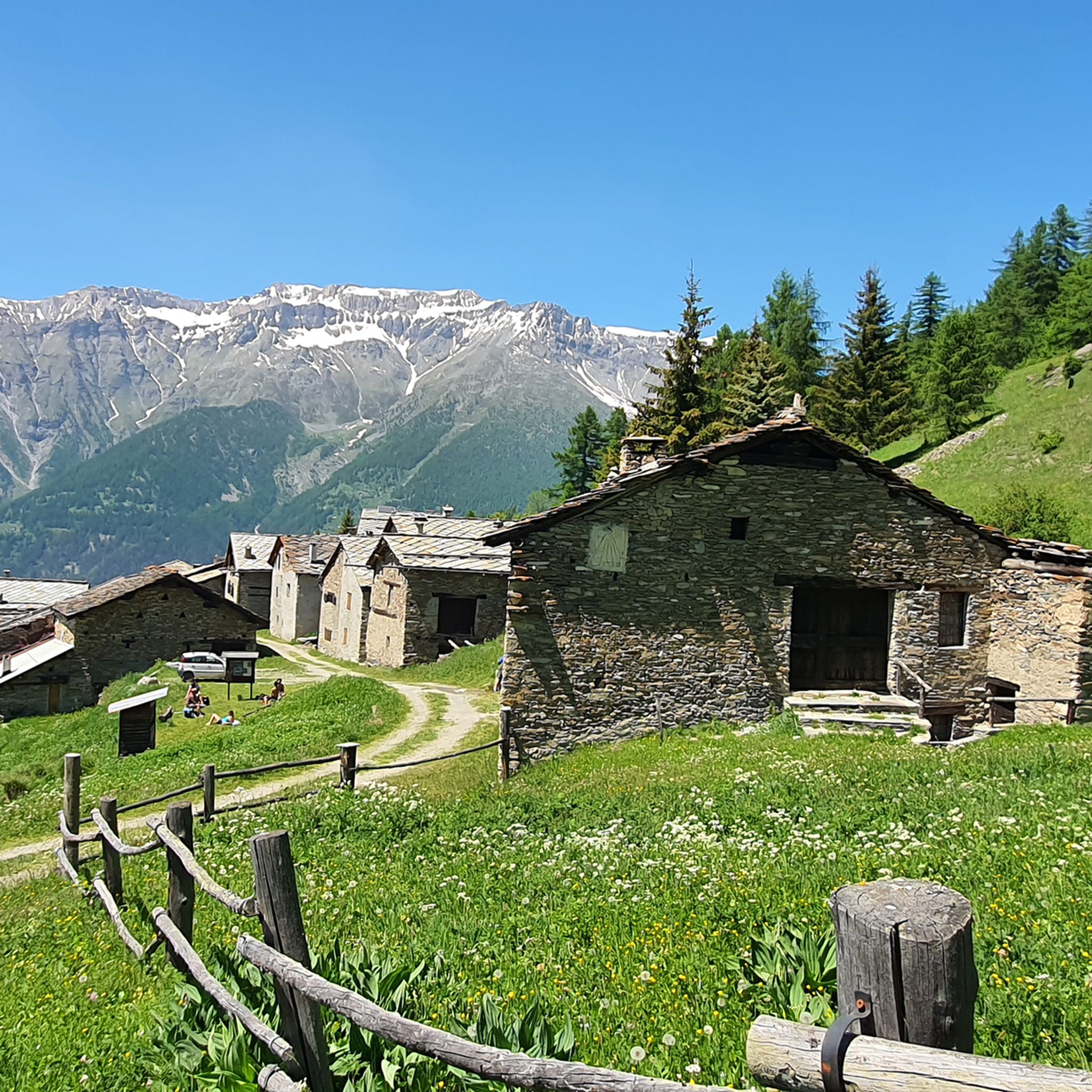
This hill is best appreciated when climbing from Monfol because it offers an excellent panoramic viewpoint over the Chisone valley. You arrive at the end of a long traverse, very restful especially if cycled due to the moderate gradients. The downside is the significant traffic of off-road vehicles, almost all foreign, that use the beautiful high-altitude road known as the Strada dell'Assietta. Make sure to refuel along the way BEFORE the pass, taking advantage of the many streams, because from the pass onwards, whether heading towards Sestriere or towards the Assietta, you'll find almost no water... and there's a lot of dust! Another recommendation: avoid this route if a thunderstorm threatens, as there are no shelters and you risk serious lightning strikes!
0
0

one of the many hills along the military road
0
0

Simply spectacular. The monument pales in comparison to the majesty of the landscape and the panoramic views of the Val di Susa and Val Chisone.
0
0

It’s a bit of a dream to get up there by bike, what more can I say? If you can, go in the off-season, because there are often quite a few motorbikes and cars. But despite that, the setting remains sublime, and the track is ultra-rolling.
2
0

Point with a great view, which commemorates the fallen of the Second World War
1
0

It is practically located on top of the remains of the fort of the same name. From here it is possible to see other forts that make up the Assietta defensive line, as well as the usual panorama of the surrounding peaks. It can be reached very easily as the area is served by a series of military roads
0
0

A hill that goes up a forest road, sometimes rocky, goes up through the heart of the Great Forest in the Parco Naturale della Gran Bosco di Salbertrand (Natural Park of the Great Forest of Salbertrand) to the Col Blegier (pass). Because it is a forest road, the trail is not technically difficult, but there is 640 m (2,100 ft) of climbing in this 7.7 km
0
0
Frequently Asked Questions
What are some of the most scenic mountain peaks for views around Pragelato?
For breathtaking panoramas, consider climbing Monte Albergian Summit, which offers an impressive vista from its over 3,000-meter peak. Another excellent choice is Monte Fraiteve, situated between the Val di Susa and Val Chisone, providing scenic views of the surrounding mountains. Col Basset also offers a panoramic point along the ridge separating the Susa and Chisone valleys.
Are there any historical sites among the mountain peaks near Pragelato?
Yes, Fort Gran Serin is a significant historical site. It's a former military fortress built at the end of the 19th century, spanning over 2.5 kilometers and once sheltering around 850 soldiers. The remains of its walls offer a fascinating glimpse into its impressive scale and historical importance.
What kind of hiking challenges can I expect on the peaks around Pragelato?
The region offers a range of challenges. Climbing Monte Albergian Summit is described as challenging but rewarding, requiring careful planning due to potential rapid weather changes. Many trails in the Val Troncea Natural Park are high-altitude and can be physically demanding, though not always technically difficult. There are also easier routes available for those seeking less strenuous walks.
When is the best time to visit the mountain peaks around Pragelato?
The best time depends on your activity. For hiking and nature exploration, summer is ideal, with wildflowers like edelweiss blooming around the Lakes of Albergian and extensive trails in Val Troncea Natural Park. For winter sports, the area is part of the vast Via Lattea ski area, making it a prime destination for skiing and snowboarding from winter into early spring.
Are there family-friendly mountain trails or viewpoints near Pragelato?
Yes, the Blegier Pass is noted as family-friendly, offering a clearing for parking and paths. The Val Troncea Natural Park also provides extensive hiking trails suitable for walking and nature exploration, with options for various difficulty levels, making it a good choice for families.
What outdoor activities can I do near the mountain peaks of Pragelato?
Beyond hiking, the area is excellent for various outdoor activities. You can explore numerous road cycling routes, such as the 'Colle delle Finestre Climb from Pragelato' or 'Prali and Fenestrelle from Pragelato'. Gravel biking is also popular, with routes like the 'Assietta gravel ring from Sestriere'. For mountain biking, trails like 'Pragelato - Massello Trail' and 'Monte Fraiteve da Pragelato' offer exciting options. You can find more details on these activities in the Road Cycling Routes around Pragelato, Gravel biking around Pragelato, and MTB Trails around Pragelato guides.
Can I find places to eat or rest near the mountain peaks?
Yes, some locations offer amenities. For instance, at the summit of Monte Fraiteve, there is a cozy bar that even serves polenta. Additionally, the area around Fort Gran Serin provides benches and tables, making it a quiet place to stay and rest.
What is the Val Troncea Natural Park, and how does it relate to Pragelato's peaks?
Pragelato is situated next to the Val Troncea Natural Park, an alpine protected area known for its high-altitude meadows and extensive hiking trails. The general mountainous terrain within this park, part of the Cottian Alps, offers breathtaking scenery and a serene environment. It's an excellent area for snowshoeing in winter and walking, cycling, and nature exploration in summer.
Are there opportunities for winter sports on the peaks around Pragelato?
Absolutely. Pragelato's mountains are integral to the Via Lattea ski area, one of the world's largest, offering over 400 km of slopes. Peaks like Monte Rognoso are key to the ski areas. Pragelato was also a venue for the 2006 Winter Olympics, hosting cross-country skiing and ski jumping, highlighting its quality winter sports facilities.
What are the typical elevations of the mountain peaks in the Pragelato region?
The mountain peaks around Pragelato are part of the Italian Alps, with many exceeding 2,800 meters in elevation. For example, Monte Albergian Summit stands at just over 3,000 meters, while Monte Fraiteve reaches 2,702 meters. These elevations contribute to the stunning scenery and diverse terrain of the region.
What do visitors appreciate most about the mountain peaks around Pragelato?
Visitors frequently highlight the impressive panoramas and breathtaking landscapes, especially from summits like Monte Albergian Summit. The historical significance of sites like Fort Gran Serin is also a draw. Many enjoy the variety of trails, from challenging climbs to more accessible routes, and the serene environment for nature exploration.
Most popular routes around Pragelato
Most popular attractions around Pragelato

Get inspired with the komoot mobile app


Explore more
See even more amazing summits around Pragelato with these guides:
