The best traffic-free bike rides around Aland-Elbe-Niederung
4.6
(5139)
20,652
riders
209
rides
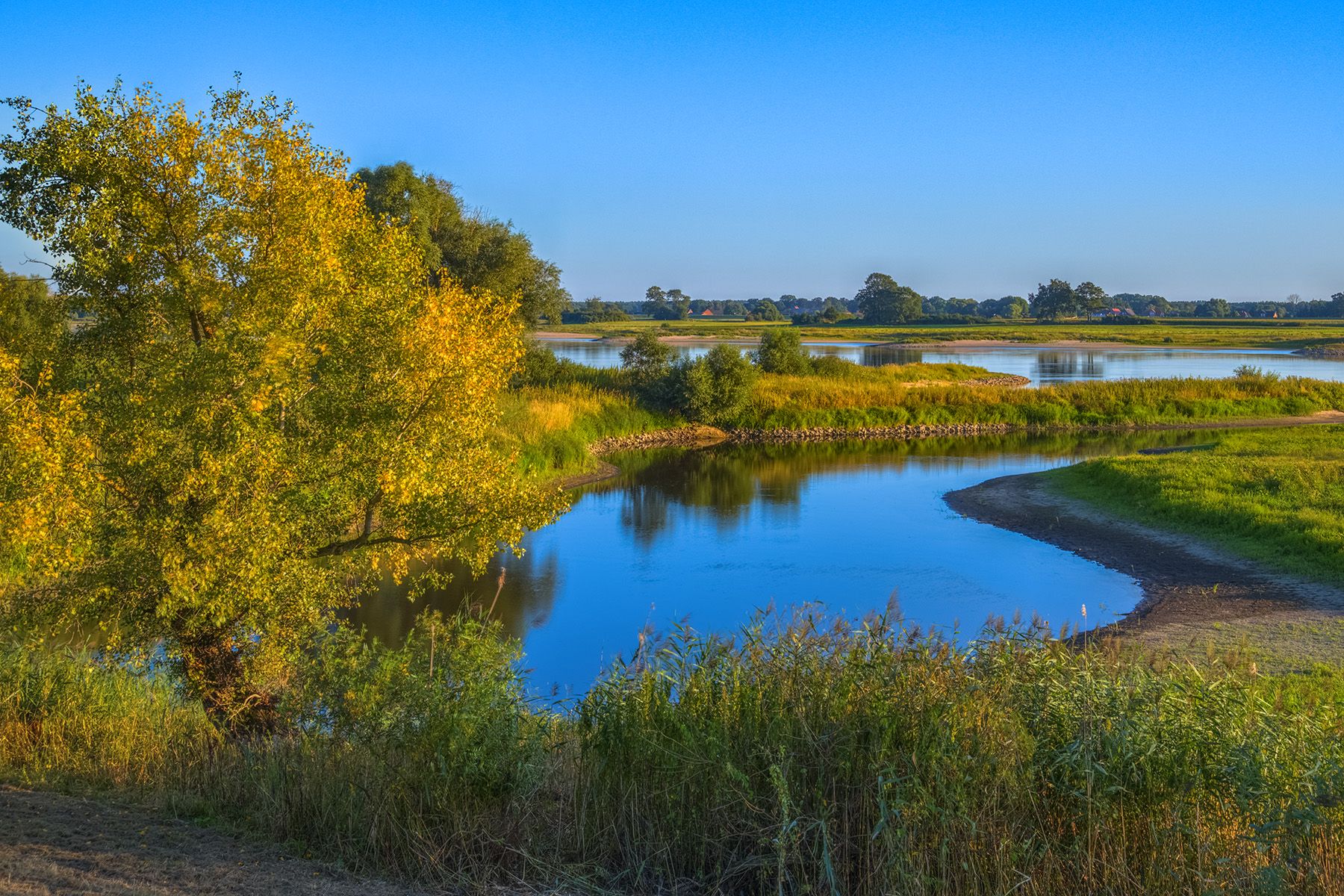
No traffic touring cycling routes around Aland-Elbe-Niederung traverse a diverse riverine landscape, part of the larger Elbe River Landscape UNESCO Biosphere Reserve. The region features approximately 6,000 hectares of wetlands, floodplain forests, and expansive meadows across the Elbe and Aland river valleys. Cyclists will find largely flat to gently rolling terrain, with paths often following the Elbe along dikes, providing extensive views of the river and its natural surroundings. This landscape offers a tranquil setting for nature observation, particularly for…
Last updated: July 12, 2026
4.7
(16)
48
riders
Easy bike ride. Great for any fitness level. Mostly paved surfaces. Suitable for all skill levels.
4.3
(7)
56
riders
Easy bike ride. Great for any fitness level. Mostly paved surfaces. Suitable for all skill levels.

Sign up for free
4.1
(7)
30
riders
Hard bike ride. Great for any fitness level. You may need to push your bike for some segments of this route.
4.9
(14)
103
riders
Easy bike ride. Great for any fitness level. Mostly paved surfaces. Suitable for all skill levels.
5.0
(1)
29
riders
Easy bike ride. Great for any fitness level. Mostly paved surfaces. Suitable for all skill levels.
Get access to more routes and recommendations from other explorers.
Sign up for free
Already have an account?
Our route recommendations are based on thousands of hikes, rides, and runs completed by other people on komoot.
Start today with a free account
Your next adventure awaits.
Login or Signup




Tips from the Community

beautiful section, you can ride up here on the dike. This provides a wonderful view to both sides.
0
0

One should check the ferry in Schnackenburg. Unfortunately, it is not running at the moment. https://www.amtlenzen.de/seite/630582 The observation tower in Schnackenburg is accessible again and the museum is very hospitable. You are happy to donate there! In Wanzer, the Bockwindmühlenfest (post mill festival) took place. A nice final experience on the way back
0
0

The Steintor in Wittenberge is the city's oldest landmark, first mentioned in 1297. Rebuilt in its current form after a fire around 1430, it was the northwestern exit of the fortified city. The tower, formerly called "Alter Turm" (Old Tower), served as a prison in the 19th century and has housed a local history museum since 1928.
1
0
The new B189 bridge near Wittenberge is part of the A14 motorway expansion and the dilapidated old bridge to the north (built in 1978, the longest GDR road bridge). The new construction, which is expected to take traffic from mid-2026, is being built as part of a major infrastructure project to modernize the Elbe crossing and replace the old structure.
1
0

The Old Main Customs Office in Wittenberge dates back to the 19th century and served to monitor the flow of goods across the Elbe River. After years of disuse, it was renovated and converted into modern apartments, while preserving its historical appearance. The building remains a testament to Wittenberge's economic importance in Elbe River trade.
0
0
A truly brilliant idea! As a cyclist, you immediately feel welcome here. A small measure with a big impact, very well implemented.
0
0

Observation of waterfowl and cranes is possible.
0
0

The windmill itself is worth seeing, and the rest area is well suited for a picnic.
0
0
Frequently Asked Questions
How many traffic-free touring cycling routes are available in Aland-Elbe-Niederung?
The Aland-Elbe-Niederung region offers over 200 dedicated traffic-free touring cycling routes. These routes are largely integrated into the renowned Elbe Cycle Path, providing a peaceful and scenic experience through the natural reserve.
What kind of terrain can I expect on these traffic-free routes?
The terrain in Aland-Elbe-Niederung is predominantly flat to gently rolling, making it ideal for relaxed touring cycling. You'll mostly find well-maintained asphalt paths, often along or on top of dikes, with some unpaved sections that are generally suitable for trekking bikes. This low gradient ensures a comfortable ride for all fitness levels.
Are there any easy, traffic-free routes suitable for beginners or families?
Yes, the region is very beginner and family-friendly, with 139 easy routes. An excellent option is the Elbe Bridge, Wittenberge – View of Wahrenberg loop from Wittenberge. This route is just under 10 km long with minimal elevation gain, offering a relaxed ride along the Elbe.
What natural features or landmarks can I see along the traffic-free cycling routes?
The routes offer stunning views of the diverse riverine landscape, including wetlands, floodplain forests, and expansive meadows. You can observe a rich variety of birdlife, such as sea eagles and ospreys. Notable landmarks and viewpoints include the Aland Bridge near Pollitz, the Aulosen Observation Tower, and the Elbe floodplain itself, which is part of a UNESCO Biosphere Reserve.
Can I find circular traffic-free routes in the Aland-Elbe-Niederung?
Absolutely. Many routes are designed as loops, allowing you to start and end at the same point. For example, consider the Aland Bridge near Pollitz – Aulosen Observation Tower loop from Wahrenberg, which is an easy 26 km ride offering beautiful views of the Aland and Elbe rivers.
What is the best time of year for traffic-free touring cycling in Aland-Elbe-Niederung?
The best time to visit is typically from spring to autumn. During these seasons, the weather is pleasant, and the natural landscape is at its most vibrant, offering excellent opportunities for birdwatching and enjoying the tranquil river views. Spring and early summer are particularly good for observing migratory birds.
Are dogs allowed on the traffic-free cycling paths?
Generally, dogs are welcome on leashes on the cycling paths in Aland-Elbe-Niederung, especially given the natural reserve status. However, always be mindful of wildlife, especially during breeding seasons, and ensure your dog does not disturb the local fauna. It's advisable to keep them on a short leash, particularly in areas with high bird activity.
Is public transport accessible for reaching these traffic-free routes?
The Aland-Elbe-Niederung region, being part of the Elbe Cycle Path network, often has good connectivity. While direct public transport to every trailhead might vary, major towns along the Elbe such as Wittenberge are well-served by regional trains, which often allow bicycles. From these points, you can easily access the traffic-free routes.
What do other touring cyclists enjoy the most about touring cycling in Aland-Elbe-Niederung?
The area is highly rated by the komoot community, with an average score of 4.6 stars. Reviewers often praise the exceptional tranquility, the flat and well-maintained paths perfect for relaxed touring, and the abundant opportunities for nature observation, especially the diverse birdlife along the Elbe and Aland rivers.
Are there any longer, more challenging traffic-free routes for experienced cyclists?
While the region is known for its flat terrain, some routes offer longer distances or slightly more varied surfaces for a greater challenge. For instance, the Schnackenburg Harbor – Aland Bridge and Windmill loop from Wahrenberg is a 27.7 km route classified as 'difficult' due to its length and potentially more exposed sections, offering a good test for experienced touring cyclists.
What kind of wildlife can I expect to see along the traffic-free routes?
The Aland-Elbe-Niederung is a globally important wetland, so you can expect to see a rich array of wildlife, particularly birds. Keep an eye out for migratory birds like whooper swans, tundra swans, and barnacle geese, as well as resident species such as storks, herons, sea eagles, and ospreys. Mammals like beavers and otters are also present in the riverine habitats.
Most popular routes around Aland-Elbe-Niederung
Most popular attractions around Aland-Elbe-Niederung

Get inspired with the komoot mobile app


Explore more
Browse the best Cycling routes in other regions.
