The best walks and hikes around Aland-Elbe-Niederung
4.5
(1011)
4,045
hikers
328
hikes
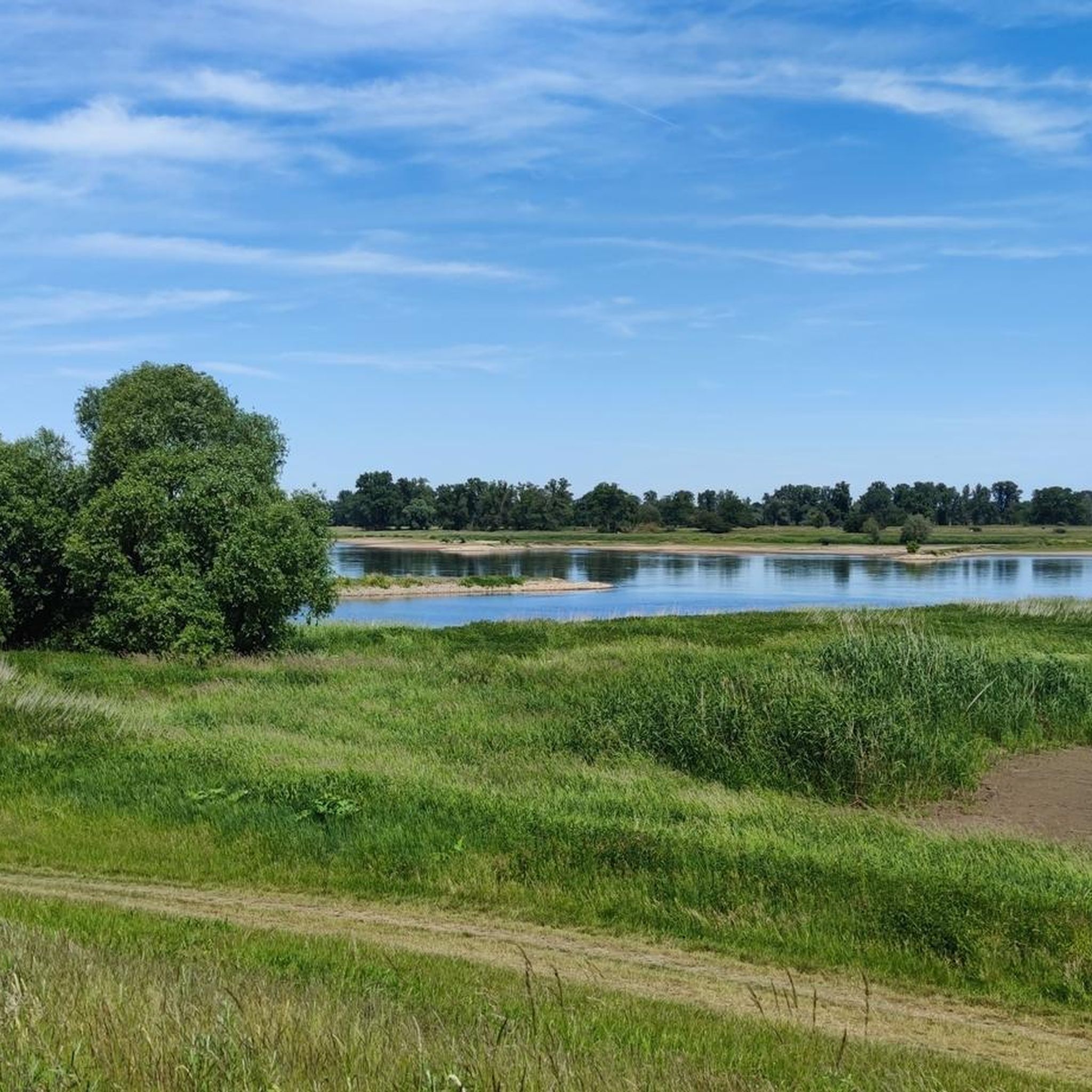
Hiking around Aland-Elbe-Niederung offers diverse trails through a 6,000-hectare nature reserve in Saxony-Anhalt, Germany. The region is characterized by the meandering Elbe River, creating a mosaic of floodplain forests, expansive meadows, and numerous oxbow lakes. Hikers can explore varied terrains including wetlands, natural river sections, and scattered inland dunes, all shaped by the dynamic riverine environment.
Best hiking trails around Aland-Elbe-Niederung
- The most popular hiking route is Grumbkow Obelisk – Stork Village Rühstädt loop from Rühstädt, a 5.3 miles…
Last updated: June 28, 2026
4.7
(27)
90
hikers
Moderate hike. Good fitness required. Easily-accessible paths. Suitable for all skill levels.
3.5
(6)
31
hikers
Moderate hike. Good fitness required. Easily-accessible paths. Suitable for all skill levels.

Sign up for free
4.8
(6)
23
hikers
9.86km
02:29
10m
10m
Moderate hike. Good fitness required. Easily-accessible paths. Suitable for all skill levels.
3.7
(3)
41
hikers
Easy hike. Great for any fitness level. Easily-accessible paths. Suitable for all skill levels.
4.6
(5)
25
hikers
7.42km
01:52
10m
10m
Easy hike. Great for any fitness level. Easily-accessible paths. Suitable for all skill levels.
Get access to more routes and recommendations from other explorers.
Sign up for free
Already have an account?
Our route recommendations are based on thousands of hikes, rides, and runs completed by other people on komoot.
Start today with a free account
Your next adventure awaits.
Login or Signup
Popular around Aland-Elbe-Niederung
Discover the Green Belt in the Elbe-Altmark-Wendland with BUND

Lowest to Highest (L2H) in Germany

Discover the nature along the “Greenbelt” together with the BUND
Cycling around Aland-Elbe-Niederung
Road Cycling Routes around Aland-Elbe-Niederung
MTB Trails around Aland-Elbe-Niederung
Running Trails around Aland-Elbe-Niederung

Gravel biking around Aland-Elbe-Niederung


Tips from the Community

Very beautiful place: the wild Stepenitz flows into the harbor basin here and you also see the well-known clock tower.
0
0
The bridge can be used by cyclists and pedestrians. It is open, as of 2026. From here, of course, you have a good view of the Elbe meadows and the city.
0
0
It is actually the mouth of the so-called Gnevsdorfer drainage channel. Anyway: a very beautiful place and a good view of the estuary. Worth it.
0
0
located directly on the water with a beautiful view over the Elbe meadows.
0
0

Actually, there are two lakes. Beautifully situated in the landscape, on the Green Belt, the former border strip between West Germany and East Germany. The beautiful river Aland also flows past here. Here you also have good opportunities to observe and photograph birds and wild animals. On my bike tours, I always enjoy cycling past here and like to make a stopover here.
0
0

The Stadtkirche St. Marien in Wittenberg, first mentioned in 1187, is considered the mother church of the Reformation, where Martin Luther preached from 1512 onwards. As the oldest building in the city (built from approx. 1281), it was the scene of the first German-language Protestant service. It houses the Cranach Altar and is part of the UNESCO World Heritage. Main preaching church of Martin Luther (since 1512) and Johannes Bugenhagen. Here, in 1521, the mass was celebrated for the first time in German and communion was administered in both kinds (bread and wine).
1
0
The Steintor in Wittenberge is the city's oldest landmark, first mentioned in 1297. Rebuilt in its current form after a fire around 1430, it was the northwestern exit of the fortified city. The tower, formerly called "Alter Turm" (Old Tower), served as a prison in the 19th century and has housed a local history museum since 1928.
1
0
The harbor originally originated in the context of Wittenberg's industrial boom as a harbor basin. After the industrial facilities in the harbor area were shut down, the Nedwighafen was converted into a modern sports boat harbor. Today, the Nedwighafen serves as a central meeting point for water tourists on the Elbe and is an important part of tourism in the Prignitz. It is centrally located in the city, in close proximity to the Alte Ölmühle.
3
0
Frequently Asked Questions
How many hiking trails are available in Aland-Elbe-Niederung?
Aland-Elbe-Niederung offers a wide variety of hiking experiences, with over 300 distinct routes available. These trails traverse the unique riverine landscapes, floodplain forests, and meadows of the 6,000-hectare nature reserve, providing options for all skill levels.
What kind of terrain can I expect on the hiking trails in Aland-Elbe-Niederung?
The terrain in Aland-Elbe-Niederung is largely shaped by the meandering Elbe and Aland rivers. You can expect a diverse mosaic of landscapes, including flat paths through floodplain forests and expansive meadows, along oxbow lakes, and occasionally past scattered inland dunes. The trails are generally accessible, with most routes featuring minimal elevation changes.
Are there easy hiking trails suitable for beginners or casual walkers?
Yes, Aland-Elbe-Niederung is very welcoming for beginners and casual walkers. There are 180 easy routes available. An example is the Havel Confluence With the Elbe – Stork Village Rühstädt loop from Rühstädt, an easy 4.1-mile (6.6 km) trail that takes about 1 hour 41 minutes to complete, offering pleasant views of the riverine landscape.
What are some notable natural features or landmarks to look out for while hiking?
The region is rich in natural beauty and historical significance. You can explore the dynamic environment of wetlands, floodplain forests, and oxbow lakes. Keep an eye out for the Elbe floodplain and the beautiful floodplain landscape on the Aland. For panoramic views, consider visiting the Aulosen Observation Tower or the View of the Hohe Garbe.
Can I spot any wildlife during my hike in Aland-Elbe-Niederung?
Aland-Elbe-Niederung is a treasure trove for nature lovers and an internationally important wetland. It's an exceptional resting ground for water and wading birds, and a crucial breeding area for species like the Common Crane and White-tailed Eagle. You might also spot endangered mammals such as beavers and otters, especially near the water bodies. Extensive reed beds provide habitat for numerous bird species, including the Sedge Warbler.
Are there any circular hiking routes in the area?
Yes, many of the trails in Aland-Elbe-Niederung are designed as circular routes, allowing you to start and end at the same point. An example is the moderate Alandauen Nature Reserve – Wanzer Post Mill loop from Stresow, which covers 9.7 km (6 miles) and takes around 2 hours 26 minutes, offering a great way to explore the wetlands.
What do other hikers enjoy most about Aland-Elbe-Niederung?
The area is highly rated by the komoot community, with an average score of 4.6 stars from over 950 reviews. Hikers frequently praise the tranquil riverine landscapes, the rich biodiversity, and the well-maintained paths that make exploring the floodplain forests and meadows a truly immersive experience. Many appreciate the opportunities for birdwatching and connecting with nature.
Are there family-friendly hiking options in Aland-Elbe-Niederung?
Yes, the generally flat and accessible terrain makes many routes suitable for families. The reserve's diverse ecosystems and wildlife viewing opportunities can be engaging for children. Look for shorter, easy trails that allow for exploration of the wetlands and observation towers, which are often popular with families.
Is it possible to hike with dogs in Aland-Elbe-Niederung?
Many trails in Aland-Elbe-Niederung are suitable for hiking with dogs, provided they are kept on a leash to protect the local wildlife and natural environment. The expansive meadows and riverbanks offer plenty of space for walks. Always check local signage for specific regulations within certain protected areas.
Are there any historical sites or cultural points of interest along the trails?
Beyond its natural beauty, Aland-Elbe-Niederung intersects with the 'Green Belt,' the former inner-German border, which is now a national natural monument. Hiking along this path allows visitors to connect with both nature and history. You can also find historical structures like the Bockwindmühle Wanzer and rest area or the Wanzer Post Mill.
Where can I find parking or access trails by public transport?
While specific parking details vary by trailhead, many popular starting points for trails, especially near villages like Rühstädt or Wittenberge, offer designated parking areas. For public transport, regional bus services connect some of the larger towns and villages within or bordering the reserve. It's advisable to check local transport schedules for the most convenient access points to your chosen trail.
Are there any longer, more challenging routes for experienced hikers?
While the region is known for its gentle terrain, there are 20 routes classified as difficult and 134 as moderate for those seeking longer excursions. These routes typically cover greater distances, allowing for a more extensive exploration of the Elbe River landscape. An example is the moderate Old Oil Mill Wittenberge – Hinzdorf Village Church loop from Wittenberge, which is 8.6 miles (13.9 km) long.
Most popular routes around Aland-Elbe-Niederung
Most popular attractions around Aland-Elbe-Niederung

Get inspired with the komoot mobile app


Explore more
Browse the best Hikes in other regions.
