The best hikes from bus stations in Parco Regionale Dell'Aveto
4.6
(1328)
4,936
hikers
67
hikes
Hiking in Parco Regionale Dell'Aveto offers diverse landscapes within the Ligurian Apennines, characterized by high peaks, varied valleys, and ancient forests. The region features prominent mountains like Monte Penna (1,735 m) and Monte Aiona (1,701 m), often displaying distinctive ophiolite rock formations. Hikers can explore three distinct valleys—Aveto, Sturla, and Graveglia—each presenting unique terrain from high-mountain scenery to olive groves. Key natural features include glacial lakes such as Lago delle Lame and the Giacopiane Dam, alongside vast woodlands and geological…
Last updated: June 26, 2026
4.7
(9)
27
hikers
9.76km
03:49
480m
480m
Moderate hike. Good fitness required. Mostly accessible paths. Sure-footedness required.
4.7
(11)
18
hikers
5.77km
01:52
220m
220m
Moderate hike. Great for any fitness level. Mostly accessible paths. Sure-footedness required.

Sign up for free
4.4
(7)
12
hikers
13.1km
05:22
630m
630m
Hard hike. Very good fitness required. Mostly accessible paths. Sure-footedness required.
3.8
(4)
17
hikers
8.25km
03:08
400m
400m
Moderate hike. Good fitness required. Mostly accessible paths. Sure-footedness required.
4.8
(4)
13
hikers
Moderate hike. Good fitness required. Mostly accessible paths. Sure-footedness required.
Get access to more routes and recommendations from other explorers.
Sign up for free
Already have an account?
Our route recommendations are based on thousands of hikes, rides, and runs completed by other people on komoot.
Start today with a free account
Your next adventure awaits.
Login or Signup
Popular around Parco Regionale Dell'Aveto
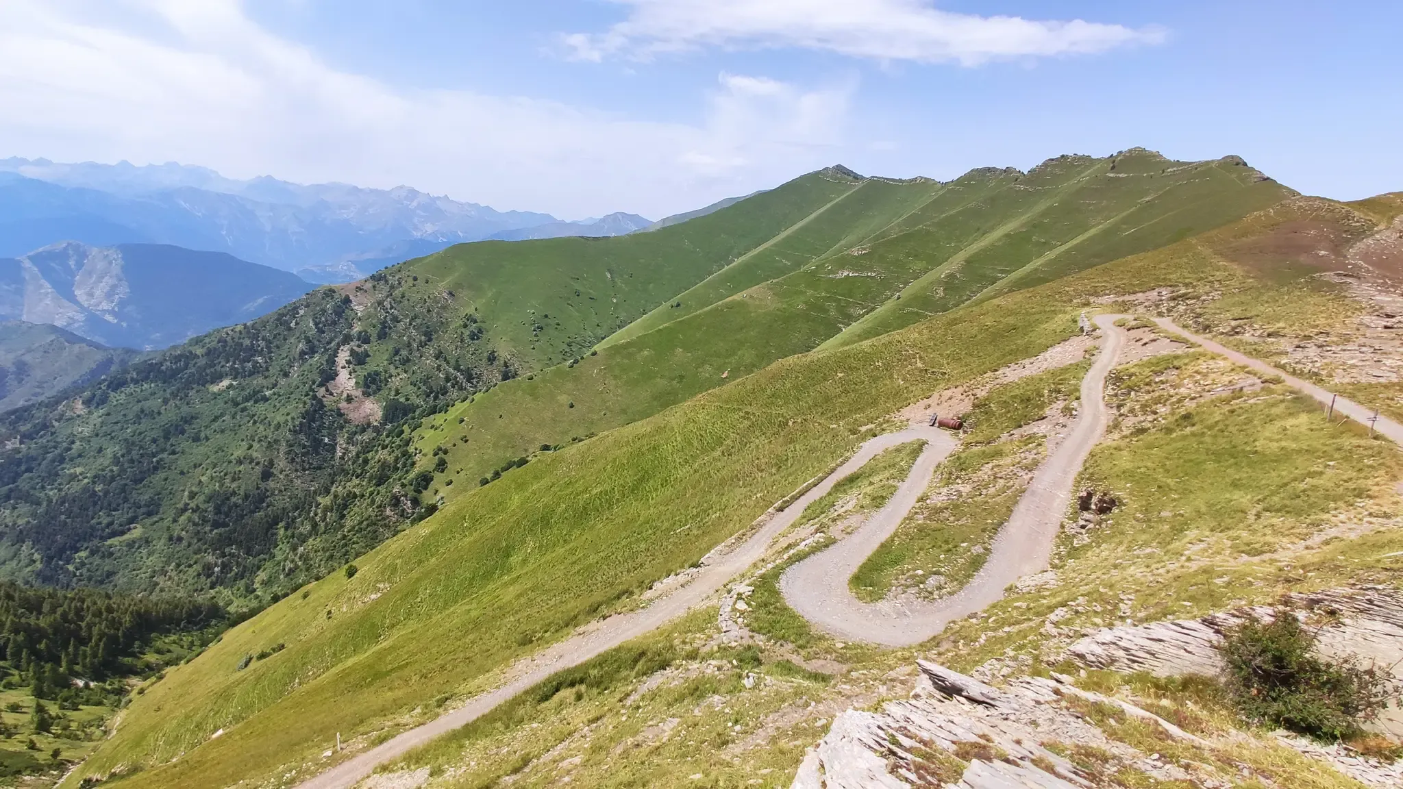
Other adventures in Parco Regionale Dell'Aveto

Tips from the Community

Description: A small body of water nestled among the woods at the Bocco Pass. It's the ideal place for a break before taking the A10 trail or to relax after returning from the Monte Zatta loop. The autumnal reflections are truly enchanting! 📸
0
0

Situated at 956 meters between the Vara and Aveto Valleys, the Bocco Pass is one of the historic passes of the Ligurian Apennines, used since ancient times as a connection between the Tyrrhenian coast and the Po Valley hinterland. Already in Roman times, it was part of a secondary transit network, but it was especially in the Middle Ages and modern times that the pass assumed a central role in local traffic: a route for merchants, shepherds, and pilgrims, it connected Chiavari and the Riviera with Varese Ligure and the Emilian plains. Traces of the ancient paving are still visible today in the surrounding woods. During the Second World War, the area served as a refuge for partisan groups, thanks to its secluded location and dense forest cover. Today, the pass is a destination for cyclists and hikers, immersed in an unspoiled mountain landscape of beech and fir forests and highland meadows, at the gateway to the Aveto Regional Natural Park.
0
0

a sweet beer and off we go again
1
0

Last part on asphalt but very beautiful
0
0

In the photo, on the right towards Colonia Devoto, central path that goes up to Cima di Levante. On the left the path ends.
0
0

The refuge was built at an altitude of 1,100 metres, on the border between pastures and centuries-old beech woods. Its paths lead to the peaks of the Aiona and Penna mountains, cross the Alta Via dei Monti Liguri and continue towards the other valleys of the Park and Emilia Romagna. https://malgazanoni.org/
1
0
Giacopiane lake is an artificial reservoir located in the Sturla valley in the municipality of Borzonasca. https://it.wikipedia.org/wiki/Lago_di_Giacopiane
1
0
Frequently Asked Questions
How many bus station hiking trails are available in Parco Regionale Dell'Aveto?
There are 36 hiking trails in Parco Regionale Dell'Aveto that are accessible from bus stations, offering a range of experiences from moderate to difficult. This includes 21 moderate and 15 difficult routes.
Are there any easy or family-friendly hikes accessible by bus in Parco Regionale Dell'Aveto?
While most routes accessible by bus are rated moderate to difficult, many sections of the park are suitable for families. For a scenic and relatively gentle experience, consider the area around the Lago delle Lame, which is a popular starting point for treks and offers accessible paths. The park is committed to accessibility, with identified paths suitable for people with disabilities in certain areas. Always check the specific route details for elevation and terrain before heading out with children.
What kind of natural attractions can I see along bus-accessible trails?
The bus-accessible trails in Parco Regionale Dell'Aveto lead to a variety of natural wonders. You can explore areas with significant geological formations, such as the ophiolite rocks on Monte Penna and Monte Aiona. The park also features beautiful lakes like the Giacopiane Dam and Lake, and the Lame lakes. Keep an eye out for waterfalls, such as the Ciana Waterfall, and enjoy vast woodlands and ancient beech forests.
Are there any circular hiking routes from bus stations?
Yes, several routes accessible by bus are circular, allowing you to return to your starting point without needing additional transport. An example is the Tour of Lake Giacopiane from Prore, which offers a scenic loop around the lake. Another option is the Megalithic Face of Borzonasca – Monastero Sant'Andrea loop from Parco Regionale dell'Aveto, which combines natural beauty with cultural interest.
Can I bring my dog on the bus-accessible hiking trails in Parco Regionale Dell'Aveto?
Generally, dogs are allowed on trails in Parco Regionale Dell'Aveto, provided they are kept on a leash. The park is home to diverse wildlife, including wild horses, wolves, and badgers, so keeping your dog under control is essential for their safety and the protection of local fauna. Always check specific trail regulations, as some protected areas or sensitive habitats might have restrictions.
What are some notable viewpoints accessible from bus stops?
The park offers breathtaking panoramic views. The Forcella Pass provides stunning vistas across the Val Sturla to the Ligurian coast. Another excellent spot is the View of Monte Aiona and the Ligurian Sea, which offers expansive scenery. Many trails, including those leading to higher peaks like Monte Ramaceto, also offer incredible outlooks.
What is the best time of year to hike from bus stations in Parco Regionale Dell'Aveto?
The best time to hike in Parco Regionale Dell'Aveto is typically from spring to autumn. Spring brings blooming wildflowers and lush greenery, while autumn offers vibrant foliage. Summer is also popular, but be prepared for warmer temperatures, especially at lower elevations. Winter hiking is possible, particularly for experienced trekkers, but requires appropriate gear for snow and ice, and some bus services might be reduced.
Are there any challenging hikes accessible by public transport?
Yes, Parco Regionale Dell'Aveto offers several challenging routes accessible by bus. For instance, the Monte Ramaceto Summit Trail from Ventarola is a difficult route that takes you to one of the park's prominent peaks. These trails often involve significant elevation gain and rugged terrain, providing a rewarding experience for experienced hikers.
What do other hikers enjoy the most about hiking in Parco Regionale Dell'Aveto?
The area is highly rated by the komoot community, with an average score of 4.56 stars. Reviewers often praise the diverse landscapes, from high-mountain scenery to ancient beech woods, and the sense of tranquility found on the trails. The well-preserved natural environment and the opportunity to spot wildlife are frequently highlighted as key attractions.
Are there places to eat or stay near the bus-accessible trailheads?
Yes, the park and its surrounding villages offer options for refreshments and accommodation. Towns like Santo Stefano d'Aveto and Rezzoaglio provide cultural experiences, local cuisine, and places to stay. Within the park, mountain refuges like the Ventarola Refuge and Rifugio Malga Zanoni offer welcoming stops for trekkers, some of which might be accessible or within reasonable distance from bus stops.
Are there any historical or cultural sites along bus-accessible trails?
Beyond natural beauty, the park offers glimpses into its rich history. You can explore the ancient village of Ventarola, known for its historic stone buildings. Some trails might also lead you near the "Face of Christ," a unique rock carving, or the Gambatesa mine, which is now a museum. The Madonna Spring – Megalithic Face of Borzonasca loop from Borzonasca is an example of a route that combines natural and cultural points of interest.
Most popular routes in Parco Regionale Dell'Aveto
Most popular attractions in Parco Regionale Dell'Aveto

Get inspired with the komoot mobile app


Explore more
Browse the best Hikes in other regions.
