The best walks and hikes in Parco Regionale Dell'Aveto
4.5
(1338)
4,950
hikers
36
hikes
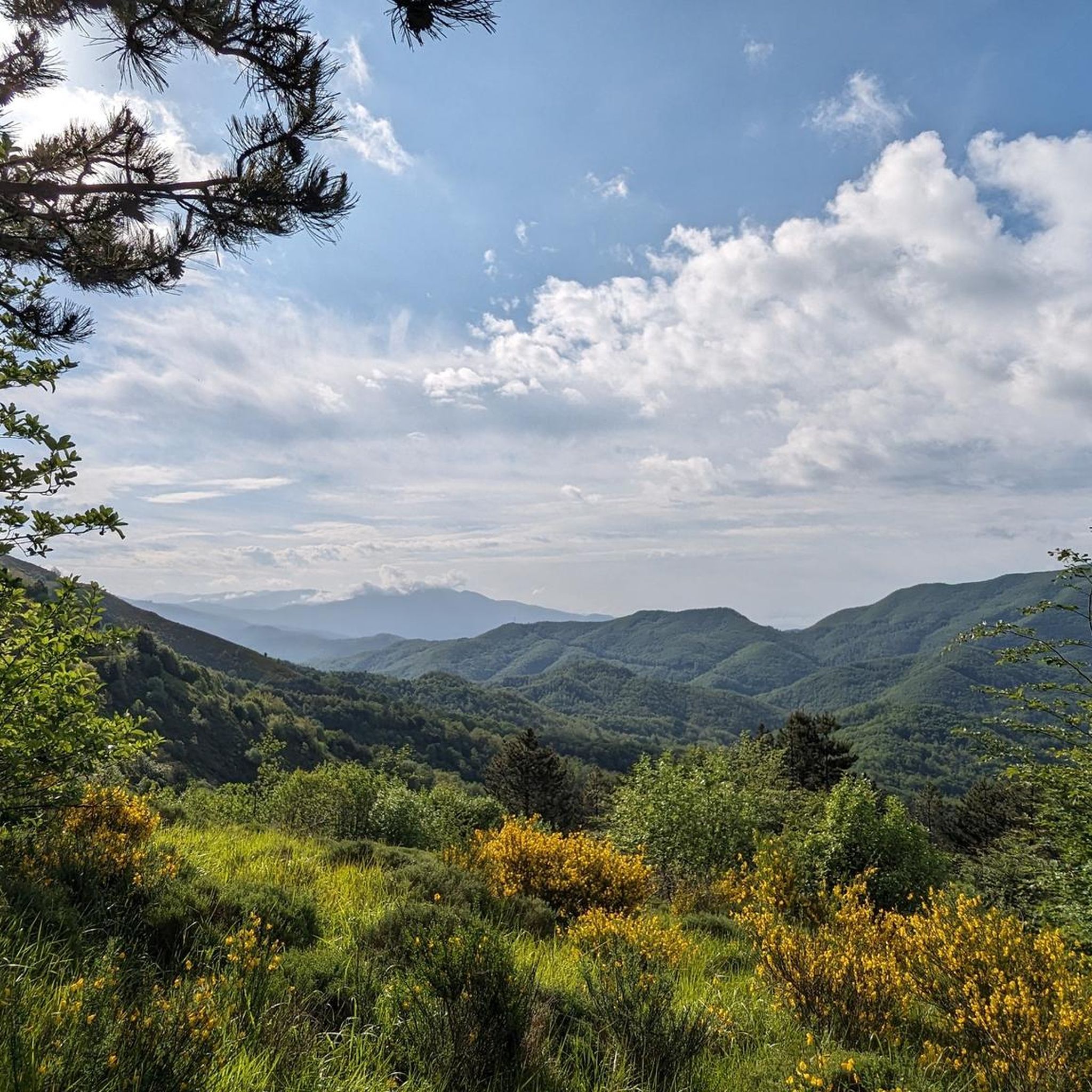
Hiking in Parco Regionale Dell'Aveto offers a diverse range of landscapes within the Ligurian Apennines. The park features prominent mountainous terrain with peaks like Monte Penna and Monte Aiona, alongside picturesque glacial lakes such as Lake Giacopiane and Lake Lame. Hikers will encounter unique geological formations, including ophiolite rocks and the magnetic Pietra Borghese, as well as extensive woodlands of beech, oak, and chestnut. This varied topography provides a rich environment for outdoor exploration.
Best hiking trails in Parco Regionale Dell'Aveto
- The most popular hiking route is Lake Giacopiane Loop, a 2.5 miles (4.0 km) trail that takes 1 hour 5 minutes to complete, circling one of the park's characteristic glacial lakes.
- Another top favourite among local hikers is Lago di Giacopiane – loop in the Parco Naturale Regionale dell'Aveto, an easy 2.5 miles (4.0 km) path. This route offers views of the lake and surrounding natural park environment.
- Local hikers also love the Liciorno/Ramaceto Loop Trail, a 7.6 miles (12.2 km) trail leading through mountainous terrain and woodlands, often completed in about 4 hours 37 minutes.
- Hiking in Parco Regionale Dell'Aveto is defined by mountainous terrain, glacial lakes, and vast woodlands. The network offers options for various ability levels, from easy strolls to challenging ascents.
- The routes in Parco Regionale Dell'Aveto are highly rated by the komoot community with an average score of 4.5 stars from more than 140 reviews. More than 490 hikers have used komoot to explore Parco Regionale Dell'Aveto's varied terrain.
Last updated: July 7, 2026
4.6
(14)
48
hikers
4.01km
01:06
60m
60m
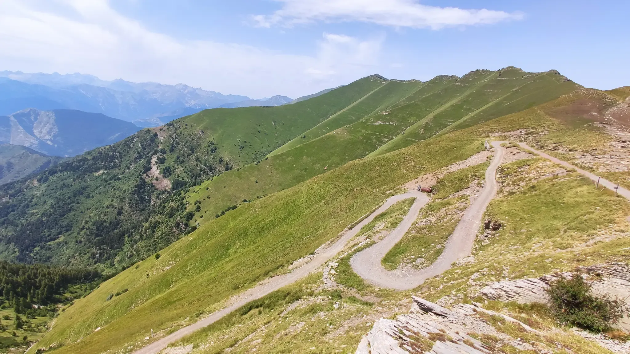
Embark on an easy hike around the Lake Giacopiane Loop, a serene path that winds through flowering meadows and vast beech forests. This accessible route offers a relaxing walk, perfect for all fitness levels and families. You will cover 2.5 miles (4.0 km) with a gentle elevation gain of 212 feet (65 metres), taking approximately 1 hour and 5 minutes to complete. As you hike, you can enjoy panoramic views that, on clear days, might even stretch all the way to the sea. The lake itself, often described as a "blue gem," provides a magnificent focal point for your journey.
Planning your visit to the Lake Giacopiane Loop is straightforward, as parking is generally available near the trailhead, ensuring an easy start to your adventure. The route's easy accessibility also makes it suitable for trekking buggies, so families with young children can comfortably enjoy the outing. Remember to bring water and snacks, especially if you plan to extend your time exploring the area beyond the loop. Always check local weather conditions before heading out, as clear days offer the best views.
One of the most distinctive features of this area is the opportunity to observe the unique Aveto wild horses, which live freely in their natural habitat close to the lake. While encountering these animals can be a highlight, it is crucial to maintain a respectful distance, as they are undomesticated. The trail is nestled within the beautiful Parco Naturale Regionale dell'Aveto, highlighting the region's commitment to preserving its natural beauty and wildlife.
4.5
(13)
45
hikers
Embark on an easy hike around Lago di Giacopiane, a picturesque glacial lake nestled in the Parco Naturale Regionale dell'Aveto. This tranquil loop covers 2.5 miles (4.0 km) with a gentle elevation gain of 204 feet (62 metres), making it suitable for all skill levels. You can expect to complete the route in about 1 hour and 6 minutes, enjoying views of extensive beech forests and the characteristic Ligurian hills.
This trail is known for its accessible path, perfect for a leisurely walk. The research does not provide specific details on trailhead access, parking, public transport, permits, fees, or seasonal closures for this particular route. However, the park generally offers diverse environments, and the lake's tranquility is maintained by prohibiting motorboat activity.
What makes this loop truly special is the chance to spot wild horses roaming freely within the natural park, a distinctive highlight of the Aveto Park. The lake itself, though an artificial reservoir created in the 1920s, blends seamlessly into the serene landscape. The route offers a peaceful immersion into the natural beauty of the region, with autumn bringing stunning foliage and spring showcasing vibrant flora.

Sign up for free
4.6
(19)
44
hikers
12.2km
04:37
490m
480m
Embark on the Liciorno/Ramaceto Loop Trail for a moderate hike through the Ligurian Apennines, offering consistent views of the Ligurian Sea and the Gulf of Tigullio. This route covers 7.6 miles (12.2 km) with an elevation gain of 1596 feet (486 metres), taking approximately 4 hours and 37 minutes to complete. You will traverse mountain passes and ridges, winding through ancient beech forests within the protected Aveto Nature Reserve, with the Cima del Monte Ramaceto offering a distinctive landmark.
When planning your visit, remember that there are no water sources along the route, so carry enough hydration for the entire journey. Proper hiking shoes are essential for the varied terrain, and layered clothing is advisable as temperatures can change quickly, especially at higher elevations. While the trail generally follows well-marked red and white CAI markers, having a map is still a good idea to stay oriented.
This loop provides a unique opportunity to experience the diverse landscapes of the Parco Naturale Regionale dell'Aveto. On a clear day from the summit of Monte Ramaceto, you might even catch a glimpse of Corsica in the distance. A small chapel at the peak adds to the scenic and cultural interest of this rewarding trail.
4.7
(10)
22
hikers
13.2km
05:20
700m
700m
Hard hike. Very good fitness required. Mostly accessible paths. Sure-footedness required.
4.7
(9)
18
hikers
11.0km
04:27
520m
520m
The A8 - Scaletta Loop Trail offers a moderate hiking experience through the varied terrain of Aveto Regional Natural Park. You will cover 6.8 miles (11.0 km) with a significant elevation gain of 1696 feet (517 metres), making it a rewarding half-day adventure that typically takes around 4 hours and 26 minutes to complete. As you hike, expect a mix of ascents and descents, providing a good workout surrounded by nature's beauty. The route passes through Passo dei Porcelletti, a mountain pass where you can anticipate expansive views of the surrounding landscape. This loop trail promises a refreshing journey through diverse natural settings.
Planning your visit to the A8 - Scaletta Loop Trail is straightforward, as specific warnings about road closures or permits are not typically noted. You can generally plan your hike without special considerations beyond your usual preparations for a day on the trails. General parking is usually available near the trailhead, but it is always a good idea to check local signage for any restrictions before you arrive. Ensure you bring enough water and snacks, as well as appropriate gear for the moderate difficulty and varied terrain.
This loop trail is a prime example of the natural beauty found within Aveto Regional Natural Park, offering a chance to immerse yourself in the region's unique ecosystem. While the specific flora and fauna are not detailed, the park's designation suggests a rich biodiversity waiting to be discovered. The trail's design as a loop ensures a continuously changing perspective, making it an excellent choice for those who enjoy exploring new sights throughout their hike. It provides a solid half-day outing for anyone looking to connect with nature in a beautiful setting.
Get access to more routes and recommendations from other explorers.
Sign up for free
Already have an account?
Our route recommendations are based on thousands of hikes, rides, and runs completed by other people on komoot.
Start today with a free account
Your next adventure awaits.
Login or Signup
Other adventures in Parco Regionale Dell'Aveto

Tips from the Community

It's really worth it. Too bad about the limitation of the €10 toll road and the difficulty in paying it: scan QR code, install App, create an account (if you have network available), understand what and how to pay, etc..... All in 15-20' if you're lucky.
0
0

Pria Burgheisa (Pietra Borghese) is a massive outcrop of mantle peridotites, among the best-known and most significant in the area. It lies on the southwestern edge of the Prato Mollo plateau, on the southern slopes of Mount Aiona, at an altitude of 1,465 m. It is a geosite of considerable petrographic, mineralogical, and regional geological interest, allowing us to study the evolution of a portion of the lithospheric mantle subsequently involved in the Apennine orogeny. The outcrop has a highly irregular shape: 30 m long, 10 m wide at its maximum, and 7–8 m high. The rocks are dark in color, ranging from blackish to brownish; the mass is affected by three main fracture systems, more or less orthogonal to each other, which fragment it into numerous square-shaped blocks. The surface of the blocks has a pitted appearance, as the pyroxene crystals, more resistant to erosion than olivine, remain prominent. At the outcrop, mantle foliation is evident, due to the presence of frequent pyroxenite bands. Source: Liguria Geosite Registry.
0
0

Not far from the Aiona–Pratomollo Refuge, near the dirt road, you come across Pietra Borghese, a truly unique rocky outcrop. At first glance, it may seem like a simple dark mass that emerges from the pastures, but it is actually a very ancient rock, among the oldest in Italy: it is over two billion years old and actually comes from the Earth's mantle. Its composition, rich in magnetite, causes compasses to go crazy in the surrounding area, and it is not uncommon for its summit to be struck by lightning during storms. Some legends have also developed around this stone, including one that wants it to be a meteorite that fell from the sky. In reality, its true charm lies in its deep geological origin, which tells an ancient story linked to the birth of the Apennines and the disappearance of a prehistoric ocean.
0
0

a sweet beer and off we go again
1
0

A little way away from the hustle and bustle of the beach promenades but still easy to reach by car. Don't forget to pay the parking fee down there beforehand. A gigantic view over the lake and, with a bit of luck, wild horses in the woods make this easy circular walk a great experience.
0
0

For almost the entire route you can enjoy a wonderful view of the Ligurian Sea
0
0

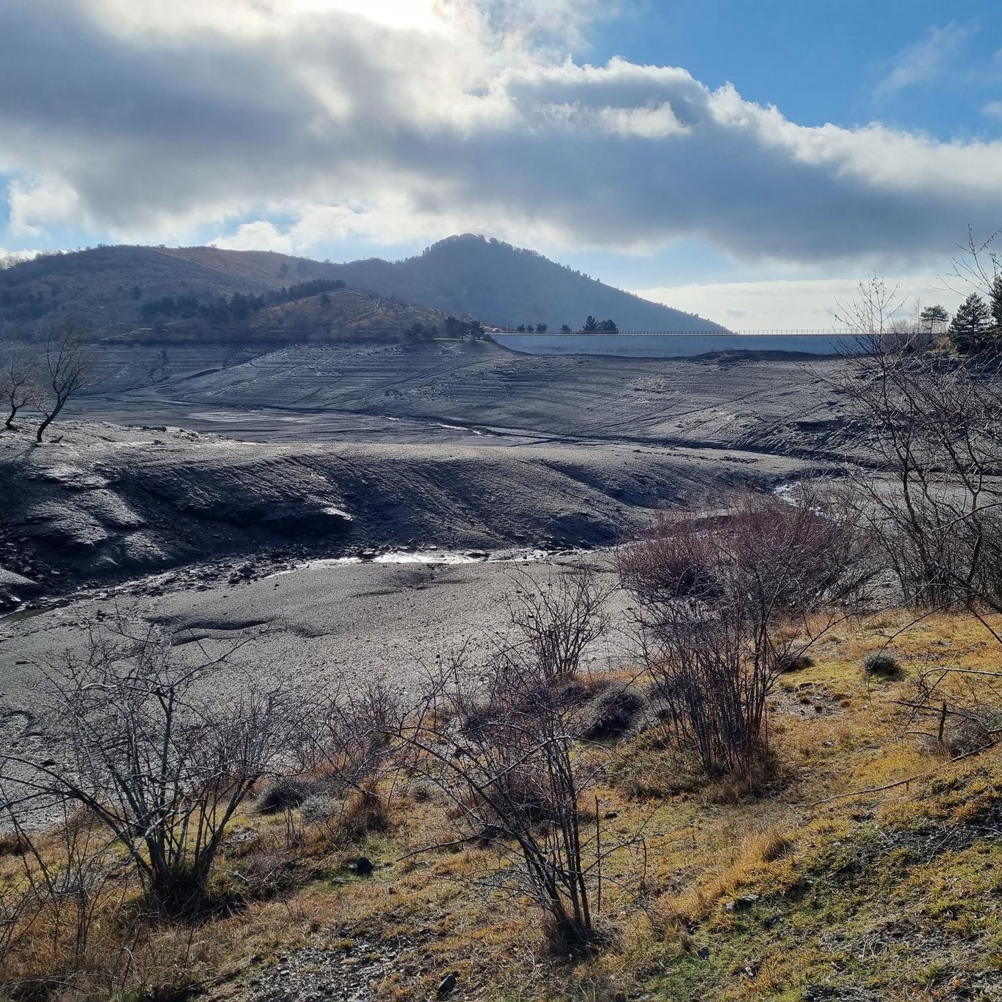
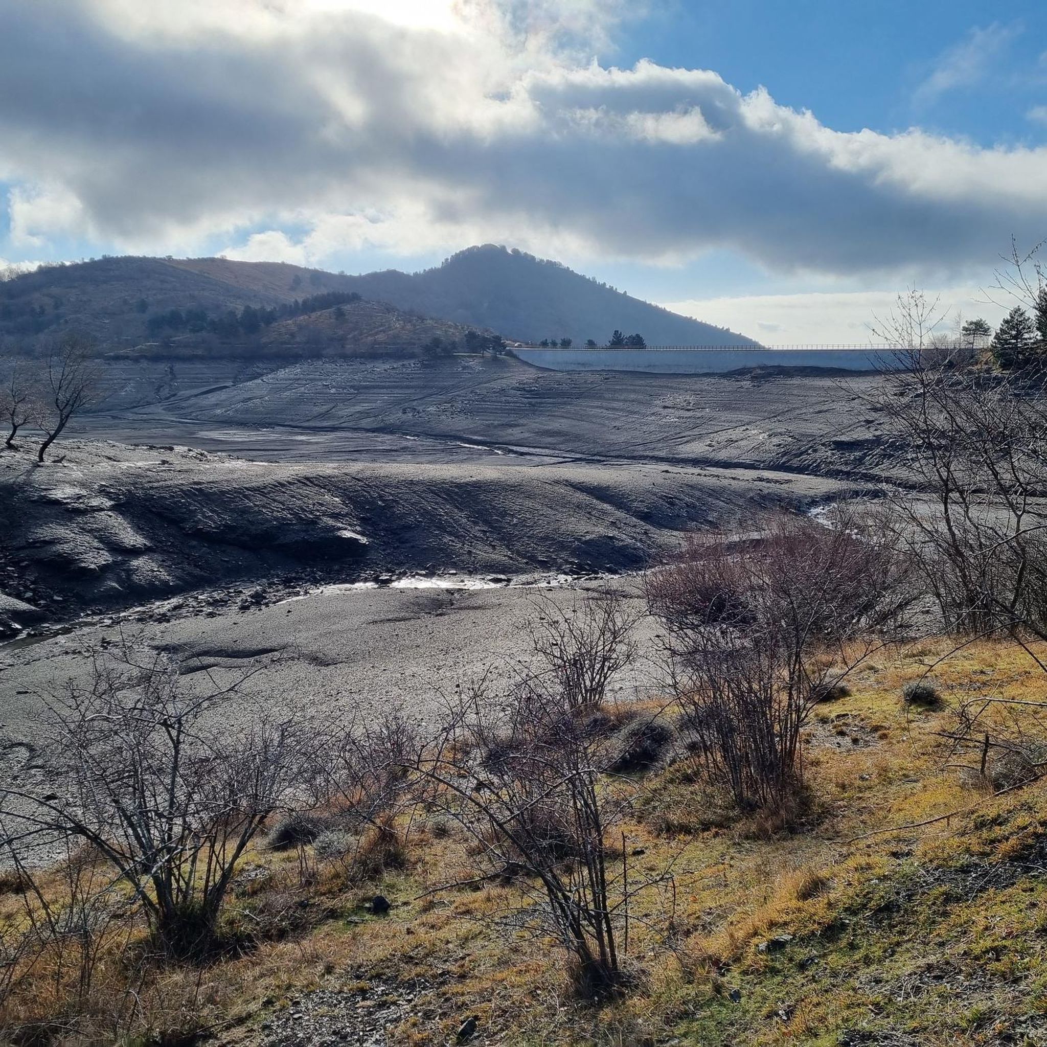
A lake to be enjoyed with your eyes as it is extremely dangerous. Since it was emptied for maintenance work, many "quicksand" danger signs have appeared... and you have to believe it! It is very dangerous to even get close to the banks.
0
0

La Bicca di Feie is located on the Alta Via
0
0
Frequently Asked Questions
How many hiking trails are there in Parco Regionale Dell'Aveto?
Parco Regionale Dell'Aveto offers a network of over 30 hiking trails, catering to various skill levels. These routes explore the park's diverse landscapes, from mountainous terrain to glacial lakes and vast woodlands.
What is the best time to visit Parco Regionale Dell'Aveto for hiking?
The park offers beautiful hiking experiences throughout the year. Spring brings vibrant flora, while autumn is particularly stunning with rich foliage in the extensive woodlands. Summer is ideal for higher altitude treks, and even winter offers opportunities for snowshoeing, especially around the glacial lakes.
Are there easy hiking routes suitable for beginners in Parco Regionale Dell'Aveto?
Yes, the park has several easy routes perfect for beginners or those seeking a relaxed stroll. For example, the Lake Giacopiane Loop is an easy 2.5-mile (4.0 km) trail that circles one of the park's picturesque glacial lakes. Another option is the Lago di Giacopiane – loop in the Parco Naturale Regionale dell'Aveto, which also offers scenic views of the lake.
Are there challenging trails for experienced hikers in Parco Regionale Dell'Aveto?
Absolutely. For experienced hikers, Parco Regionale Dell'Aveto features several difficult trails, often involving significant elevation gain and longer distances. Routes like the Prato Mollo e Malga Zanoni – loop tour, spanning over 8 miles (13 km) with considerable ascent, provide a good challenge. The park's mountainous terrain, including peaks like Monte Penna and Monte Aiona, offers demanding ascents with panoramic rewards.
What natural features or landmarks can I see while hiking in Parco Regionale Dell'Aveto?
Hikers can explore a variety of natural features. The park is home to several glacial lakes, such as Lake Giacopiane and Lake Lame, known for their blue-green waters. You can also discover unique geological formations like Pietra Borghese, a magnetic rock mass. Viewpoints like View of Monte Aiona and the Ligurian Sea offer expansive vistas. Additionally, the park features vast woodlands and the Forcella Pass.
Are there any waterfalls in Parco Regionale Dell'Aveto?
Yes, the park features beautiful water elements. You can find the Ciana Waterfall, which is a notable natural highlight within the region. The park's glacial origins mean water features are abundant, including the Giacopiane Dam and Lake and the Water Sources of Monte Aiona.
Can I see wild horses in Parco Regionale Dell'Aveto?
Yes, one of the unique attractions of Parco Regionale Dell'Aveto is its herds of wild horses. These are descendants of abandoned domestic horses that have adapted to the wild. Observing them in their natural habitat is a popular activity, often with specialized guides.
Are there circular hiking routes in Parco Regionale Dell'Aveto?
Many of the trails in Parco Regionale Dell'Aveto are designed as circular routes, allowing you to start and end at the same point. Examples include the Liciorno/Ramaceto Loop Trail and the various loops around Lake Giacopiane, providing convenient options for exploration.
Are the hiking trails in Parco Regionale Dell'Aveto suitable for families with children?
Many trails in Parco Regionale Dell'Aveto are suitable for families, especially the easier, shorter loops around the glacial lakes. These paths offer gentle terrain and beautiful scenery, making them enjoyable for all ages. Always check the specific trail details for distance and elevation to ensure it matches your family's capabilities.
Are dogs allowed on the hiking trails in Parco Regionale Dell'Aveto?
Generally, dogs are welcome on trails in Parco Regionale Dell'Aveto, but it's always recommended to keep them on a leash, especially in areas with wildlife or near grazing animals. Please respect local regulations and ensure you clean up after your pet to preserve the park's natural beauty.
Is there parking available at the trailheads in Parco Regionale Dell'Aveto?
Yes, parking is typically available at or near the main trailheads and popular starting points within Parco Regionale Dell'Aveto. Specific parking information can often be found on individual route descriptions or local park signage. Some popular spots might have designated parking areas.
What do other hikers enjoy the most about hiking in Parco Regionale Dell'Aveto?
The area is highly rated by the komoot community, with an average score of 4.5 stars from over 140 reviews. Reviewers often praise the diverse landscapes, from the serene glacial lakes to the challenging mountain peaks, and the opportunity to observe unique natural features like the wild horses and geological formations.
Are there any refuges or huts for hikers in the park?
Yes, hikers can find hospitality and resting spots within the park. Notable refuges include the Ventarola Refuge and Rifugio Malga Zanoni. These facilities can serve as excellent starting points for longer treks or provide a place to rest and refuel during your hike.
Most popular routes in Parco Regionale Dell'Aveto
Most popular attractions in Parco Regionale Dell'Aveto

Get inspired with the komoot mobile app


Explore more
Browse the best Hikes in other regions.
