The best road cycling routes in Parco Regionale Dell'Aveto
4.4
(55)
1,287
riders
22
rides
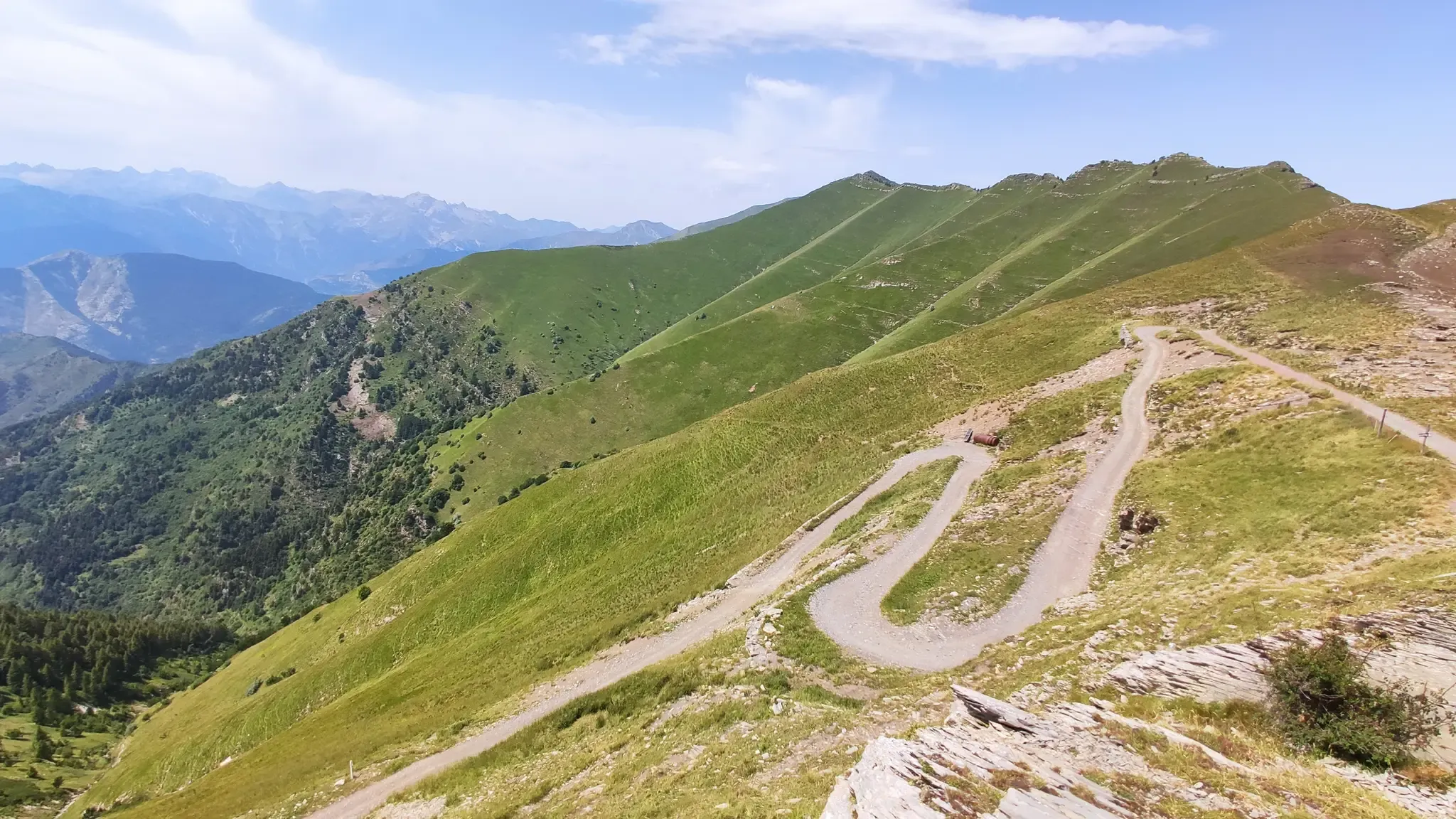
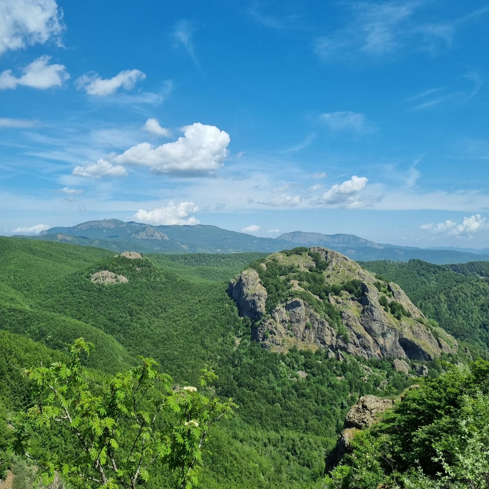
Road cycling routes in Parco Regionale Dell'Aveto are set within the Ligurian Apennines, characterized by significant peaks like Monte Penna and Monte Aiona, and diverse valleys such as Aveto, Sturla, and Graveglia. The region offers varied terrain with extensive woodlands and glacial lakes, providing a backdrop for road cycling. Mountain passes, including Forcella Pass, present opportunities for sustained climbs. The landscape includes ophiolite rock formations and well-preserved rural areas.
Best road cycling routes in Parco Regionale Dell'Aveto
- The most popular…
Last updated: July 1, 2026
4
riders
38.8km
01:58
640m
640m
Moderate road ride. Good fitness required. Mostly well-paved surfaces and easy to ride.
4.0
(3)
7
riders
33.1km
01:26
310m
310m
Moderate road ride. Good fitness required. Mostly well-paved surfaces and easy to ride.

Sign up for free
15
riders
36.6km
02:23
1,110m
1,110m
Hard road ride. Very good fitness required. Mostly well-paved surfaces and easy to ride.
5.0
(2)
46
riders
95.9km
05:01
1,710m
1,710m
Hard road ride. Very good fitness required. Some segments of this route may be unpaved and difficult to ride.
4.0
(1)
64
riders
69.0km
03:25
1,100m
1,100m
Hard road ride. Very good fitness required. Mostly well-paved surfaces and easy to ride.
Get access to more routes and recommendations from other explorers.
Sign up for free
Already have an account?
Our route recommendations are based on thousands of hikes, rides, and runs completed by other people on komoot.
Start today with a free account
Your next adventure awaits.
Login or Signup
Other adventures in Parco Regionale Dell'Aveto

Tips from the Community

Fresh and comfortable, on the road...
0
0

The Passo della Cappelletta (1,085 m a.s.l.) is a charming Apennine pass located on the border between Emilia-Romagna (province of Parma/Piacenza) and Liguria. It is famous for its imposing wind turbines and its proximity to Monte Gottero.
0
0

From here you can get everywhere!
0
0

A beautiful village perched in the Ligurian Apennines. It's worth stopping to see the well-preserved walls of the Malaspina Fieschi Doria Castle, for an excellent coffee at Bar Leon D'oro, and especially for the "Gobeletti" pastries from the Chiesa pastry shop.
0
0

Situated at 717 meters above sea level, Santa Maria del Taro is a hamlet in the municipality of Tornolo (province of Parma), nestled in the heart of the Northern Apennines, near the border between Emilia and Liguria. Since the early Middle Ages, its strategic position along the ancient ridge road connecting the sea to the Po Valley has made it a transit and trade center, as well as a military and commercial control point. The name itself recalls the religious devotion that has permeated the town for centuries: the church-sanctuary dedicated to the Nativity of Mary, rebuilt in neoclassical style between 1807 and 1834, stands on an older structure and has been the spiritual center of the upper Taro Valley for centuries. The building, with its broad façade and stone bell tower, preserves a deep devotional tradition that is still alive. A short walk from the center is the Ponte dei Priori, a medieval humpbacked stone structure that once served as the only permanent access to the valley and symbolically marked the passage between the lands of the Malaspina and Fieschi families, two powerful feudal families of the Apennines. Over the centuries, Santa Maria del Taro has maintained an identity suspended between Emilian and Ligurian culture, evident in the features of its rural architecture, local dialects, and popular customs.
0
0
Situated at 956 meters between the Vara and Aveto Valleys, the Bocco Pass is one of the historic passes of the Ligurian Apennines, used since ancient times as a connection between the Tyrrhenian coast and the Po Valley hinterland. Already in Roman times, it was part of a secondary transit network, but it was especially in the Middle Ages and modern times that the pass assumed a central role in local traffic: a route for merchants, shepherds, and pilgrims, it connected Chiavari and the Riviera with Varese Ligure and the Emilian plains. Traces of the ancient paving are still visible today in the surrounding woods. During the Second World War, the area served as a refuge for partisan groups, thanks to its secluded location and dense forest cover. Today, the pass is a destination for cyclists and hikers, immersed in an unspoiled mountain landscape of beech and fir forests and highland meadows, at the gateway to the Aveto Regional Natural Park.
0
0

Going up towards La Scoglina, on the left
0
0
Frequently Asked Questions
How many road cycling routes are available in Parco Regionale Dell'Aveto?
There are over 20 road cycling routes in Parco Regionale Dell'Aveto, offering a range of experiences from moderate loops to challenging mountain climbs. The komoot community has explored these routes over 1,500 times.
What are the typical difficulty levels for road cycling in Parco Regionale Dell'Aveto?
The routes in Parco Regionale Dell'Aveto cater to various skill levels. While the majority, about 15, are classified as difficult due to significant elevation gains, there are also 6 moderate routes and 1 easier option available for those seeking less strenuous rides.
Are there any family-friendly road cycling routes in Parco Regionale Dell'Aveto?
While many routes in Parco Regionale Dell'Aveto feature challenging climbs, there is at least one easier route available. For families, it's advisable to look for routes with less elevation gain and shorter distances, or consider the moderate options like the Colle Caprile, Leivi loop from Borzonasca, which is 14.3 miles (23.0 km) long and leads through the scenic Sturla Valley.
What kind of natural features and landmarks can I see along the road cycling routes?
Road cycling routes in Parco Regionale Dell'Aveto offer diverse scenery. You can encounter significant peaks like Monte Penna and Monte Aiona, glacial lakes such as Giacopiane Dam and Lake, and extensive beech woods. Notable landmarks include the Forcella Pass, which offers expansive views towards the coast, and unique ophiolite rock formations.
Are there any waterfalls to see while road cycling in the park?
Yes, the park features natural attractions like the Ciana Waterfall. While not directly on every road cycling route, it's an example of the natural beauty you can explore in the region.
What is the best time of year for road cycling in Parco Regionale Dell'Aveto?
The park's extensive forests are particularly stunning in autumn when the foliage changes color, offering a beautiful environment for cycling. Spring and early summer also provide pleasant conditions before the peak heat, with the high-mountain landscapes being accessible. Always check local weather conditions, especially for mountain passes.
Are there any circular road cycling routes in the region?
Yes, many of the routes in Parco Regionale Dell'Aveto are designed as loops, allowing you to start and end at the same point. An example is the challenging Passo del Biscia – Bocco Pass loop from Parco Regionale dell'Aveto, which covers 53.4 miles (86.0 km) through mountainous terrain.
What do other cyclists say about road cycling in Parco Regionale Dell'Aveto?
The area is highly rated by the komoot community, with an average score of 4.5 stars from over 80 reviews. Cyclists often praise the challenging yet scenic routes, the diverse landscapes from coastal views to alpine-like scenery, and the relatively light traffic on the roads, especially on weekdays.
Are there options for longer, more challenging road cycling tours?
Absolutely. For experienced cyclists seeking a significant challenge, routes like the Bocco Pass – Passo di Cento Croci (1,055 m) loop from Monte Zatta di Levante offer nearly 60 miles (96 km) with substantial elevation gain, providing a rewarding experience through the park's demanding terrain.
Can I find places to rest or refuel along the routes?
While specific cafes or pubs are not detailed for every route, the park does have refuges such as Ventarola Refuge and Rifugio Malga Zanoni, which can serve as resting points. It's always recommended to plan your route and check for available services in towns or villages along your chosen path.
What kind of views can I expect on the road cycling routes?
The region offers a mix of high-mountain landscapes, serene valleys, and extensive beech woods. From certain points, especially along ascents like the one towards Forcella Pass, you can enjoy expansive views towards the Ligurian coast. The View of Monte Aiona and the Ligurian Sea is a particularly notable viewpoint.
Are there any routes that pass through different types of valleys?
Yes, the park encompasses three distinct valleys: the Aveto Valley with its high-mountain landscapes, the Sturla Valley featuring meadows and woods, and the Graveglia Valley known for its rural landscapes. Routes like the Bocco Pass – Wouter Weylandt Memorial loop from Monte Zatta di Levante will take you through varied terrain characteristic of these valleys.
Most popular routes in Parco Regionale Dell'Aveto
Most popular attractions in Parco Regionale Dell'Aveto

Get inspired with the komoot mobile app


Explore more
Browse the best Road cycling routes in other regions.
