Las Trampas Regional Wilderness
Las Trampas Regional Wilderness
The 5 Most Amazing Peaks in Las Trampas Regional Wilderness
Best mountain peaks in Las Trampas Regional Wilderness are found in a rugged and scenic park in the East Bay, characterized by steep hills, oak woodlands, and open grasslands. The region's name, "Las Trampas," meaning "the traps," originates from the method Native Americans used to trap elk. This diverse landscape offers challenging hikes and rewarding views across its prominent peaks. The park is known for its significant elevation changes and varied terrain.
Best mountain peaks in Las Trampas Regional Wilderness
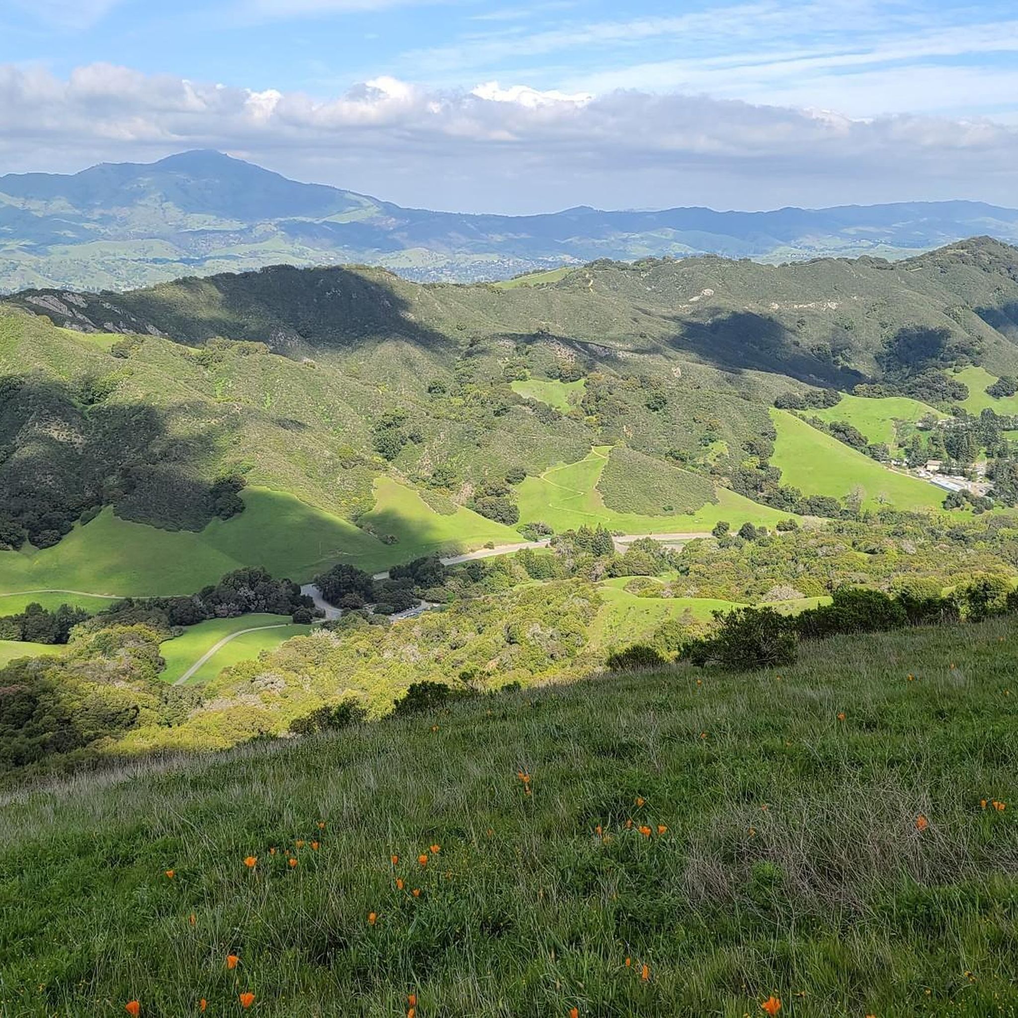
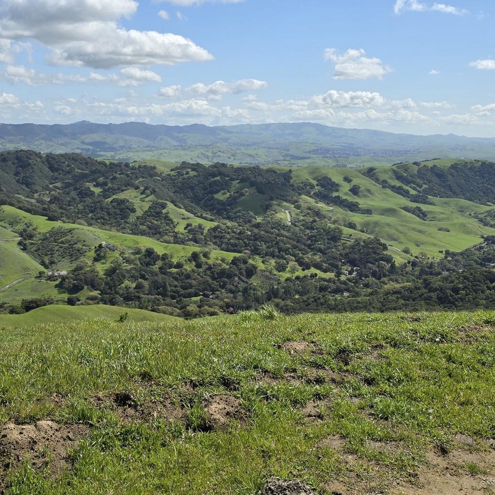
- The most popular mountain peaks is Las Trampas Ridge, a viewpoint that offers views of the Ignacio, San Ramon, and Amador valleys. Mount Diablo is also visible from this ridge.
- Another must-see spot is View from Las Trampas Peak, a viewpoint at the summit. This peak provides expansive views of the surrounding valleys and Mount Diablo.
- Visitors also love Eagle Peak, a summit. This peak, standing at 1430 feet, offers views of open meadows, San Ramon Valley, and Mount Diablo.
- Las Trampas Regional Wilderness is known for its prominent summits, viewpoints, and natural monuments. The area offers a variety of mountain peaks to see and explore, each with distinct features and views.
- The mountain peaks in Las Trampas Regional Wilderness are appreciated by the komoot community, with 4 highlights, 4 photos, and 4 upvotes.
Last updated: August 19, 2026
Las Trampas Ridge
Highlight • Viewpoint
Further on, Mount Diablo stands out.
Tip by

Eagle Peak
Highlight • Summit
Tip by

Sign up now to discover places like this
Get recommendations on the best single tracks, peaks, & plenty of other exciting outdoor places.
Sign up for free
View from Las Trampas Peak
Highlight • Viewpoint
Tip by
"Rock 2" Radio Tower
Highlight • Summit
Tip by

Start today with a free account
Your next adventure awaits.
Login or Signup
Popular around Las Trampas Regional Wilderness

Hiking treasures in the Bay Area
Hiking in Las Trampas Regional Wilderness
Cycling in Las Trampas Regional Wilderness
MTB Trails in Las Trampas Regional Wilderness
Road Cycling Routes in Las Trampas Regional Wilderness
Running Trails in Las Trampas Regional Wilderness

Gravel biking in Las Trampas Regional Wilderness
Other adventures in Las Trampas Regional Wilderness

Tips from the Community

Eagle Peak, standing at 1430 feet, lives up to its fitting name, offering a bird's-eye view of the open meadows, San Ramon Valley, and Mount Diablo.
0
0
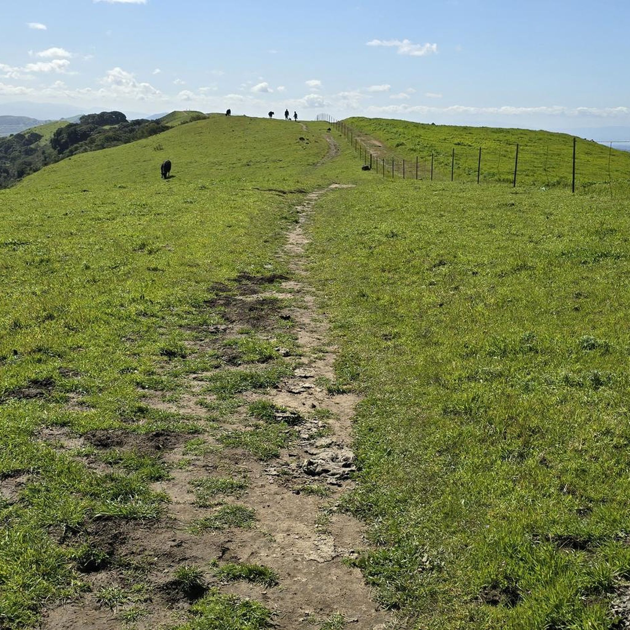
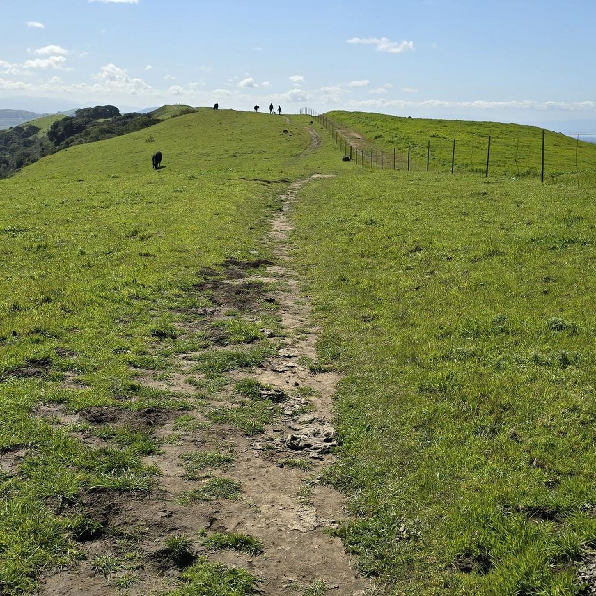
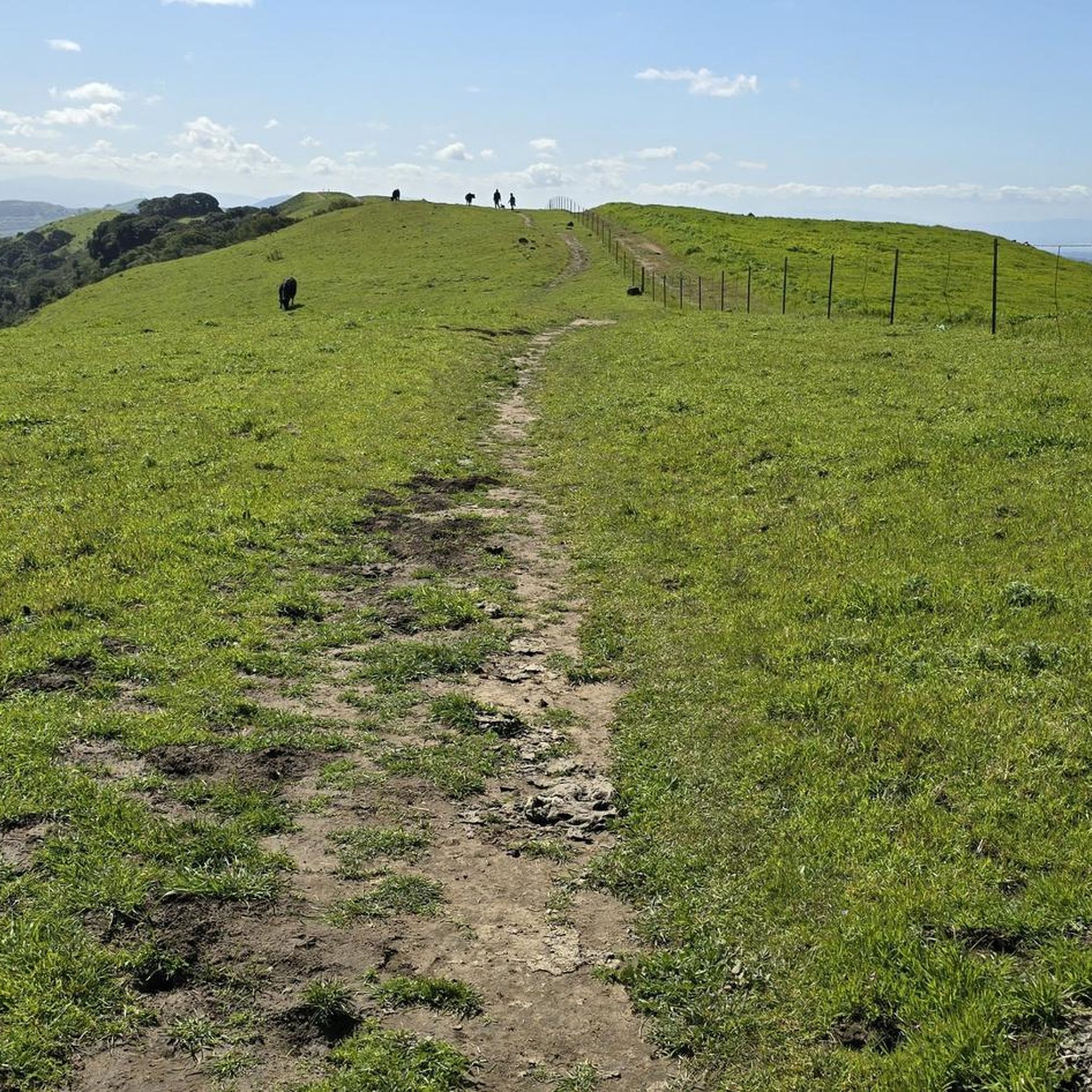
The name "Las Trampas," meaning "the traps" in Spanish, originates from the method Native Americans used to trap elk while hunting, by utilizing the ridge to trap their prey. The summit offers plenty of stunning views for you to enjoy.
0
0

From this ridge you embrace quite a few points of view. Starting with the valleys of Ignacio, San Ramon and Amador. Further on, Mount Diablo stands out.
0
0

This place was once designated SF-25C, home to a Nike surface-to-air guided missile system during the Cold War. The peak is called "Rock 2" Elevation 2024. The body of water you can see in the westerly-facing photos is the San Francisco Bay. The body of land behind it is the peninsula. On a clear day you can see even further to see Sutro Tower, and even the Pacific Ocean.
0
0
Frequently Asked Questions
Which peaks offer the most expansive views in Las Trampas Regional Wilderness?
For breathtaking panoramic views, consider hiking to Las Trampas Ridge or View from Las Trampas Peak. From these points, you can see the Ygnacio, San Ramon, and Amador valleys, as well as Mount Diablo and the Carquinez Straits. Rock 2 also offers extensive vistas of the San Francisco Bay, including downtown San Francisco, the Bay Bridge, and Mount Umunhum.
What unique natural features can I expect to see on the peaks?
The peaks in Las Trampas Regional Wilderness offer diverse natural features. On the western Rocky Ridge, leading to Rock 2, you'll find massive rock formations, wind caves, and Devil's Hole, with exposed rocks containing fossils over ten million years old. In spring, this ridge is also known for an abundance of wildflowers. Las Trampas Peak features a beautiful oak tree at its summit, providing shade.
How challenging are the hikes to the mountain peaks in Las Trampas Regional Wilderness?
The hikes to the peaks are generally considered challenging, often involving steep climbs. For instance, the hike to Rock 2 via the Rocky Ridge View Trail has a steep initial ascent. Trails to Eagle Peak can also be steep and rugged. These peaks provide a good hill-climbing workout, making them suitable for intermediate hikers looking for a rewarding experience.
Are there family-friendly options for hiking the peaks?
While many peak trails involve significant elevation gain, some sections or shorter loops within Las Trampas Regional Wilderness might be more accessible for families. For easier hiking options in the region, you can explore routes like the easy hikes in Las Trampas Regional Wilderness guide, which includes trails like the Rocky Ridge View Trail.
When is the best time of year to hike the peaks in Las Trampas Regional Wilderness?
Spring is an excellent time to visit, especially for the abundance of wildflowers along Rocky Ridge. Fall and winter can also offer pleasant hiking conditions with cooler temperatures and clearer views. Summers can be hot and exposed, so early morning hikes are recommended during this season.
What types of outdoor activities can I enjoy around the mountain peaks?
Beyond hiking to the summits, Las Trampas Regional Wilderness offers a variety of outdoor activities. You can find numerous hiking trails, including easy and intermediate options. The area is also popular for mountain biking, with dedicated MTB trails and gravel biking routes.
Are there any historical points of interest on the peaks?
Yes, "Rock 2" Radio Tower, also known as Rock 2, has historical significance. It was once designated SF-25C, serving as a Nike surface-to-air guided missile system site during the Cold War. This adds a layer of historical context to your hike amidst the natural beauty.
Can I bring my dog on the trails to the peaks?
Las Trampas Regional Wilderness generally allows dogs on trails, but it's always best to check specific park regulations and trail signage for any restrictions, especially regarding leash requirements or sensitive wildlife areas. Ensure your dog is well-behaved and can handle the challenging terrain.
What kind of flora and fauna can I expect to see while hiking the peaks?
The park features diverse landscapes including oak woodlands and open grasslands. You'll encounter various native plants, and in spring, the Rocky Ridge is particularly vibrant with wildflowers. The region is home to wildlife, including deer, coyotes, and a variety of bird species, living up to the name Eagle Peak.
Is parking available near the trailheads for the peaks?
Yes, Las Trampas Regional Wilderness has several access points with parking areas. Common trailheads for accessing the peaks include those off Bollinger Canyon Road and the main park entrance. It's advisable to arrive early on weekends or during peak seasons to secure a spot.
Do I need a permit to hike the peaks in Las Trampas Regional Wilderness?
Generally, permits are not required for day hiking in Las Trampas Regional Wilderness. However, it's always a good practice to check the official East Bay Regional Park District website for the most current information regarding any fees, permits, or specific regulations that might apply to certain activities or areas within the park.
What makes Vail Peak a notable destination?
Vail Peak, standing at 1,788 feet, is often included in longer, multi-peak hikes within Las Trampas Regional Wilderness. While specific expansive views directly from its summit are not consistently highlighted, the trail leading to it follows a fairly narrow ridgeline with outstanding views. It's primarily a destination for peak-baggers or those undertaking extensive loops that encompass multiple summits, contributing to the challenging wilderness experience of the park.
Most popular routes in Las Trampas Regional Wilderness
Most popular attractions in Las Trampas Regional Wilderness

Get inspired with the komoot mobile app


Explore more
See even more amazing summits in Las Trampas Regional Wilderness with these guides:
