Routes

Planner

Features

Updates

App

Login or Signup

Get the App

Login or Signup

Routes
Hikes
United States
California
Contra Costa County

Las Trampas Regional Wilderness

The best walks and hikes in Las Trampas Regional Wilderness

4.7

(135)

2,035

hikers

30

hikes

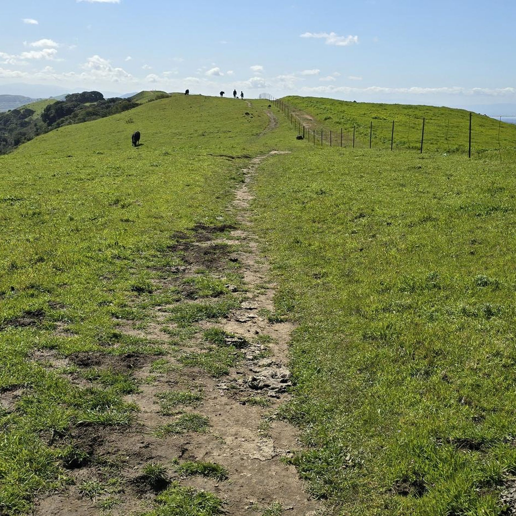
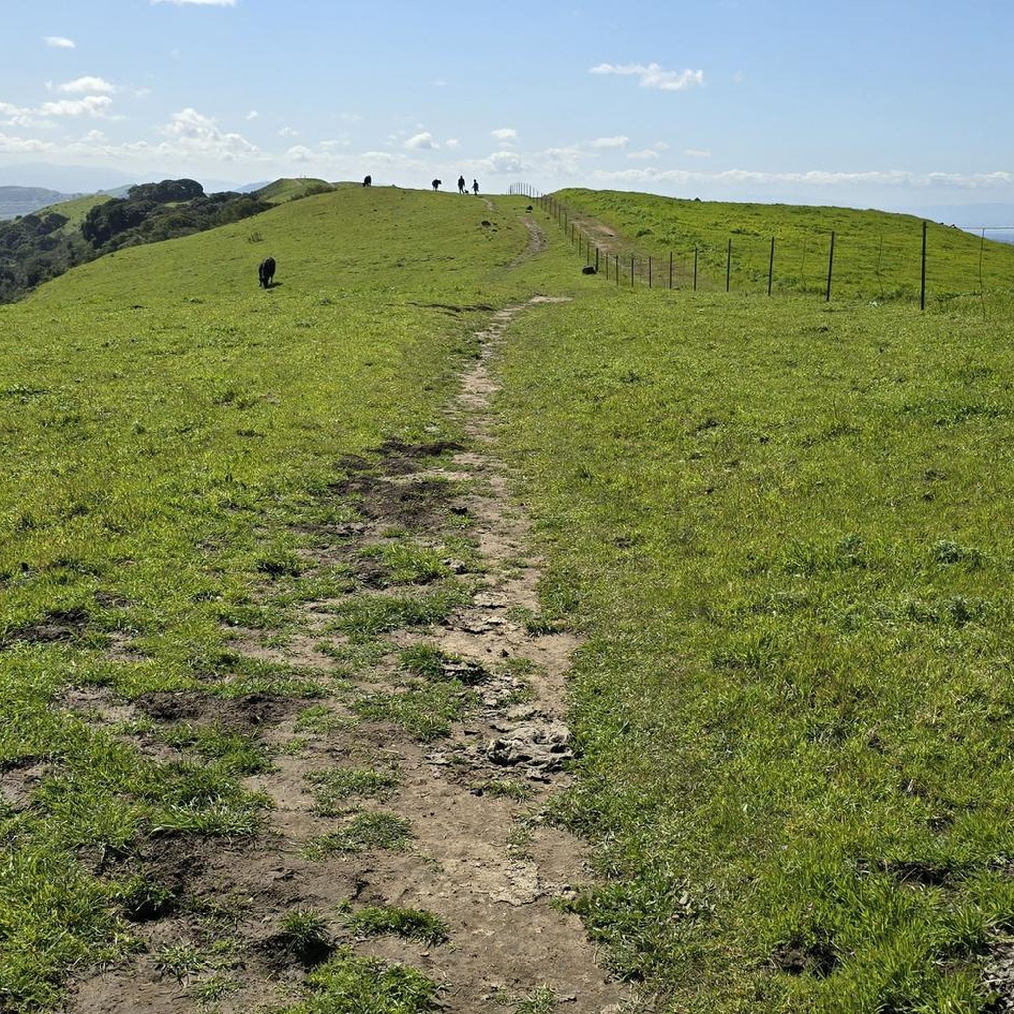
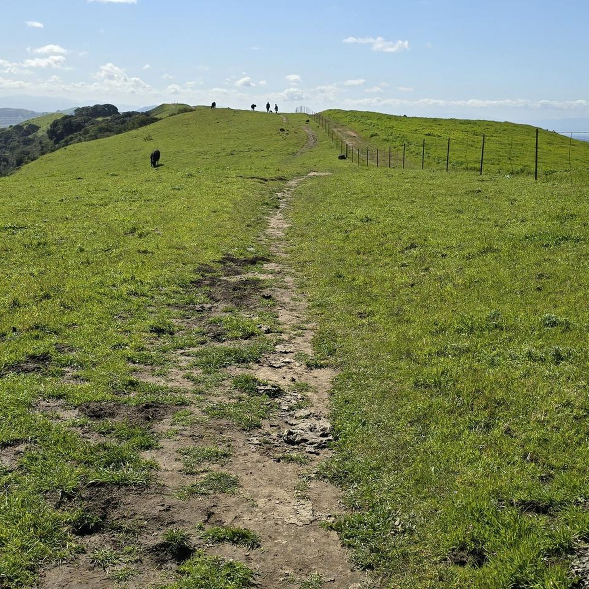
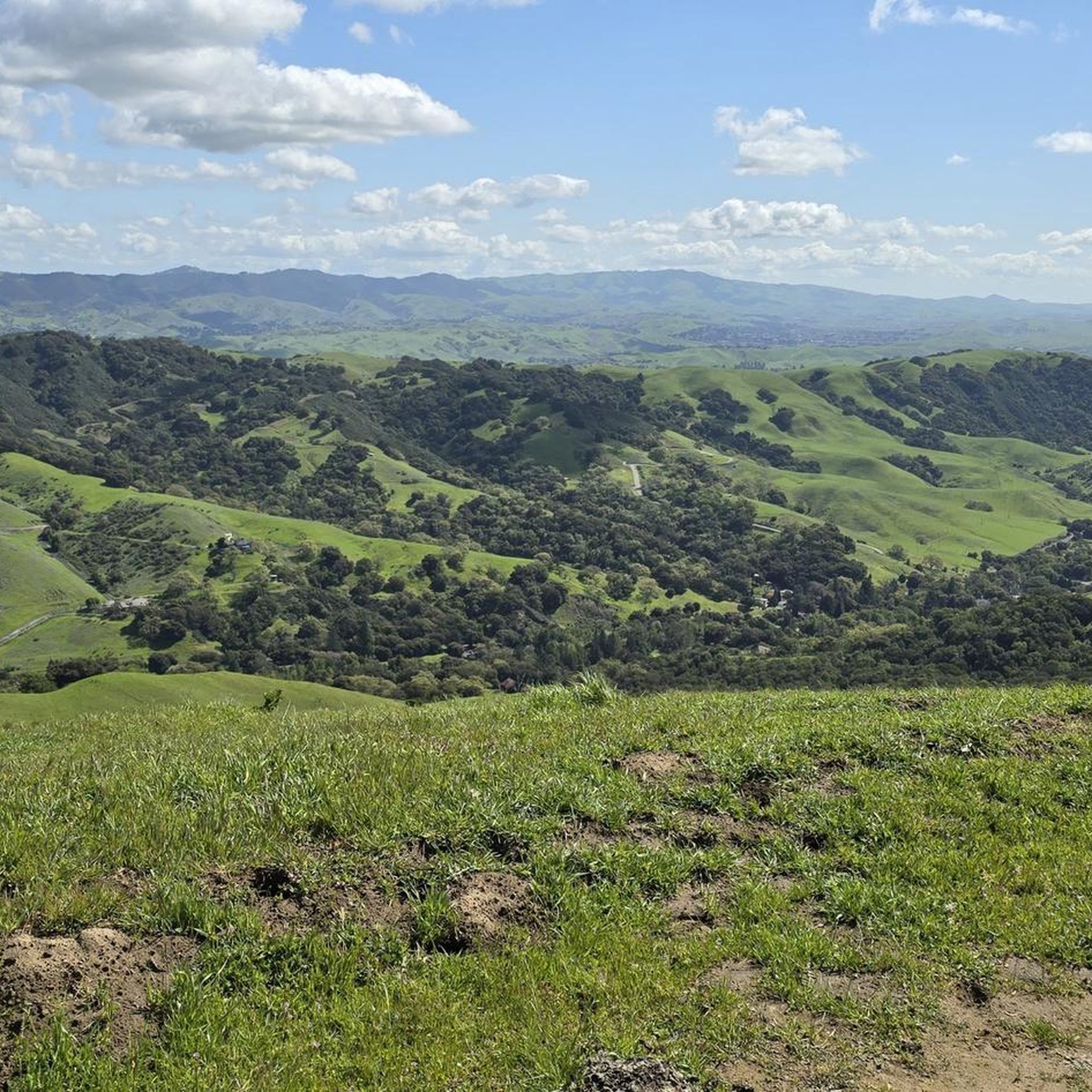
Hikes in Las Trampas Regional Wilderness traverse a rugged landscape of steep, rolling hills and two primary ridges, Las Trampas and Rocky Ridge. The park is characterized by its challenging terrain, with significant elevation changes through oak woodlands and open grasslands. The trail system offers views of the San Ramon Valley and Mount Diablo.

Best hiking trails in Las Trampas Regional Wilderness

  • The most popular hiking route is Elderberry, Rocky Ridge View, Devil’s Hole & Sycamore Trail loop β€” Las Trampas Wilderness Regional Preserve, a 6.4 mile (10.3 km) trail that takes around 3 hours 30 minutes to complete. This route features steep climbs and passes through a box canyon known as Devil's Hole.
  • Another top favourite among local hiking enthusiasts is Las Trampas Ridge Loop β€” Las Trampas Regional Wilderness, a moderate 7.9 mile (12.7 km) path. The trail follows the scenic Las Trampas Ridge, providing views over the surrounding valleys.
  • Local hiking enthusiasts also love the Rock 2 via Rocky Ridge View & Elderberry Trail loop β€” Las Trampas Regional Wilderness, a 4.7 mile (7.6 km) trail leading through open hillsides, often completed in about 2 hours 20 minutes.
  • Hiking in Las Trampas Regional Wilderness is defined by steep ascents, scenic ridgelines, and oak-dotted hills. The network of trails provides options for hikers looking for both moderate loops and more challenging hikes with significant elevation gain.
  • The routes in Las Trampas Regional Wilderness are highly rated by the komoot community with an average score of 4.6 stars from over 40 reviews. More than 800 hikers have used komoot to explore Las Trampas Regional Wilderness's varied terrain.

Last updated: June 25, 2026

4.0

(1)

36

hikers

#1.

Elderberry to Cuesta Loop

8.56km

02:39

310m

290m

Embark on the Elderberry to Cuesta Loop, a moderate hike spanning 5.3 miles (8.6 km) with an elevation gain of 1019 feet (311 metres). This route offers a rewarding experience through diverse terrain, leading you to expansive canyon views looking towards Mount Diablo. You can expect to complete this loop in about 2 hours and 38 minutes, enjoying the varied landscapes and a unique resting spot with panoramic vistas.

Before you head out, remember that an annual permit from EBMUD might be necessary for this trail, so check local regulations beforehand. The route has exposed sections, especially at higher elevations, making it crucial to carry plenty of water to stay hydrated. If you plan to bring your dog, they are welcome on the trail but must be kept on a leash, and you are responsible for carrying out their waste.

This loop is nestled within the Las Trampas Regional Wilderness, known for its continuous scenic overlooks. From higher points, you can enjoy not only Mount Diablo but also the Tri-Valley and even the distant San Mateo Bridge on a clear day. The Cuesta Trail segment provides a more secluded hiking experience, offering a peaceful contrast to the more open sections of the trail.

Navigate with device

Send to Phone

Save

Moderate

5.0

(1)

5

hikers

Embark on the Calaveras and Del Amigo Trail Loop for a moderate hiking challenge that offers rewarding views. This 3.9-mile (6.3 km) route features significant elevation changes, gaining 863 feet (263 metres) as you navigate its steep sections, particularly along the Del Amigo Trail. You can expect the terrain to be dusty and rugged in places, with some grades reaching up to 35%, making it a good workout that takes around 2 hours and 1 minute to complete. From the ridge, you will find expansive views to the east and southeast, often marked by an American flag or school flag near the summit.

Before you head out, be prepared for a strenuous hike due to the trail's challenging steepness. While specific warnings for snow or closures are not typically mentioned, always check local conditions before your visit to Las Trampas Regional Wilderness. Parking is generally available at the trailheads, but arriving early on busy days is a good idea to secure a spot.

This loop is a notable option within the Las Trampas Regional Wilderness for its intense climbs and panoramic vistas. The trail's steepness, with an average grade of 15%, makes it a favorite for those seeking a vigorous outdoor experience. It provides a unique perspective of the region, allowing you to see far across the landscape after conquering its demanding ascents.

Moderate
guide_signup
Let us show you the way with the komoot mobile app
With aΒ free komoot account, you can easily find, customize, and navigate endless outdoor adventures.

Sign up for free

3

hikers

Embark on the Las Trampas and Rocky Ridge Loop, a difficult hiking adventure spanning 13.7 miles (22.1 km) with a significant elevation gain of 3169 feet (966 metres). You can expect to spend around 7 hours and 2 minutes traversing its varied terrain, which includes steep service roads, bumpy singletrack, and fire roads. The highlight of this route is undoubtedly the expansive panoramic views from Rocky Ridge, where you can often spot Bollinger Canyon, Mount Diablo, and even the San Francisco skyline on a clear day. As you hike, you'll also encounter rolling grassy hills, particularly vibrant in winter and spring, and might even see unique rock formations and grazing cattle.

When planning your visit, be aware that the trail can be quite muddy and rutted during winter and early spring, especially in areas where cattle graze. If you plan to hike during the summer months, prepare for sun-baked and dusty conditions, so bring plenty of water and sun protection. It's also important to note that some sections of the trail, particularly those extending onto East Bay Municipal Utility District (EBMUD) property, may require a permit, so check ahead of time.

This loop offers a rewarding experience within the Las Trampas Regional Wilderness, known for its diverse landscapes and wildlife. The area's unique geology contributes to the varied terrain and distinct rock formations you'll encounter. The rolling grassy hills provide a striking contrast to the distant urban skyline, making this trail a notable escape for those seeking a challenging hike with expansive vistas in the region.

Hard

Embark on the Ringtail Cat, Madrone and Point of No Return Loop for an easy hiking experience that packs a punch. This 2.6-mile (4.2 km) route guides you through shaded woodlands filled with oak trees, offering a refreshing escape. You will gain 865 feet (264 metres) in elevation, providing rewarding views of rolling hills and distant vistas of Mount Diablo, all within an estimated 1 hour and 26 minutes.

When planning your visit, remember that the trail is generally accessible, but prepare for unpaved and sometimes uneven terrain. After rain, some sections might be muddy, so sturdy hiking shoes are a good idea for comfort and stability. In drier conditions, you could encounter loose gravel, making proper footwear even more important for a secure footing.

The Madrone Trail section is particularly notable for its gorgeous woodland scenery, providing a peaceful atmosphere as you hike. This loop offers a quick yet rewarding outdoor experience within the Las Trampas Regional Wilderness, perfect for a refreshing outing when you want to connect with nature.

Easy

If you're looking for a challenging hike, the Carr Ranch Loop and Rocky Ridge Trail delivers a strenuous workout across 9.9 miles (15.9 km). You'll ascend a significant 2704 feet (824 metres), requiring about 5 hours and 17 minutes to complete this difficult route. The trail winds through varied terrain, moving from shaded woodlands along Buckhorn Creek into open grasslands and onto rolling ridgelines. Prepare for stiff uphill climbs and steep descents that test your endurance. Your efforts are rewarded with sweeping panoramic views from high points like Rock 2, where you can see the Diablo Range, Carquinez Strait, and San Francisco Bay. This route offers a true sense of accomplishment for experienced hikers.

Before you head out, be aware that parts of this route cross East Bay Municipal Utility District (EBMUD) land, so you will need an EBMUD trail permit to access it. The best time to hike this trail is typically during the cooler months of winter or spring. During these seasons, you'll experience abundant wildflowers and avoid the dusty conditions of late summer or the heavy mud of the wet season. Always check local conditions and permit requirements before planning your visit to ensure a smooth experience.

This trail is notable for its dramatic elevation changes and the diverse ecosystems you traverse, from shaded creek beds to exposed ridge tops. The Las Trampas Regional Wilderness, where this trail is located, is known for its rugged beauty and extensive network of trails. The panoramic 360-degree views from the ridgelines are a highlight, offering expansive vistas that truly showcase the region's natural grandeur. It's a fantastic option if you want to push your limits and be rewarded with spectacular scenery.

Hard
Sign up for free to see 26 more hikes in Las Trampas Regional Wilderness.

Get access to more routes and recommendations from other explorers.

Sign up for free

Already have an account?

Our route recommendations are based on thousands of hikes, rides, and runs completed by other people on komoot.

Start today with a free account

Your next adventure awaits.

Login or Signup

Popular around Las Trampas Regional Wilderness

Hiking treasures in the Bay Area

Cycling in Las Trampas Regional Wilderness

MTB Trails in Las Trampas Regional Wilderness

Road Cycling Routes in Las Trampas Regional Wilderness

Running Trails in Las Trampas Regional Wilderness

Gravel biking in Las Trampas Regional Wilderness

Other adventures in Las Trampas Regional Wilderness

Hiking treasures in the Bay Area

Hiking Collection by

komoot

Tips from the Community

Efraim Petel
April 7, 2024, Bollinger Canyon Trailhead

For the Rocky Ridge trail hike, I suggest to have a hat, hiking poles, sun-glasses and of course water. Most of the trail is without any shade. Depends on the season, some portions of the trail could be muddy. Park the car in the parking lot at the end of Bollinger Canyon Road. If parking lot is full you can park along the road. This is the staging area and the start and end of our hike is here. Restrooms are available only at this place. To start the Rocky Ridge Trail, go to the north-west corner of the parking lot (north of the restrooms) and start going up on the paved road. Note that most of the climb is this segment, but afterwards the trail is pretty easy. No shade on Rocky Ridge, some shade on Elderberry.

0

0

Sue
September 15, 2023, Bollinger Canyon Trailhead

This trailhead is an excellent staging area centrally located within the Park, making it a great starting or resting point for multiple hike variations. There is plenty of parking, restrooms and drinking water. The Sycamore Trail is closed temporarily due to a landslide, so check the Park's website for updates. The Cuesta Trail is an excellent alternative if you plan to hike the Ridge View Trail loop.

1

0

Eagle Peak, standing at 1430 feet, lives up to its fitting name, offering a bird's-eye view of the open meadows, San Ramon Valley, and Mount Diablo.

0

0

The name "Las Trampas," meaning "the traps" in Spanish, originates from the method Native Americans used to trap elk while hunting, by utilizing the ridge to trap their prey. The summit offers plenty of stunning views for you to enjoy.

0

0

From this ridge you embrace quite a few points of view. Starting with the valleys of Ignacio, San Ramon and Amador. Further on, Mount Diablo stands out.

0

0

Restrooms, water, and shade. Good starting or rest point, near the middle of the park, almost all trails lead down to this area.

0

0

Ridge View and Elderberry Trails are the most gradual way to descend or climb this ridge.

0

0

Near the highest point on the ridge, this might have the best view. Sycamore trail down to Devil's Hole is a very steep descent. Staying along Ridge View Trail maintains a more gradual level and, well, great Ridge views.

0

0

Frequently Asked Questions

Are dogs allowed in Las Trampas Regional Wilderness?

Yes, dogs are welcome in Las Trampas Regional Wilderness. They must be on a leash in developed areas like parking lots and picnic sites. On the trails, they can be off-leash as long as they are under voice control. Be aware that you will likely encounter grazing cattle in the park.

How challenging are the hikes in Las Trampas?

The trails in Las Trampas are known for being steep and rugged, often featuring twice the elevation gain of other Bay Area parks. Most routes are considered moderate to difficult, making it an excellent choice for hikers seeking a strenuous workout with rewarding views. The terrain consists of rolling hills and two main ridges, Las Trampas Ridge and Rocky Ridge.

Are there any easier or family-friendly trails?

While the park is known for its challenging terrain, there are some options suitable for a less strenuous outing. The park has a number of trails rated as easy. For a shorter, more manageable hike, consider the Corduroy Hills Trail loop. It offers a good taste of the park's scenery without the intense elevation gain of the main ridge trails.

What is the best time of year to hike in Las Trampas?

The best times to visit are spring and fall. In spring, the hills are green and covered in vibrant wildflowers. Fall offers cooler temperatures and clearer skies for panoramic views. Summers can be very hot and dry with little shade on the exposed ridges, while winters can be muddy and slippery after rain.

What are the trail conditions like after it rains?

Trails can become very muddy and slippery, especially on the steep sections. The park's clay-rich soil holds water, so it's best to wait a few days after a significant rainfall for the trails to dry out. Always wear sturdy hiking boots with good traction, particularly during the wet season.

Where can I park to access the trails?

There are several staging areas for accessing the trails. The main entrance is at the end of Bollinger Canyon Road, which leads to the Las Trampas Wilderness Regional Preserve parking area. Other popular access points include the Las Trampas Elderberry Trailhead and the Elworthy Staging Area, both of which are highly regarded by local hikers.

Which trails offer the best views?

For expansive views, the trails along Rocky Ridge and Las Trampas Ridge are unparalleled. From these high points, you can see across the San Ramon and Amador valleys, with clear views of Mount Diablo to the east. The Las Trampas northern loop is a great option that takes you along scenic ridgelines with sweeping vistas.

How does hiking in Las Trampas compare to Mount Diablo?

Both parks offer challenging hikes with significant elevation gain and great views. Las Trampas is generally considered more rugged and remote, with a wilder feel. While Mount Diablo is taller and offers 360-degree summit views, Las Trampas provides a more intimate experience with its rolling hills, oak woodlands, and dramatic canyons.

Is there any interesting geology or history in the park?

Yes, the park has a rich history. The Rocky Ridge area contains fascinating wind-carved sandstone formations. Geologically, the park is also known for Miocene-era fossils, including parts of a mastodon that were discovered here. You can also find remnants of a Cold War-era Nike missile site within the park boundaries.

What do other hikers think of Las Trampas Regional Wilderness?

The area is highly rated by the komoot community, with an average score of 4.6 stars. Reviewers frequently praise the park's challenging climbs, stunning panoramic views from the ridges, and the sense of true wilderness so close to urban areas. The green hills and wildflowers in the spring are also a common highlight.

How many trails are there in the park?

There are over 20 hiking routes to explore in Las Trampas Regional Wilderness on komoot. These range from short, easy walks to strenuous, all-day adventures, covering the park's diverse terrain of canyons, hills, and ridgelines.

Is horseback riding allowed on the trails?

Yes, Las Trampas is a popular destination for horseback riding. Most of the trails in the 5,342-acre park are multi-use and open to equestrians. The wide fire roads and scenic ridge trails are particularly well-suited for riding.

Most popular routes in Las Trampas Regional Wilderness

Family-friendly hikes in Las Trampas Regional Wilderness

Most popular attractions in Las Trampas Regional Wilderness

Places to see

Store rating

Get inspired with the komoot mobile app

With aΒ free komoot account, you can easily find, customize, and navigate endless outdoor adventures.

or

Join komoot Now

Store rating

Explore more

Browse the best Hikes in other regions.

Reinhardt-Redwood Regional ParkMount Diablo State ParkTilden Regional ParkBriones Regional ParkRichmondPachecoWalnut CreekOrindaAlamoBay PointKensingtonDiabloNorth GateReliez ValleyMoragaLafayetteAntiochConcordBishop Ranch Regional Open Space PreserveBlackhawkDiablo Foothills Regional ParkMulholland Open Space PreserveShell RidgeBrentwoodAntioch Dunes National Wildlife RefugeContra Costa CentreVine HillHerculesSan RamonPort CostaByronPleasant HillPittsburgMartinezPinoleAcalanes RidgeClaytonDanvilleRodeoCastle HillOakleyCrockettMountain ViewNorth RichmondEl CerritoWildcat Canyon Regional ParkEl SobranteKennedy Grove Regional Recreation AreaMarsh Creek State ParkSaranapCrockett Hills Regional ParkNorris CanyonRollingwoodSan PabloContra Loma Regional ParkClydeAlhambra ValleyCamino TassajaraLafayette Reservoir Recreation AreaSan MiguelEast Richmond HeightsTara HillsBayviewKnightsenMontalvin ManorBethel Island

Nearby adventure guides

Things to Do around Alamo

background

Get ready to conquer new peaks

Sign up for Free

Explore
RoutesRoute plannerFeaturesHikesMTB TrailsRoad cycling routesBikepackingSitemap
Download the app
Follow Us on Socials

Β© komoot GmbH

Privacy Policy