Las Trampas Regional Wilderness
Las Trampas Regional Wilderness
Attractions and Places To See in Las Trampas Regional Wilderness - Top 17
Best attractions and places to see in Las Trampas Regional Wilderness, a 5,342-acre park, include rugged terrain, panoramic vistas, and diverse natural features. The wilderness is characterized by two prominent ridges, Las Trampas Ridge and Rocky Ridge, with Bollinger Creek flowing between them. It features varied geological formations, including sandstone outcrops and ancient marine fossils, alongside diverse flora and wildlife. The park also surrounds the Eugene O'Neill National Historic Site, adding a cultural dimension to its natural offerings.
Best attractions…
Last updated: August 29, 2026
Bollinger Canyon Trailhead
Highlight • Trail
Tip by

Del Amigo Trail
Highlight (Segment) • Trail
Tip by

Sign up now to discover places like this
Get recommendations on the best single tracks, peaks, & plenty of other exciting outdoor places.
Sign up for free
Devil's Hole Trail
Highlight (Segment) • Trail
Tip by
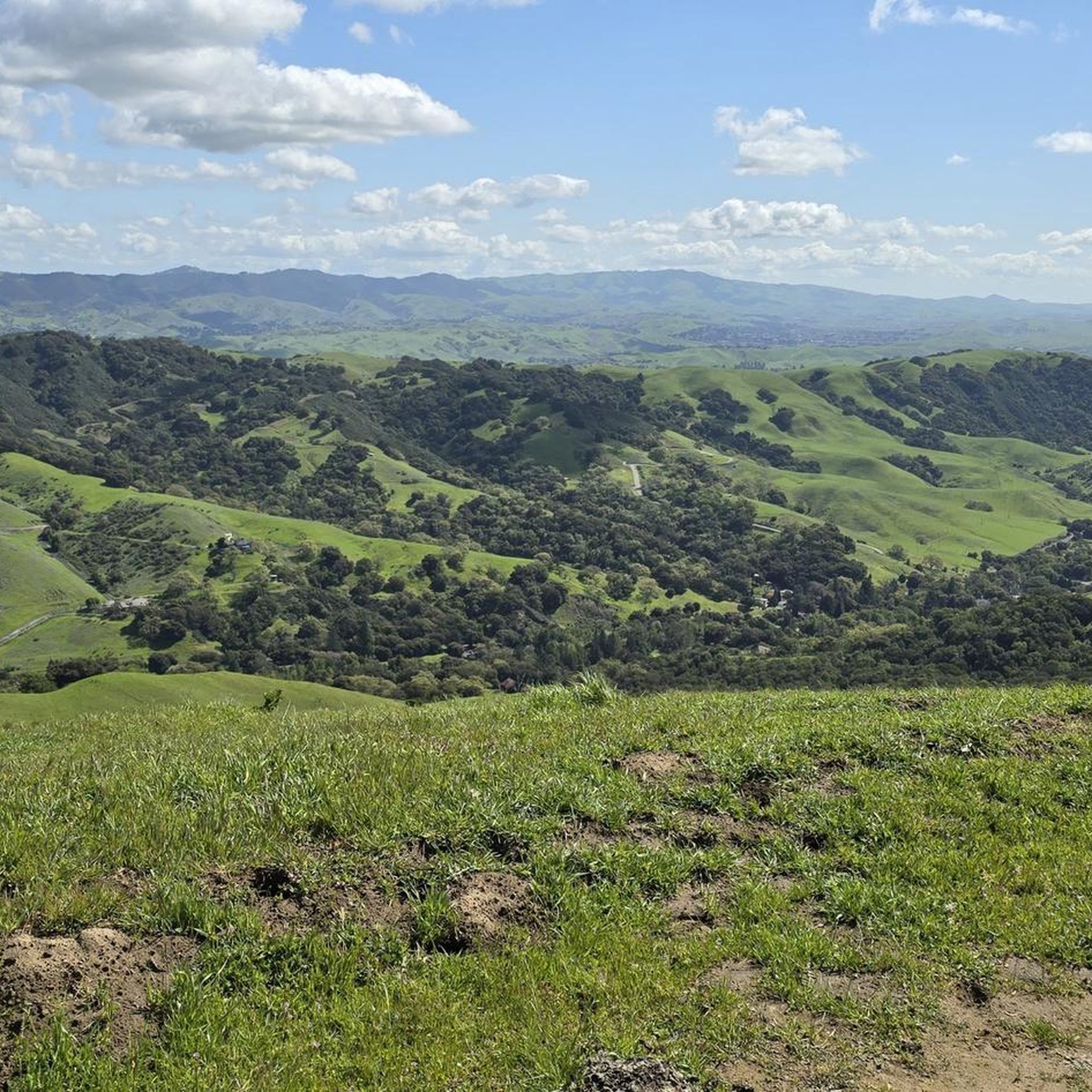
Las Trampas Ridge
Highlight • Viewpoint
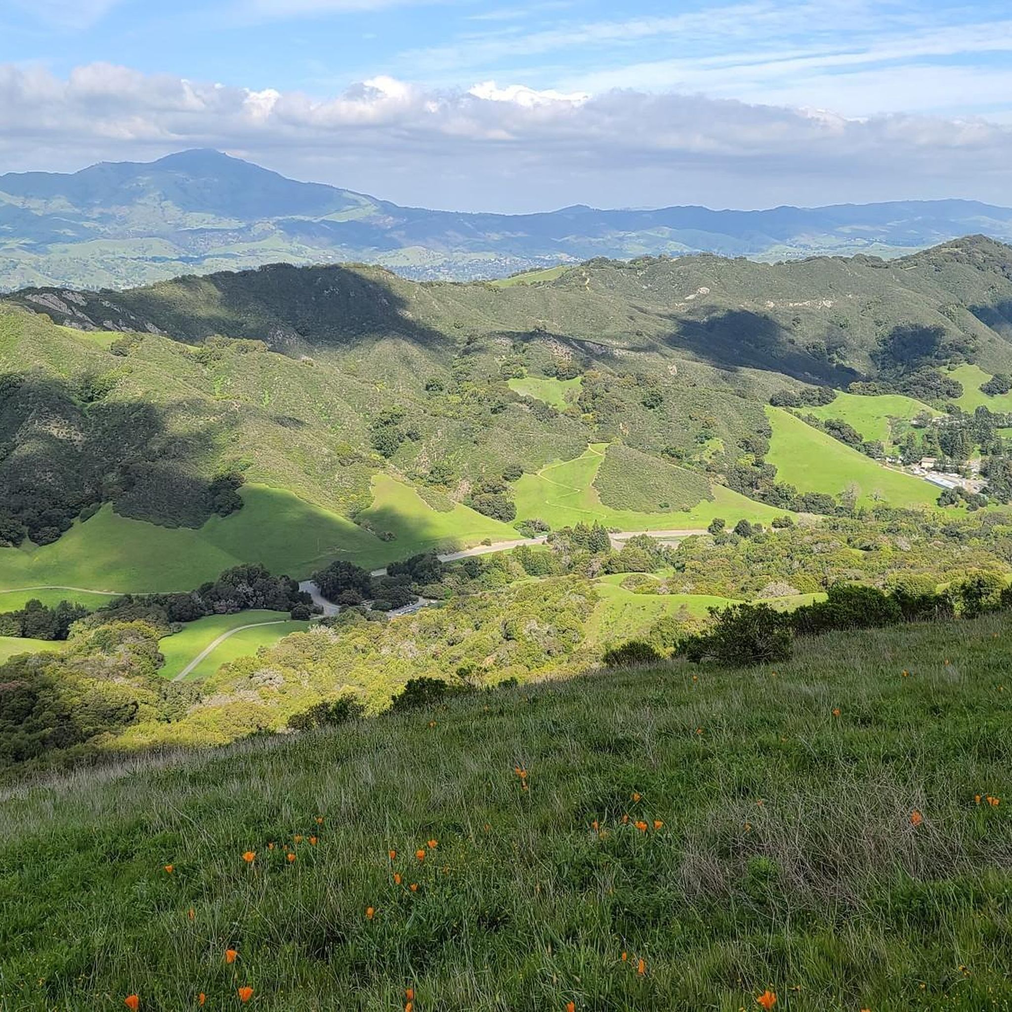
Further on, Mount Diablo stands out.
Tip by

Elderberry Trail
Highlight (Segment) • Trail
Tip by
Sign up for free to discover even more attractions in Las Trampas Regional Wilderness.
Sign up for free
Already have an account?
Start today with a free account
Your next adventure awaits.
Login or Signup
Popular around Las Trampas Regional Wilderness

Hiking treasures in the Bay Area
Hiking in Las Trampas Regional Wilderness
Cycling in Las Trampas Regional Wilderness
MTB Trails in Las Trampas Regional Wilderness
Road Cycling Routes in Las Trampas Regional Wilderness
Running Trails in Las Trampas Regional Wilderness

Gravel biking in Las Trampas Regional Wilderness
Other adventures in Las Trampas Regional Wilderness

Tips from the Community

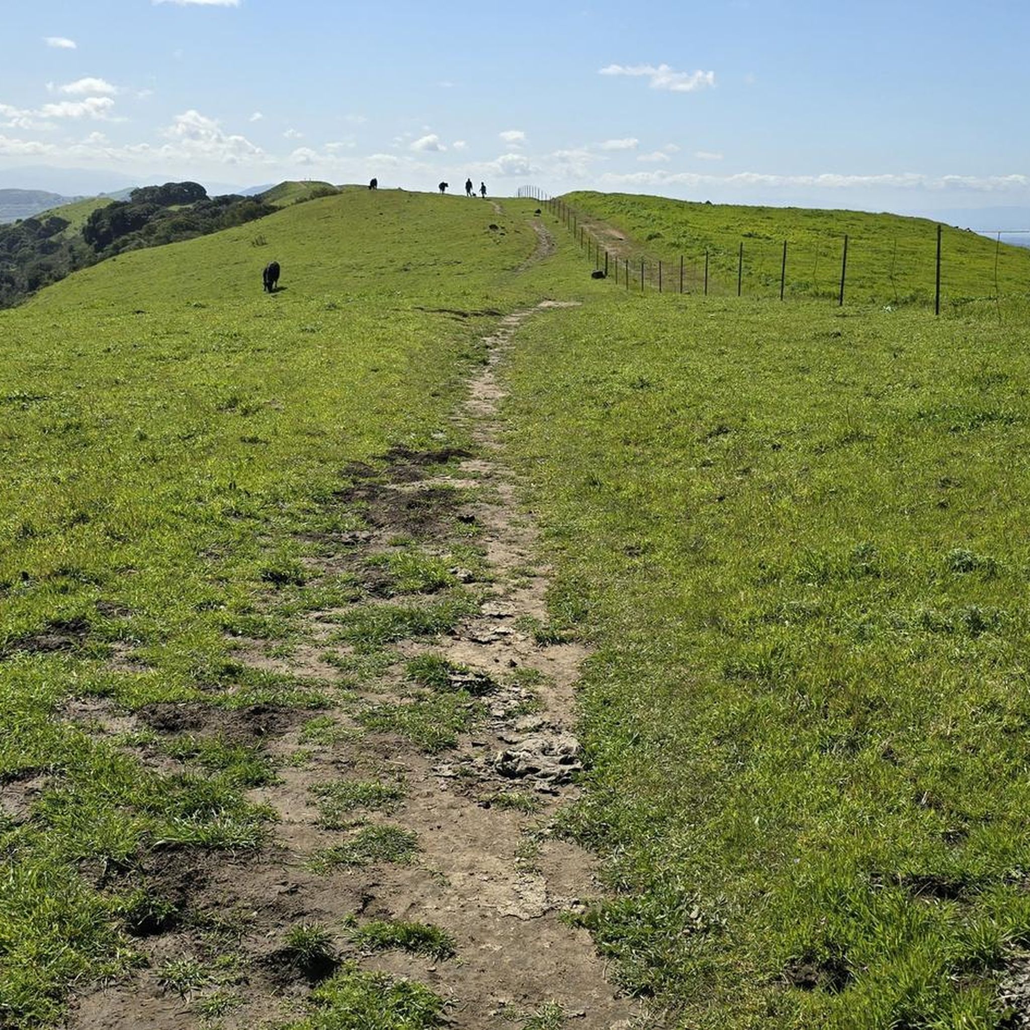
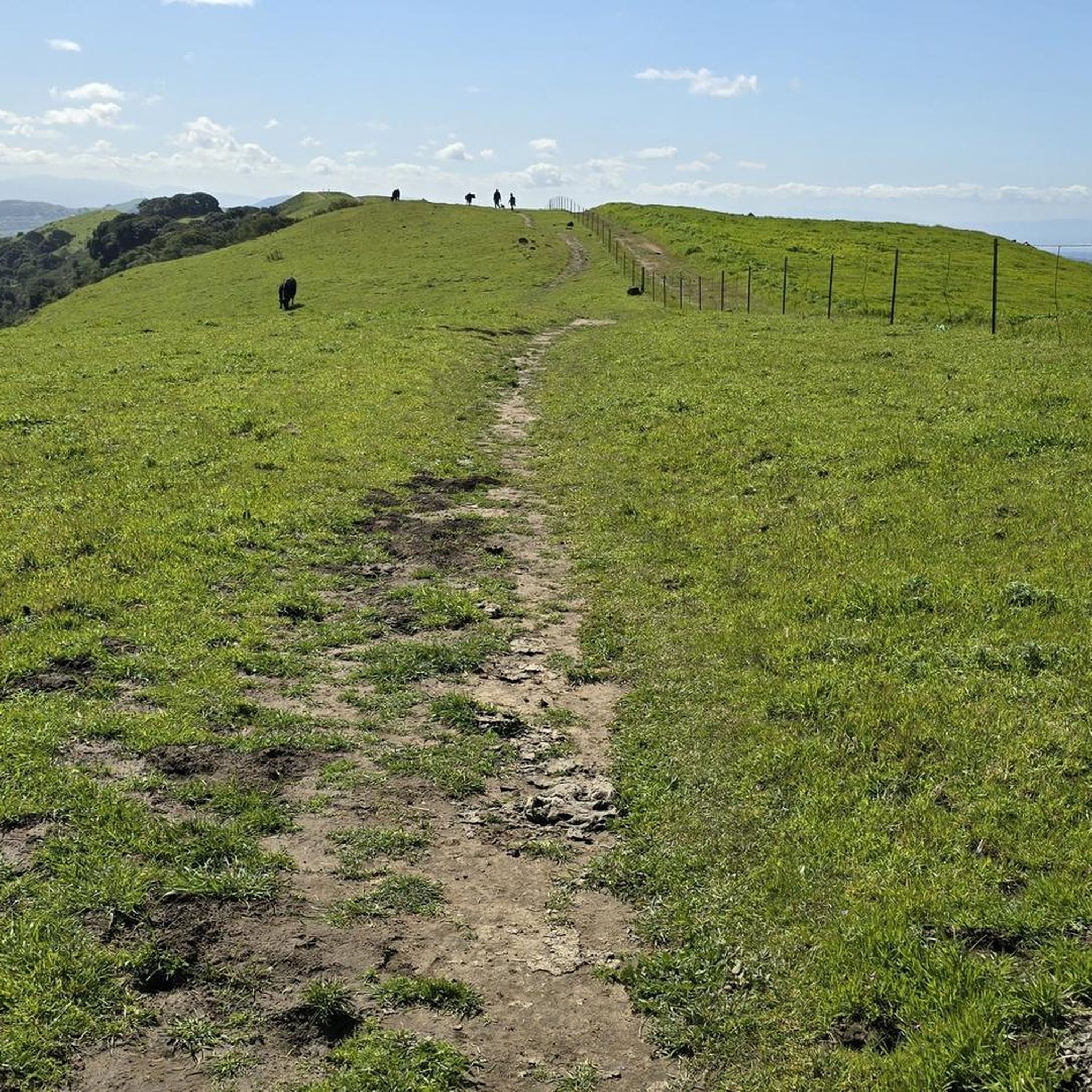
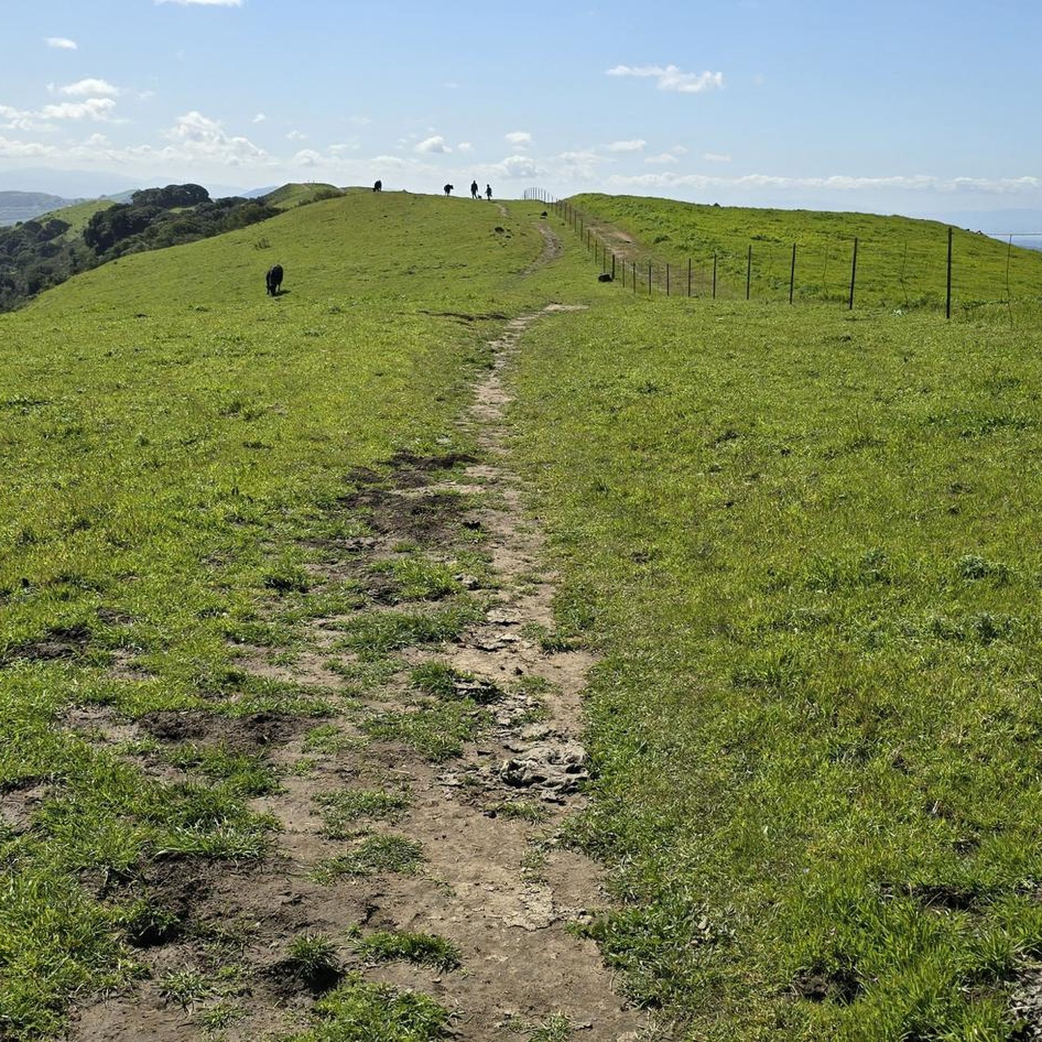
For the Rocky Ridge trail hike, I suggest to have a hat, hiking poles, sun-glasses and of course water. Most of the trail is without any shade. Depends on the season, some portions of the trail could be muddy. Park the car in the parking lot at the end of Bollinger Canyon Road. If parking lot is full you can park along the road. This is the staging area and the start and end of our hike is here. Restrooms are available only at this place. To start the Rocky Ridge Trail, go to the north-west corner of the parking lot (north of the restrooms) and start going up on the paved road. Note that most of the climb is this segment, but afterwards the trail is pretty easy. No shade on Rocky Ridge, some shade on Elderberry.
0
0

Del Amigo Trail runs roughly north-to-south, but with an eastward bend that holds the trail near to a ridge line that offers continual, stunning views to the east and southeast
0
0
Del Amigo Trail runs roughly north-to-south, but with an eastward bend that holds the trail near to a ridge line that offers continual, stunning views to the east and southeast.
0
0

Elderberry Trail offers a nice gradual climb after the Corral Camp junction, with oak trees for occasional shade along the way to the ridge. The canyon views to the east toward Mount Diablo are fantastic. Wildflowers blanket the hillsides, especially in the early spring, which can alter the duration of your hike depending on how much time you spend enjoying the scenery.
1
0
This trailhead is an excellent staging area centrally located within the Park, making it a great starting or resting point for multiple hike variations. There is plenty of parking, restrooms and drinking water. The Sycamore Trail is closed temporarily due to a landslide, so check the Park's website for updates. The Cuesta Trail is an excellent alternative if you plan to hike the Ridge View Trail loop.
1
0
This well-maintained trail offers fantastic views of the San Francisco Bay, Mount Diablo, the Livermore Valley and the Sacramento River Delta. In the spring, many wildflowers bloom on the green hillsides, with lupine and golden poppies blooming as late as October. Any time of year is beautiful here, encouraging you to take a break from the steep climb and take a few gorgeous photos.
1
0

From this ridge you embrace quite a few points of view. Starting with the valleys of Ignacio, San Ramon and Amador. Further on, Mount Diablo stands out.
0
0

Restrooms, water, and shade. Good starting or rest point, near the middle of the park, almost all trails lead down to this area.
0
0
Frequently Asked Questions
What are the best trails for hiking in Las Trampas Regional Wilderness?
Las Trampas Regional Wilderness offers an extensive trail system with options for various skill levels. For challenging hikes, consider the Devil's Hole Trail, which provides fantastic views of the San Francisco Bay and Mount Diablo. The Del Amigo Trail follows a ridge line with continual views to the east and southeast. For a more gradual climb with scenic canyon views, try the Elderberry Trail. You can find more hiking options, including easy and difficult routes, in the Hiking in Las Trampas Regional Wilderness guide.
Where can I find panoramic viewpoints in Las Trampas Regional Wilderness?
The wilderness is renowned for its panoramic vistas. The Las Trampas Ridge offers expansive views of the Ignacio, San Ramon, and Amador valleys, with Mount Diablo visible in the distance. Rocky Ridge, reaching 2,024 feet, also provides dramatic views. Many trails, including the Devil's Hole Trail, feature scenic overlooks of the San Francisco Bay, Livermore Valley, and the Sacramento River Delta.
Are there any historical or cultural sites within or near Las Trampas Regional Wilderness?
Yes, the park completely surrounds the Eugene O'Neill National Historic Site (Tao House) on its eastern side. This site preserves the home and studio where Nobel laureate playwright Eugene O'Neill wrote some of his most famous plays. It is accessible from Las Trampas via hiking trails or by road from Danville. Additionally, a portion of the area was used as a NIKE missile site during the Cold War, and the Rocky Ridge View Trail was originally built as an Army road to access a radar facility.
What kind of natural features can I expect to see in Las Trampas Regional Wilderness?
Las Trampas is characterized by two prominent, hilly ridges: Las Trampas Ridge and Rocky Ridge, with Bollinger Creek flowing through the valley between them. The wilderness features sharply varied geologic formations, including sandstone outcrops, interbedded conglomerate limestones with ancient marine fossils, and remnants of ancient shorelines. You might also discover hidden waterfalls in the eastern section of the park and diverse flora, including wildflowers in spring.
What wildlife can be spotted in Las Trampas Regional Wilderness?
The wilderness is home to diverse wildlife. Visitors may encounter puma (mountain lion), bobcat, deer, gray fox, raccoons, and skunks. Birdwatchers can look for hawks, vultures, and occasional eagles. After winter rains, amphibians like the California newt can also be seen, particularly along Bollinger Creek trails.
When is the best time to visit Las Trampas Regional Wilderness, especially for wildflowers?
While any time of year offers beauty, spring is particularly spectacular for wildflowers. The hillsides are transformed by abundant wildflowers such as lupine and golden poppies. The Devil's Hole Trail and Elderberry Trail are noted for their vibrant displays during this season.
Are there family-friendly activities or trails in Las Trampas Regional Wilderness?
While many trails feature steep climbs, some options are more accessible. The Bollinger Canyon Trailhead is a convenient starting point with amenities like restrooms and drinking water. For easier hikes, you can explore routes mentioned in the Easy hikes in Las Trampas Regional Wilderness guide, such as the Ringtail Cat, Madrone and Point of No Return Loop.
What facilities are available at the Bollinger Canyon Trailhead?
The Bollinger Canyon Trailhead serves as an excellent staging area centrally located within the park. It offers plenty of parking, restrooms, and drinking water, making it a convenient starting or resting point for various hikes.
Are there specific permits required to hike in certain areas of Las Trampas Regional Wilderness?
Yes, a portion of Las Trampas on the western slope is a sensitive watershed for the East Bay Municipal Utility District (EBMUD). Hiking in this specific area requires a valid EBMUD permit.
What cycling opportunities are available in or around Las Trampas Regional Wilderness?
While mountain biking is permitted on half of the trails within the wilderness, you can also find extensive cycling routes nearby. For example, the Cycling in Las Trampas Regional Wilderness guide features routes like the Iron Horse Regional Trail and loops that include Mount Diablo, offering options from moderate to difficult.
What do visitors enjoy most about Las Trampas Regional Wilderness?
Visitors frequently praise the park's extensive trail system, offering challenging terrain and rewarding panoramic views. The diverse natural features, including unique geological formations and abundant wildflowers in spring, are also highly appreciated. Many enjoy the opportunity for wildlife viewing and the sense of rugged escape the wilderness provides.
Are there picnic areas available in the park?
Yes, there are two first-come, first-served picnic areas, Steelhead and Shady, located near the main parking lot. For larger groups, picnic sites can be reserved at the nearby Little Hills Picnic Ranch.
Most popular routes in Las Trampas Regional Wilderness
Most popular attractions in Las Trampas Regional Wilderness

Get inspired with the komoot mobile app


Explore more
Still not found the Highlight you’re looking for? See guides of the top attractions in other regions:
