The best traffic-free bike rides in John Muir Wilderness
4.8
(4)
653
riders
9
rides
Road biking near John Muir Wilderness offers routes through dramatic high-Sierra terrain, characterized by deep canyons, lofty peaks, expansive alpine meadows, and numerous crystal-clear alpine lakes. While the wilderness itself is largely a roadless area, roads leading into and bordering it provide excellent conditions for road cycling. These routes often feature significant elevation gains and provide views of impressive granite formations and diverse forest types.
Best no traffic road cycling routes in John Muir Wilderness
- The most popular no traffic…
Last updated: July 9, 2026
20
riders
33.0km
02:23
930m
940m
Hard road ride. Very good fitness required. Some segments of this route may be unpaved and difficult to ride.
7
riders
27.9km
01:36
270m
270m
Moderate road ride. Great for any fitness level. Some segments of this route may be unpaved and difficult to ride.

Sign up for free
4
riders
34.0km
02:44
1,180m
1,180m
Hard road ride. Very good fitness required. Mostly well-paved surfaces and easy to ride.
2
riders
27.3km
02:03
620m
620m
Moderate road ride. Good fitness required. Mostly well-paved surfaces and easy to ride.
2
riders
25.2km
01:41
830m
830m
Moderate road ride. Good fitness required. Mostly well-paved surfaces and easy to ride.
Get access to more routes and recommendations from other explorers.
Sign up for free
Already have an account?
Our route recommendations are based on thousands of hikes, rides, and runs completed by other people on komoot.
Start today with a free account
Your next adventure awaits.
Login or Signup
Popular around John Muir Wilderness

John Muir Trail – Along the legendary trail through the magical Sierra Nevada

The Sierra High Route — Solitude in California's alpine country

Pacific Crest Trail from Mexico to Canada – 4,200 kilometres of wilderness
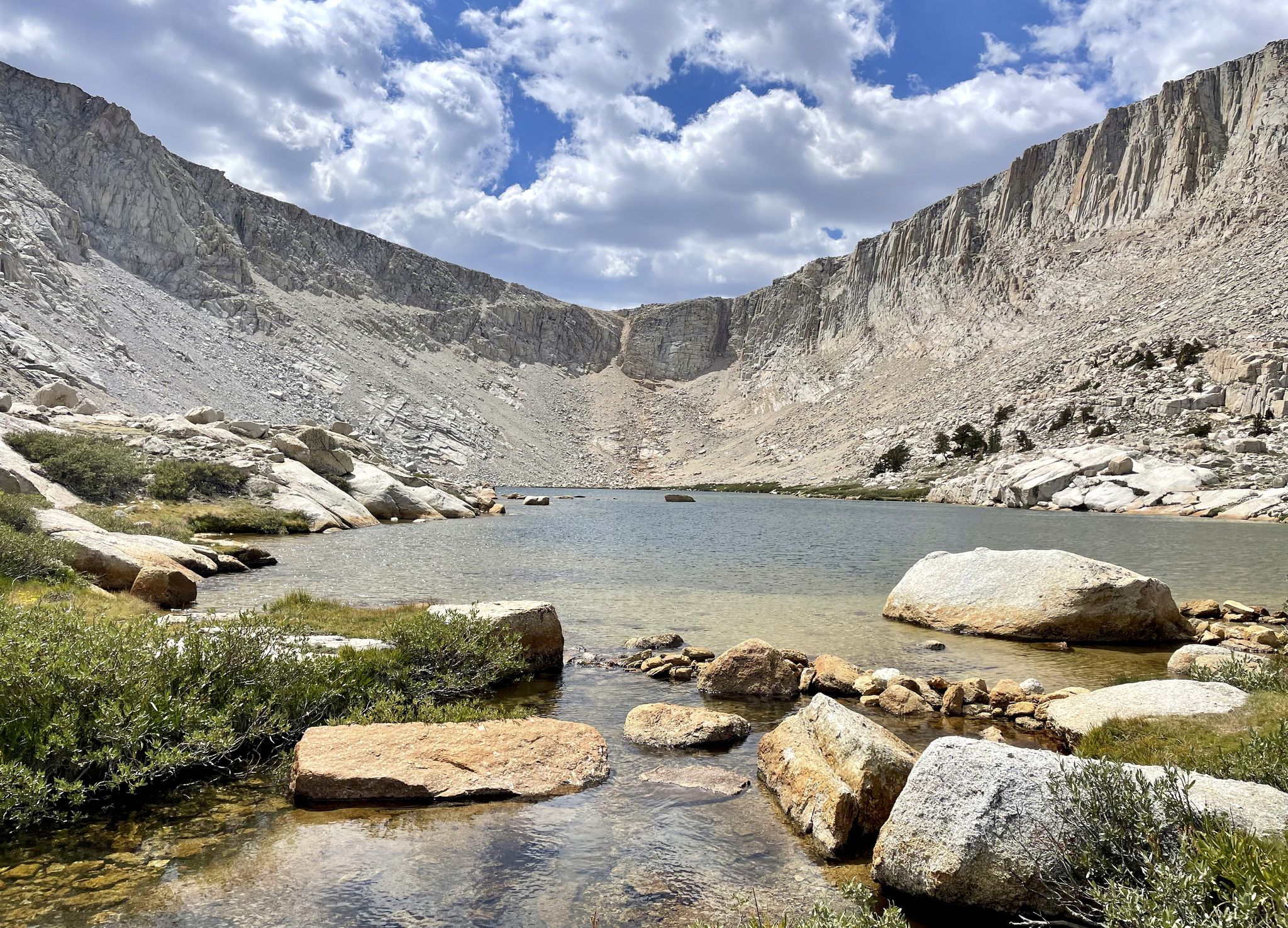
Cottonwood Lakes Loop — Exploring the Golden Trout Wilderness

Traffic-free bike rides in John Muir Wilderness
Other adventures in John Muir Wilderness


Tips from the Community

This crystal-clear subalpine lake is not directly visible from the road, but it is an easy 200 feet from Rock Creek. This is an awesome spot to take a lunch break and enjoy the mountains.
0
0

Mammoth Mountain Resort is a premier destination for skiing & snowboarding. However, the resort and its surrounding area also have plenty to do throughout the rest of the year. If you don't have a bike there are plenty of places to rent from so you can take advantage of the many miles of road and trails. If you ever need to meet up with someone just say you'll find them at the iconic Mammoth statue and you won't have any trouble finding each other.
0
0

This is a great 15-mile road climb that winds through a beautiful canyon, culminating at the gate of the Pine Creek Tungsten Mine. The road grade ranges between 4% and 11%, but the steeper grades are not sustained for too long, making it an enjoyable ride.
0
0
Glacier Lodge Road offers several great hill climbs on your way up to Big Pine Creek Trailhead. The average slope is around 7%, with the steepest grade just over 12%. The trailhead marks the end of the road, providing a great place to take a break with restrooms and plenty of shade.
0
0
Pleasant Valley Dam Road provides a car-free ride around the shores of Pleasant Valley Reservoir. There is a gate that is closed to cars and most of the road is paved; however, the northwest section is smooth gravel.
0
0
You can cycle down to the Ranger Station for free and there is a bike rack to leave your bike while you explore the area. If you're not up to cycling back up the hill towards Mammoth Lakes you can pay to ride the shuttle back up if there is room. Keep in mind that the road down is steep and narrow, uphill traffic has the right of way, and the 15 mph speed limits applies to bikes as well as motor vehicles.
0
0

Mosquito Flats Trailhead area is the highest trailhead in the state of California. At this spot, there is a backpackers' campground and a parking lot. This is the kick-off spot for a south-traveling venture along the Little Lakes Valley Trail.
0
0

In summer a popular hiking destination, in winter part of the ski area. The giant mammoth statue is absolutely fitting for the bustling mountain town of Mammoth at the foot of the Sierra Nevada.
3
0
Frequently Asked Questions
How many no-traffic road cycling routes are available in the John Muir Wilderness area?
There are 10 dedicated no-traffic road cycling routes in the John Muir Wilderness area, offering a variety of experiences for cyclists. These routes are carefully selected to provide stunning views of the Sierra Nevada without the disturbance of vehicle traffic.
What is the best time of year for road cycling in the John Muir Wilderness?
The best time for road cycling in the John Muir Wilderness area is typically from late spring through early autumn. During these months, roads are generally clear of snow, and the weather is most favorable for enjoying the high-Sierra terrain, alpine meadows, and lakes. Always check local conditions before planning your ride, especially for higher elevation routes.
Are there any beginner-friendly no-traffic road cycling routes?
While many routes in the John Muir Wilderness area feature significant elevation gains, there are options suitable for moderate fitness levels. For example, the Horseshoe Lake – Lake Mary loop from Red Cones Trailhead is a moderate route that offers beautiful scenery without extreme difficulty. It's a great way to experience the region's beauty on mostly paved surfaces.
What kind of landscapes can I expect to see on these routes?
Road cycling routes in the John Muir Wilderness area offer breathtaking views of dramatic high-Sierra terrain. You'll encounter deep canyons, snow-capped peaks, expansive alpine meadows, and crystal-clear alpine lakes. The region is also characterized by impressive granite formations and diverse forest types, providing a truly immersive natural experience.
Are there any challenging no-traffic road cycling routes for experienced cyclists?
Absolutely! For experienced cyclists seeking a challenge, routes like Mosquito Flats Trailhead – Serene Lake loop from Tom's Place and Glacier Lodge Road offer difficult ratings with significant elevation gains, pushing your fitness while rewarding you with spectacular views of the Sierra Nevada.
What do other road cyclists enjoy most about the John Muir Wilderness?
The John Muir Wilderness area is highly rated by the komoot community, with an average score of 5.0 stars. Reviewers often praise the stunning, untouched natural beauty, the challenging yet rewarding climbs, and the peaceful experience of cycling on roads with minimal to no traffic, allowing for full immersion in the high-Sierra landscape.
Are there any notable natural attractions or landmarks along these routes?
While the core wilderness is primarily for hiking, the roads leading into and bordering it offer access to incredible natural features. You can find stunning lakes such as First Lake, Second Lake and Temple Crag, and Lone Pine Lake. Additionally, you'll be cycling with views of majestic peaks like Mount Whitney and mountain passes like Kearsage Pass.
Are there any loop routes for road cycling in the John Muir Wilderness area?
Yes, several routes offer a loop experience, allowing you to start and end at the same point. The Horseshoe Lake – Lake Mary loop from Red Cones Trailhead is a popular moderate option, and the Mosquito Flats Trailhead – Serene Lake loop from Tom's Place provides a more challenging loop for experienced riders.
Is public transport available to access the cycling routes?
While the John Muir Wilderness itself is remote, some gateway communities may offer limited public transport options or shuttle services during peak seasons. However, for most road cycling routes, personal vehicle access to trailheads or starting points is generally recommended. It's advisable to research specific transport options for your chosen route's starting location.
Are there any road cycling routes that pass by Devil's Postpile National Monument?
Yes, the route Mammoth Mountain to Devil's Postpile National Monument via Minaret Road offers a fantastic opportunity to cycle towards this unique geological feature. This moderate route provides stunning views and a chance to visit a significant landmark in the region.
Are there any gravel-friendly road cycling routes in the area?
Yes, for those who enjoy a mix of paved and well-maintained gravel surfaces, the Pleasant Valley Dam loop — Gravel is a moderate option. This route allows you to explore different terrains while still enjoying a no-traffic cycling experience.
Most popular routes in John Muir Wilderness
Most popular attractions in John Muir Wilderness

Get inspired with the komoot mobile app


Explore more
Browse the best Road cycling routes in other regions.
