The best hikes from bus stations in John Muir Wilderness
4.6
(229)
4,426
hikers
19
hikes
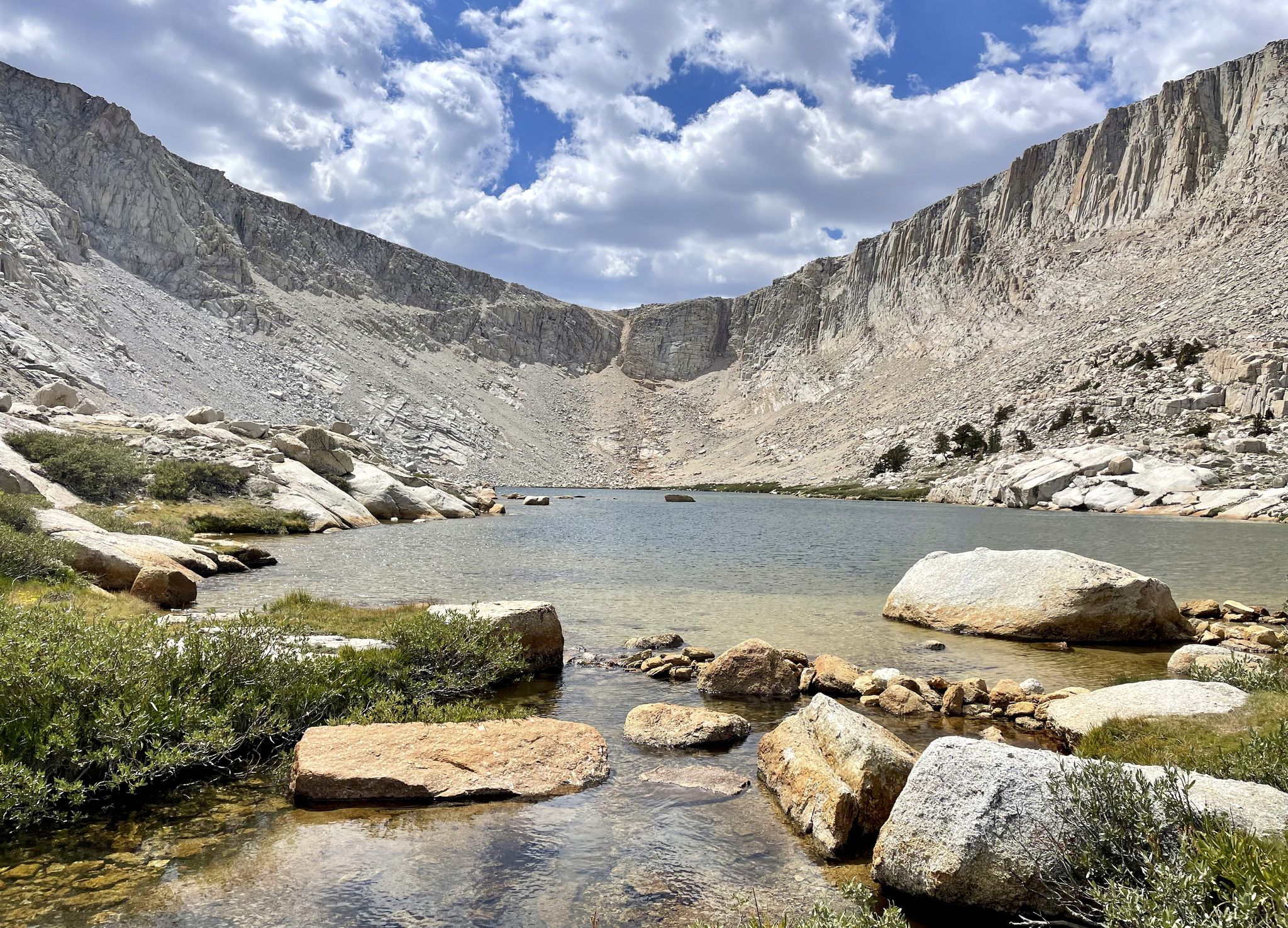
Bus station hiking trails in John Muir Wilderness traverse a landscape of high granite peaks, deep canyons, and numerous alpine lakes. This vast wilderness, part of the Sierra Nevada, features elevations ranging from 4,000 feet to nearly 14,500 feet. The terrain is characterized by glacially carved valleys, extensive subalpine meadows, and forests of pine and fir. Hikers can explore a network of trails that wind through diverse ecosystems, offering varied challenges and scenic viewpoints.
Best bus station hiking trails in…
Last updated: July 8, 2026
26
hikers
10.7km
03:21
420m
420m
Moderate hike. Good fitness required. Easily-accessible paths. Suitable for all skill levels.
5.0
(2)
50
hikers
10.2km
03:14
420m
420m
Moderate hike. Good fitness required. Easily-accessible paths. Suitable for all skill levels.

Sign up for free
12
hikers
6.64km
01:58
200m
200m
Easy hike. Great for any fitness level. Easily-accessible paths. Suitable for all skill levels.
3
hikers
10.9km
03:15
320m
320m
Moderate hike. Good fitness required. Easily-accessible paths. Suitable for all skill levels.
3
hikers
12.9km
03:48
380m
380m
Moderate hike. Good fitness required. Easily-accessible paths. Suitable for all skill levels.
Get access to more routes and recommendations from other explorers.
Sign up for free
Already have an account?
Our route recommendations are based on thousands of hikes, rides, and runs completed by other people on komoot.
Start today with a free account
Your next adventure awaits.
Login or Signup
Popular around John Muir Wilderness



Other adventures in John Muir Wilderness


Tips from the Community

Blue Lake sits just a few miles after South Lake, in a beautiful alpine landscape. After Blue Lake you can choose your path to many other pristine and isolated alpine lakes.
1
0
Chocolate Lake is not made of chocolate but serves crystal clear water with sweet views of Cloudripper Mountain and Chocolate Peak. This is the first and smaller lake of the three Chocolate Lakes. Take your time here, but remember that there is much more to see.
1
0
This is the third and biggest of the Chocolate Lakes. Each one of the lakes has its beauty and a different perspective of the mountains. The lakes have this name because they sit in front of Chocolate Peak, which is formed by rocks of a soft brown color, looking like a chocolate mountain.
2
0

Long Lake is one of several lakes surrounding Chocolate Peak. From the trail, you are treated to wonderful views of Long Lake, Cloudripper, Chocolate Peak and Mount Goode.
0
0
Blue Lake is a beautiful alpine lake in the John Muir Wilderness. The trail to get to the lake is fairly challenging, but it is well worth the effort for the beauty of the lake and its surroundings.
0
0

Lake Sabrina was created by damming the middle fork of Bishop Creek. The lake is located at an elevation of 9,128 feet and offers a seasonal cafe, a small store, a boat dock, and a campground.
0
0

Don’t spend too much time down here! Or else you might pass out from the breathtaking views!! Here, Mt Goode dominates the skyline to the west, and Picture Puzzle watches closely over the lake from the east!! OH OH OH- and can we talk about the fact that there is an ISLAND in this lake?! It’s a little baby island!!
1
0
I really enjoyed the views from this lake a chocoLOT 😆 Cloudripper really takes the (chocolate)cake as far as mountain vistas goes here! Oh you thought we were done with the chocolate puns? Haha, nope- I’ve still got a few Twix up my sleeve 😉
1
0
Frequently Asked Questions
How many bus station hiking trails are available in John Muir Wilderness?
There are 22 hiking routes in the John Muir Wilderness that are accessible from bus stations. These trails offer a range of experiences, from easy strolls to challenging ascents.
What kind of terrain can I expect on bus-accessible hikes in John Muir Wilderness?
The John Muir Wilderness is characterized by dramatic glacially carved terrain, featuring granite peaks, deep canyons, and numerous alpine lakes. Trails often involve significant elevation changes, leading through diverse ecosystems from pine forests at lower elevations to subalpine meadows and rocky fellfields higher up. Expect well-maintained trails, but some routes can be physically demanding.
Are there any easy bus-accessible hikes suitable for beginners or families?
Yes, there are 10 easy routes accessible by bus. For a pleasant, shorter option, consider the Sabrina Lake loop from Aspendell, which is 6.6 km long with moderate elevation gain, offering beautiful lake views.
What are some notable natural features or landmarks I can see on these trails?
Many bus-accessible trails lead to stunning natural features. You can explore numerous alpine lakes, such as Second Lake, Skelton Lake, and First Lake. The wilderness is also home to majestic peaks like Mount Whitney and impressive mountain passes such as Kearsage Pass and Silver Pass.
Are there any circular routes accessible from bus stations?
Yes, several circular routes are available. The Chocolate Lakes loop is a moderate 10.7 km option, while the Sabrina Lake loop from Sabrina Dam offers another moderate 10.2 km circuit around the lake.
What is the best time of year to hike these bus-accessible trails?
The best time to hike in the John Muir Wilderness is typically from late spring through early fall (June to October). During these months, snow has usually melted from most trails, and the weather is generally more stable. However, always check current conditions, especially for higher elevation routes, as snow can persist into summer.
What do other hikers enjoy most about hiking in John Muir Wilderness?
The John Muir Wilderness is highly rated by the komoot community, with an average score of 4.6 out of 5 stars from 239 ratings. Reviewers often praise the stunning alpine scenery, the abundance of pristine lakes, and the sense of wilderness immersion, even on trails accessible by public transport.
Are there any challenging bus-accessible hikes for experienced hikers?
Yes, for experienced hikers seeking a challenge, the Long Lake, North End – Bishop Pass loop from Hillside Dam is a difficult 16.7 km route with over 600 meters of elevation gain. This trail offers a strenuous but rewarding experience through high-alpine landscapes.
Can I find shorter, moderate hikes that are still rewarding?
Absolutely. The Long Lake, North End – John Muir Wilderness Boundary loop from Hillside Dam is a moderate 7.6 km hike that provides a great balance of distance and scenic beauty without being overly strenuous. It's a good option for a half-day adventure.
Do I need a permit for day hikes from bus stations in John Muir Wilderness?
While many day hikes do not require permits, overnight trips into the John Muir Wilderness typically do, and these are often subject to trailhead quotas due to the area's popularity. It's always advisable to check with the Inyo or Sierra National Forests for the most current regulations regarding permits, even for day use, especially during peak seasons.
What should I pack for a day hike in the John Muir Wilderness?
Even for day hikes, it's crucial to be prepared for varying conditions. Pack layers of clothing, as temperatures can change rapidly, especially at higher elevations. Bring plenty of water, snacks, sun protection (hat, sunscreen), a map and compass or GPS device, a first-aid kit, and sturdy hiking boots. Rain gear is also recommended, as afternoon thunderstorms can occur.
Most popular routes in John Muir Wilderness
Most popular attractions in John Muir Wilderness

Get inspired with the komoot mobile app


Explore more
Browse the best Hikes in other regions.
