The best traffic-free bike rides in John Muir Wilderness
3.9
(12)
568
riders
17
rides
No traffic touring cycling routes in John Muir Wilderness traverse a landscape defined by high-Sierra terrain, featuring majestic granite peaks, deep canyons, and numerous alpine lakes. The region, part of California's Sierra Nevada, offers diverse forest types across varying elevations. While primarily known for hiking, specific routes suitable for touring bicycles exist within or adjacent to this vast wilderness area. These routes often follow roads through valleys and mountain passes, providing access to the area's natural beauty.
Best no traffic…
Last updated: July 9, 2026
24.5km
01:58
690m
690m
The South Lake — Bishop touring cycling route is a relentless climb through the stunning High Sierra, offering a true test of endurance for advanced cyclists. As you ascend, the…
15.1km
01:12
410m
410m
Cycle 9.4 miles (15.1 km) from Portal Forebay to Mono Hot Springs via Kaiser Pass Road, a moderate route with 1361 feet of gain.

Sign up for free
6
riders
9.50km
00:39
160m
160m
Moderate bike ride. Good fitness required. Mostly paved surfaces. Suitable for all skill levels.
5.0
(1)
27
riders
17.2km
01:13
270m
270m
Moderate bike ride. Good fitness required. Mostly paved surfaces. Suitable for all skill levels.
6
riders
24.2km
02:20
430m
430m
Hard bike ride. Good fitness required. You may need to push your bike for some segments of this route.
Get access to more routes and recommendations from other explorers.
Sign up for free
Already have an account?
Our route recommendations are based on thousands of hikes, rides, and runs completed by other people on komoot.
Start today with a free account
Your next adventure awaits.
Login or Signup
Popular around John Muir Wilderness

John Muir Trail – Along the legendary trail through the magical Sierra Nevada

The Sierra High Route — Solitude in California's alpine country

Pacific Crest Trail from Mexico to Canada – 4,200 kilometres of wilderness
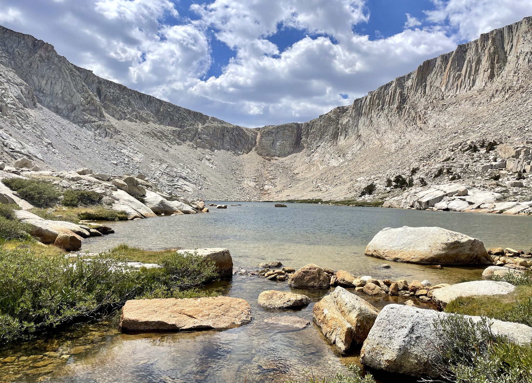
Cottonwood Lakes Loop — Exploring the Golden Trout Wilderness

Traffic-free bike rides in John Muir Wilderness
Other adventures in John Muir Wilderness


Tips from the Community

From this spot on the shore of Twin Lakes, you get a great view of Twin Falls as it plunges down the rocky cliff, framed by towering evergreens and the dramatic ridgeline of the Eastern Sierra. If you visit in early summer, you’ll catch the falls at their peak—fed by snowmelt, with distant peaks still dusted in white.
0
0

Twin Falls connects Twin Lakes and Mamie Lake. This small stretch of river cascades down the rocks, flowing through a small patch of forest. It can be viewed from the trail or the road, and if you venture a little further up, you’ll also get a view of Twin Lakes.
0
0
Lake Mary is nestled in front of a red basalt cliff and surrounded by forest, creating a scenic setting. In the winter, the area is blanketed in snow, making it ideal for cross-country skiing.
1
0

Great mountain lake that invites you to swim and is ideal for a short walk.
0
0

Twin Lakes, as its name suggests, is a park comprised of a set of connected lakes to the southeast of Mammoth Mountain. Eruptions of Mammoth Mountain caused the formation of lava cliffs on one side of the lakes. The other side has a campground and ski lodge.
0
0
Lake Mary is the largest lake of the over one hundred lakes that comprise the Mammoth Lakes area. The lake has a campground to the northeast and two marinas offering boat and kayak rentals.
0
0

This lake is found between Lake Mary and Horseshoe Lake, and is a highly popular fishing spot. Numerous picnic areas are available for visitors to enjoy the stunning views of the water. Additionally, there are vantage points offering views of Mammoth Mountain and the spillway to Twin Lakes.
0
0
This spot along the road that leads to Twin Lakes Campground has a bridge over Mammoth Creek that offers views of the 250-foot drop of Twin Falls.
0
0
Frequently Asked Questions
Are there dedicated no-traffic touring cycling routes within the John Muir Wilderness itself?
While the John Muir Wilderness is a vast and beautiful area, it is primarily designated for hiking and backpacking, with extensive wilderness regulations. Direct touring cycling within the protected wilderness boundaries is generally not feasible or permitted, as the terrain consists mainly of hiking trails rather than roads suitable for touring bikes. However, the routes listed in this guide are carefully selected to offer traffic-free touring cycling experiences in areas adjacent to or near the John Muir Wilderness, providing similar stunning High Sierra landscapes.
How many no-traffic touring cycling routes are available in the John Muir Wilderness region?
This guide features over 20 no-traffic touring cycling routes in the John Muir Wilderness region. These routes range in difficulty and length, offering options for various skill levels and preferences.
What is the best time of year for no-traffic touring cycling in this region?
The best time for touring cycling in the John Muir Wilderness region is typically from late spring through early fall (roughly May to October). During these months, snow has usually melted from lower and mid-elevation routes, and the weather is generally more stable and pleasant. Always check local conditions and forecasts before heading out, especially for higher elevation routes, as weather can change rapidly in the Sierra Nevada.
What kind of terrain can I expect on these no-traffic touring cycling routes?
The routes in this guide, while outside the strict wilderness boundaries, traverse areas characterized by the dramatic High Sierra landscape. You can expect granite peaks, alpine lakes, pine forests, and deep canyons. While the routes are selected for touring bicycles, some may involve varied surfaces, so bikes with wider tires are often recommended for comfort and stability.
Are there any easy no-traffic touring cycling routes suitable for beginners or families?
Yes, there are a few easier options available. For instance, the Horseshoe Lake – Horseshoe Lake loop from Red Cones Trailhead is an easy route that offers a pleasant, shorter ride. Always check the route details for specific difficulty ratings and elevation profiles to ensure it matches your group's abilities.
What are some notable natural attractions I might see along these routes?
While the routes themselves are outside the strict wilderness, the surrounding region is rich with natural beauty. You might encounter stunning alpine lakes, dramatic mountain passes, and views of towering peaks. Highlights in the broader area include Mount Whitney (the tallest peak in the contiguous U.S.), Skelton Lake, First Lake, and Second Lake and Temple Crag. Many routes offer scenic vistas of these iconic Sierra Nevada features.
Are there any circular no-traffic touring cycling routes available?
Yes, several routes in this guide are circular, allowing you to start and end at the same point. An example is the Horseshoe Lake – Horseshoe Lake loop from Red Cones Trailhead. Circular routes are convenient for day trips as they eliminate the need for shuttle arrangements.
What do other touring cyclists enjoy most about cycling in the John Muir Wilderness region?
The komoot community highly rates the touring cycling experiences in this region, with an average score of 4.0 stars. Reviewers often praise the breathtaking High Sierra scenery, the sense of solitude on the traffic-free paths, and the challenging yet rewarding climbs that lead to spectacular views of alpine lakes and granite peaks.
Are there any routes that offer significant elevation changes for a challenging ride?
Absolutely. The John Muir Wilderness region is known for its dramatic topography, and several routes offer substantial climbs. For a challenging experience, consider the South Lake — Bishop route, which features significant elevation gain and descent, providing a demanding yet rewarding ride through stunning landscapes.
Can I find routes that connect different points of interest or towns?
Yes, some routes serve as excellent connectors between scenic areas or small towns adjacent to the wilderness. For example, the Portal Forebay to Mono Hot Springs via Kaiser Pass Road offers a moderate ride that links different locations, allowing you to explore more of the region's diverse landscapes.
Are there any routes that pass by lakes or offer opportunities for scenic stops?
Many routes in this guide will take you past or near the numerous alpine and subalpine lakes that characterize the High Sierra. The Twin Lakes – Duck Pass Trailhead loop from Twin Lakes is a great example, offering beautiful lakeside views and opportunities for picturesque stops. The region boasts nearly a thousand lakes, so scenic water features are a common highlight.
Most popular routes in John Muir Wilderness
Most popular attractions in John Muir Wilderness

Get inspired with the komoot mobile app


Explore more
Browse the best Cycling routes in other regions.
