The best waterfall hikes and walks in John Muir Wilderness
4.6
(226)
4,401
hikers
14
hikes
Waterfall hiking trails in John Muir Wilderness traverse a vast expanse of rugged Sierra Nevada terrain, characterized by snow-capped mountains, deep canyons, and landscapes sculpted by ancient glaciers. The region features granite basins, numerous high peaks, and over 950 high-altitude lakes. Elevations range significantly, supporting diverse ecosystems from dense forests of pine and fir to alpine zones. This environment provides a rich setting for exploring various waterfall features.
Best waterfall hiking trails in John Muir Wilderness
- The most popular waterfall…
Last updated: June 24, 2026
17
hikers
13.3km
04:30
1,080m
40m
Hard hike. Very good fitness required. Easily-accessible paths. Suitable for all skill levels.
2
hikers
2.31km
00:45
120m
90m
Easy hike. Great for any fitness level. Easily-accessible paths. Suitable for all skill levels.

Sign up for free
2
hikers
42.7km
12:23
1,530m
290m
Hard hike. Very good fitness required. Easily-accessible paths. Suitable for all skill levels.
108km
34:30
3,840m
3,830m
Hard hike. Very good fitness required. Mostly accessible paths. Sure-footedness required.
4.9
(9)
142
hikers
15.2km
04:55
690m
690m
Moderate hike. Good fitness required. Easily-accessible paths. Suitable for all skill levels.
Get access to more routes and recommendations from other explorers.
Sign up for free
Already have an account?
Our route recommendations are based on thousands of hikes, rides, and runs completed by other people on komoot.
Start today with a free account
Your next adventure awaits.
Login or Signup
Popular around John Muir Wilderness



Other adventures in John Muir Wilderness


Tips from the Community

The name says it all! Absolutely unreal views south onto the Palisade group!
1
0
The pictures taken from this small rocky outcrop above Second Lake, marked here by a tentsite symbol, are ICONIC. If the pictures above look familiar, that’s because… well.. they are! Temple Crag from across Second Lake is one of the most frequently photographed “scenes” of the Eastern Sierras. Just a quick search on the internet of “Big Pine Lakes” will pull up countless pictures almost identical to each other of this exact lake/peak combo. (Seriously, try it 😂) And honestly, it’s easy to understand why! The setting is otherwordly!
1
0
FIRST Lake is, ironically, the LAST place for this water to rest before heading down through Big Pine Valley as the North Fork Big Pine Creek and entering, as a tributary, the Owens River 6,000ft below! To the east you are offered a lovely view to Mount Alice, while to the south Temple Crag commands your attention! The water in First Lake, as well as the ither Big Pine Lakes, often can be seen with a beautiful teal hue, caused by the refraction of sunlight on particles of glacial silt in the water!
0
0
Behold! to the southeast! Mount Alice! In his book, “The High Sierra,” author R.J. Secor describes Mount Alice as, “… the biggest pile of rubble in the High Sierra.” 😂
2
0
Cascade created by the North Fork Big Pine Creek!
1
0

Third Lake, like the other reservoirs along the North Fork Big Pine Creek Trail, has a bunch of camping around the shores of the water. Just make sure to follow LNT principles if you stay overnight (or even if you just hang out by the lake for part of the day).
0
0
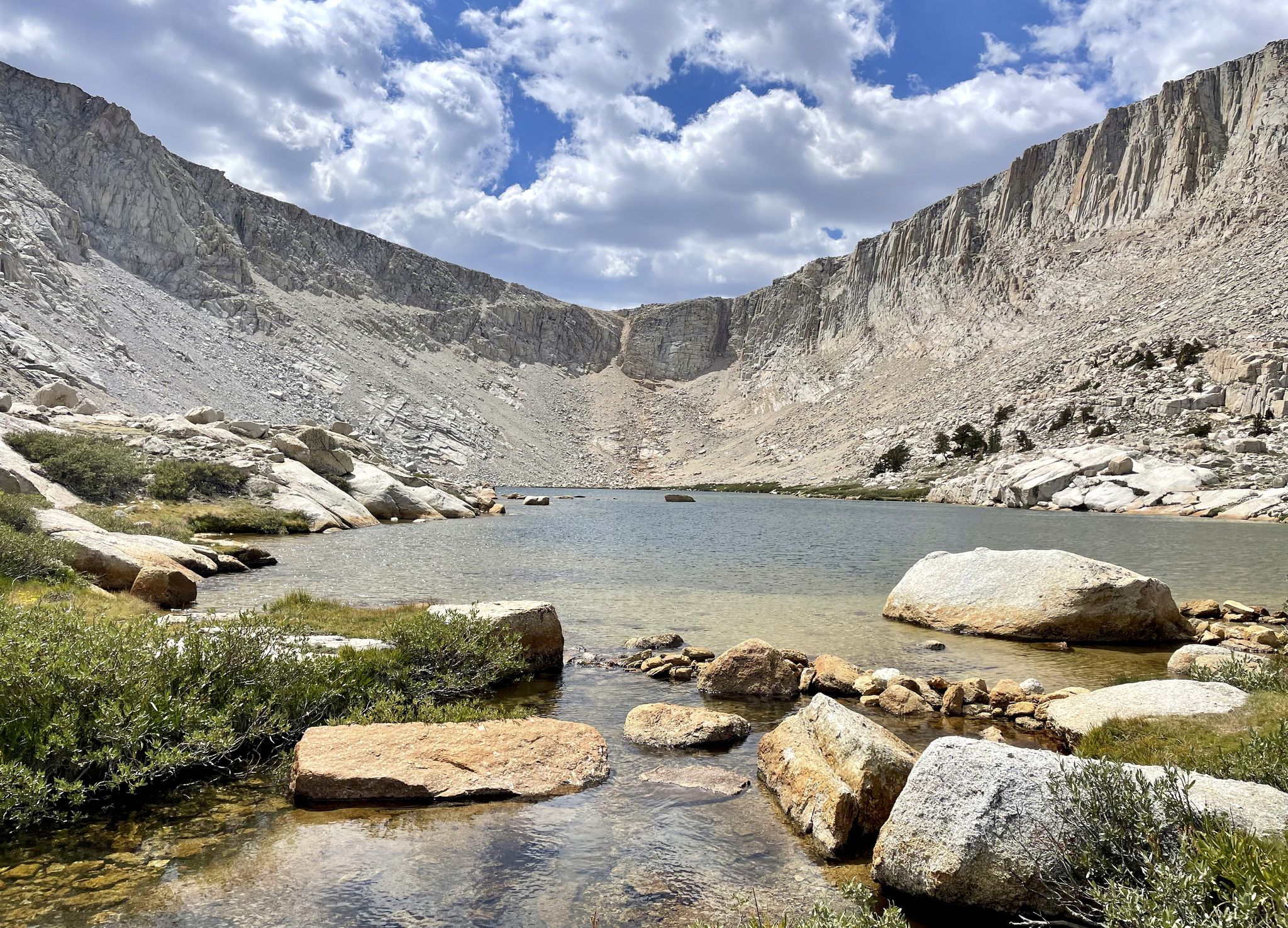
Every alpine lake has its own qualities that make it stand out, but Second Lake has often been called the most beautiful of the numbered lakes in this part of the John Muir Wilderness. This could be because it's the biggest or because it's the easiest to explore in depth since there is a spur trail that travels between this lake and First Lake.
0
0
First Lake is one of many reservoirs in this section of the John Muir Wilderness and Inyo National Forest. This is a gorgeous lake that you'll view from above from the North Fork Big Pine Creek Trail with Mount Alice towering in the background.
0
0
Frequently Asked Questions
How many waterfall hiking trails are available in John Muir Wilderness?
There are over 15 dedicated waterfall hiking trails in the John Muir Wilderness, offering a variety of experiences from easy strolls to challenging multi-day treks. These routes traverse the region's stunning glacially carved terrain, leading to numerous high-altitude lakes and scenic viewpoints.
What is the best time of year to visit John Muir Wilderness for waterfall hikes?
The best time to visit for waterfall hikes is typically from late spring to early fall (June through September). During this period, snowmelt feeds the waterfalls, making them most impressive, and trails are generally clear of snow. Always check current conditions, as higher elevations can retain snow later into the season.
Are there any easy waterfall hikes suitable for families in John Muir Wilderness?
Yes, there are several easier options. For a family-friendly experience, consider the Big Pine Creek Campground and Glacier Lodge Loop Trail. This easy 1.4-mile (2.3 km) trail takes about 45 minutes to complete and winds through scenic forested canyons, offering gentle access to the area's natural beauty.
What kind of terrain can I expect on waterfall hikes in John Muir Wilderness?
Waterfall hikes in John Muir Wilderness feature diverse terrain, from forested canyons at lower elevations to rugged granite basins and high mountain passes. You'll encounter landscapes dramatically sculpted by glaciers, with significant elevation changes on many routes. Trails can range from well-maintained paths to more primitive, rocky sections.
Are dogs allowed on waterfall hiking trails in John Muir Wilderness?
Generally, dogs are permitted on trails within the John Muir Wilderness, but they must be kept on a leash. Always check specific trail regulations before heading out, as some areas or national park sections may have restrictions. Remember to practice Leave No Trace principles, including packing out all pet waste.
What are some notable natural features or landmarks I might see on a waterfall hike?
Beyond the waterfalls themselves, you'll encounter numerous stunning natural features. Many trails lead to pristine alpine lakes like First Lake or Skelton Lake. You might also pass through dramatic mountain passes such as Kearsage Pass or Silver Pass, offering breathtaking panoramic views of the Sierra Nevada.
Do I need a permit for day hikes to waterfalls in John Muir Wilderness?
For day hikes, permits are generally not required. However, for overnight backpacking trips into the wilderness, a wilderness permit is mandatory. It's always best to check with the Inyo or Sierra National Forests for the most current regulations, especially for popular trailheads, as quotas may apply.
What do other hikers enjoy most about waterfall hiking in John Muir Wilderness?
The John Muir Wilderness is highly rated by the komoot community, with an average score of 4.6 stars from over 120 reviews. Hikers frequently praise the region's unparalleled natural beauty, the pristine alpine lakes, and the dramatic, glacially carved landscapes that create stunning backdrops for the waterfalls.
Are there any challenging waterfall hikes for experienced hikers?
Absolutely. For experienced hikers seeking a challenge, the Florence Lake to Evolution Valley Trail is a difficult 26.5-mile (42.7 km) path that showcases deep canyons and extensive backcountry. Another demanding option is the North Lake South Lake Loop, a multi-day adventure covering over 67 miles (107 km) with significant elevation gain.
Where can I find parking for waterfall trailheads in John Muir Wilderness?
Parking is typically available at designated trailheads, often near popular access points like Big Pine or Mammoth Lakes. Due to the popularity of the area, especially during peak season, parking lots can fill up quickly. Arriving early is recommended, and some trailheads may require a wilderness permit for overnight parking.
Are there any waterfall hikes that are also circular routes?
Yes, there are circular routes that allow you to experience the diverse landscapes, including potential waterfall views. For example, the First Lake – Second Lake and Temple Crag loop from Trout Pond is a moderate 9.3-mile (15 km) loop that explores alpine lakes and offers scenic vistas, often including smaller cascades fed by snowmelt.
What should I pack for a day hike to a waterfall in John Muir Wilderness?
For a day hike, essential items include plenty of water, snacks, sun protection (hat, sunscreen, sunglasses), layers of clothing as weather can change rapidly, a first-aid kit, and a map or GPS device. Sturdy hiking boots are recommended due to varied terrain. Depending on the season, insect repellent can also be useful.
Most popular routes in John Muir Wilderness
Most popular attractions in John Muir Wilderness

Get inspired with the komoot mobile app


Explore more
Browse the best Hikes in other regions.
