The best MTB trails in the Medicine Bow Mountains
5.0
(1)
28
riders
11
rides
Mountain biking in the Medicine Bow Mountains offers diverse terrain, ranging from expansive grasslands and pine forests to high alpine glades and rugged peaks. The region features elevations up to 12,013 feet and is characterized by distinctive rock outcroppings and deep glacial lakes. Extensive trail systems cater to various skill levels, providing opportunities to explore varied ecosystems within the Medicine Bow National Forest.
Best mountain bike trails in the Medicine Bow Mountains
- The most popular mountain bike trail is Medicine Bow Rail Trail, a 24.5 miles (39.5 km) trail that takes 3 hours 15 minutes to complete. This multi-use gravel path follows an old railroad grade through the national forest.
- Another top favourite among local mountain bikers is Rock Creek Trail, a moderate 21.7 miles (35.0 km) path. This route features over 2,400 feet of elevation gain through varied forest landscapes.
- Local mountain bikers also love the Barber Lake Trail, a 6.4 miles (10.4 km) trail leading through diverse terrain with significant elevation gain, often completed in about 1 hour 10 minutes.
- Mountain biking in the Medicine Bow Mountains is defined by pine forests, alpine glades, and granite rock outcroppings. The network offers options for different ability levels, from easy paths to technically demanding routes.
- The guide includes highly-rated routes that showcase the best of the region's landscape. More than a dozen mountain bikers have used komoot to explore Medicine Bow Mountains's varied terrain.
Last updated: July 7, 2026
3
riders
10.6km
01:07
260m
260m
This mountain biking route from Dumont Lake to Rabbit Ears Peak offers a moderate challenge over 6.6 miles (10.6 km). You will gain 864 feet (263 metres) in elevation, typically taking about 1 hour and 7 minutes to complete. The trail winds through varied terrain, from smoother jeep roads to technical singletrack with rocky and rooty sections. As you climb, you'll pedal through open alpine meadows and dense aspen forests. The highlight is reaching Rabbit Ears Peak itself, where you can admire its distinctive stone monoliths and expansive views.
Be ready for a physical challenge on this route, especially given the high altitude around Dumont Lake, which sits at 9,620 feet. The peak itself is quite exposed, so you should always check the weather forecast for wind and storms before you head out. After rain, you might encounter muddy sections on the trail, so prepare your gear accordingly. Starting early in the day can help you avoid afternoon winds and potential thunderstorms.
This trail is located within the Medicine Bow-Routt National Forest, offering a true high-country experience. The distinctive Rabbit Ears Peak is a prominent landmark in the area, known for its unique geological formations. Keep an eye out for alpine lakes like Fishhook Lake as you navigate the diverse landscape. This ride provides a rewarding journey through a beautiful and rugged part of the Rockies.
39.5km
03:15
160m
160m
Embark on a moderate mountain biking adventure along the Medicine Bow Rail Trail, a 24.5 miles (39.5 km) route that takes about 3 hours and 14 minutes to complete. You will gain 529 feet (161 metres) in elevation as you pedal through the remote and rugged Medicine Bow-Routt National Forest. Expect varied forest landscapes, including areas affected by past burns, and keep an eye out for wildlife like moose. The trail offers a unique high-altitude experience, winding through scenic terrain.
When planning your visit, remember that the trail sits at over 9,000 feet, so be prepared for potential high-altitude sickness and sudden weather changes, including snow at any time of year. While most trailheads provide restrooms, water is generally not available, so bring enough for your ride. If you visit during hunting season, typically October, it is wise to wear orange vests for visibility. The Lake Owen Trailhead serves as a main gateway to the trail.
This route offers a glimpse into the 'Old West' as you traverse national forest land in southeastern Wyoming. The fall season is particularly rewarding, bringing vibrant colors and abundant wildlife to the area. The trail's high elevation and remote setting make it a distinctive option for those seeking a true mountain biking escape in a wild environment.

Sign up for free
35.0km
03:30
730m
730m
Embark on a moderate mountain biking adventure along the Rock Creek Trail, a 21.7-mile (35.0 km) route that promises a rewarding challenge. You will navigate through a deep canyon, experiencing a progressively more technical descent as you ride. The scenery shifts from beautiful aspen groves to enchanted forest-like areas, offering a picturesque backdrop for your 3 hours and 30 minutes ride. Expect to cross several side creeks via bridges, adding to the dynamic terrain. With a total elevation gain of 2410 feet (735 metres), this trail keeps you engaged from start to finish.
Consider riding the Rock Creek Trail as a shuttle to manage the progressively technical descent more easily. If you plan to use a shuttle system, make sure to arrange your logistics in advance. Always check local conditions before you head out, as seasonal factors can impact the trail. This will help you prepare for any specific considerations or closures.
The route takes you through Medicine Bow-Routt National Forest, offering a true backcountry mountain biking experience. As you descend, keep an eye out for large talus slopes that add to the rugged character of the landscape. The trail's setting within the national forest provides a rich natural environment, making it a notable option for those seeking a challenging ride surrounded by diverse ecosystems.
10.4km
01:11
340m
340m
Embark on the Barber Lake Trail for a moderate mountain biking adventure through Medicine Bow National Forest. This scenic route stretches 6.4 miles (10.4 km) and challenges you with 1107 feet (337 metres) of elevation gain, typically taking about 1 hour and 10 minutes to complete. As you ride, you will follow Libby Creek and pass by the serene Barber Lake, enjoying picturesque views and varied terrain that includes some rocky sections.
To begin your ride, you can access the trail from either the Green Rock Picnic Ground, located on Highway 130, or the Centennial Visitor Center. If you choose to park at the Green Rock Picnic Ground, be aware that a daily use fee might be required. Plan your visit accordingly to ensure a smooth start to your mountain biking experience.
This trail offers more than just a ride; it provides a chance to immerse yourself in the natural beauty of the area. Beyond the immediate views of Libby Creek and Barber Lake, you will also catch glimpses of the majestic peaks of the Snowy Range in the distance. The varied landscape and natural features make this a rewarding outing for mountain bikers looking for a true forest experience.
9.44km
01:00
250m
250m
Embark on the Centennial Ridge Road mountain biking route, an easy 5.9 miles (9.4 km) journey that takes you through the scenic Medicine Bow-Routt National Forest. You will encounter old Forest Service roads, which can be rocky and rutted in places as you ascend, gaining 818 feet (249 metres) in elevation. This ride is estimated to take about 1 hour, offering a straightforward experience where the effort is well rewarded with expansive panoramic views from the top.
To begin your adventure, you can find the trailhead conveniently located across from the USDA Forest Service Visitor Center on Wyoming Highway 130. This spot provides accessible parking, making your arrival and departure smooth. There are no specific permits or fees mentioned for riding this route, so you can focus on enjoying the ride without extra administrative steps.
Beyond the physical challenge, the Centennial Ridge Road offers a unique blend of natural beauty and historical interest. As you reach higher elevations, you can visit the Miner's Cabin, adding a touch of local history to your ride. The route also provides an excellent overlook of Centennial, Wyoming, allowing you to appreciate the varied terrain and the sense of adventure that defines this part of the national forest.
5.59km
00:31
70m
70m
Embark on an easy mountain biking adventure along the Heart Lake Trail, a 3.5-mile (5.6 km) route that offers a quick escape into nature. You will gain 241 feet (74 metres) in elevation, making it a gentle ride that most can complete in about 30 minutes. The trail begins in an old growth forest, transitioning into an open meadow that bursts with wildflowers in early summer. As you climb, you will find expansive views from the ridge above Heart Lake, a prominent feature of this scenic route.
When planning your visit, be aware that this is a multi-use trail, and it sees heavy ATV and OHV traffic, particularly during hunting season. Consider planning your ride outside of these times for a more peaceful experience. While generally easy, some sections might be less bike-friendly, and you might prefer to hike the final ascent to reach the best viewpoints. Also, note that e-bikes are typically not permitted on this trail.
Located within the vast Medicine Bow-Routt National Forest, the Heart Lake Trail provides a beautiful setting for a short ride. The varied landscape, from dense forest to open meadows, offers a dynamic experience. It is a great option if you are looking for a relatively flat and accessible trail to enjoy the natural beauty of the area without committing to a long or strenuous outing.
6.71km
00:40
130m
130m
Embark on the Quealy Lake Trail for an easy mountain biking experience through Medicine Bow-Routt National Forest. This route spans 4.2 miles (6.7 km) and involves a manageable elevation gain of 431 feet (131 metres), typically completed in about 39 minutes. You will navigate diverse terrain, from forested sections to open subalpine and alpine landscapes, encountering doubletrack 4x4 roads that feature some challenging spots with boulders, potholes, and roots. Keep an eye out for beautiful alpine lakes, such as Reservoir Lake, and enjoy expansive meadows along the way.
Accessing the trailhead for the Quealy Lake Trail often requires a high-clearance 4WD vehicle due to the remote nature of the area. The forest roads leading to the start are generally well-signed, which helps with navigation. Since this is a multi-use route, be prepared to share the path with ATVs. Plan your visit during suitable weather conditions, as the trail's higher elevation can be impacted by snow or other seasonal closures.
The Quealy Lake Trail offers more than just a ride; it provides a chance to immerse yourself in the natural beauty of the region. As you progress, you will be treated to impressive vistas of Medicine Bow Peak, particularly noticeable on your return journey. This trail stands out for its blend of accessible mountain biking and stunning high-country scenery, making it a great option if you are looking for a relatively quick yet rewarding outdoor adventure.
32.2km
03:20
600m
600m
Mountain bike the moderate 20.0-mile Wyoming Trail (Continental Divide Trail) through diverse landscapes and remote wilderness.
9
riders
34.7km
03:25
750m
750m
Hard mountain bike ride. Good fitness required. Advanced riding skills necessary. Some portions of the route may require you to push your bike.
5.0
(1)
6
riders
17.2km
01:41
380m
380m
Hard mountain bike ride. Good fitness required. Advanced riding skills necessary. Some portions of the route may require you to push your bike.
Our route recommendations are based on thousands of hikes, rides, and runs completed by other people on komoot.
Start today with a free account
Your next adventure awaits.
Login or Signup
Tips from the Community

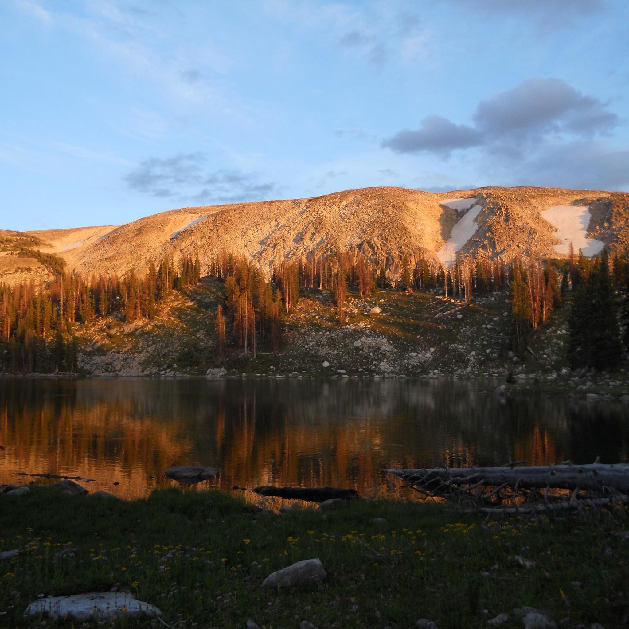
Here, you can enjoy stunning views of Rabbit Ears. It's a great place to pause and take in the views before making your way back.
0
0
For mountain bikers, the Rabbit Ears Trail is a lung-scorching climb and a heart-pumping descent! This technically easy jeep road delivers postcard-worthy panoramas, but thin air and steep sections test your endurance.
0
0
This section of the Fish Creek Trail rewards cyclists with breathtaking views of Long Lake. Perfect for a quick rest before powering ahead or turning back.
0
0

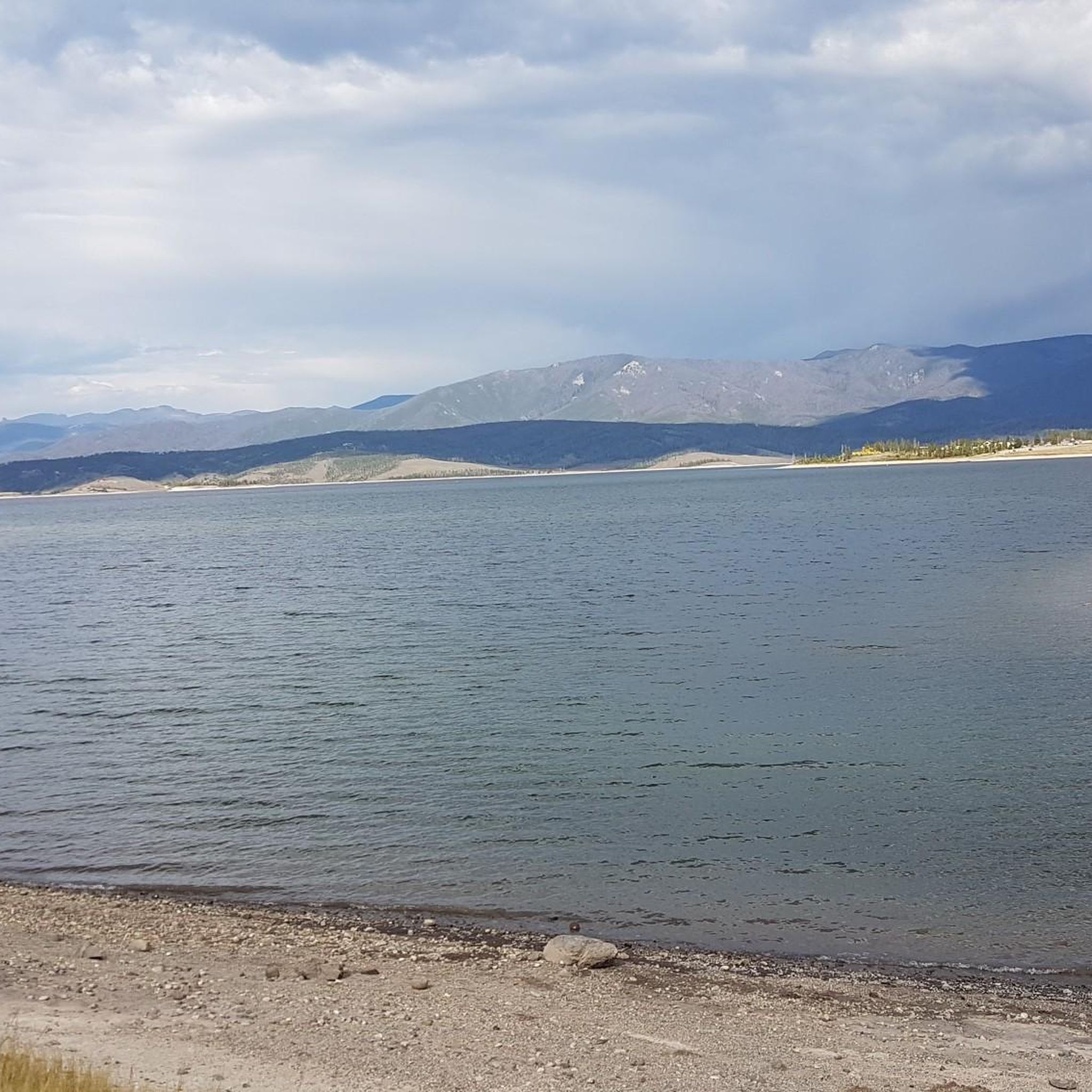
This park near the Fraser River has a small fishing pond, picnic areas and some short connected trails. It is an entrance point to Granby from the south, and ends the Fraser to Granby Trail.
0
0

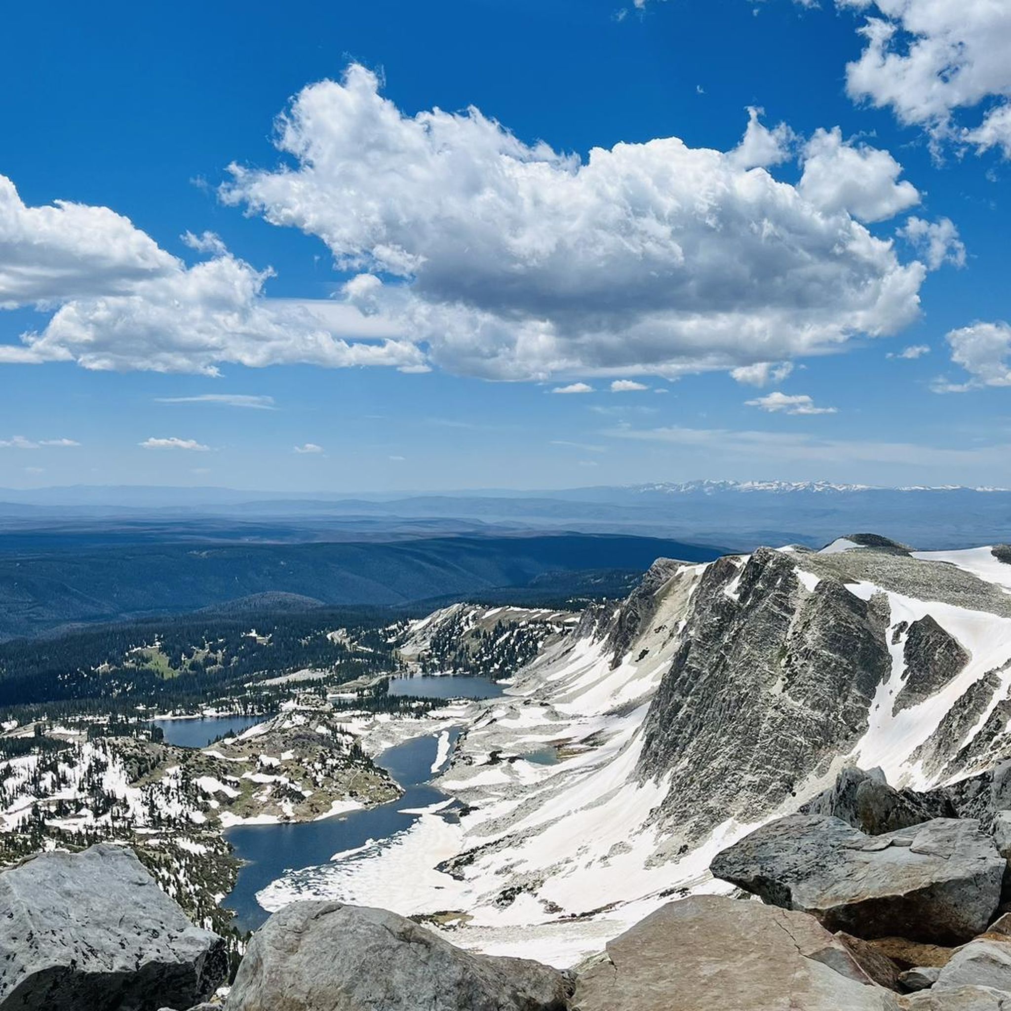
This section of trail is a steady, unrelenting — excuse me, exhilarating — northbound climb along the Wyoming Trail, which overlaps with the Continental Divide Trail. Not all of the CDT is open to mountain bikers, but this portion is, and you'll get just one or two breaks in the elevation gain until you reach Buffalo Pass.
1
0
This is a great spot to catch a view of Rabbit Ears Peak looming above you. The ascent to the actual peak is a technical rock climb, and the rock climb itself is very loose and crumbly — so for most trail runners, this is as far up as you'd ever want to go.
1
0
Barber Lake's roadside access makes it a great place to start, stop, or turn around on a ride along the nearby Barber Lake Trail (sometimes also called the Libby Creek Trail, since it ties in to the trail of that same name). If you start your ride here you can power up the trail's consistent elevation gain, then pretty much coast on the way back. Or you can make a loop by riding one way on Barber Lake Road. Barber Lake Trail, itself, is fun single and double track. Believe it or not, this is a great place for spotting butterflies too. Keep an eye out for species like the hoary anglewing and the green comma if you pause in your ride.
1
0
Although this challenging singletrack doesn't get a lot of traffic (probably because you need a 4-wheel-drive vehicle with high ground clearance to reach the trailhead), it's a fun one. You'll grind out some elevation gain on the way up, then gain it all back on the way down again. If you want a longer ride, this trail also links in with the Gap Lakes Trail and beyond.
1
0
Frequently Asked Questions
How many mountain bike trails are there in the Medicine Bow Mountains?
The Medicine Bow Mountains offer a diverse network of over a dozen mountain bike trails. These routes cater to various skill levels, from easy paths to technically demanding rides, allowing you to explore the region's unique landscapes.
What kind of terrain can I expect on mountain bike trails in the Medicine Bow Mountains?
You'll encounter a wide variety of terrain, from expansive grasslands and pine forests to high alpine glades and rugged peaks. The region is known for its distinctive rock outcroppings, deep glacial lakes, and varied ecosystems. Trails can range from smooth gravel paths to technical singletrack with embedded rocks.
Are there easy mountain bike trails suitable for beginners or families?
Yes, there are several easy trails perfect for beginners or family outings. For example, the Heart Lake Trail is an easier 3.5-mile route offering scenic views and wildflowers. Another good option is the Quealy Lake Trail, which is also considered easy.
What are some challenging mountain bike trails for experienced riders?
For experienced riders seeking a challenge, the Medicine Bow Mountains offer routes with significant elevation gain and technical sections. The Kaibab Park loop from Granby is a difficult 21.5-mile route with over 2,400 feet of elevation gain. The Medicine Bow Peak Trail, while not listed in the guide, is also known for its very challenging, physically and mentally demanding rocky terrain, suitable for highly experienced riders.
When is the best time of year to go mountain biking in the Medicine Bow Mountains?
The prime season for mountain biking in the Medicine Bow Mountains is typically from mid-June to late October, when trails are clear of snow and accessible. The Medicine Bow Rail Trail, for instance, is best enjoyed during this period. Always check local conditions before heading out, as higher elevations can retain snow longer.
Can I spot wildlife while mountain biking in the Medicine Bow Mountains?
Absolutely! The Medicine Bow Mountains are rich in wildlife. While riding, you might spot moose, elk, mule deer, beaver, pronghorn, and various bird species. The area is also home to less common animals like Canada lynx, red fox, coyotes, bobcats, black bears, and mountain lions. Many trails offer solitude, increasing your chances of wildlife encounters.
Are there any notable natural attractions or landmarks to see along the trails?
Yes, the region is dotted with stunning natural features. You can find deep glacial lakes like Lookout Lake and Twin Crater Lakes. The iconic Medicine Bow Peak offers panoramic views, and the Libby Flats Observation Point provides another excellent viewpoint. The Vedauwoo Recreation Area, known for its distinctive rock outcroppings, is also a popular spot for outdoor activities.
Are dogs allowed on mountain bike trails in the Medicine Bow Mountains?
Many trails within the Medicine Bow National Forest are dog-friendly, especially those on Forest Service land. However, regulations can vary, so it's always best to check specific trail rules or Forest Service guidelines before bringing your dog. Always keep your dog under control and pack out any waste.
Are there options for winter fat biking in the Medicine Bow National Forest?
While the guide focuses on traditional mountain biking, the Medicine Bow National Forest does offer opportunities for winter fat biking on designated trails, particularly those that are groomed or packed. The Snowy Range Scenic Byway (Highway 130), though closed to vehicles in winter, can sometimes be used for fat biking. It's crucial to check current conditions and specific trail access for fat biking before planning a winter trip.
Where can I find parking or trailheads for mountain biking in the Medicine Bow Mountains?
The Medicine Bow Mountains offer numerous trailheads and parking areas, especially within the Medicine Bow National Forest. Many popular routes, such as the Medicine Bow Rail Trail and Rock Creek Trail, have designated access points. Look for signs indicating public access and parking at the start of trails. The region also provides numerous campsites and picnic areas, often co-located with trail access.
What makes the Medicine Bow Rail Trail a popular choice for mountain bikers?
The Medicine Bow Rail Trail is popular because it's a relatively flat, multi-use gravel path that follows an old railroad grade. This 24.5-mile trail winds through the national forest, offering a less technical ride suitable for full-suspension and hybrid mountain bikes, and is enjoyed by cyclists, hikers, and horseback riders alike.
What is the overall rating for mountain biking in the Medicine Bow Mountains by the komoot community?
The Medicine Bow Mountains are highly regarded by the komoot community. More than a dozen mountain bikers have used komoot to explore the varied terrain, often praising the diverse landscapes, from pine forests to alpine glades, and the options available for different ability levels.
Are there any longer mountain bike routes for endurance riders?
For endurance riders, the Medicine Bow Mountains offer several longer routes. The Rock Creek Trail is a moderate 21.7-mile path with over 2,400 feet of elevation gain. Another excellent option is the Wyoming Trail (Continental Divide Trail), which spans over 20 miles and features significant elevation changes.
Most popular routes in the Medicine Bow Mountains
Most popular attractions in the Medicine Bow Mountains

Get inspired with the komoot mobile app


Explore more
Browse the best MTB trails in other regions.
