Easy hikes and walks around Saintes
4.5
(1344)
11,468
hikers
371
hikes
Easy hiking trails around Saintes traverse a diverse landscape shaped by the Charente River and its surrounding countryside. The region features tranquil river paths, marshlands, forests, and vineyards, offering varied natural settings for walks. Hikers can explore protected areas like the Marais d'Yves Nature Reserve, which includes dried-up marshes and coastal sections. The terrain generally consists of gentle hills and riverbanks, providing accessible routes for various fitness levels.
Best easy hiking trails around Saintes
- The most popular easy hiking route…
Last updated: October 24, 2026
4.5
(2)
7
hikers
4.27km
01:08
40m
40m
Easy hike. Easily walkable paths.
4.5
(17)
136
hikers
Easy hike. Easily walkable paths.

5.0
(10)
90
hikers
Easy hike. Easily walkable paths.
4.5
(11)
100
hikers
Easy hike. Easily walkable paths.
3.0
(3)
77
hikers
Easy hike. Easily walkable paths.
5.0
(4)
50
hikers
6.25km
01:37
30m
30m
Easy hike. Easily walkable paths.
4.8
(9)
50
hikers
Easy hike. Easily walkable paths.
4.0
(3)
41
hikers
Easy hike. Easily walkable paths.
4.7
(6)
45
hikers
5.76km
01:29
30m
30m
Easy hike. Easily walkable paths.
4.5
(2)
30
hikers
5.60km
01:25
10m
10m
Easy hike. Easily walkable paths.
Get access to more routes and recommendations from other explorers.
Already have an account?
Our route recommendations are based on thousands of hikes, rides, and runs completed by other people on komoot.
Start today with a free account
Your next adventure awaits.





Tips from the Community

A place out of time, magnificent!
0
0

The height of the two pavilions relative to the central body of the castle gave me a hard time identifying this castle. Indeed, the photo was taken from the Charente river, so the perspective is distorted compared to those existing on the WEB, and even AI had some difficulties. However, it was the heritage source that provided a decisive indication: the current main entrance is located to the south, at the end of the park, and opens directly onto the Quai des Fleurs and the Charente river with a gate perfectly aligned with the central body, and which is officially described as having square pillars and wrought iron gates. Note that the castle is private and unfortunately not open to visitors. 1. The estate already existed in the 17th century The Pépinière is therefore not a creation of the late 19th century. In 1660, documents mention Marie de Puyrigaud as "lady of La Pépinière". There was therefore already a noble dwelling at this location. The choice of this location is logical: the property is situated on a hill overlooking the Charente, just above the large shipyard of Saint-Savinien. This shipyard was active for several centuries, from the 13th century until around 1860. The location of La Pépinière thus allowed it to directly overlook the activities of the port and the shipyard. 2. The castle visible on Claude Masse's plan in 1713 In 1713, the military engineer Claude Masse produced a plan of Saint-Savinien and the Charente valley. At the location of La Pépinière, he depicts: a massive construction flanked by three or four towers, preceded by a large garden descending towards the Charente. In other words, the estate then had a much more fortified silhouette than that of the current castle. This also means that the two elements surrounding the central body are part of an ancient architectural tradition of the site, even if the pavilions you see today are not necessarily the old towers. 3. 18th century: outbuildings remain Several buildings around the current castle could be the former outbuildings of the estate. One building located on the other side of the path to La Pépinière notably bears the date 1760, engraved on the keystone of its gate. There were also, towards the Charente, constructions that could have served in the 19th century as housing for employees or the caretaker. 4. 1847: the park is still organized around the old dwelling The eastern boundary wall bears the date 1847. The Napoleonic cadastral map of 1828 still shows the old dwelling surrounded by its park, as well as several annex buildings. We can therefore reconstruct this succession quite precisely: 17th century → old noble dwelling ↓ 1713 → vast house with 3 or 4 towers, according to Claude Masse ↓ 18th century → transformation and development of outbuildings ↓ 1828 → old dwelling still present ↓ 1847 → dated boundary wall ↓ circa 1900 → disappearance of the old dwelling and construction of the current castle 5. The current castle is much more recent as it dates from the very beginning of the 20th century. It was built by J. Lestrade, a contractor from Saint-Savinien, from plans attributed to the architect Georges Naud. The new building was designed with an H-shaped floor plan: -a central body; -two wings forming pavilions; -the pavilions have three levels; -their slate roofs are hipped and very high; -the central body has a Mansart roof. The heritage notice precisely describes these two pavilions as being topped with hipped conical roofs. The two "towers" appear taller than the central body. They are in reality the two side pavilions, which have three levels and whose very high roofs further accentuate this impression.
0
0

Built from the 11th century on the cliff overlooking the Gironde estuary, this church is sometimes considered the archetype of the Saintonge Romanesque style.
0
0

You absolutely must follow the guided tour by this passionate and fascinating volunteer guide, photos are not allowed inside the site but it is worth the detour and the effort to climb to the top of the cliff. It is possible to bring the bikes inside the fence, so they are safe.
0
0
🪩 The Louis Mérit and Roger Mauret Pétanque Court The Saujon pétanque court, officially named the Louis Mérit and Roger Mauret Pétanque Court, is a municipal facility located on the Voie de la Taillée in Saujon. It consists primarily of a pétanque court with a stabilized/cinder surface, suitable for both pétanque and jeu provençal. 📅 Origins and Development There is no precise official date published by the town hall or readily accessible online local archives, but sports directories indicate that this facility could date from 1965–1974 (estimate based on local data for referenced sports facilities). → This suggests that the courts were already in place in the second half of the 20th century, corresponding to a period when pétanque clubs were becoming more structured in France and dedicated municipal facilities were often created. 🏆 Activity and Functions Over Time The pétanque court hosts local pétanque competitions and events, including competitions open to the public such as those organized as part of community events (for example, a "Pink October" competition in October 2025). It is used by individual players, recreational groups, and the local pétanque club (Pétanque Saujon-Vaux), which organizes official FFPJP competitions—including departmental qualifiers and championships—at its facilities in Saujon and Vaux-sur-Mer. 🏅 Name and Local Recognition The naming of the court after Louis Mérit and Roger Mauret suggests that these two individuals likely made a significant contribution to pétanque or community life in Saujon (such names often honor active members of the local sports community), but online sources do not provide detailed biographies of these individuals. → More detailed information can be obtained by consulting the municipal archives, local association newsletters, or by contacting the Saujon town hall. 🏡 Position in local life The pétanque court is part of the traditional outdoor sports landscape in Saujon, alongside other municipal facilities (stadium, swimming pool, tennis courts, etc.), and testifies to the deep roots of pétanque in local culture for several decades.
0
0
🏊♂️ Origins and Opening The Saujon swimming pool, now known as Espace Aquatique de la Lande, opened on June 22, 1995. It will therefore celebrate its 30th anniversary in 2025, with festive events planned to mark the occasion. ⚙️ Community Management For approximately 30 years, the facility was managed by a Single-Purpose Intermunicipal Syndicate (SIVU), bringing together several municipalities in the local area (including Saujon, Balanzac, Corme-Écluse, L’Éguille-sur-Seudre, etc.). This structure facilitated access to swimming, aquatic activities, and swimming lessons for local residents. 📉 End of the Syndicate and Transfer In 2025, the SIVU was dissolved, marking a new chapter in the swimming pool's history. The financial review and preparations for the transfer were completed at the last delegates' meeting. As of July 1, 2025, the management and responsibility for the swimming pool have been transferred to the Royan Atlantique Agglomeration Community (CARA) as part of a community swimming pool plan aimed at pooling resources, harmonizing services, and preparing for the facility's renovation. 🧠 Role and Local Impact The facility is considered a key leisure and aquatic sports venue for Saujon and the surrounding towns, attracting more than 80,000 visitors annually and offering a variety of activities such as swimming, aquagym, aquabiking, and sessions adapted for people with disabilities. 🛠️ Future Prospects As part of the CARA swimming pool plan, the Saujon swimming pool is slated for future renovation and is expected to be integrated into a larger network of aquatic facilities including other towns (such as Royan, Étaules, and Cozes). 📍 Current Features The aquatic center currently includes: A 25-meter indoor pool with a gradual depth, A paddling pool and outdoor pools with water slides (seasonal), Indoor and outdoor swimming slots depending on the time of year.
0
0

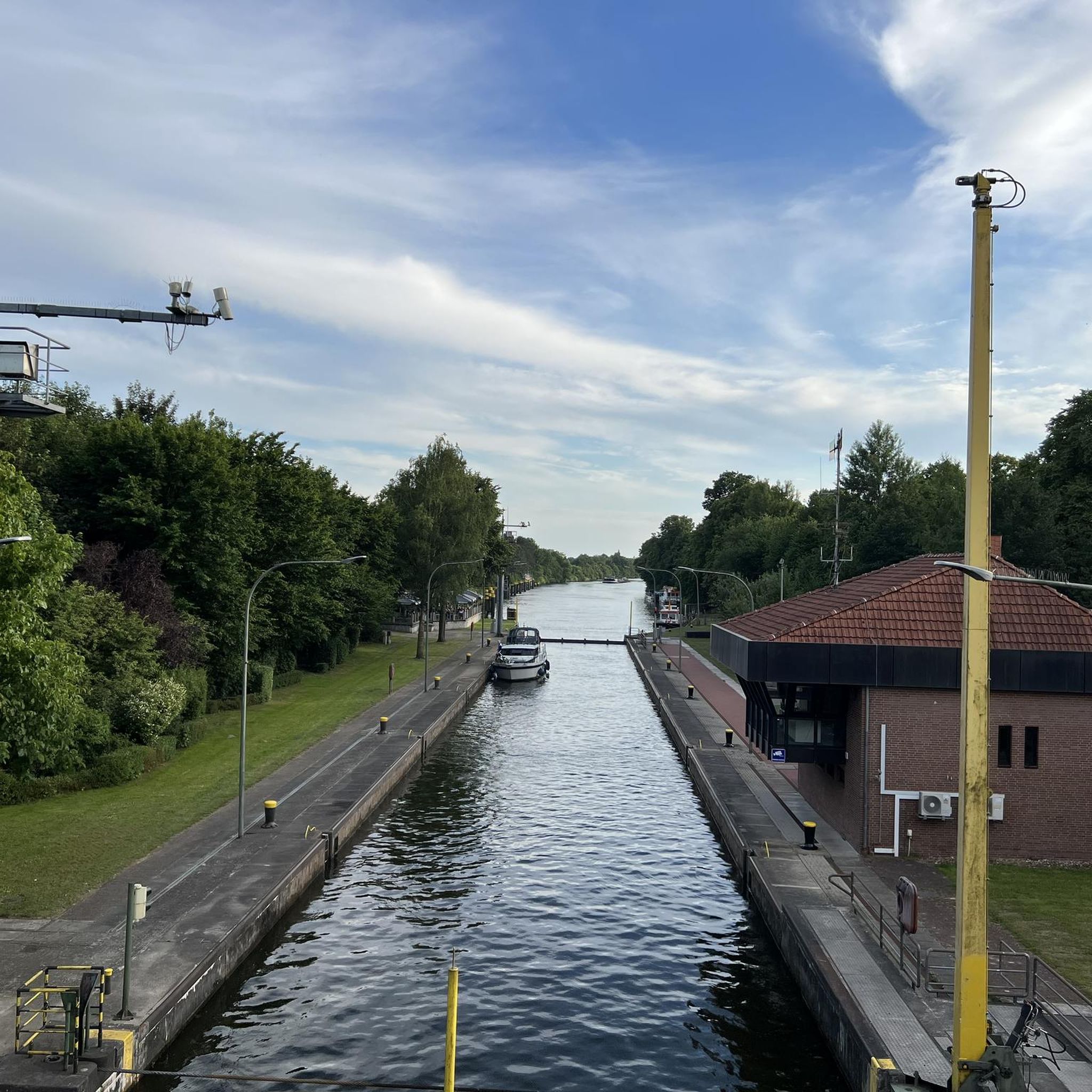
The flushing lock is located at the head of the port, between the north bank's embankment and the south bank's quay. A retention basin, occupying the non-navigable Seudre riverbed as far as Saujon, follows the flushing lock. Within the retention basin, rubble stone embankments extend the lock's return walls for a few meters. The lock itself forms a bridge carrying a road. The lock bridge consists of two piers, forming three arches, each housing two gates. On the upstream side of the lock, the piers have semicircular cutwaters. The three bands are stacked and terminate in clamps. The lock ends with a cornice resting on modillions. The cornice follows the shape of the cutwaters. A metal balustrade, also semicircular in shape, is fixed to the top of the lock. This balustrade is framed by two stone moldings. The sluice gate and its upstream and downstream return walls are constructed of dressed stone. The masonry is of medium and regular quality, except for the coping of the return walls, which features large and regular masonry. The upstream north return wall is lower than the one on the south bank. A small parapet of recently constructed white rubble masonry surmounts it. The sluice gate is equipped with metal gates, the modern racks of which are visible. The first sluice gate was built around 1825 on the site of a former tidal mill. During the works carried out between 1839 and 1842, the sluice gate's embankment was modified to allow the passage of vehicles. Between 1847 and 1853, the lock was enlarged to allow for larger flushes, and the reservoir was excavated. Return walls were also built to connect the flushing lock to the riprap. It was then restored in 1865 and completely rebuilt between 1868 and 1869. The lock is 10.50 m wide, and its gates are each 1.50 m wide. The reservoir is 700 m long and has an average width of 30 m.
0
0
Frequently Asked Questions
How many easy hiking trails are available around Saintes?
There are over 160 easy hiking trails around Saintes, offering a wide variety of landscapes from tranquil river paths to historic urban environments. These routes are generally well-suited for various fitness levels.
Are there family-friendly easy hikes in Saintes?
Yes, many easy trails around Saintes are perfect for families. These routes often feature gentle terrain and shorter distances. A great option is the Saintes – loop, which is 4.3 km long and offers a general exploration of the area.
Can I find circular easy walks in the Saintes area?
Absolutely. Many easy hikes around Saintes are circular, allowing you to start and end at the same point. For example, the Saintes Public Garden – Archaeological museum loop from Saintes is a popular 6.4 km circular path that combines natural spaces with historical sites within the city.
Are easy hiking trails around Saintes suitable for dogs?
The diverse landscapes around Saintes, including riverbanks and forests, generally welcome dogs. It's always recommended to keep your dog on a leash, especially in nature reserves or areas with wildlife. Always check local signage for specific restrictions.
What kind of natural landscapes can I expect on easy hikes near Saintes?
Easy hikes near Saintes traverse varied landscapes, including the tranquil banks of the Charente River, open meadows, and peaceful forests like the Forêt de la Roche Courbon. You can also explore protected areas such as the Marais d'Yves Nature Reserve, which features dried-up marshes and coastal sections.
Are there any historical sites or landmarks to see on easy hikes?
Yes, Saintes is rich in history, and many easy trails incorporate historical sites. You can walk past the well-preserved Roman amphitheater and the Arch of Germanicus. The Saintes Public Garden – Archaeological museum loop is a great example, passing by the Saintes Public Garden and the Archaeological Museum.
What do other hikers enjoy most about easy hikes in Saintes?
The easy hikes in Saintes are highly rated by the komoot community, with an average score of 4.5 stars from over 450 reviews. Hikers often praise the tranquil river paths, the diverse ecosystems of local nature reserves, and the ability to combine historical sightseeing with their walks.
Are there easy trails that offer coastal views near Saintes?
While Saintes itself is inland, the wider region of Charente-Maritime offers easy trails with coastal views. For instance, you can experience coastal vistas from areas like the Boulevard du Marais, where the landscape changes with tidal variations. The View of Suzac Beach – View from the Cliffs loop from Saint-Georges-de-Didonne offers beautiful cliffside and beach views.
Can I find easy hikes that pass by interesting natural attractions?
Yes, several easy hikes will lead you to unique natural attractions. For example, the Grottes de Matata – Le Port loop from Meschers-sur-Gironde takes you near the Grottes de Matata, a fascinating cave system. You can also find trails near the Suzac Forest.
Are there any easy trails that explore the local vineyards or countryside?
The countryside of Charente-Maritime around Saintes is characterized by meadows, forests, and vineyards. Many easy trails will take you through this picturesque rural landscape, offering a chance to experience the region's agricultural beauty. The Monolithic Hermitage loop from Mortagne-sur-Gironde leads through varied terrain typical of the area.
What is the best time of year for easy hiking in Saintes?
Saintes offers pleasant hiking conditions for easy trails throughout much of the year. Spring and autumn provide mild temperatures and beautiful scenery, with blooming flowers or vibrant fall foliage. Summer is also suitable, especially for shaded forest paths or river walks, though it can be warmer.
Are there easy hikes that include views of castles or other grand structures?
Yes, the region around Saintes features historical architecture that can be incorporated into your hikes. While not directly on every easy trail, some routes offer views or proximity to impressive structures like the Crazannes Castle or the Abbaye de Fontdouce, allowing you to combine nature with cultural exploration.
Are there easy trails suitable for a short stroll, perhaps less than an hour?
Yes, many easy trails around Saintes are relatively short and can be completed in about an hour or slightly more. For example, the Saintes – loop is 4.3 km and typically takes around 1 hour 8 minutes, perfect for a refreshing short walk.
Most popular routes around Saintes
Most popular attractions around Saintes

Get inspired with the komoot mobile app


Didn’t find what you were looking for?
Check out more Hikes throughout Saintes below and find the perfect route in your destination.
Explore more
Browse the best Hikes in other regions.
