Easy hikes and walks in Trollstigen Landskapsvernområde
4.5
(753)
5,191
hikers
100
hikes
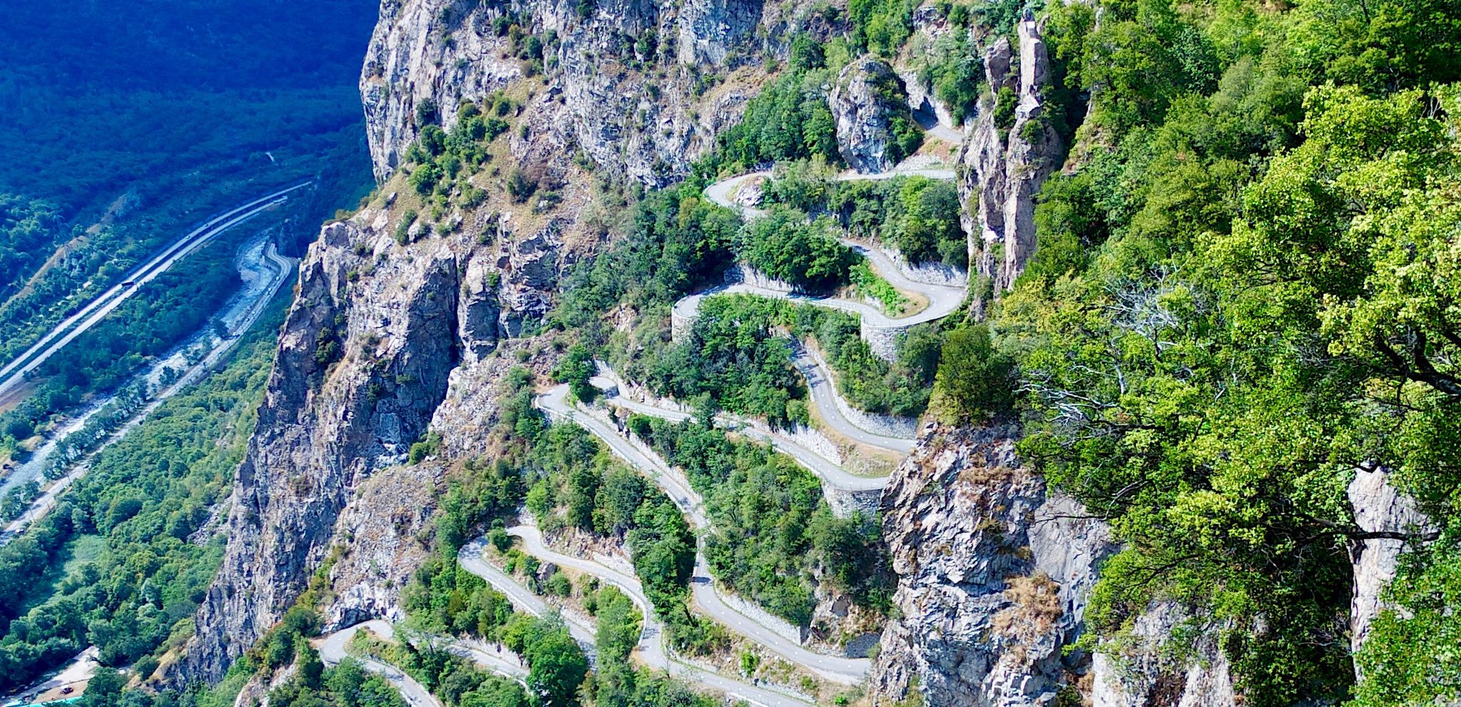
Easy hiking trails in Trollstigen Landskapsvernområde traverse a landscape characterized by steep mountains, lush valleys, and deep gorges. The region features dramatic natural formations, including the iconic Trollstigen mountain road and the 320-meter-high Stigfossen waterfall. These physical features create a varied terrain for hikers, offering both verdant valleys and elevated viewpoints. The area's geological values and cultural heritage are preserved within this protected landscape.
Best easy hiking trails in Trollstigen Landskapsvernområde
- The most popular easy hiking route is Trollstigen Visitor Center – Trollstigen loop from Brønnsletta, a 0.8 miles (1.3 km) trail that takes about 21 minutes to complete. This route offers direct views of the Trollstigen road and the surrounding mountain scenery.
- Another top favourite among local hikers is Kløvstein Parking Area – Hiking Hut loop from Brønnsletta, an easy 2.2 miles (3.6 km) path. This trail leads through varied terrain with an elevation gain of about 334 feet (102 meters).
- Local hikers also love the Juvat Viewpoint – Gudbrandsjuvet Gorge loop from Gudbrandsjuvet, a 1.5 miles (2.4 km) trail leading through a scenic gorge, often completed in about 40 minutes.
- Hiking in Trollstigen Landskapsvernområde is defined by steep mountains, verdant valleys, and dramatic waterfalls. The network offers options for different ability levels, with many routes suitable for easy excursions.
- The routes in Trollstigen Landskapsvernområde are highly rated by the komoot community with an average score of 4.4 stars from over 280 reviews. More than 1,800 hikers have used komoot to explore Trollstigen Landskapsvernområde's varied terrain.
Last updated: May 10, 2026
4.6
(8)
60
hikers
1.26km
00:21
20m
20m
Easy hike. Great for any fitness level. Easily-accessible paths. Suitable for all skill levels.
4.0
(2)
8
hikers
3.62km
01:05
100m
100m
Easy hike. Great for any fitness level. Easily-accessible paths. Suitable for all skill levels.

Sign up for free
4.0
(6)
23
hikers
2.17km
00:36
40m
40m
Easy hike. Great for any fitness level. Easily-accessible paths. Suitable for all skill levels.
5.0
(2)
7
hikers
4.90km
01:17
30m
30m
Easy hike. Great for any fitness level. Easily-accessible paths. Suitable for all skill levels.
17
hikers
6.70km
01:50
110m
110m
Easy hike. Great for any fitness level. Easily-accessible paths. Suitable for all skill levels.
Get access to more routes and recommendations from other explorers.
Sign up for free
Already have an account?
Our route recommendations are based on thousands of hikes, rides, and runs completed by other people on komoot.
Start today with a free account
Your next adventure awaits.
Login or Signup
Popular around Trollstigen Landskapsvernområde
Other adventures in Trollstigen Landskapsvernområde

Tips from the Community

Designed like a small city park.
0
0

Very nice place. Nice view down into the gorge.
0
0

Norway's most famous serpentine road should be visited early because it gets crowded during peak season.
1
0

The Trollstigen is one of the most impressive mountain roads in Europe. It climbs a good 400 meters in 11 hairpin bends and connects Romsdalen with Geiranger. The viewing platforms offer a fantastic view of the pass. But the most impressive part, for me, is the crossing of the 320-meter-high waterfall, Stigfossen.
8
1

The climb from Andalsnes is closed until July 14, 2025, due to landslide repairs, but the south side of Trollstigen is open up to the viewpoint. On a clear day, you can see the switchbacks – a must-see on any 🇳🇴 trip!
0
0

Andalsnes is a young town with about 3000 inhabitants. It is the administrative centre of the municipality of Rauma in More and Romsdal. The town is located at the mouth of the Rauma River, which is known for its salmon. The town is surrounded by mountains that are up to 1000 metres high
0
0
The museum has a modern exhibition that tells the history and development of mountaineering in a variety of ways. You can also touch and try out the equipment. The indoor climbing wall has 60 climbing routes spread over 20 anchor points. The café has space for 100 people indoors, with additional seating outside.
1
0
Opened in 2016 Is Norway's second highest indoor climbing wall, suitable for all ages from 3 to ...... years A gift and outdoor equipment shop is located there. In winter there are guided mountain tours, snowshoe hikes and much more. The exhibition in the museum includes 16 exciting installations that convey various aspects of mountain sports
1
0
Frequently Asked Questions
How many easy hiking trails are available in Trollstigen Landskapsvernområde?
There are over 30 easy hiking trails in Trollstigen Landskapsvernområde, offering a variety of experiences through its dramatic landscapes. In total, the region features more than 100 hiking routes across all difficulty levels.
What do other hikers enjoy most about the easy trails in Trollstigen Landskapsvernområde?
The easy trails in Trollstigen Landskapsvernområde are highly rated by the komoot community, with an average score of 4.4 stars from over 280 reviews. Hikers often praise the spectacular views of the winding Trollstigen road, the powerful Stigfossen waterfall, and the unique natural features of the protected landscape.
Are there any circular easy hikes in Trollstigen Landskapsvernområde?
Yes, several easy circular routes are available. A popular option is the Trollstigen Visitor Center – Trollstigen loop from Brønnsletta, which is about 0.8 miles (1.3 km) long. Another favorite is the Kløvstein Parking Area – Hiking Hut loop from Brønnsletta, spanning 2.2 miles (3.6 km) with varied terrain.
What natural features can I see on easy hikes in the area?
Easy hikes in Trollstigen Landskapsvernområde allow you to experience lush valleys, steep mountains, and deep gorges. You can witness the iconic Trollstigen mountain road, the impressive 320-meter-high Stigfossen waterfall, and enjoy panoramic views from various points. The region's geological values are a significant part of its appeal.
Are there family-friendly easy hikes in Trollstigen Landskapsvernområde?
Many easy trails are suitable for families. Routes like the Trollstigen Visitor Center – Trollstigen loop from Brønnsletta are short and offer engaging views, making them ideal for a family outing. The Trollstigen Visitor Center itself provides amenities and easy access to viewpoints.
Are there easy hikes with good viewpoints?
Absolutely. The region is renowned for its spectacular vistas. The Trollstigen Visitor Center – Trollstigen loop offers direct views of the famous road and surrounding mountains. You can also find excellent perspectives from the View of Trollstigen and Stigfossen Waterfall and the View of Trollstigen highlights.
How long do easy hikes in Trollstigen Landskapsvernområde typically take?
The duration of easy hikes varies. Shorter routes, like the Trollstigen Visitor Center – Trollstigen loop, can be completed in about 20-30 minutes. Longer easy trails, such as the Kløvstein Parking Area – Hiking Hut loop (2.2 miles), might take around 1 hour and 5 minutes, depending on your pace.
Are there easy hikes that pass by waterfalls?
Yes, the region is famous for its waterfalls. The Trollstigen road itself crosses the impressive 320-meter-high Stigfossen waterfall. Many viewpoints and trails, including those accessible from the Trollstigen Visitor Center, offer stunning views of this cascade and other smaller falls.
What facilities are available near the easy hiking trails?
The Trollstigen Visitor Center is a key hub, offering amenities such as shops and cafes. It also features architect-designed viewpoints, providing a comfortable base before or after your hike. Many trails are easily accessible from this central point.
When is the best time of year for easy hikes in Trollstigen Landskapsvernområde?
The best time for hiking in Trollstigen Landskapsvernområde is typically during the summer months when the mountain roads are open and the weather is most favorable. The landscape is lush, and conditions are generally good for exploring the trails. Always check local conditions before heading out.
Are there easy hikes with parking available?
Yes, parking is available at key access points. For example, the Kløvstein Parking Area – Hiking Hut loop starts directly from a parking area, making it convenient for hikers arriving by car. The Trollstigen Visitor Center also offers ample parking.
What should I wear for easy hikes in Trollstigen Landskapsvernområde?
Even for easy hikes, it's recommended to wear good hiking boots for stability and comfort on varied terrain. The weather in the mountains can change quickly, so layers are advisable, along with waterproof outerwear. Bring water and snacks, and consider sun protection.
Most popular routes in Trollstigen Landskapsvernområde
Most popular attractions in Trollstigen Landskapsvernområde

Get inspired with the komoot mobile app


Explore more
Browse the best Hikes in other regions.
