The best waterfall hikes and walks in Shawnee National Forest
4.8
(25)
256
hikers
3
hikes
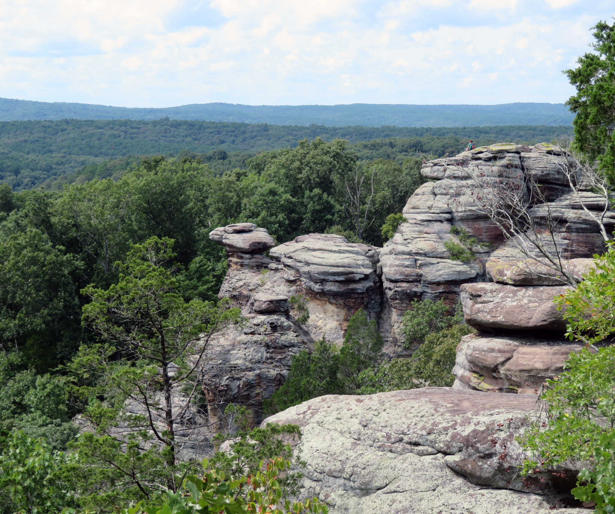
Waterfall hiking trails in Shawnee National Forest traverse a diverse landscape of oak-hickory forests, wetlands, and canyons in southern Illinois. The region is characterized by ancient geological formations, including massive sandstone, limestone, and shale escarpments, shaped by glacial activity. Hikers can explore lush canyons, sheer bluffs, and areas with clear, rocky streams. The varied terrain offers opportunities to discover natural landmarks and scenic viewpoints.
Best waterfall hiking trails in Shawnee National Forest
- The most popular waterfall hiking route is Bork's…
Last updated: October 10, 2026
4.19km
01:09
70m
50m
This combined route through Ferne Clyffe State Park offers a tranquil journey through quiet woods, past impressive bluffs, and alongside scenic creeks. The highlight is Bork's Waterfall, cascading into a…
284km
76:52
3,890m
4,020m
Embark on the River to River Trail, a difficult hiking route that spans 176.2 miles (283.5 km) across southern Illinois. You will experience a diverse and often rugged journey, gaining…

1
hikers
3.01km
00:47
20m
20m
The Jackson Falls Trail offers a delightful journey through the dense forests and scenic creeks of Shawnee National Forest. You'll discover impressive sandstone formations and the seasonal Jackson Falls, which…
Our route recommendations are based on thousands of hikes, rides, and runs completed by other people on komoot.
Start today with a free account
Your next adventure awaits.
Popular around Shawnee National Forest
Other adventures in Shawnee National Forest

Tips from the Community

One of several campgrounds in Ferne Clyffe State Park; this one is a nice middle ground for backpackers and "rustic" car campers, with camping pads, pit toilets, showers(!), cooking grills and picnic tables. If you want more quiet, there's another class C campground, specifically for backpackers, about a half-mile away.
0
0
The River to River Trail goes straight across the dam for Dutchman Lake. The views from the trail can be particularly pretty in the fall, when the trees blaze with orange and yellow — but the lake and accompanying creek are also the best source of water for miles around. (Make sure you filter the water before drinking!)
0
0
This natural area centers around the prominent rocky Crow Knob, which is said to have become the place of worship, and a utilitarian lookout point, for a community of freed slaves in pre-Civil War times. They began meeting at the knob after their church was burned.
0
0
Max Creek is said to be the site of a vortex, where orbs of mysterious, maybe supernatural light are sometimes seen floating around on their own. I don't know about that, but the creek is pretty much the best water source along this section of the River to River Trail. For weary thru-hikers there are plenty of flat spots to camp here, too.
0
0
This is the shorter, more direct of two trails leading south to Trigg Tower, an abandoned fire watchtower that has been repurposed into a lookout tower. It's the last remaining fire tower in Shawnee National Forest, and there is a manmade pond at this intersection that (in theory) has water year-round.
0
0
Ruby Falls is a modest little waterfall, located about a half-mile north (as the trail goes, not as the crow flies) of the River to River Trail.
0
0
Just north of here is a small reservoir along the River to River Trail. If you're thru-hiking it can be a nice place to camp, although there are no designated campsites or amenities — you're on your own for choosing an appropriate backcountry camping area. Beware of unstable rocks and ground near the dam's outflow. If you want to get closer to the lake, hike west until you strike the old, rough road that will take you right to its shores.
0
0
One of the major crossing points of Lusk Creek; keep an eye out for a good primitive camping spot east of here, within an easy walk of the crossing but not so close to the water that you could be swept away if it rises quickly. (Depending on conditions, the creek can rise six feet or more in a few hours — not the sort of thing you want happening in your vicinity while you're fast asleep.) In typical conditions, if you scout around near the crossing you might be able to find a built-up section of rocks you can cross in shallow water.
0
0
Frequently Asked Questions
How many waterfall hiking trails are available in Shawnee National Forest?
Shawnee National Forest offers a selection of waterfall hiking trails. This guide features 3 distinct routes, ranging from easy strolls to more challenging, longer adventures, all designed to lead you to captivating cascades and scenic water features.
What is the best time of year to visit the waterfalls in Shawnee National Forest?
The waterfalls in Shawnee National Forest are often at their most impressive during spring, following snowmelt and seasonal rains. Fall also offers a beautiful backdrop of vibrant foliage. While some waterfalls may have reduced flow in drier summer months, the lush canyons and unique geological formations remain scenic year-round.
Are there any easy or beginner-friendly waterfall hikes?
Yes, there are several easy options perfect for beginners or those seeking a relaxed walk. The Jackson Falls Trail is an easy 3 km route that leads to scenic bluffs and waterfalls, ideal for a gentle introduction to the area's natural beauty.
Can I bring my dog on the waterfall trails?
Many trails within Shawnee National Forest are dog-friendly, but it's always best to check specific regulations for each trail or area. Generally, dogs should be kept on a leash to protect wildlife and ensure the safety of other hikers. Always pack out any waste.
Are there any family-friendly waterfall hikes suitable for children?
Absolutely. Many of the shorter, easier trails are suitable for families. The Bork's Waterfall, Bobcat, and Big Buck Creek Trail is an easy 4.2 km loop that offers a pleasant experience for families, combining waterfalls with diverse forest scenery.
What kind of terrain can I expect on these waterfall hikes?
The terrain around Shawnee National Forest's waterfalls can vary. You might encounter well-maintained paths, but also rugged sections with exposed roots, rocks, and potentially muddy or slippery surfaces, especially after rain. Some trails wind through lush canyons, along bluffs, or through dense oak-hickory forests. Sturdy hiking shoes with good grip are recommended.
Are there any circular routes that feature waterfalls?
Yes, some waterfall trails offer circular options, allowing you to experience diverse scenery without retracing your steps. For example, the Bork's Waterfall, Bobcat, and Big Buck Creek Trail is an easy loop that showcases waterfalls and the surrounding natural environment.
What other natural landmarks or attractions are near the waterfall trails?
Shawnee National Forest is rich in natural beauty beyond its waterfalls. Nearby attractions include the dramatic sandstone formations of Garden of the Gods Recreation Area, the scenic Chalk Bluff Overlook, and the diverse landscapes of Ferne Clyffe State Park. The extensive River to River Trail also passes through many significant natural areas, including parts of Giant City State Park.
What should I wear or bring for a waterfall hike in Shawnee National Forest?
Given the varied terrain and potential for wet conditions, wear sturdy, waterproof hiking boots with good ankle support. Dress in layers suitable for the weather, and bring rain gear, especially in spring. A backpack with water, snacks, a first-aid kit, and a map or GPS device is highly recommended. Insect repellent can also be useful, particularly during warmer months.
Is parking available at the trailheads for waterfall hikes?
Most popular trailheads within Shawnee National Forest, including those leading to waterfalls, offer designated parking areas. However, these can fill up quickly during peak seasons or on weekends. It's advisable to arrive early, especially for well-known spots, to secure a parking space.
What do other hikers enjoy most about the waterfall trails in Shawnee National Forest?
The komoot community highly rates the hiking experiences in Shawnee National Forest, with an average score of 4.9 stars. Reviewers often praise the serene beauty of the forest, the unique geological formations, and the refreshing sight and sound of the waterfalls. The diversity of trails, from easy walks to challenging routes, is also frequently highlighted.
Most popular routes in Shawnee National Forest
Most popular attractions in Shawnee National Forest

Get inspired with the komoot mobile app


Explore more
Browse the best Hikes in other regions.
