The best cycling routes in Berowra Valley Regional Park
4.3
(52)
1,342
riders
51
rides
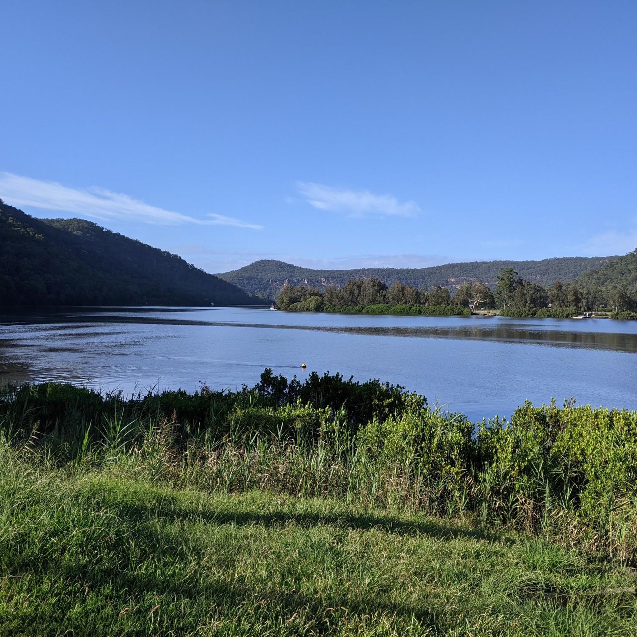
Touring cycling in Berowra Valley Regional Park offers routes through a landscape characterized by deep bushland valleys, sandstone ridges, and significant waterways like Berowra Creek. The park's terrain includes varied elevation changes, from gentle slopes along creek lines to more challenging climbs on the valley sides. This environment provides a mix of shaded paths and open sections, suitable for different cycling experiences. The region is part of the Sydney North Shore, known for its natural beauty and extensive network of…
Last updated: July 4, 2026
18
riders
25.8km
01:39
310m
310m
Moderate bike ride. Good fitness required. Mostly paved surfaces. Suitable for all skill levels.
5
riders
13.8km
00:57
230m
230m
Moderate bike ride. Good fitness required. Mostly paved surfaces. Suitable for all skill levels.

Sign up for free
5
riders
104km
06:51
1,390m
1,390m
Hard bike ride. Very good fitness required. Mostly paved surfaces. Suitable for all skill levels.
30
riders
93.5km
06:10
1,250m
1,250m
Hard bike ride. Very good fitness required. Mostly paved surfaces. Suitable for all skill levels.
21
riders
Hard bike ride. Very good fitness required. Mostly paved surfaces. Suitable for all skill levels.
Get access to more routes and recommendations from other explorers.
Sign up for free
Already have an account?
Our route recommendations are based on thousands of hikes, rides, and runs completed by other people on komoot.
Start today with a free account
Your next adventure awaits.
Login or Signup

Tips from the Community

Berowra is a popular town for hikers, cyclists, and other outdoor enthusiasts of the great Sydney area. There is a popular hiking track between Berowra and Cowan that makes up part of The Great North Walk. Though this is usually done as a point to point walk, the convenient public transit links between the two towns make it easy to get back to your starting point.
0
0

Lyrebird Gully Track stretches 8.6 kilometers one way, and on each side of the track is a trackhead. This is the southernmost track head; both the north and south track heads have a train station, so bushwalkers can walk the Lyrebird Gully Track as an out-and-back or one-way and return to the other end on a 15-minute train ride.
0
0
Tunks Creek Bridge is a historic truss road bridge spanning its namesake creek in Galston Gorge. The bridge was built between 1893-94 and spans 20 metres across the creek. It was added to the on the New South Wales State Heritage Register in June of 2000.
0
0

I love riding along the Cycleway, especially the sections where they have separate the pedestrians from the cyclists
0
0
the is a great ride, especially when you are coming back down the hill
0
0

Easy ride along the river. Elevation gain about 80m
0
0

Weekends will be busy lots of family and casual riders
0
0
The M7 is a great cycleway where you can safely ride without the worry of cars
0
0
Frequently Asked Questions
How many touring cycling routes are available in Berowra Valley Regional Park?
There are over 50 touring cycling routes available in Berowra Valley Regional Park, offering a diverse range of experiences for cyclists. These routes vary in difficulty, from easy paths to more challenging rides through bushland valleys and hilly terrain.
What is the general difficulty level of touring bike trails in Berowra Valley Regional Park?
Berowra Valley Regional Park offers a mix of touring cycling routes suitable for various skill levels. You'll find approximately 4 easy routes, 25 moderate routes, and 23 difficult routes. The terrain often includes varied elevation changes, from gentle slopes along creek lines to more challenging climbs on the valley sides.
Are there any family-friendly touring bike trails in Berowra Valley Regional Park?
Yes, there are several easier touring cycling routes that are suitable for families, particularly those with less elevation gain. While specific 'family-friendly' designations aren't always explicit, routes with lower difficulty ratings and shorter distances are generally more appropriate. Always check the route details for elevation and surface conditions before heading out with children.
What kind of terrain can I expect on touring bike routes in Berowra Valley Regional Park?
Touring cycling in Berowra Valley Regional Park is characterized by deep bushland valleys, sandstone ridges, and significant waterways like Berowra Creek. You can expect varied elevation changes, from gentle slopes along creek lines to more challenging climbs. The environment provides a mix of shaded paths and open sections, often on sealed roads or well-maintained tracks suitable for touring bikes.
Are there any circular touring bike routes in Berowra Valley Regional Park?
Yes, many of the touring cycling routes in Berowra Valley Regional Park are designed as loops, allowing you to start and finish at the same point. For example, the Bobbin Head Picnic Area – Bobbin Head loop from Hornsby Heights is a popular 16.0-mile (25.8 km) option, and the Bobbin Head – Bobbin Head Picnic Area loop from Mount Colah offers a shorter 8.6-mile (13.8 km) ride.
What is the best season for touring bike riding in Berowra Valley Regional Park?
The Sydney North Shore region generally experiences mild winters and warm summers. Spring and autumn are often considered the best seasons for touring cycling in Berowra Valley Regional Park, offering pleasant temperatures and less extreme weather. During summer, it's advisable to ride early in the morning or late afternoon to avoid the midday heat, and always carry plenty of water.
Where can I find parking for touring bike trails in Berowra Valley Regional Park?
Parking is available at various access points around Berowra Valley Regional Park, particularly near popular starting points for routes. For instance, areas around Bobbin Head Picnic Area or trailheads accessible from suburbs like Hornsby Heights or Mount Colah often have designated parking facilities. Always check specific route descriptions for recommended parking locations.
Is public transport available to access touring cycling routes in Berowra Valley Regional Park?
Public transport access to Berowra Valley Regional Park is possible, though it may require some planning. Train stations in nearby suburbs like Hornsby or Mount Colah can provide access points, often requiring a short ride to reach the park's trailheads. Check local bus services for connections to areas closer to the park's entrances.
What do other touring cyclists enjoy most about touring cycling in Berowra Valley Regional Park?
The touring cycling routes in Berowra Valley Regional Park are highly rated by the komoot community, with an average score of 4.5 stars from over 40 reviews. Cyclists often praise the diverse bushland scenery, the challenge of the varied terrain, and the sense of immersion in nature so close to Sydney. The network offers options for different ability levels, from beginner touring bike routes to more challenging rides.
Are there any long-distance or challenging touring bike routes in the park?
Yes, for experienced touring cyclists seeking a challenge, Berowra Valley Regional Park and its surrounding areas offer longer and more difficult routes. An example is the Wisemans Ferry – Galston Gorge Bridge loop from Mount Colah, a substantial 64.9-mile (104.4 km) trail with significant climbs and descents, typically taking nearly 7 hours to complete. Another challenging option is the Pie in the Sky – Galston Gorge Bridge loop from Cherrybrook, covering 93.2 miles (150 km).
Can I find scenic viewpoints along the touring cycling routes?
Yes, the park's landscape of deep bushland valleys and sandstone ridges naturally offers numerous scenic viewpoints. As you cycle, particularly on routes that climb to higher elevations, you'll encounter vistas overlooking the Berowra Creek and the expansive bushland. Keep an eye out for designated lookouts or clearings that provide panoramic views of the region's natural beauty.
What kind of wildlife might I encounter while touring cycling in Berowra Valley Regional Park?
Berowra Valley Regional Park is home to diverse Australian wildlife. While cycling, you might spot various bird species, including kookaburras, lorikeets, and honeyeaters. Keep an eye out for wallabies, echidnas, and goannas, especially in quieter bushland sections. Remember to observe wildlife from a distance and avoid disturbing their natural habitat.
Most popular routes in Berowra Valley Regional Park

Get inspired with the komoot mobile app


Explore more
Browse the best Cycling routes in other regions.
