The best cycling routes in Moervaartdepressie
4.6
(51)
389
riders
36
rides
Touring cycling in Moervaartdepressie offers a low-lying, flat terrain ideal for accessible routes. The region is characterized by its serene waterways, including the Moervaart and Zuidlede rivers, alongside extensive grasslands and forests. Cyclists can explore long, straight, unpaved lanes known as "dreven," which are often tree-lined and contribute to the area's tranquil environment. This undeveloped landscape provides a peaceful setting for cycling through natural and historical features.
Best touring cycling routes in Moervaartdepressie
- The most popular touring cycling route is…
Last updated: July 4, 2026
4.0
(1)
35
riders
9.13km
00:45
10m
10m
Easy bike ride. Great for any fitness level. Mostly paved surfaces. Suitable for all skill levels.
4.1
(10)
30
riders
Easy bike ride. Great for any fitness level. Mostly paved surfaces. Suitable for all skill levels.

Sign up for free
4.8
(6)
25
riders
46.2km
02:57
40m
40m
Hard bike ride. Good fitness required. You may need to push your bike for some segments of this route.
11
riders
13.5km
00:58
10m
10m
Easy bike ride. Great for any fitness level. Mostly paved surfaces. Suitable for all skill levels.
5.0
(1)
28
riders
17.3km
01:05
20m
20m
Easy bike ride. Great for any fitness level. Mostly paved surfaces. Suitable for all skill levels.
Get access to more routes and recommendations from other explorers.
Sign up for free
Already have an account?
Our route recommendations are based on thousands of hikes, rides, and runs completed by other people on komoot.
Start today with a free account
Your next adventure awaits.
Login or Signup

Tips from the Community

The wooden arch bridge over the Stekense Vaart, named after Frans Coppens, was receiver-clerk in the municipality of Sinaai for almost a quarter of a century. He played an important role in "de Groote Watering van Sinay", the name given to the project launched by the Boerenbond in 1926. This project was initiated after repeated floods and aimed to make the polders 'dry'. The construction of the pumping station near Hondsnest was one of the first achievements within this project. During the Second World War, the unemployed were employed to clean or widen ditches. Under the impetus of dike reeve Jozef "meester" Maes and... receiver-clerk Frans Coppens (!), major reclamation works were carried out in the 60s, continuing into the following decades. Thus, Hondsnest got a new pumping station in 1975. In the meantime, the watering area had been converted into a polder, pursuant to the polder law of June 3, 1957. source: info file "Polder Daknam-Sinaai"
2
0
The Sint-Annakerk is located in the Heirbrug district. This district originated from 1880 onwards, when workers' houses were built. In 1931, a parish was founded. Church services were temporarily held in a practice room at the school. Lack of money and economic stagnation, and later the Second World War, prevented the construction of a definitive church. The church was built in 1949-1950 according to the design of Adrien Bressers. It is striking that the tower is not integrated into the building, but was built next to it, on a square floor plan. Source: Wikipedia.
4
0

The pumping station at the Frans Coppens Bridge serves to pump excess water from the lower surrounding area into the canal.
4
0
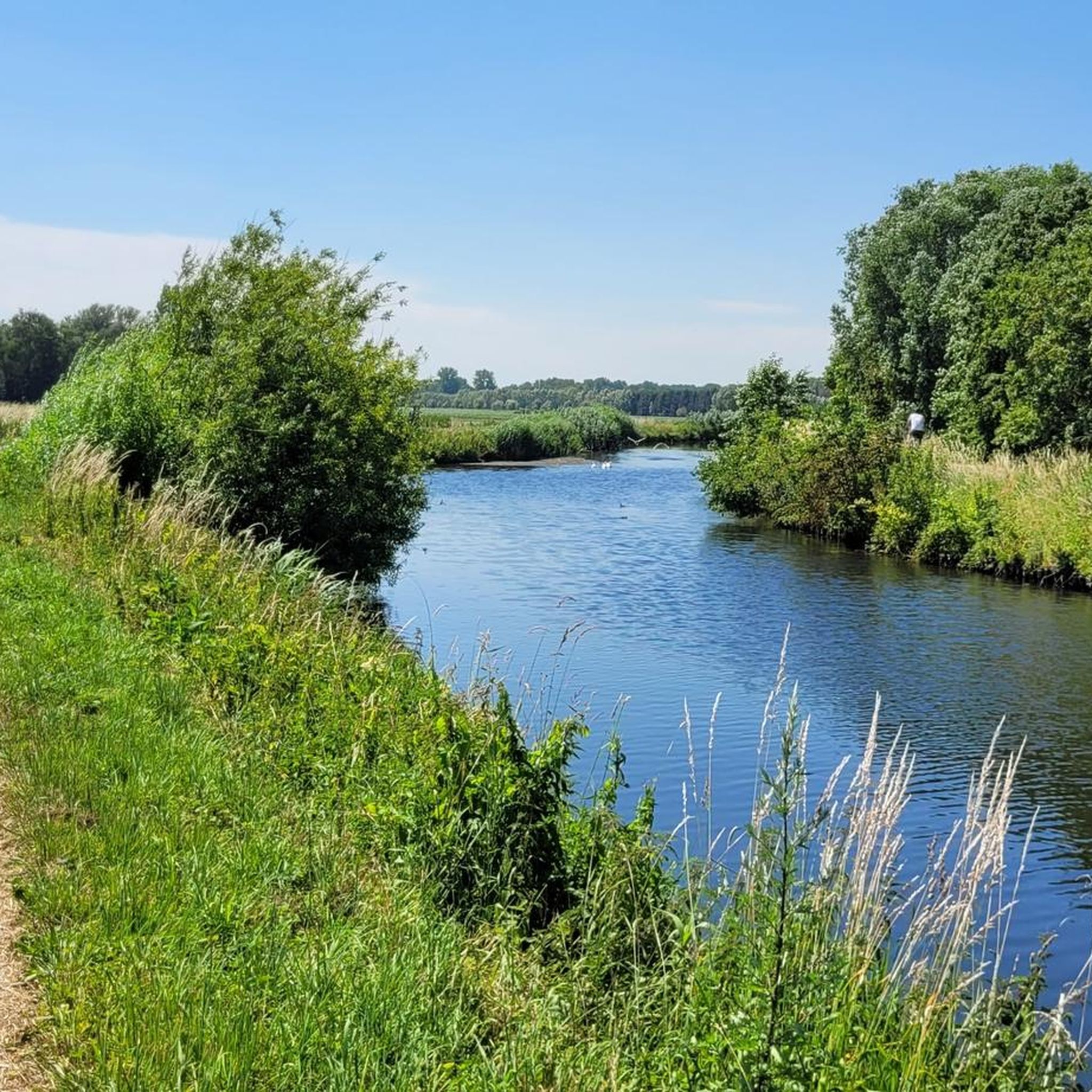
It is well worth stopping on top of the bridge. The view from the Stekense Vaart looks like a landscape painting. The bridge is named after honorary citizen Frans Coppens from Klein-Sinaai. As receiver-clerk he made a great contribution in his career. The canal used to be an important connection between the Dutch Hulst and Ghent.
3
0
This bridge ensures that you can cross the Zuidlede dry-shod. Be aware that the road surface can be dangerously slippery in wet weather. Tip: cross this curved bridge with some caution.
6
0
The Langelede was dug to enable the transport of peat. The peat came from a bog area, owned by the abbey of Marquette. It is not clear when this happened, although it is known that the name 'langhe lee' first appeared in 1317. After the bog soils were exhausted, the Langelede fell into disuse. The revival came in 1775, when the Moervaart and Langelede were canalised to enable the drainage of excess water from Ghent. The route via the current Lange Boomstraat was replaced by a new section towards the Oudenburgse sluis. However, the treaty of 1839 limited the drainage to the Netherlands and the Langelede had to be dammed. Afterwards, it was still used for the transport of white sand and sugar beets. Source: municipality of Wachtebeke and Heemkundige Kring De Vierschaar
5
0
The Hefbrug is a silent witness to the important IJzerenweg over the waterway.
1
0
Formerly known as "Kasteel Van Geeterayen" (according to an old postcard) with associated park with ponds. Former country house built by doctor M. Van Geeteruyen from Lokeren as a replacement or as an extension of a house built in 1870 on the same site by notary Van Landeghem from Lokeren. Large villa in eclectic style remarkable for its monumental character, picturesque appearance and remarkable mixture of building characteristics derived from timber and half-timbered construction, art nouveau and traditional country house architecture. Source: Lanclus, Kathleen & Verbeeck, Mieke (1993)
6
0
Frequently Asked Questions
How many touring cycling routes are available in Moervaartdepressie?
Moervaartdepressie offers over 30 touring cycling routes, catering to various skill levels. You'll find a good mix of easy, moderate, and some more challenging options to explore the region.
What kind of terrain and surface can I expect on Moervaartdepressie's cycling routes?
The Moervaartdepressie is characterized by its low-lying, flat terrain, making for generally easy riding. Many routes feature well-paved surfaces, especially along the Moervaart Towpath and transformed old railway lines. You'll also encounter long, straight, unpaved lanes known as "dreven," which are often tree-lined and provide a tranquil cycling experience.
Are there any family-friendly touring cycling routes in Moervaartdepressie?
Yes, Moervaartdepressie has several easy routes suitable for families. A great option is the Cathedral of Poplars – Puyenbroeck Provincial Domain loop from De Eenbes, which is 5.8 miles (9.3 km) long and explores the natural beauty around Provinciaal Domein Puyenbroeck. The flat terrain and dedicated paths make it ideal for a relaxed family outing.
Can I bring my dog on the touring cycling routes in Moervaartdepressie?
While specific regulations for dogs on cycling routes can vary, many of the natural areas and towpaths in Moervaartdepressie are generally dog-friendly, provided your dog is kept on a leash. Always check local signage, especially within nature reserves or provincial domains like Puyenbroeck, for any specific rules regarding pets.
What are the best times of year to go touring cycling in Moervaartdepressie?
The spring and autumn months typically offer the most pleasant conditions for touring cycling in Moervaartdepressie, with mild temperatures and beautiful scenery. Summer can also be enjoyable, though it may be warmer. The flat terrain makes it accessible even in cooler weather, but always check the forecast for rain.
Are there circular touring cycling routes in Moervaartdepressie?
Yes, many routes in Moervaartdepressie are designed as loops, allowing you to start and end at the same point. An example is the Wachtebeke–Moerbeke Rail Trail – Kloosterbos loop from Moerbeke, an easy 15.5 miles (25.0 km) path that follows a former railway bed through the Kloosterbos.
What interesting sights or natural features can I see along the touring cycling routes?
Along the routes, you can discover a variety of natural and historical features. Highlights include the serene Moervaart Towpath, the picturesque Stekense Canal, and the tranquil Bosdam Pond. You might also pass by historical sites like the former Castle of Eksaarde, situated at the edge of the marshy areas, or the Chapel of the Cross.
How can I access the Moervaartdepressie cycling routes by public transport?
Public transport access to Moervaartdepressie is possible, particularly to towns bordering the depression like Moerbeke and Wachtebeke. From these points, you can easily connect to the cycling network. Check local bus or train schedules for the most convenient connections to your desired starting point.
Where can I park my car when visiting Moervaartdepressie for cycling?
Parking is generally available at key access points and provincial domains. For instance, Provinciaal Domein Puyenbroeck often provides parking facilities, which is a good starting point for routes like the Moervaart Towpath – Towpath Along the Moervaart loop from Provinciaal Domein Puyenbroeck. Parking can also be found in towns like Moerbeke-Waas and Wachtebeke, which serve as gateways to the region's cycling paths.
What do other touring cyclists enjoy the most about touring cycling in Moervaartdepressie?
The area is highly rated by the komoot community, with an average score of 4.6 stars from over 40 reviews. Reviewers often praise the peaceful, flat terrain, the serene waterways, and the well-maintained paths that make for a relaxing and enjoyable cycling experience. The natural beauty and quiet atmosphere are frequently highlighted.
Are there any routes that follow old railway lines in Moervaartdepressie?
Yes, the region has successfully transformed old railway lines into cycling paths. A notable example is the Old Tram Route – Ter Beuken Bicycle Bridge loop from De Eenbes, which offers a smooth and scenic ride, connecting different parts of the landscape.
Most popular routes in Moervaartdepressie
Most popular attractions in Moervaartdepressie

Get inspired with the komoot mobile app


Explore more
Browse the best Cycling routes in other regions.
