The best walks and hikes in Moervaartdepressie
4.3
(7097)
38,369
hikers
104
hikes
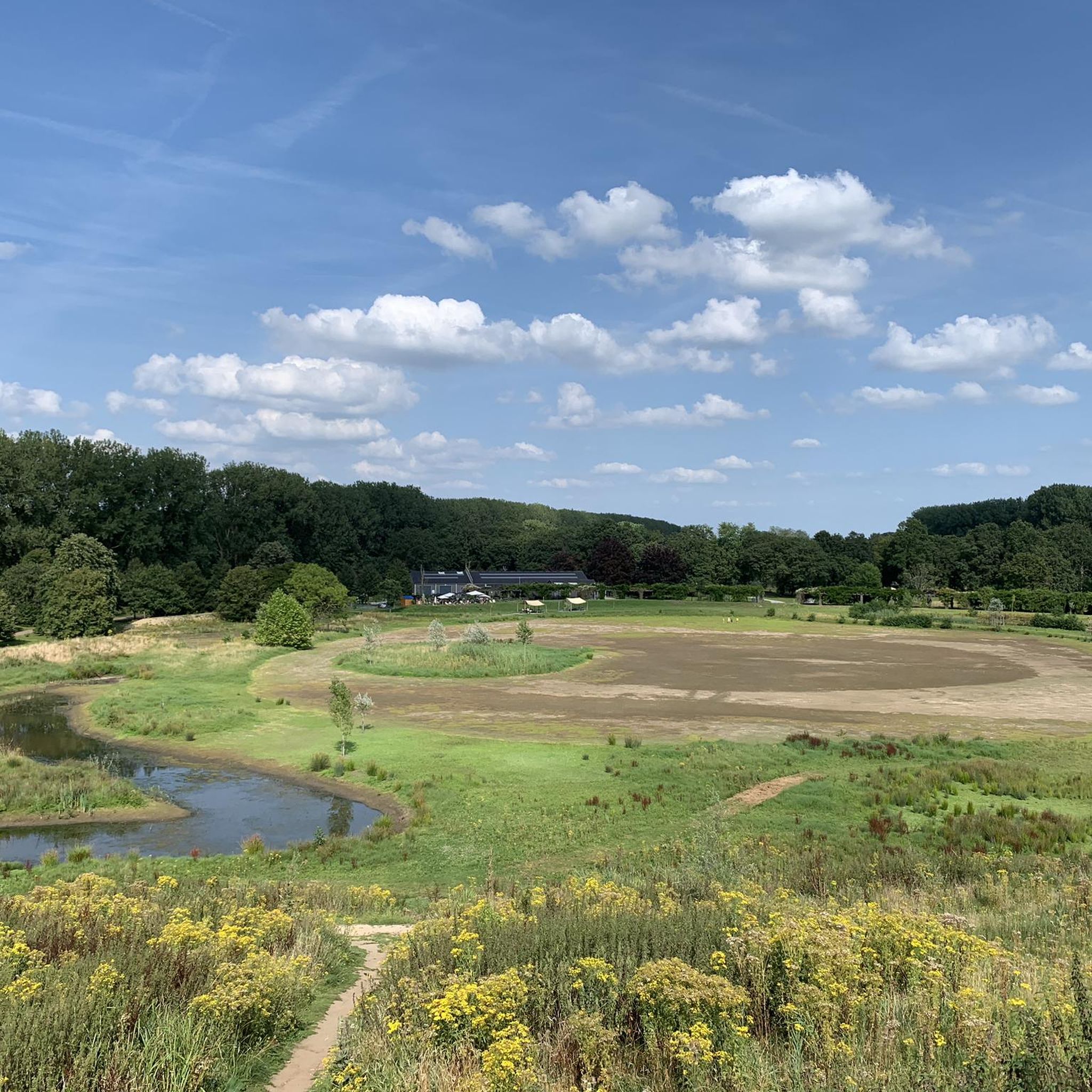
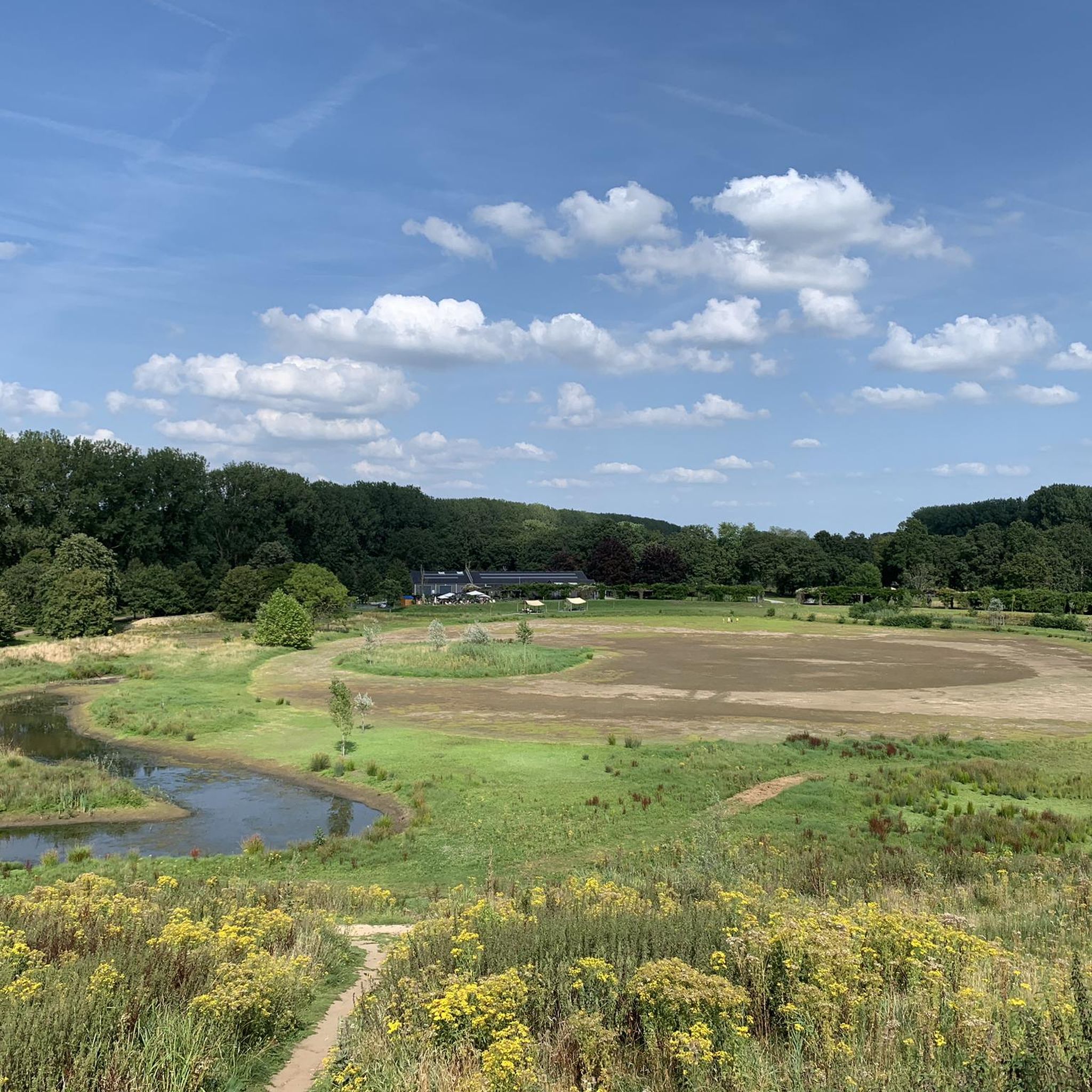
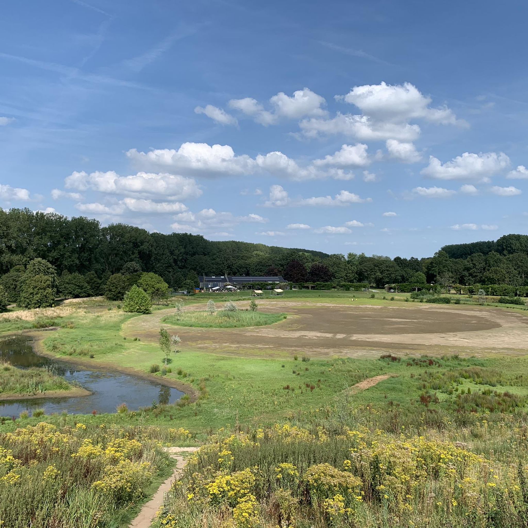
Hiking trails in Moervaartdepressie are found within a low-lying area of East Flanders, shaped by its unique geological history. The region features diverse terrain, including sand plains, ancient river systems, and remnants of a Late Glacial Lake. Hikers will encounter extensive forest complexes like the Heirnisse and Vette Meersbossen, as well as waterways such as the Zuidlede and Moervaart river, which are prominent landscape features. This blend of varied ecosystems and historical reclamation patterns offers a range of walking experiences.
…Last updated: June 29, 2026
4.7
(23)
184
hikers
5.36km
01:21
10m
10m
Easy hike. Great for any fitness level. Easily-accessible paths. Suitable for all skill levels.
4.5
(107)
527
hikers
12.6km
03:10
10m
10m
Moderate hike. Good fitness required. Easily-accessible paths. Suitable for all skill levels.

Sign up for free
4.5
(119)
571
hikers
15.2km
03:49
10m
10m
Moderate hike. Good fitness required. Easily-accessible paths. Suitable for all skill levels.
4.5
(39)
149
hikers
8.12km
02:02
10m
10m
Moderate hike. Good fitness required. Easily-accessible paths. Suitable for all skill levels.
4.6
(34)
252
hikers
Moderate hike. Good fitness required. Easily-accessible paths. Suitable for all skill levels.
Get access to more routes and recommendations from other explorers.
Sign up for free
Already have an account?
Our route recommendations are based on thousands of hikes, rides, and runs completed by other people on komoot.
Start today with a free account
Your next adventure awaits.
Login or Signup

Tips from the Community

The wooden arch bridge over the Stekense Vaart, named after Frans Coppens, was receiver-clerk in the municipality of Sinaai for almost a quarter of a century. He played an important role in "de Groote Watering van Sinay", the name given to the project launched by the Boerenbond in 1926. This project was initiated after repeated floods and aimed to make the polders 'dry'. The construction of the pumping station near Hondsnest was one of the first achievements within this project. During the Second World War, the unemployed were employed to clean or widen ditches. Under the impetus of dike reeve Jozef "meester" Maes and... receiver-clerk Frans Coppens (!), major reclamation works were carried out in the 60s, continuing into the following decades. Thus, Hondsnest got a new pumping station in 1975. In the meantime, the watering area had been converted into a polder, pursuant to the polder law of June 3, 1957. source: info file "Polder Daknam-Sinaai"
2
0
The lookout tower in the Fondatie van Boudelo nature reserve is a design by the young architectural firm Baeten Hylebos Architecten. The tower stands diagonally relative to the avenue amidst the undergrowth, a few meters from the path. In the Architecture Book Flanders N°14 (2021), it is poetically described as follows: In the doorway "light seeps in through the cracks of the planked walls and falls onto a staircase that winds invitingly around the central column. The walk upwards already offers, here and there, some perspectives on the surrounding natural beauty. For this purpose, the planks of the wall conveniently lie in a horizontal articulation. At the top of the stairs, the true reward awaits: an impressive tableau of fields, ponds, forests, birds, and if you're lucky, a leap of deer."
3
0

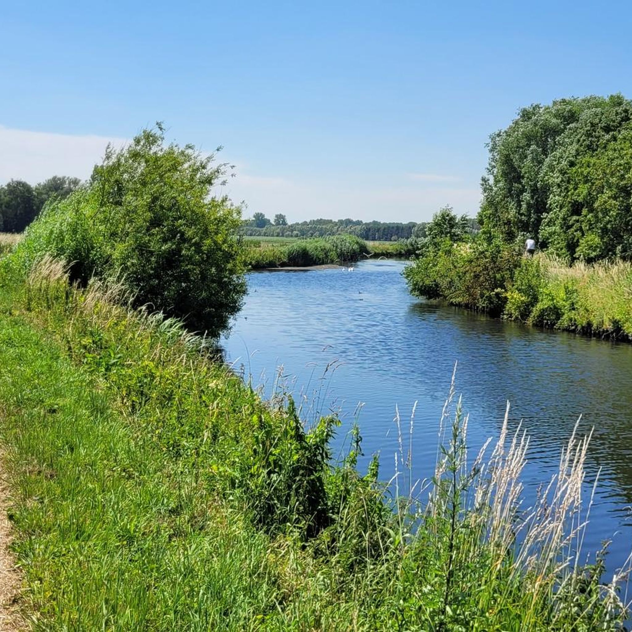
The pumping station at the Frans Coppens Bridge serves to pump excess water from the lower surrounding area into the canal.
4
0
It is well worth stopping on top of the bridge. The view from the Stekense Vaart looks like a landscape painting. The bridge is named after honorary citizen Frans Coppens from Klein-Sinaai. As receiver-clerk he made a great contribution in his career. The canal used to be an important connection between the Dutch Hulst and Ghent.
3
0
Here he is on his island, the giant Gnome of Puyenbroeck. He is a landmark on the playground.
7
0
't Veldcafe in Moerbeke is a nice cycling café where strong cycling stories are shared over a pint. The terrace at the back is recommended. Here you have a relaxing view of the Zuidlede.
5
0


Fan of cobblestones? Check out our Collection of ready-made cobblestone cycling routes, collected in the book “De Hel van het Zuiden”, downloadable for €9. You get 7 routes, with multiple distances. 25 GPXs in total! Of course incl. pre-fun via Komoot! You can find this section in the routes! https://www.komoot.com/nl-nl/collection/2485043/-de-hel-van-het-zuiden-kasseien-routes-gids-e-book
0
1
Frequently Asked Questions
How many hiking trails are there in Moervaartdepressie?
There are over 100 hiking trails available in Moervaartdepressie, offering a wide range of options for different fitness levels and preferences. The komoot community has mapped 119 routes in total.
What kind of terrain can I expect on hikes in Moervaartdepressie?
The Moervaartdepressie features diverse terrain, including sand plains, ancient river systems, and remnants of a Late Glacial Lake. You'll encounter extensive forest complexes like the Heirnisse and Vette Meersbossen, open grasslands, and mosaic landscapes. The region is generally low-lying with minimal elevation changes, making for accessible walks.
Are there circular walks available in Moervaartdepressie?
Yes, many of the hiking routes in Moervaartdepressie are circular. For example, the Zuidlede – Puyenbroeck Provincial Park loop from Eksaarde is a moderate 15 km circular path, and the Stekense Canal – Frans Coppens Bridge loop from Heirnisse offers an 8 km circular route.
What are the difficulty levels of hiking trails in Moervaartdepressie?
The trails in Moervaartdepressie cater to various fitness levels. The majority are easy, with 76 routes classified as such. There are also 36 moderate routes and a few more challenging options, with 7 difficult trails available for experienced hikers.
What natural features can I see while hiking in Moervaartdepressie?
You can explore various natural features, including the Moervaart and Zuidlede rivers, which are prominent waterways. The region also boasts extensive forest complexes like the Heirnisse and Vette Meersbossen, and the Natura 2000 protected Heidebos. You might also encounter several ponds and lakes, such as Bosdam Pond and the Rowing Pond within Provincial Domain Puyenbroeck.
Are there any historical sites or landmarks to explore?
Yes, the landscape bears marks of historical reclamation, with distinctive long, straight, tree-lined avenues. You can also find historical bridges over the Moervaart, such as the Terwest Bridge. The Chapel of the Cross is another notable point of interest.
What do other hikers enjoy most about hiking in Moervaartdepressie?
The area is highly rated by the komoot community, with an average score of 4.6 stars from over 700 reviews. Hikers often praise the diverse landscapes, the extensive network of paths, and the blend of natural beauty with historical elements. Many appreciate the accessibility of the trails for various skill levels.
Are the hiking trails in Moervaartdepressie suitable for families with children?
Yes, Moervaartdepressie offers many family-friendly options, particularly within the Provincial Domain Puyenbroeck. Easy routes like the Small loop in Puyenbroeck hiking trail (5.4 km) are ideal for families, providing accessible paths through forests and recreational areas.
Can I bring my dog on the hiking trails in Moervaartdepressie?
Many trails in Moervaartdepressie are suitable for dogs, especially those through the extensive forest complexes and along the waterways. It's always recommended to keep dogs on a leash and check local signage for any specific restrictions in certain nature reserves or protected areas.
Where can I find parking for hiking trails in Moervaartdepressie?
Provincial Domain Puyenbroeck is a major hub and offers ample parking, serving as a starting point for many routes, including the Donkey and Foal Sculpture – Zuidlede loop. Other trailheads often have designated parking areas, especially near villages or recreational zones.
Is public transport available to reach hiking areas in Moervaartdepressie?
While specific public transport connections vary, some areas within Moervaartdepressie, particularly around larger towns or the Provincial Domain Puyenbroeck, may be accessible by bus. It's advisable to check local public transport schedules for the most up-to-date information on routes and stops near your desired trailhead.
Are there places to eat or drink near the hiking trails?
The Provincial Domain Puyenbroeck, a significant recreational area within Moervaartdepressie, offers facilities where you can find refreshments. Additionally, nearby villages and towns surrounding the depression will have cafes and restaurants where you can refuel after your hike.
Most popular routes in Moervaartdepressie
Most popular attractions in Moervaartdepressie

Get inspired with the komoot mobile app


Explore more
Browse the best Hikes in other regions.
