The best MTB trails in the San Juan Mountains
5.0
(31)
1,850
riders
163
rides
Mountain biking in the San Juan Mountains offers diverse terrain characterized by rugged volcanic peaks, deep river valleys, and extensive trail systems. The landscape features alpine meadows, dense pine forests, and aspen groves, with many routes crossing the Continental Divide. This region provides a variety of challenging rides and rewarding descents for mountain bikers.
Best mountain bike trails in the San Juan Mountains
- The most popular mountain bike trail is Imogene Pass Road, a difficult 18.5 miles (29.8 km) trail that takes 3 hours 55 minutes to complete. This route ascends to a high alpine pass, offering rugged terrain and expansive views.
- Another top favourite among local mountain bikers is Nellie Creek Road, a moderate 4.0 miles (6.5 km) path. This route leads through a scenic mountain area with notable elevation gain.
- Local mountain bikers also love the Yankee Boy Basin OHV Route, an 11.0 miles (17.8 km) trail leading through a high alpine basin, often completed in about 3 hours 10 minutes.
- Mountain biking in the San Juan Mountains is defined by volcanic peaks, deep river valleys, and dense pine forests. The network offers options for easy, moderate, and difficult ability levels.
- The routes in San Juan Mountains are highly rated by the komoot community with an average score of 5.0 stars from more than 10 reviews. More than 1600 mountain bikers have used komoot to explore San Juan Mountains's varied terrain.
Last updated: June 23, 2026
3
riders
29.8km
03:55
1,490m
1,740m
Prepare for a challenging mountain biking journey on Imogene Pass Road, a difficult route spanning 18.5 miles (29.8 km). You will climb a significant 4893 feet (1491 metres) in elevation, with an estimated duration of 3 hours and 55 minutes. As you pedal, you will experience high-alpine terrain, passing historic mining structures and the fascinating Tomboy Ghost Town, all while enjoying panoramic views of the San Juan Mountains. Look out for lush valleys, waterfalls, and abundant wildflowers, especially when you ascend above the treeline.
Planning your ride requires attention to the seasons, as the route is typically open from late June through September. Heavy snow causes closures from approximately December 1 to May 15, so always check conditions before you go. This is a shared route, meaning you will encounter 4WD vehicles and Jeeps along the way. Parking is available at the Imogene Pass Trailhead, making it convenient to start your adventure.
This iconic route connects the historic towns of Telluride and Ouray, offering a true high-alpine experience. It is a notable trail in the region for its blend of natural beauty and historical significance, showcasing remnants of a bygone mining era. The journey provides a unique perspective on the San Juan Mountains, making it a memorable ride for those seeking a demanding but rewarding outdoor challenge.
1
riders
6.51km
01:24
630m
0m
Nellie Creek Road offers a challenging mountain biking experience through the rugged terrain of Uncompahgre National Forest. This moderate route spans 4.0 miles (6.5 km) and demands a significant climb of 2072 feet (632 metres), typically taking about 1 hour and 23 minutes to complete. As you ride, you'll navigate a path known for its technical demands, passing by numerous waterfalls, including the prominent Nellie Creek Falls, and enjoying views of the towering Uncompahgre Peak.
Be prepared for rough conditions on this trail, which is primarily a four-wheel-drive road. You can expect to encounter loose boulders, deep dips, and several creek crossings. The route is impassable during winter due to heavy snowfall, and summer afternoons often bring severe thunderstorms, so plan your visit accordingly. Also, be aware that some sections are narrow, which can make passing other vehicles difficult.
The initial part of the trail winds through a forest alongside Nellie Creek, where you might spot signs of beaver activity. The Aspens here are particularly beautiful, especially if you visit in the fall. This trail stands out for its combination of demanding physical effort and spectacular high-alpine scenery, making it a memorable ride for those seeking a true mountain adventure.

Sign up for free
17.8km
03:11
1,400m
220m
The Yankee Boy Basin OHV Route offers a difficult mountain biking experience through stunning alpine scenery, nestled beneath prominent San Juan peaks like Mount Sneffels. You will cover 11.0 miles (17.8 km) and gain an impressive 4592 feet (1400 metres) in elevation, typically taking around 3 hours and 10 minutes to complete. Expect to ride past vibrant wildflowers in early summer, discover flowing waterfalls, and see historic mining ruins such as the Camp Bird Mine.
Planning your visit requires attention to the terrain, which becomes progressively rougher, rockier, and steeper as you climb, especially beyond the Mount Sneffels trailhead. The upper sections are very technical, even requiring high-clearance vehicles for motorized use. Parking is available at the Trailhead at Yankee Boy Basin Road, so you can start your ride directly from there.
This route is notable for its rich blend of natural beauty and historical significance within the Uncompahgre National Forest. As you ride, you will pass through lush evergreen forests and encounter various viewpoints, including the Camp Bird Road Scenic Outlook, which offers expansive vistas of the surrounding landscape. The combination of challenging terrain and rewarding views makes this a memorable ride for experienced mountain bikers.
50
riders
38.5km
03:21
550m
1,180m
Moderate mountain bike ride. Good fitness required. Suitable for all skill levels.
43
riders
20.7km
02:51
390m
390m
Get ready for a dynamic mountain biking experience on the Technical Loop, a difficult route spanning 12.9 miles (20.7 km). You'll navigate varied terrain, including rocky climbs and fast flow sections, as you gain 1289 feet (393 metres) of elevation. The trail features tight bermed switchbacks and a challenging Free Fall section, promising an engaging ride for experienced riders. Expect to spend around 2 hours and 51 minutes on this loop, with some parts offering beautiful, green scenery to enjoy between the technical challenges.
The Technical Loop is located within the Hartman Rocks Recreation Area, close to Gunnison, Colorado. You'll find parking generally available at the designated trailheads throughout the recreation area. Before heading out, it's always a good idea to check local conditions. Weather can significantly impact trail access and riding conditions, especially during the shoulder seasons, so plan your visit accordingly to ensure a safe and enjoyable ride.
This route is specifically designed for experienced riders looking to test their skills on two wheels. It incorporates sections like Ridge Trail and Rattlesnake Trail, both known for their technical demands. The varied landscape and challenging features make the Technical Loop a notable option for mountain bikers seeking an adrenaline-pumping adventure in the Hartman Rocks area.
17
riders
36.1km
05:37
700m
700m
Get ready for a difficult mountain biking adventure on The Hartman Rocks Big loop, spanning 22.4 miles (36.1 km) with a significant 2289 feet (698 metres) of elevation gain. This route takes you through diverse high-desert terrain, featuring extensive singletrack and slickrock sections. You will navigate rolling hills dotted with sagebrush and encounter striking granite rock formations, including technical features like rock rollers and drops. Expect to spend around 5 hours and 36 minutes on this challenging ride, with expansive vistas from viewpoints like the Top of the World Trail. You can see the Gunnison Basin to the north and the majestic San Juan Mountains, West Elks, and Sawatch Range to the south.
Planning your visit is straightforward, as the Hartman Rocks Recreation Area is easily accessible from Gunnison. You will find ample parking available at various trailheads. Because of its high desert ecosystem, the trails here tend to dry out earlier than those at higher elevations, making it an excellent choice for spring and extended fall riding. Remember that these are multi-use trails, so you will be sharing them with dirt bikers, hikers, and trail runners.
This comprehensive loop offers a truly rewarding experience for skilled riders looking to explore the unique high desert ecosystem of the Hartman Rocks Recreation Area. The striking granite rock formations and diverse trail surfaces, from singletrack to slickrock, make it a standout destination. It is a place where you can push your limits while enjoying the rugged beauty of the landscape and the far-reaching views from its highest points.
18
riders
39.7km
04:14
1,260m
1,260m
Embark on the Blackhawk Co. Trail eastern loop for a difficult mountain biking adventure spanning 24.7 miles (39.7 km). You will conquer a significant 4126 feet (1258 metres) of elevation gain, with the entire ride estimated to take around 4 hours and 13 minutes. This route immerses you in rugged high-alpine terrain, featuring long, sustained climbs, especially up Hermosa Park Road, leading to spectacular vistas of the San Juan Mountains and the Sneffels range as you traverse lush forests and vibrant aspen groves.
Planning your visit requires careful consideration, as this advanced mountain biking trail is not suitable for beginners. It features black diamond difficulty singletrack with very steep and rocky sections that demand experience. Always check local conditions before you go, particularly given the high elevation, to be aware of any potential snow or road closures. Parking is generally available at various trailheads in the Rico area, providing convenient access to this challenging loop.
This iconic San Juan ride is nestled within the vast San Juan National Forest, offering a true taste of high-country mountain biking. The trail is renowned for its unique blend of demanding physical effort and rewarding natural beauty, making it a standout experience in the region. You will find yourself riding through flower-filled valleys and past towering peaks, showcasing the diverse ecosystems of the Colorado Rockies.
17
riders
26.5km
02:16
870m
870m
The Prospect Loop Trail offers a challenging mountain biking experience, covering 16.5 miles (26.5 km) with a significant 2846 feet (867 metres) of elevation gain. You can expect a true cross-country ride through dense woodland and spruce forests within Prospect Basin, providing plenty of shade and a cool atmosphere. The route features significant climbs and fun winding descents, taking approximately 2 hours and 16 minutes to complete, making it a difficult but rewarding adventure for experienced riders. You will find beautiful views, especially during the first quarter of the loop, and pass by the Telluride Gondola.
When planning your visit, be aware that accessing parts of the trail via the gondola mid-station during operating hours usually requires a bike park pass. This is a shared trail, so you should expect to encounter hikers along the way. Always check local conditions before you head out, as sections of the varied terrain, including singletrack, can be quite muddy. It is wise to start early to make the most of your ride and avoid any potential crowds.
This route stands out as a robust mountain biking option in the Telluride Bike Park, designed for those seeking a substantial workout. The trail's journey through the natural environment of Prospect Basin highlights the region's diverse ecosystems. It provides a distinct experience compared to other trails, focusing on a comprehensive loop that tests your endurance and skill. The presence of the Telluride Gondola also hints at the area's broader recreational offerings.
17
riders
12.4km
01:30
510m
520m
Embark on the Pass and Coal Creek Loop, a moderate mountain biking route spanning 7.7 miles (12.4 km) with an elevation gain of 1676 feet (511 metres). You'll navigate diverse terrain, from winding singletrack through pine forests to open fields dotted with wildflowers. The route offers expansive views of the San Juan Mountains and the valley below, especially as you approach areas like Coal Bank Pass, making for an engaging ride that typically takes about 1 hour and 30 minutes to complete.
When planning your visit, be aware that the trail can be snow-covered from around October until July, so aim for late summer or early fall for optimal mountain biking conditions. Many riders choose to park at the Coal Creek Trail exit and then ride up the highway to Coal Bank Pass. This strategy helps you avoid a significant climb at the end of your descent, allowing for a more enjoyable finish to your ride.
This loop is highly regarded in San Juan National Forest for its rewarding descents and technical sections. Expect roots, tight turns, and flowy corners on both Pass Creek and Coal Creek, which add to the challenge and fun. The varied landscape and consistent views make this a standout option if you're looking for a dynamic mountain biking experience in the region.
13
riders
14.0km
01:33
400m
400m
Prepare for a truly demanding mountain biking experience on the Raiders Ridge Loop, a difficult route stretching 8.7 miles (14.0 km) with a significant 1328 feet (405 metres) of elevation gain. You will navigate relentlessly rugged terrain, characterized by technical sandstone singletrack, chundery boulders, and slickrock slabs, all while tackling numerous drops. The ride, which typically takes about 1 hour and 32 minutes, offers rewarding panoramic views from the Raider Ridge Overlook, where you can spot Durango, Fort Lewis College, Animas Mountain, and the distant La Plata Mountains.
This challenging trail is not suitable for beginners and requires a high level of skill and fitness to complete safely. To make the most of your visit, plan your ride during the spring or fall months. Summers in Durango can bring intense heat, especially on the exposed ridge sections, making for a less enjoyable and potentially risky experience.
The Raiders Ridge Loop is a prominent part of the larger Horse Gulch Trail System in Durango, Colorado, known for its extensive network of trails. While the route demands considerable effort, the expansive vistas across the surrounding landscape provide a compelling reason to push through the technical sections. It stands out as a notable option for experienced mountain bikers seeking a rigorous and visually rewarding adventure in the region.
Get access to more routes and recommendations from other explorers.
Sign up for free
Already have an account?
Our route recommendations are based on thousands of hikes, rides, and runs completed by other people on komoot.
Start today with a free account
Your next adventure awaits.
Login or Signup
Popular around San Juan Mountains

The Colorado Trail — Ten incredible days in the Rocky Mountains
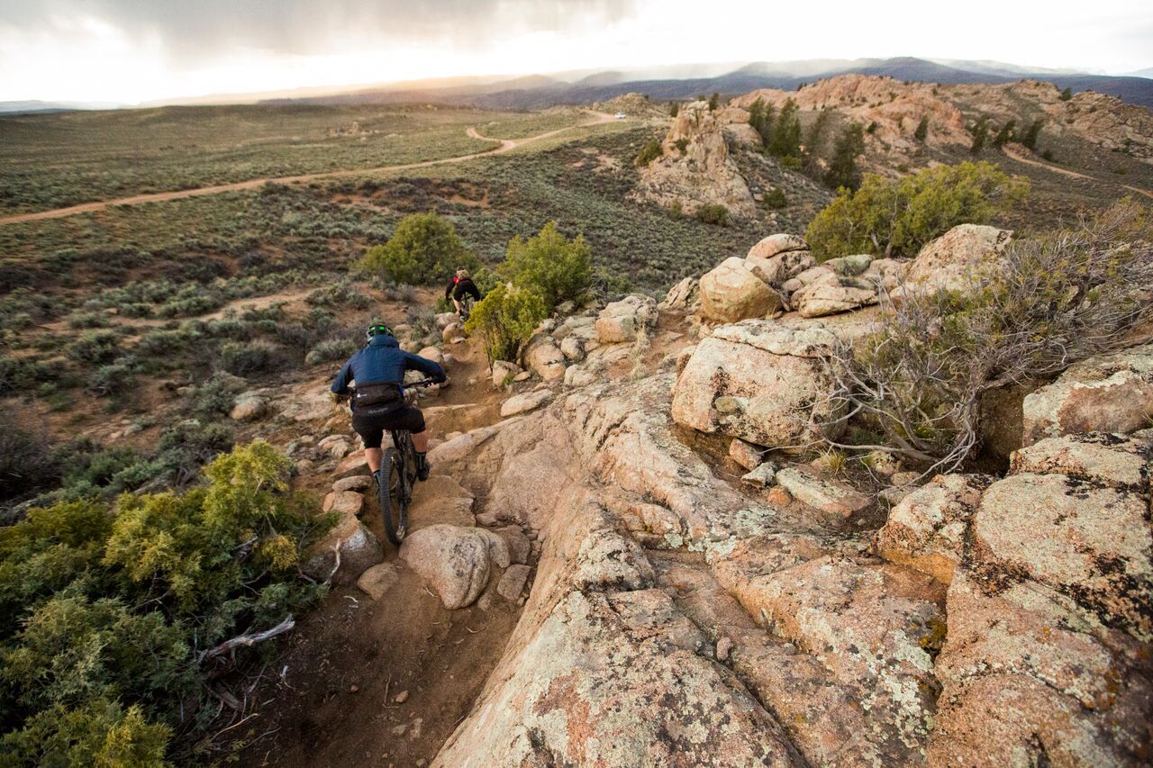
Hartman Rocks – rocky desert trails in Gunnison, Colorado
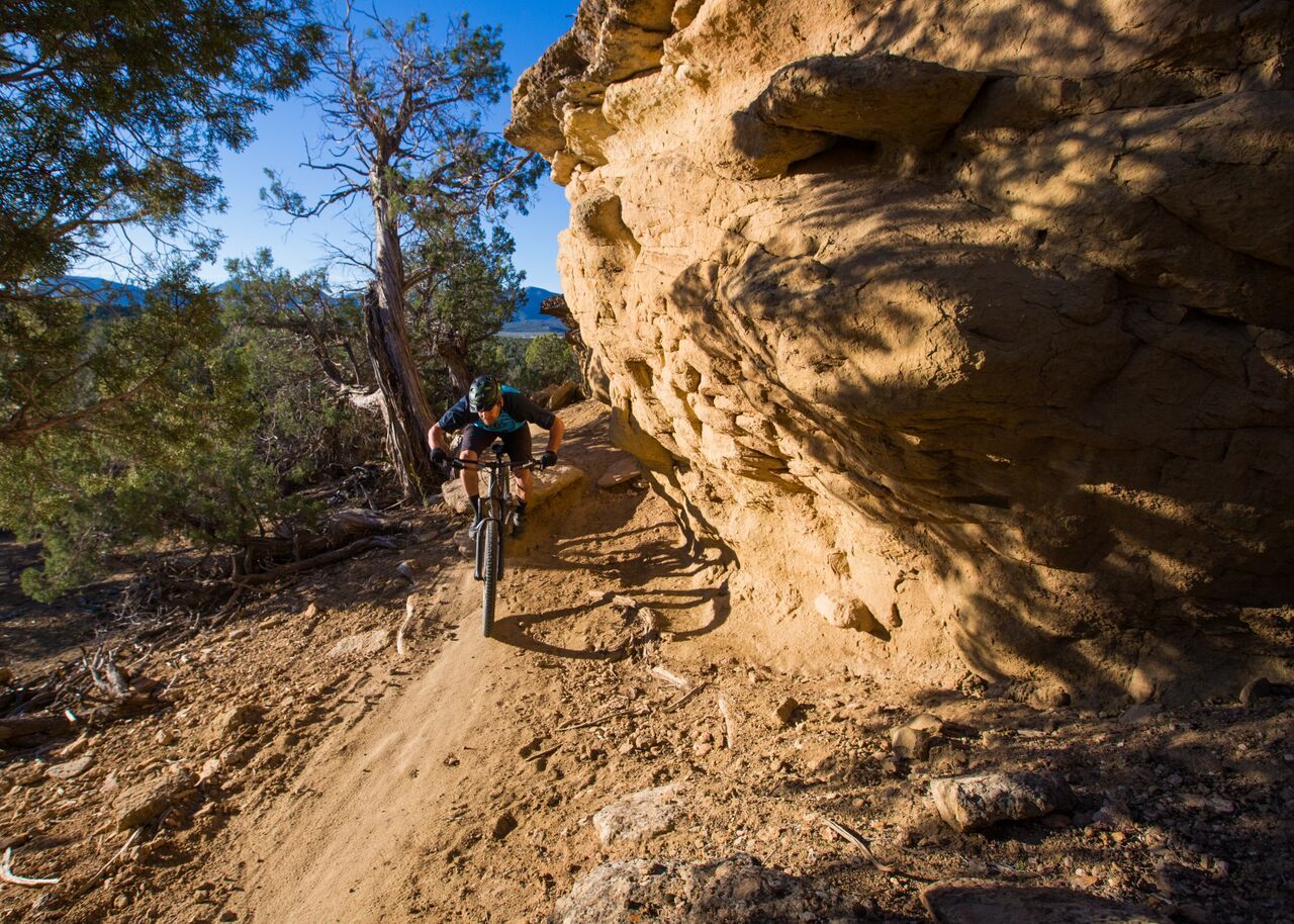
Unforgettable MTB adventures in Colorado's south-west

Colorado Trail — The pinnacle of wild Colorado
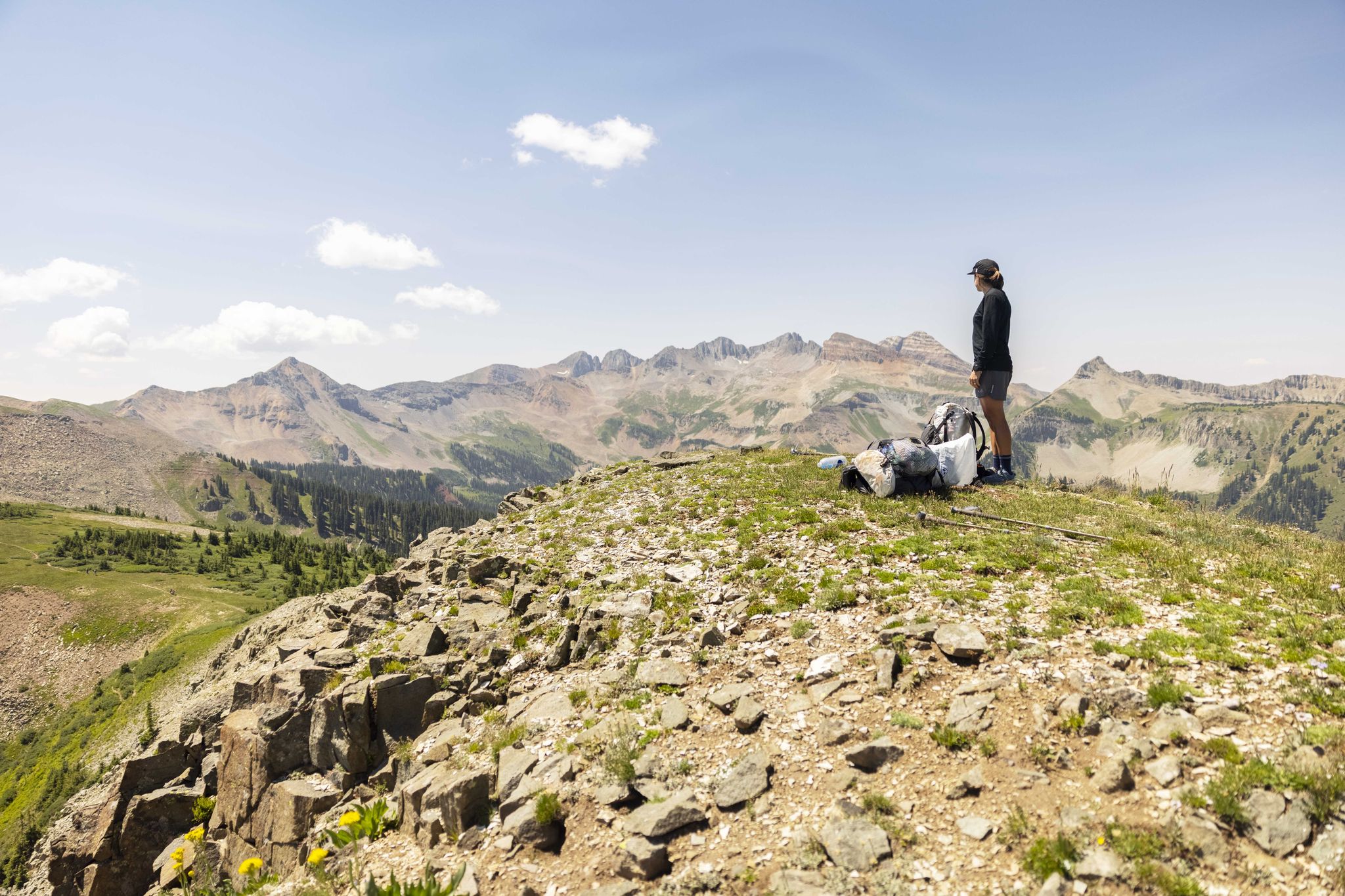
The Colorado Trail — Hiking from Silverton to Durango
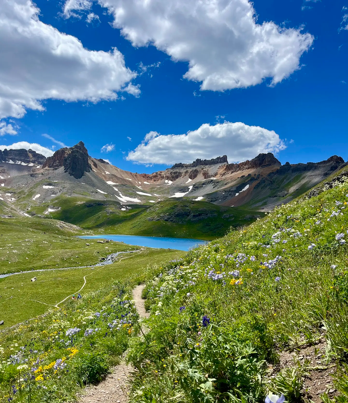
Softrock 100: Four Days Through Colorado’s Alpine Wilds

The Continental Divide Trail — Across the sky of America
Hiking in the San Juan Mountains
Road Cycling Routes in the San Juan Mountains
Running Trails in the San Juan Mountains
Other adventures in the San Juan Mountains


Tips from the Community

A rugged mountain run that follows a tumbling creek through a narrow canyon, with steep walls rising on both sides. The sound of rushing water and glimpses of small cascades keep the climb lively, while the cool air from the creek offers relief on warm days. A tough but scenic stretch on the way to higher ground or to Ouray.
0
0

The Perimeter Trail is one of the main trail in Ouray and gives you great views of the town and mountains. There is also one of several via ferrata accesses here.
0
0

The view is mind-blowing! Stopp and enjoy it. It can't get any better than this.
1
0
There is a little parking area for the Hermosa Creek Trail system, which is quite extensive. And if you want to stay overnigt: The is a beautiful campground next to the trailhead, the Lower Hermosa Campground. It does not get much more convenient than this!
1
0
Wow, what a great day on two wheels! The Hermosa Creek Trail is a must-do if you love challenging singletrails in remote areas. Bring plenty of water and a bunch of snacks. The trail is usually ridden as a shuttle ride. Just call Hermosa Tours the day before you want to ride this trail and check if they have seats available. The phone number and prices can be found here: https://hermosatours.net/Durango-bike-shuttle.html.
1
0

This cliff is fairly clear of cars. Runners are often spotted running alongside this road. When taking pictures, watch out for oncoming vehicles
0
0

Hermosa Creek Trailhead and Jones Creek Trailhead are located just next to each other, with two separate trails that take you into or along the edge of Hermosa Creek Wilderness. At Jones Creek Trailhead, you will find a primitive campground and pit toilets.
0
0

Hermosa Creek Trail runs through the Hermosa Creek Wilderness Area. It includes smooth climbs with beautiful views. The trailhead provides valuable information about the area and the trail itself (though the latter is hard to lose).
0
0
Frequently Asked Questions
How many mountain bike trails are available in the San Juan Mountains?
The San Juan Mountains offer a vast network for mountain biking, with over 130 routes available on komoot. This includes a diverse range of trails, from easy paths to challenging, high-alpine adventures.
What is the best time of year for mountain biking in the San Juan Mountains?
The prime season for mountain biking in the San Juan Mountains typically runs from late spring through early autumn. Higher elevation trails, especially those crossing the Continental Divide, are usually clear of snow from July to September. Always check local trail conditions before heading out, as weather can change rapidly in the mountains.
Are there any easy mountain bike trails suitable for beginners or families?
While many trails in the San Juan Mountains are challenging, there are options for easier rides. Komoot lists 6 easy routes, which are great for those new to mountain biking or looking for a more relaxed experience. These trails often feature smoother terrain and less elevation gain, allowing riders to enjoy the scenic beauty without extreme difficulty.
Where can I find challenging mountain bike trails in the San Juan Mountains?
For experienced riders seeking a challenge, the San Juan Mountains offer numerous difficult routes, with 86 such trails listed on komoot. Notable options include the demanding Imogene Pass Road, which ascends to a high alpine pass, and the Yankee Boy Basin OHV Route, leading through a high alpine basin. These trails feature rugged terrain and significant elevation changes.
Are there any mountain bike trails near Durango?
Yes, Durango is a popular hub for mountain biking in the San Juan Mountains. A well-known trail in the vicinity is the Hermosa Creek Trail – Durango, which offers a moderate 23.9-mile ride through scenic landscapes. The San Juan National Forest, which surrounds Durango, also provides extensive singletrack options.
What kind of views can I expect on mountain bike trails in the San Juan Mountains?
Mountain biking in the San Juan Mountains offers spectacular views of rugged volcanic peaks, deep river valleys, and expansive alpine meadows. Many trails provide panoramic vistas of 14,000-foot peaks and dense pine forests. You can also find viewpoints like Raider Ridge Overlook, offering stunning perspectives of the landscape.
Are there any loop mountain bike trails in the San Juan Mountains?
Yes, the San Juan Mountains feature several excellent loop trails for mountain bikers. For instance, the Technical Loop offers a challenging 12.9-mile ride, while The Hartman Rocks Big loop provides a longer, difficult 22.4-mile experience. Another option is the Prospect Loop Trail, a difficult 16.5-mile route.
What do other mountain bikers enjoy most about the San Juan Mountains?
The San Juan Mountains are highly rated by the komoot community, with an average score of 5.0 stars from over 19 reviews. Riders frequently praise the diverse terrain, from high alpine environments to dense forests, and the rewarding descents. The breathtaking scenery, including dramatic peaks and pristine natural features, is also a consistent highlight for visitors.
Are there any notable landmarks or attractions along the mountain bike routes?
Beyond the stunning natural beauty, the San Juan Mountains offer several points of interest. You might encounter mountain passes like Spring Creek Pass or San Luis Pass. The region is also home to charming mountain towns like Telluride, which originated as old mining camps and now serve as vibrant hubs. You can also find highlights such as Animas Mountain Trail.
What is the general difficulty level of mountain biking in the San Juan Mountains?
The San Juan Mountains cater to a wide range of skill levels, though a significant portion of the trails are considered challenging. Komoot lists 86 difficult routes and 47 moderate ones, alongside a few easier options. Riders should be prepared for varied terrain, including technical sections, significant elevation changes, and high-altitude riding, especially on trails that cross the Continental Divide.
Are there any point-to-point mountain bike routes available?
Yes, the San Juan Mountains offer point-to-point routes for those looking for longer, more adventurous rides. The renowned Colorado Trail, for example, includes sections through the San Juans that are popular for multi-day bikepacking, often utilizing hut-to-hut systems. While specific point-to-point routes are not detailed in the provided data, the extensive trail network allows for custom planning of such adventures.
Can I bring my dog on mountain bike trails in the San Juan Mountains?
Many trails in the San Juan Mountains, particularly those within the San Juan National Forest, are dog-friendly. However, regulations can vary by specific trail or wilderness area. It's always best to check local signage or the managing agency's website for the most current rules regarding dogs, and to ensure your dog is well-behaved and on a leash where required.
Most popular routes in the San Juan Mountains
Most popular attractions in the San Juan Mountains

Get inspired with the komoot mobile app


Explore more
Browse the best MTB trails in other regions.
