Attractions and Places To See around Zervreilasee - Top 4
Best attractions and places to see around Zervreilasee include a large reservoir nestled in the Swiss canton of Graubünden, characterized by its alpine scenery. Located near the upper Valser Tal, it is surrounded by peaks of the Adula Alps, many exceeding 3,000 meters. The area offers a blend of natural beauty, including mountain lakes and valleys, alongside notable man-made structures like the Zervreila Dam.
Best attractions and places to see around Zervreilasee
- The most popular attractions is Zervreila Dam,…
Last updated: October 4, 2026
Zervreila–Frunt–Gadastatt Trail near Vals
Highlight (Segment) • Trail
Translated by Google •
Tip by

Zervreila Dam
Highlight • Monument
Showing Translation
Tip by
Sign up now to discover places like this
Get recommendations on the best single tracks, peaks, & plenty of other exciting outdoor places.
Bridge Over Zervreila Reservoir
Highlight • Bridge
Translated by Google •
Tip by

Zervreila Reservoir
Highlight • Lake
Translated by Google •
Tip by
Zervreilasee Dam to Frunt Trail
Highlight (Segment) • Trail
Translated by Google •
Tip by
Start today with a free account
Your next adventure awaits.
Tips from the Community

Start at the Vals cable car. The gondola is free in summer. A simple but beautiful hike through the raised moor. At the Zervraila reservoir, return to Vals by scooter. These can be rented at the restaurant at Lake Zervraila. You return to the cable car parking lot.
0
0

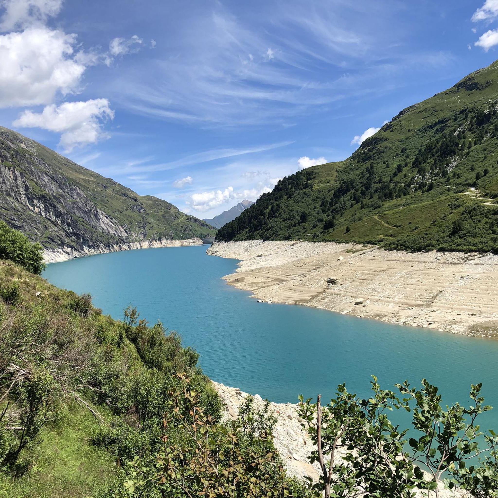
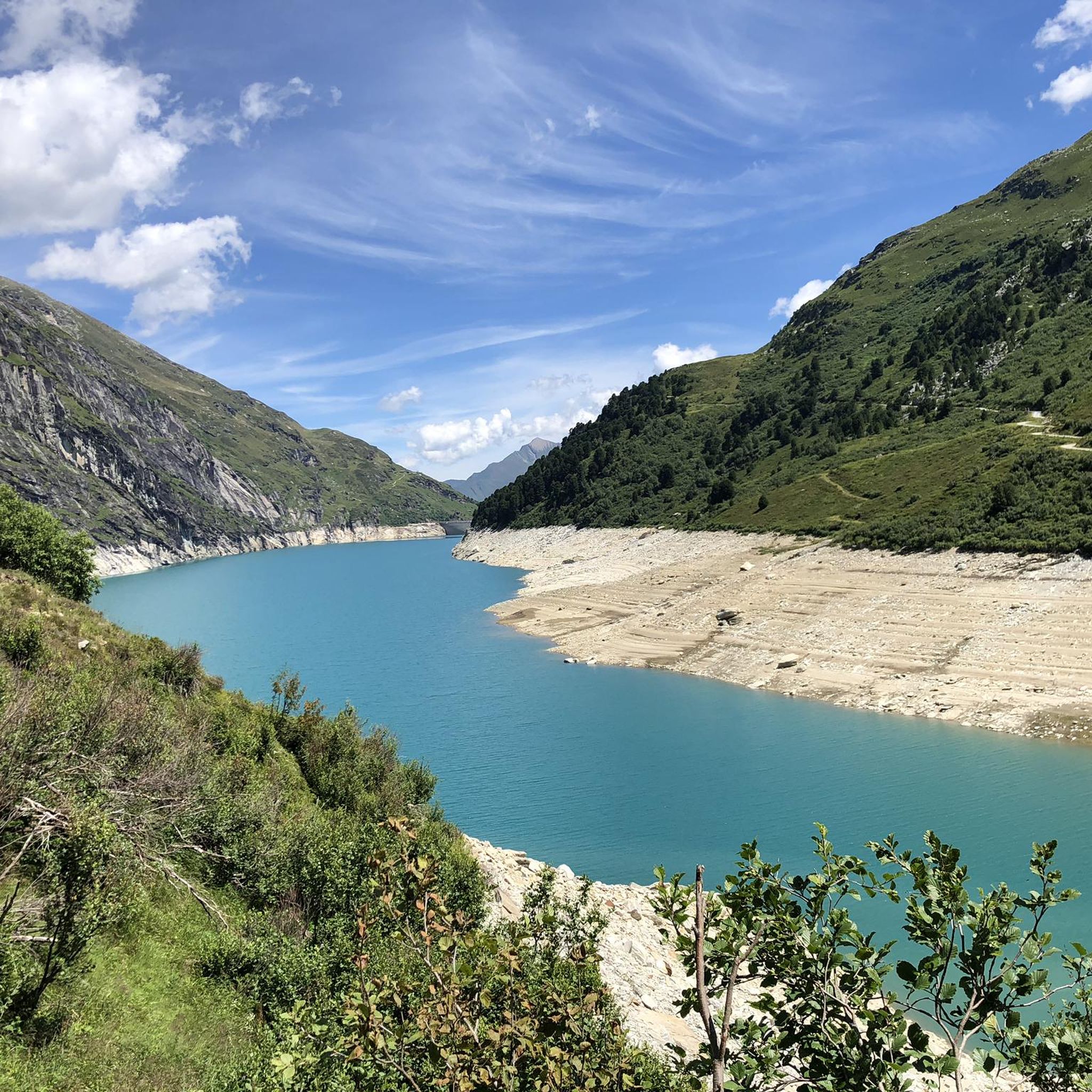
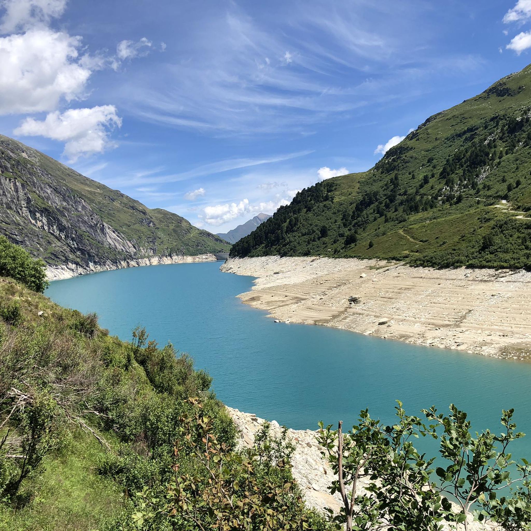
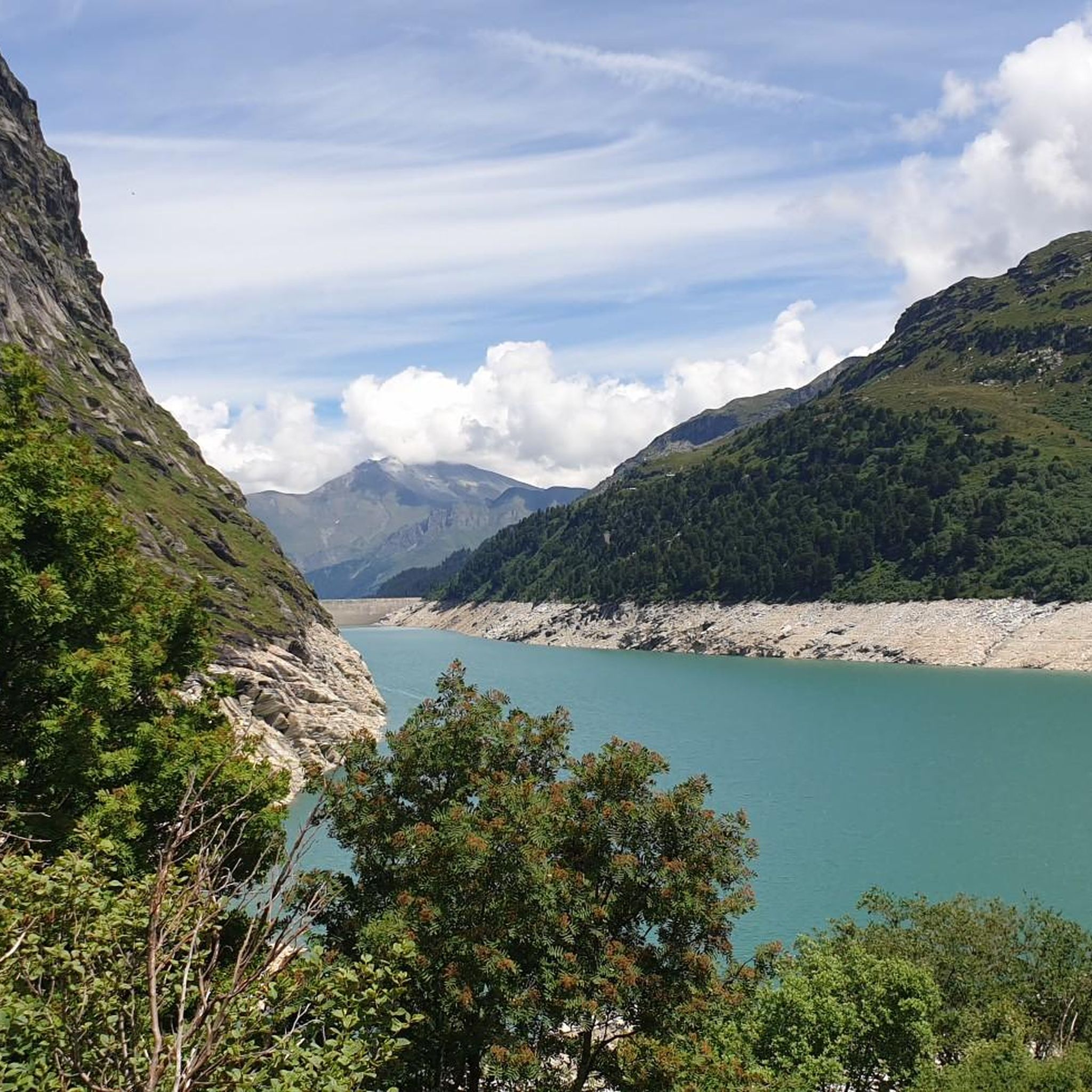
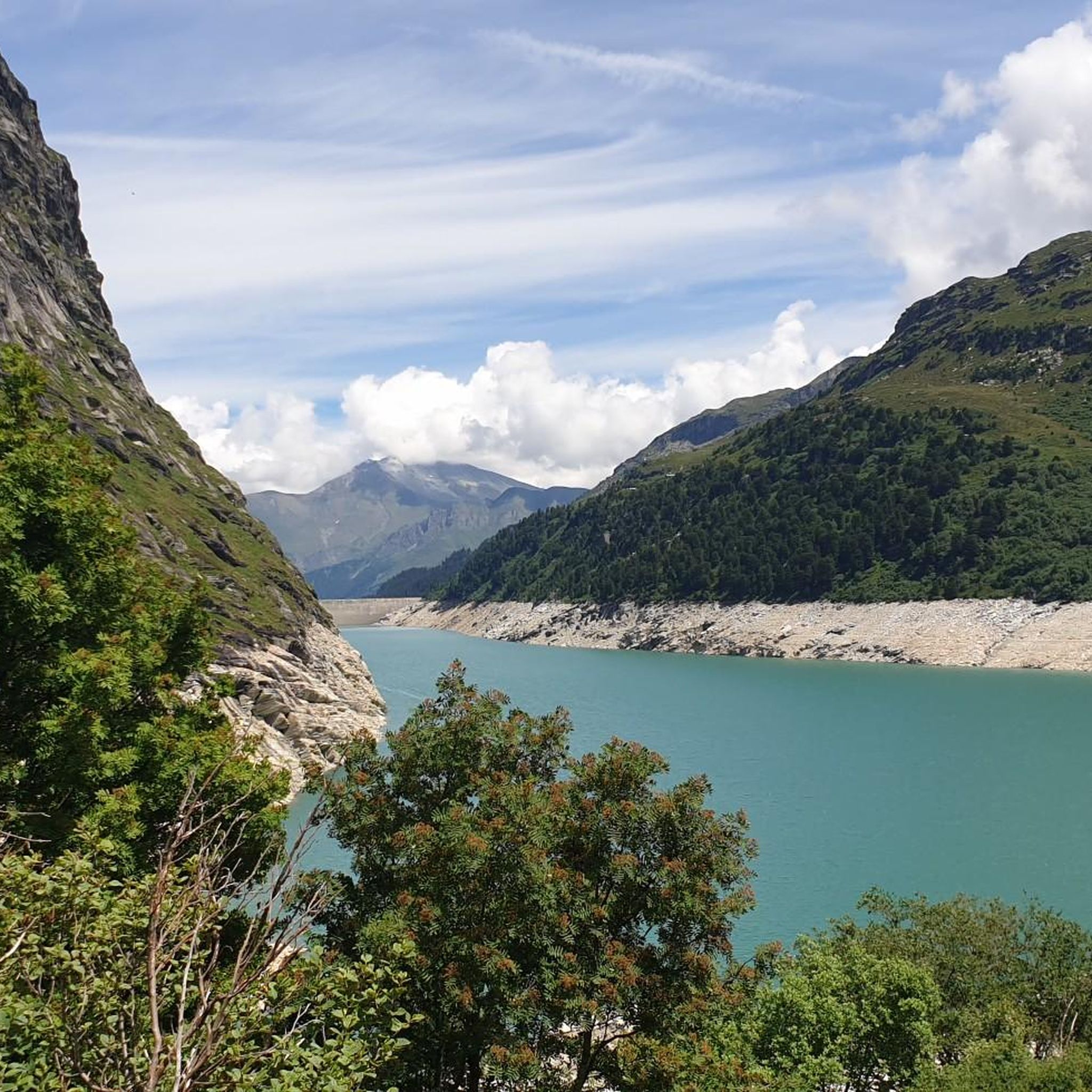
Zervreilasee at 1862 m The Zervreilasee, also spelled Zerfreilasee, is an artificial lake in the municipality of Vals in the canton of Graubünden. The lake is located at the end of the Valsertal valley between the peaks of Fanellhorn, Zervreilahorn, and Frunthorn at an altitude of 1862 meters above sea level. The lake was named after the village of Zervreila, which was flooded by the dam. The Zerfreila reservoir is fed, among others, by the Canalbach, the Hornbach, the Finsterbach, and the Valser Rhein, the latter also flowing back again after the dam. The gravity dam, located on the northeastern shore of the lake, was built in the 1960s and is 151m high. The length of the Zervreilasee is around four kilometers, depending on the water level. Text / Source: Schweizersee.ch https://www.schweizersee.ch/zervreilasee/
14
0
Kraftwerke Zervreila (KWZ), Vals Kraftwerke Zervreila AG (KWZ), based in Vals, was founded on May 17, 1952, as a partnership. During the construction years 1953-1958, around CHF 285 million were spent, the majority of which flowed to the country's construction industry and the machinery and apparatus industry. Large and small commercial enterprises in the catchment area of the concession municipalities benefited from a multitude of diverse orders and work assignments. During the period of highest employment, up to 1,500 people were employed on the KWZ construction sites. The commissioning of the facilities took place in 1958. Text / Source: Kraftwerke Zervreila AG, Vadianstrasse 59, 9000 St. Gallen https://www.kwz.ch/ueber-uns/geschichte/
14
0

The free hiking bus comes here on the weekends in the summer months at 5.30 p.m. (after prior notification by telephone) and drives back to Vals. Please see the notices for exact dates or ask at the tourist information office in Vals.
0
0
Open 365 days, 24 hours!
0
0

This is effectively an above-average beautiful high-altitude trail. Prepared in winter.
1
0
The name of the highlight doesn't really reveal itself to me, but the view of the Zervreilastausse is very nice, especially with lots of water in it.
0
0
Frequently Asked Questions
What are the most striking natural features around Zervreilasee?
The Zervreilasee itself is a primary attraction, known for its expansive, turquoise waters nestled at 1,862 meters. It's dramatically framed by the towering peaks of the Adula Alps, including the impressive Güferhorn and the distinctive Zervreilahorn, often called Graubünden's Matterhorn for its iconic reflections on the water.
Are there other notable mountain lakes to explore besides Zervreilasee?
Yes, the area boasts several beautiful natural mountain lakes. You can discover the high-lying Guraletschsee, known for its diverse landscape and moor areas, the small and dark Ampervreilasee, and the crystalline Selvasee, all offering unique scenic beauty.
What makes the Valsertal valley and Canaltal unique for exploration?
The Valsertal valley is wild and rocky, inviting exploration and tranquility, and is renowned for rare crystals. The secluded Canaltal high valley features spectacular mountain scenery, large boulders, and the constant rush of water, making it ideal for a beautiful half-day hike.
Are there any significant man-made structures or historical sites to visit near Zervreilasee?
Absolutely. The Zervreila Dam, completed in 1957, is a significant 151-meter-high monument accessible for pedestrians and cyclists, offering great views. You can also visit the old settlement of Frunt and the St. Anna Chapel, a historical and cultural point of interest located above the lake.
What are some recommended family-friendly hikes around Zervreilasee?
A popular and family-friendly option is the Zervreila–Frunt–Gadastatt Trail, which takes about 1.5 hours. It features highlights like the dam and the historic settlement of Frunt with its small chapel. Another easy family-friendly excursion is the 7.5 km hike from the Zervreila restaurant to the Guraletsch Alp and Guraletschsee.
Are there options for more challenging hikes in the Zervreilasee area?
Yes, for those seeking a more challenging trek, the '3-Lakes Hike' is a popular route offering stunning views and encompassing Zervreilasee, Ampervreilasee, Guraletschsee, and Selvasee, along with views of the Zervreilahorn. You can find more challenging routes, including 3000m summit hikes like to the Fanellhorn (3,124 meters), in the Hiking around Zervreilasee guide.
Can I find dog-friendly hiking trails near Zervreilasee?
Yes, there are several dog-friendly hiking options. For example, the moderate route from Gadastatt to the Hängela Mountain Inn & Yurts offers great views. You can explore more options in the Dog-friendly hikes around Zervreilasee guide.
What other outdoor activities are available besides hiking?
Beyond hiking, the Zervreilasee region is excellent for road cycling. You can find various routes, from moderate loops like the Vals village square – Obertor Ilanz loop to more difficult ones such as the Disentis Abbey – Lukmanier Pass loop. Discover these in the Road Cycling Routes around Zervreilasee guide.
What is the best time of year to visit Zervreilasee for outdoor activities?
The best time to visit Zervreilasee for outdoor activities is typically during the warmer months, from late spring to early autumn, when hiking trails are clear of snow and the weather is most favorable for exploring the alpine scenery. Always check local weather conditions before your visit.
Are there dining options or places to get refreshments in the area?
Yes, you can find refreshments at the Gadastatt Panorama Restaurant, which is accessible via the Vals–Gadastatt Gondola. Additionally, the Selvaalp, near Selvasee, is known for producing multi-award-winning alpine cheese, suggesting local culinary offerings.
How can I reach the Zervreilasee area by public transport?
While specific details on public transport directly to the lake are best checked with local tourist information, the Vals–Gadastatt Gondola provides access to the Gadastatt Panorama Restaurant, which can serve as a starting or ending point for many hikes. During summer weekends, a free hiking bus sometimes operates, offering transport back to Vals from locations like the Bridge Over Zervreila Reservoir; inquire at the tourist information office in Vals for exact dates and times.
Can I walk across the Zervreila Dam?
Yes, the Zervreila Dam is wide and accessible for both pedestrians and cyclists, offering excellent views of the reservoir and surrounding mountains.
Most popular routes around Zervreilasee
Most popular attractions around Zervreilasee

Get inspired with the komoot mobile app


Explore more
Still not found the Highlight you’re looking for? See guides of the top attractions in other regions:
