The best walks and hikes around Zervreilasee
4.7
(547)
4,300
hikers
83
hikes
Hiking around Zervreilasee is characterized by a rugged alpine environment featuring prominent granite peaks, expansive mountain waters, and the distinct granite formations of the Adula Alps. The region encompasses the wild Vals Valley and its side valleys, offering diverse terrain for exploration. Hikers will find trails leading through high moor areas with meadows, alongside several alpine lakes, and past the impressive Zervreila dam. Elevations on some paths can reach nearly 3,000 meters.
Best hiking trails around Zervreilasee
- The most popular hiking route is St. Anna Chapel on Frunt – View of Lake Zervreila loop from Zervreila, a moderate 5.6 miles (9.1 km) trail that takes 2 hours 52 minutes to complete. This route offers views of the reservoir and passes the historic St. Anna Chapel.
- Another top favourite among local hikers is View of Zervreila Reservoir – Amperfreila Alpine Huts loop from Zervreila, a difficult 7.4 miles (11.9 km) path. This trail provides high alpine scenery and expansive views of the Zervreila Reservoir and surrounding peaks.
- Local hikers also love the Guraletschsee – Zervreila Restaurant and Dam loop from Zervreila, an 8.0 miles (12.8 km) trail leading through alpine lakes and past the Zervreila Dam, often completed in about 7 hours 16 minutes.
- Hiking around Zervreilasee is defined by granite peaks, clear alpine lakes, and high moor areas. The network offers options for easy, moderate, and difficult ability levels.
- The routes in Zervreilasee are highly rated by the komoot community with an average score of 4.7 stars from over 450 reviews. More than 4000 hikers have used komoot to explore Zervreilasee's varied terrain.
Last updated: September 27, 2026
5.0
(2)
42
hikers
18.7km
08:21
1,000m
1,000m
Hard hike. Very good fitness required. Mostly accessible paths. Sure-footedness required.
10
hikers
6.89km
04:14
1,200m
Hard hike. Very good fitness required. Sure-footedness, sturdy shoes and alpine experience required.

5.0
(1)
11
hikers
11.4km
05:52
1,190m
140m
Hard hike. Very good fitness required. Sure-footedness, sturdy shoes and alpine experience required.
4.7
(76)
468
hikers
9.07km
02:52
350m
350m
Moderate hike. Good fitness required. Easily-accessible paths. Suitable for all skill levels.
5.0
(23)
111
hikers
Hard hike. Very good fitness required. Mostly accessible paths. Sure-footedness required.
Get access to more routes and recommendations from other explorers.
Already have an account?
Our route recommendations are based on thousands of hikes, rides, and runs completed by other people on komoot.
Start today with a free account
Your next adventure awaits.
Tips from the Community

The Kristallloch fire pit is a beautiful spot for a cozy break on the hike from Gadastatt to Zervreila. From the Gadastatt mountain station, a wide hiking trail initially leads towards Zerfreila, before it turns into a path. After about a kilometer (approx. half an hour's hike), you will reach the fire pit on the left side. The Kristallloch fire pit is small but nice. It has a stone table and offers a wonderful view of the Valser mountain world. Firewood is available on the right side of the hiking trail.
1
0

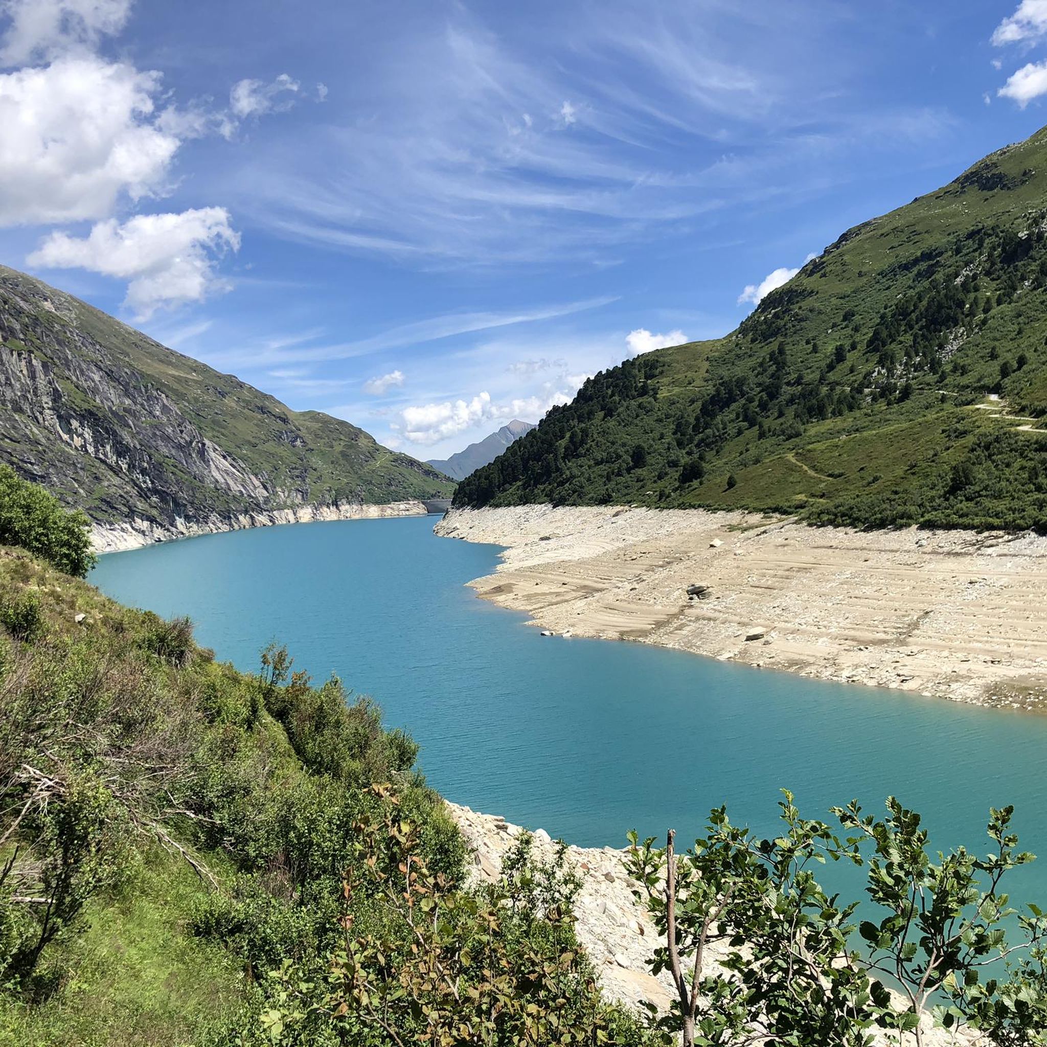
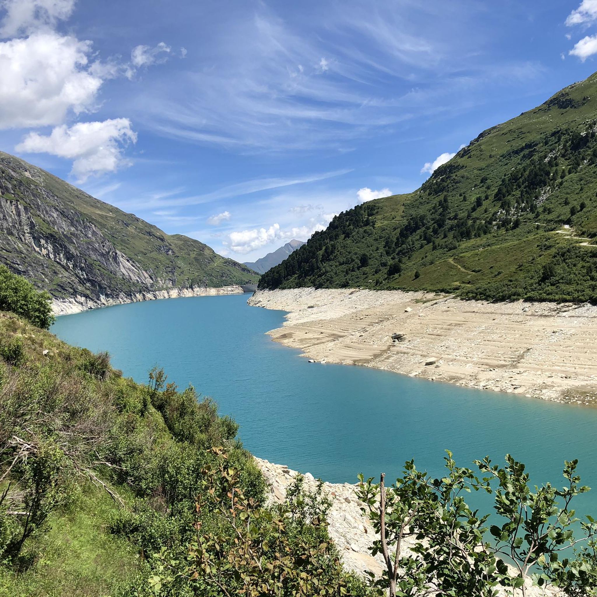
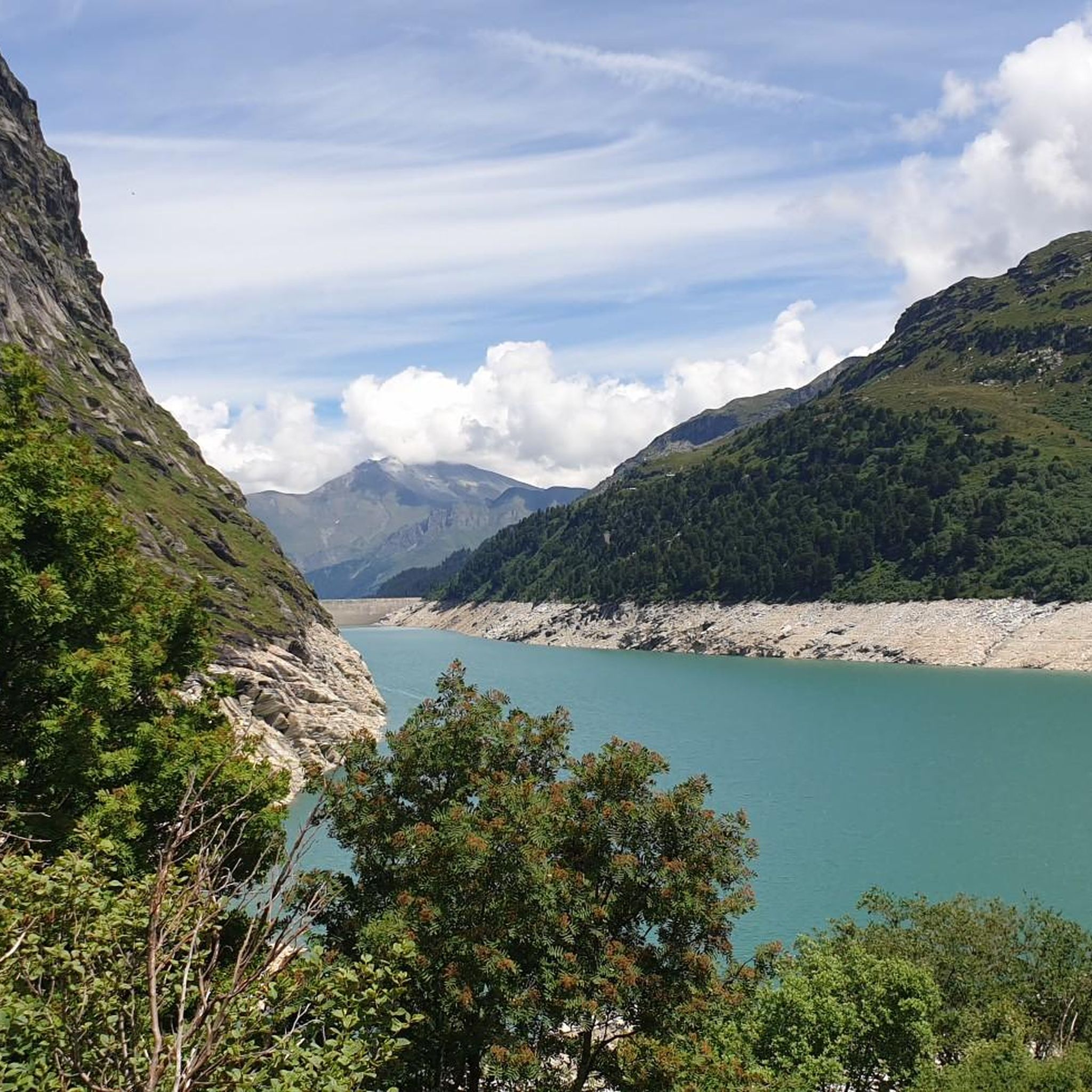
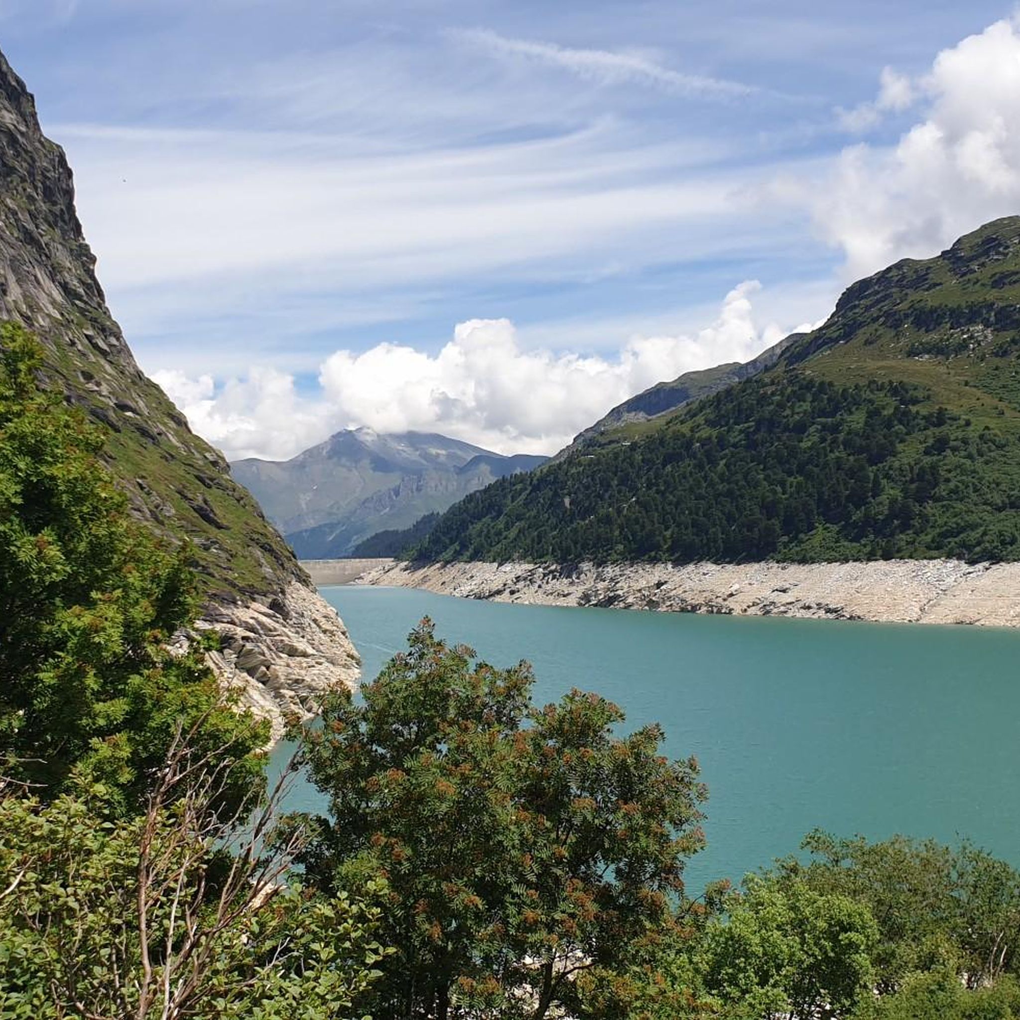
The Zervreilasee, also spelled Zerfreilasee, is idyllically located in the Valsertal valley and is the starting point for many summit hikes.
0
0
The Furggelti is a breathtaking pass between the Zervreilahorn and the Furggeltihorn.
0
0

Start at the Vals cable car. The gondola is free in summer. A simple but beautiful hike through the raised moor. At the Zervraila reservoir, return to Vals by scooter. These can be rented at the restaurant at Lake Zervraila. You return to the cable car parking lot.
0
0

The Länta Hut of the Swiss Alpine Club has stood under a mighty boulder for 111 years. It is an extremely cozy and small hut (34 beds) with an authentic alpine ambience and a surrounding mountain landscape of superlatives. The hut's exclusively vegetarian cuisine is fantastic and highly recommended.
0
0
South of the Guraletschsee and north of the Selvasee lies a similar altitude. The three lakes are connected by hiking trails and can be reached from Zervreila or directly from Vals.
0
0
The Länta hut stands under a mighty rock block. It is located in Länta, in the upper section of the Valsertal valley, between Zerfreilasee and Rheinwaldhorn, at an altitude of over 2,090 meters, has 30 beds and is very cozy. In the evening there is a multi-course menu, in the morning breakfast with home-baked bread and muesli. There are all kinds of drinks with and without alcohol. There is no large menu, cooking is always seasonal and everything is freshly prepared.
1
1
Frequently Asked Questions
How many hiking trails are available around Zervreilasee?
There are over 85 hiking trails around Zervreilasee, catering to various skill levels. You'll find a mix of easy, moderate, and difficult routes to explore the alpine landscape.
What are the typical terrain and difficulty levels for hikes in Zervreilasee?
The terrain around Zervreilasee is characterized by a rugged alpine environment with prominent granite peaks, clear mountain waters, and high moor areas. Trails range from easy walks around the reservoir to challenging high-altitude routes reaching nearly 3,000 meters. Komoot classifies 12 routes as easy, 39 as moderate, and 34 as difficult.
What natural features and landmarks can I expect to see while hiking around Zervreilasee?
Hikers can enjoy views of the majestic Zervreilahorn, often called Graubünden's Matterhorn, and other peaks of the Adula Alps. The area features several beautiful alpine lakes, including Guraletschsee, Ampervreilsee, and Selvasee. You can also see the impressive 151-meter-high Zervreila Dam and the historic Zervreila Chapel. Some trails might even lead past waterfalls or offer glimpses of the retreating Läntagletscher.
Are there family-friendly hiking options around Zervreilasee?
Yes, there are easier and family-friendly paths, such as walks directly around the Zervreila reservoir. The region's diverse network includes routes suitable for leisurely strolls, allowing families to enjoy the alpine scenery without extreme challenges.
Can I bring my dog on hikes around Zervreilasee?
Many trails in the Zervreilasee area are suitable for dogs, but it's always recommended to keep them on a leash, especially in areas with livestock or protected wildlife. Ensure your dog is accustomed to alpine terrain and carry enough water for both of you.
Are there good circular hiking routes in the Zervreilasee area?
Yes, Zervreilasee offers several excellent circular routes. For example, the St. Anna Chapel on Frunt – View of Lake Zervreila loop from Zervreila is a moderate 5.6-mile trail. Another option is the St. Bartholomew’s Chapel – Zervreila Reservoir loop from Zervreila, which is a moderate 8.8-mile route.
How can I access the Zervreilasee hiking area by public transport or car?
Zervreilasee can be reached by car, with parking available near the dam and restaurant. For public transport, you would typically travel to Vals and then connect to Zervreila. The village of Zervreila, near the dam, serves as a common starting point for many hikes.
When is the best time of year to go hiking around Zervreilasee?
The best time for hiking around Zervreilasee is generally during the warmer months, from late spring to early autumn (June to October), when trails are free of snow and weather conditions are more stable. High-altitude routes may still have snow patches earlier in the season.
What kind of challenging hikes are available for experienced mountaineers?
Experienced mountaineers can find several challenging routes. The View of Zervreila Reservoir – Amperfreila Alpine Huts loop from Zervreila is a difficult 7.4-mile path offering high alpine scenery. Another demanding option is the Guraletschsee – Zervreila Restaurant and Dam loop from Zervreila, an 8.0-mile trail leading through alpine lakes with significant elevation gain.
Are there places to eat or stay near the Zervreilasee hiking trails?
Yes, there are facilities near Zervreilasee. You'll find a restaurant at Lake Zervreila, which is a popular spot for hikers. For accommodation, options are available in the nearby Vals Valley.
What do other hikers say about the trails around Zervreilasee?
The trails around Zervreilasee are highly rated by the komoot community, with an average score of 4.7 stars from over 450 reviews. Hikers often praise the stunning alpine scenery, the clear mountain lakes, and the diverse range of routes available for all skill levels.
Are there any less crowded hiking trails or areas to explore?
While popular routes can see more visitors, exploring the side valleys of the wild Vals Valley or venturing onto some of the more challenging high-altitude paths can lead to quieter experiences. The extensive network of trails means it's often possible to find serene spots away from the main attractions.
Most popular routes around Zervreilasee
Most popular attractions around Zervreilasee

Get inspired with the komoot mobile app


Explore more
Browse the best Hikes in other regions.
