The best MTB trails around Zervreilasee
4.4
(67)
507
riders
10
rides
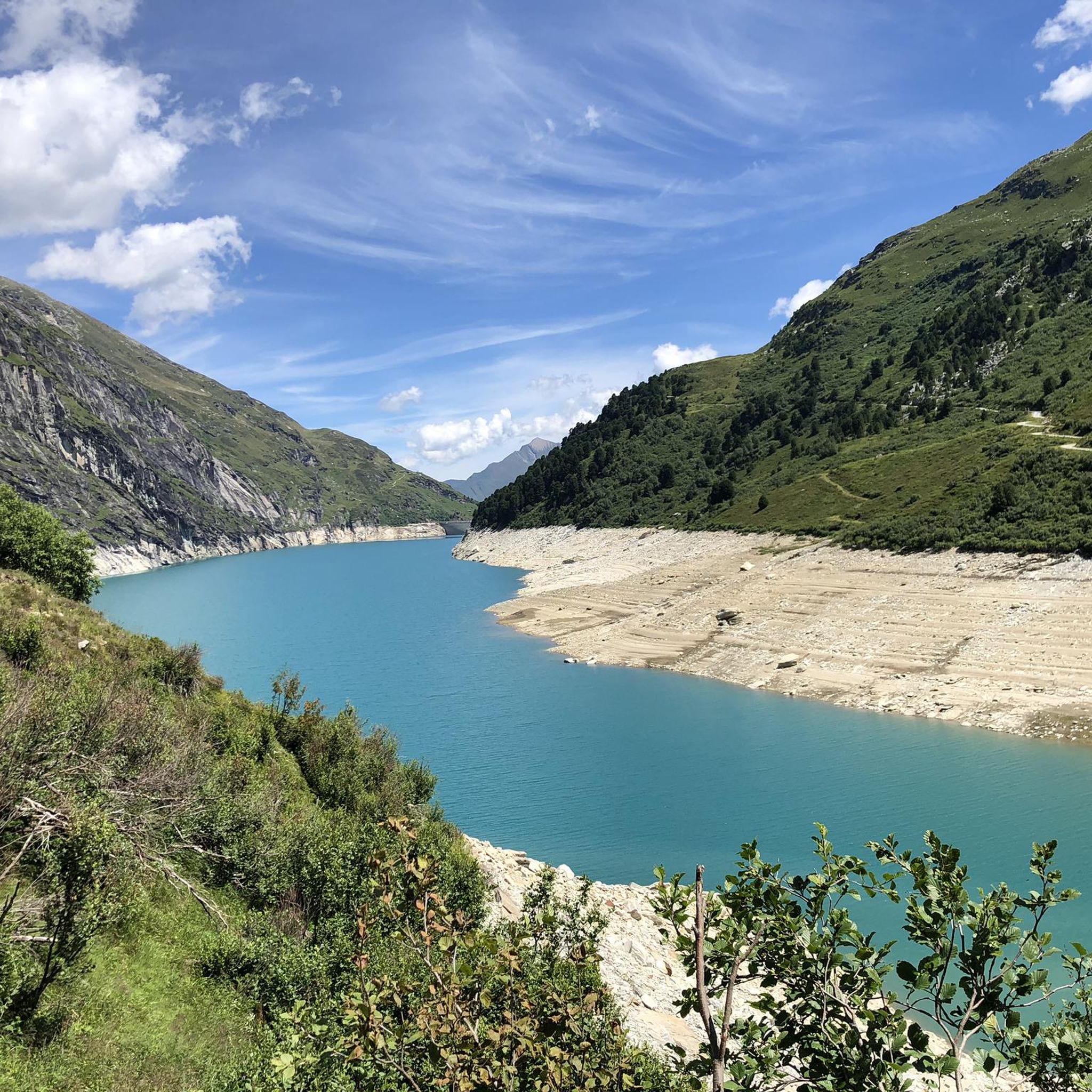
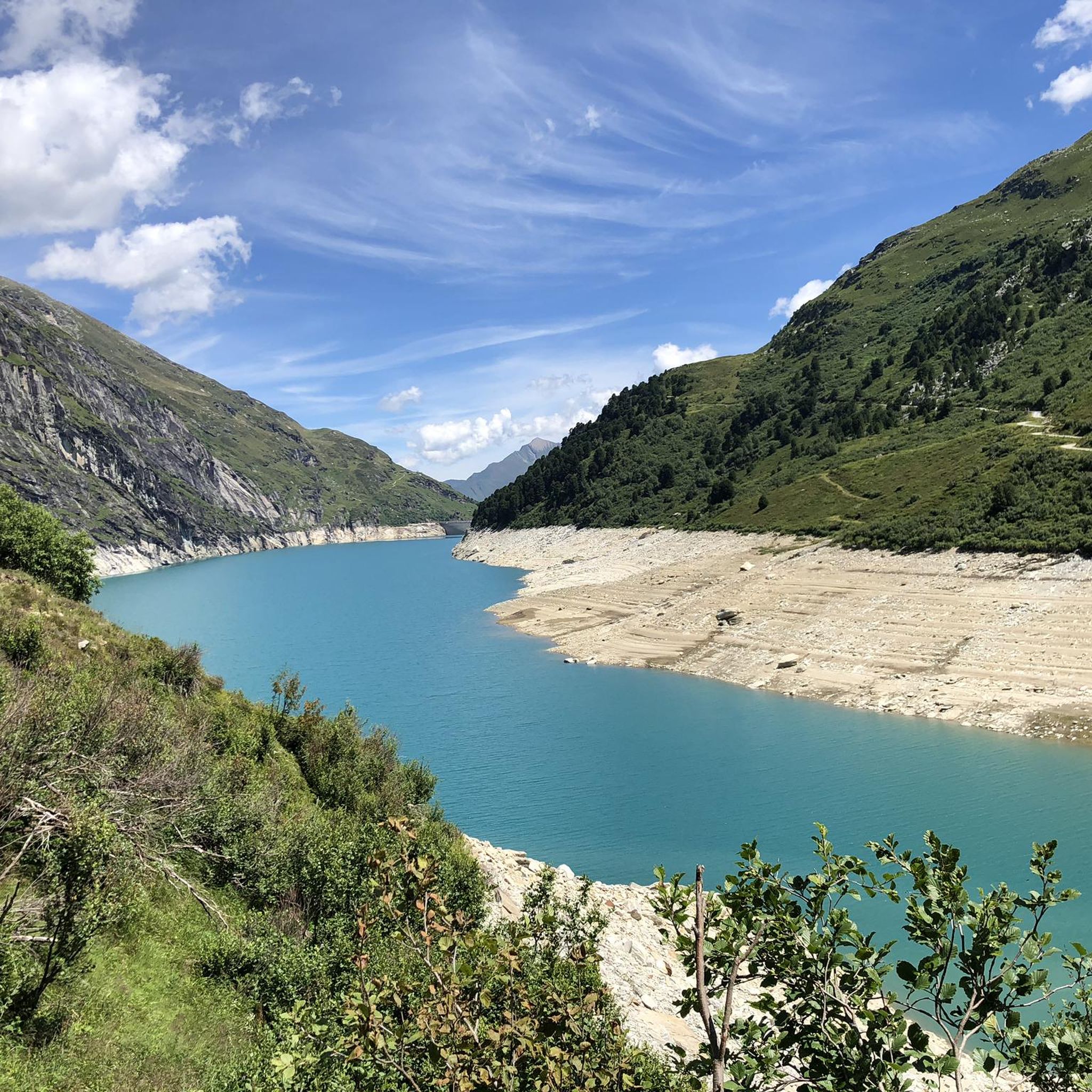
Mountain biking around Zervreilasee offers diverse terrain in the Swiss Alps, centered around the Zervreilasee reservoir. The region features a mountainous backdrop including the Zervreilahorn, the deep Valser Rheinschlucht with its steep rock faces, and untouched alpine high valleys like Canaltal and Läntatal. The area provides a network of trails suitable for various skill levels, from lake shore paths to challenging alpine routes.
Best mountain bike trails around Zervreilasee
- The most popular mountain bike trail is Canal Bridge – Zervreila…
Last updated: September 27, 2026
13
riders
15.3km
01:44
420m
420m
Hard mountain bike ride. Good fitness required. Advanced riding skills necessary. Some portions of the route may require you to push your bike.
2
riders
31.6km
04:41
1,430m
1,430m
Hard mountain bike ride. Very good fitness required. Advanced riding skills necessary. Some portions of the route may require you to push your bike.

4.7
(29)
170
riders
32.4km
03:43
1,180m
1,180m
Hard mountain bike ride. Very good fitness required. Advanced riding skills necessary. Some portions of the route may require you to push your bike.
4.7
(3)
65
riders
13.4km
01:29
490m
490m
Hard mountain bike ride. Good fitness required. Advanced riding skills necessary. Some portions of the route may require you to push your bike.
4.8
(4)
24
riders
13.9km
01:36
580m
580m
Hard mountain bike ride. Good fitness required. Advanced riding skills necessary. Some portions of the route may require you to push your bike.
Get access to more routes and recommendations from other explorers.
Already have an account?
Our route recommendations are based on thousands of hikes, rides, and runs completed by other people on komoot.
Start today with a free account
Your next adventure awaits.
Tips from the Community

Start at the Vals cable car. The gondola is free in summer. A simple but beautiful hike through the raised moor. At the Zervraila reservoir, return to Vals by scooter. These can be rented at the restaurant at Lake Zervraila. You return to the cable car parking lot.
0
0

In summer, every Saturday village market
0
0

Very nice view of the valley, yurts can also be rented for overnight stays
1
0

Vals Deep in the Valsertal, a side valley of the Surselva south of Ilanz, at 1250m lies the mountain village of Vals. Around the village square are still original Walser houses covered with stone slabs of Vals quartzite. The quiet Grisons resort offers hiking pleasure, wellness in the thermal bath and winter sports opportunities on the Dachberg. The Valsertal owes its wilderness and diversity in a small space to the forces of water. Over millions of years, ice and rain have shaped the deeply cut mountain valley. Vals' most important asset is the 30-degree thermal spring, the only one in Graubünden that comes directly from the ground. The thermal bath, built by star architect Peter Zumthor from local quartzite, showcases the elements of water and stone and combines them to create a wellness experience. The building of timeless quality and simple elegance has also become a place of pilgrimage for those interested in architecture. An intact agriculture and alpine farming characterises the valley and delights attentive mountaineers: A few years ago, the Vals farmers decided to produce exclusively organic products. Text / Source: myswitzerland.com https://www.myswitzerland.com/de-ch/reiseziele/vals-valsertal/
14
1
Vals Village Square Around the village square, you can still see original Walser houses covered with stone slabs of Vals quartzite. Text / Source: myswitzerland.com https://www.myswitzerland.com/de-ch/reiseziele/vals-valsertal/
13
1
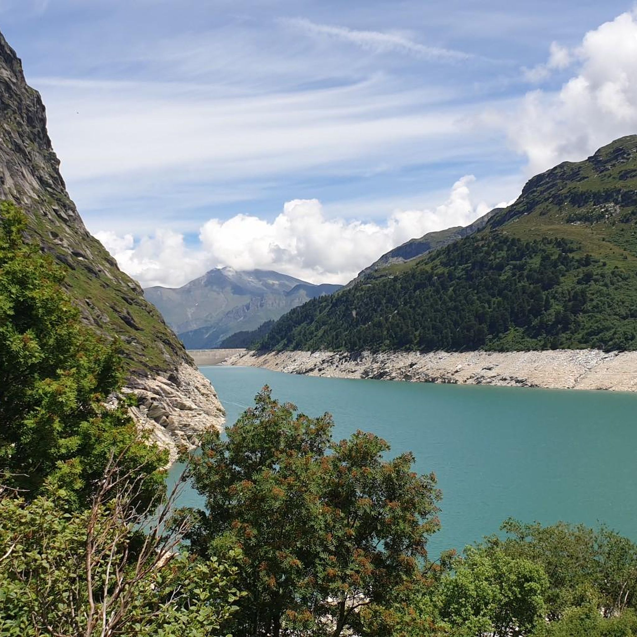
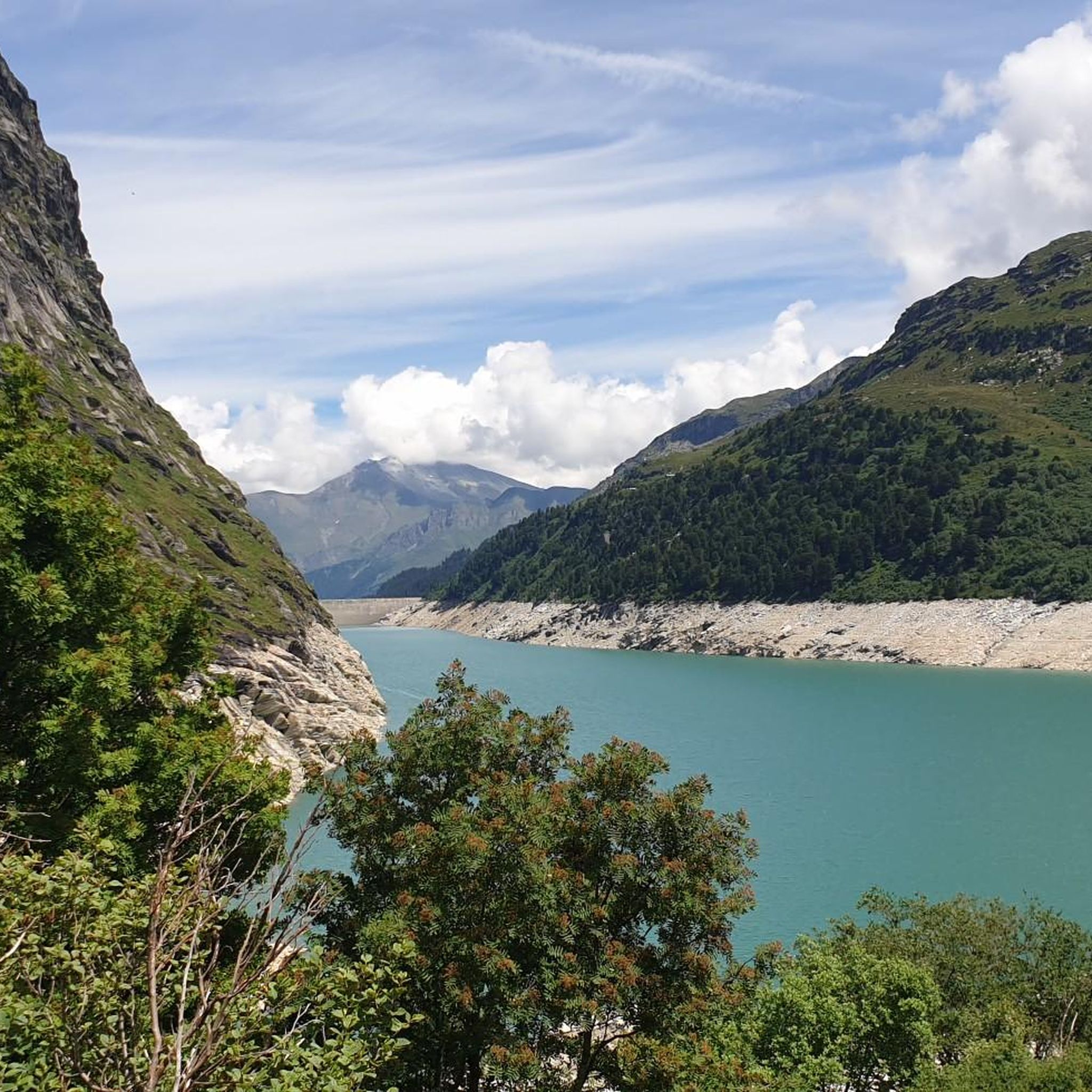
Zervreilasee at 1862 m The Zervreilasee, also spelled Zerfreilasee, is an artificial lake in the municipality of Vals in the canton of Graubünden. The lake is located at the end of the Valsertal valley between the peaks of Fanellhorn, Zervreilahorn, and Frunthorn at an altitude of 1862 meters above sea level. The lake was named after the village of Zervreila, which was flooded by the dam. The Zerfreila reservoir is fed, among others, by the Canalbach, the Hornbach, the Finsterbach, and the Valser Rhein, the latter also flowing back again after the dam. The gravity dam, located on the northeastern shore of the lake, was built in the 1960s and is 151m high. The length of the Zervreilasee is around four kilometers, depending on the water level. Text / Source: Schweizersee.ch https://www.schweizersee.ch/zervreilasee/
14
0
Kraftwerke Zervreila (KWZ), Vals Kraftwerke Zervreila AG (KWZ), based in Vals, was founded on May 17, 1952, as a partnership. During the construction years 1953-1958, around CHF 285 million were spent, the majority of which flowed to the country's construction industry and the machinery and apparatus industry. Large and small commercial enterprises in the catchment area of the concession municipalities benefited from a multitude of diverse orders and work assignments. During the period of highest employment, up to 1,500 people were employed on the KWZ construction sites. The commissioning of the facilities took place in 1958. Text / Source: Kraftwerke Zervreila AG, Vadianstrasse 59, 9000 St. Gallen https://www.kwz.ch/ueber-uns/geschichte/
14
0
Frequently Asked Questions
What types of mountain bike trails can I expect around Zervreilasee?
The Zervreilasee region offers a diverse range of mountain bike trails, from relatively flat lake shore paths to challenging alpine routes. You'll find paths winding through the dramatic Valser Rheinschlucht, untouched alpine high valleys like Canaltal and Läntatal, and routes with significant elevation changes. The area features 13 mountain bike tours, including 1 easy, 3 moderate, and 9 difficult options.
Are there any easy mountain bike trails suitable for beginners or families in Zervreilasee?
Yes, there is at least one easy mountain bike trail available. While many routes are more challenging, the lake shore paths along Zervreilasee are generally described as relatively flat and enjoyable, making them suitable for easier rides. For a specific route, consider exploring options that stick closer to the lake's perimeter.
What are some notable natural features or landmarks to see while mountain biking in Zervreilasee?
The Zervreilasee area is rich in natural beauty and landmarks. You can expect to see the striking blue-green Zervreilasee reservoir itself, the prominent Zervreilahorn, and the deep Valser Rheinschlucht with its steep rock faces. Other notable features include untouched alpine high valleys like Canaltal and Läntatal, and the impressive Zervreila Dam. The old settlement of Frunt, with its small St. Anna Chapel, is also a scenic point of interest.
What do other mountain bikers say about the trails in Zervreilasee?
The mountain bike trails around Zervreilasee are highly regarded by the komoot community, with an average rating of 4.5 stars from over 40 reviews. More than 500 mountain bikers have used komoot to explore the varied terrain, often praising the stunning alpine scenery, the diverse trail network, and the unique experience of riding through areas like the Valser Rheinschlucht.
Are there any circular mountain bike routes around Zervreilasee?
Yes, several routes in the area are designed as loops. For example, the difficult Canal Bridge – Zervreila Reservoir loop from Zervreila offers views of the reservoir and alpine landscape. Another challenging option is the Zervreila Chapel – Canal Bridge loop from Vals, which explores the vicinity of the chapel and bridge.
Can I bring my dog on the mountain bike trails in Zervreilasee?
The 'Fairtrail Grisons' initiative in the region promotes harmonious coexistence between hikers and mountain bikers, and mountain biking is generally permitted on hiking trails unless officially banned. While specific dog regulations for each trail may vary, it's generally advisable to keep dogs on a leash, especially in populated areas or near livestock, and to ensure they are well-behaved and don't disturb wildlife or other trail users.
What is the best time of year to go mountain biking in Zervreilasee?
The best time for mountain biking in Zervreilasee is typically during the warmer months, from late spring to early autumn (roughly June to October), when the alpine trails are free of snow and weather conditions are most favorable. Always check local weather forecasts and trail conditions before heading out, as high-altitude areas can experience sudden changes.
Are there any challenging mountain bike trails for experienced riders?
Absolutely. The Zervreilasee area is well-known for its challenging routes, with 9 out of 13 tours rated as difficult. An example is the Vals village square – St. Anna Chapel on Frunt loop from Vals, a difficult 31.4 km path traversing varied mountain terrain. Another demanding option is the Tomül Pass – Vals village square loop from Vals, covering 23.4 km with significant elevation.
Where can I find parking for mountain biking near Zervreilasee?
Parking is generally available in the vicinity of Zervreilasee and the nearby village of Vals. Specific parking areas are often located near trailheads or popular starting points. It's recommended to check local signage upon arrival for designated parking zones and any associated fees.
Are there any specific permits required for mountain biking in Zervreilasee?
In the Grisons region, mountain biking is generally permitted on hiking trails unless explicitly banned by official signage. The 'Fairtrail Grisons' initiative encourages mutual respect between trail users. You typically do not need a specific permit for mountain biking itself, but always adhere to local regulations and signage.
Can I reach the Zervreilasee mountain bike trails using public transport?
The Zervreilasee area is accessible, and public transport options, such as buses, often connect to the village of Vals, which serves as a gateway to the region. From Vals, you may be able to access various trailheads or find local transport options to get closer to the lake. It's advisable to check current bus schedules and routes for the most up-to-date information.
Are there any mountain huts or places to stop for refreshments along the trails?
Yes, for those venturing into the higher alpine areas, the Läntahütte SAC offers a welcoming mountain hut experience. Additionally, the village of Vals, located near Zervreilasee, provides various options for cafes, restaurants, and accommodation where you can refuel and relax after your ride.
Most popular routes around Zervreilasee
Most popular attractions around Zervreilasee

Get inspired with the komoot mobile app


Explore more
Browse the best MTB trails in other regions.
