The best traffic-free bike rides around Saint-Étienne-Vallée-Française
3.7
(7)
38
riders
2
rides
Gravel biking around Saint-Étienne-Vallée-Française offers diverse terrain within the Cévennes National Park, a UNESCO World Heritage site. The region features sharp ridges, deep valleys, and varied ecosystems, with surrounding peaks reaching up to 1000 meters. Routes traverse schist formations, lush chestnut groves, and dense forests, often alongside the Gardon river. This landscape provides significant elevation gains and varied routes for gravel cyclists.
Best no traffic gravel bike trails around Saint-Étienne-Vallée-Française
- The most popular no traffic gravel bike trail is Saint-Étienne-Vallée-Française…
Last updated: July 13, 2026
5.0
(2)
5
riders
41.8km
03:55
1,190m
1,190m
Hard gravel ride. Very good fitness required. Mostly paved surfaces. Suitable for all skill levels.
5
riders
Hard gravel ride. Very good fitness required. Mostly paved surfaces. Suitable for all skill levels.

Sign up for free
4
riders
130km
10:33
2,510m
2,510m
Hard gravel ride. Very good fitness required. Mostly paved surfaces. Suitable for all skill levels.
Our route recommendations are based on thousands of hikes, rides, and runs completed by other people on komoot.
Start today with a free account
Your next adventure awaits.
Login or Signup


Other adventures around Saint-Étienne-Vallée-Française

Tips from the Community


The Via Ardeche railway cycle path is a nice idea in itself, but unfortunately, the perfect surface (asphalt) is only present in the tunnel sections. The rest is rough concrete, gravel, and even worse.
0
0
The Via Ardeche railway cycle path is a nice idea in itself, but unfortunately, the perfect surface (asphalt) is only present in the tunnel sections. The rest is rough concrete, gravel, and even worse. It's pleasantly cool in the tunnel.
1
0
The Via Ardeche railway cycle path is a nice idea in itself, but unfortunately, the perfect surface (asphalt) is only present in the tunnel sections. The rest is rough concrete, gravel, and even worse.
0
1
The Via Ardeche railway cycle path is a nice idea in itself, but unfortunately, the perfect surface (asphalt) is only present in the tunnel sections. The rest is rough concrete, gravel, and even worse.
0
0
In the tunnel it is best to drive on the asphalt, after that there is too much grit on the asphalt or concrete
0
0

Magnificent panoramas, a must-see
0
0

The Doulovy viaduct is one of the three largest viaducts in the Cévennes. Built in 1876, it was once used to transport coal by train.
0
0
Frequently Asked Questions
How many no-traffic gravel bike trails are available in Saint-Étienne-Vallée-Française?
There are several dedicated no-traffic gravel bike trails around Saint-Étienne-Vallée-Française. This guide features 3 routes specifically chosen for their low-traffic nature, offering a peaceful and immersive cycling experience.
What is the typical terrain and difficulty for no-traffic gravel biking in this region?
The terrain in Saint-Étienne-Vallée-Française is diverse, characterized by sharp ridges, deep valleys, and varied ecosystems within the Cévennes National Park. You'll encounter schist formations, lush chestnut groves, and forests. Routes often feature significant elevation gains, with some peaks reaching up to 1000 meters. The trails listed in this guide are generally rated as difficult, requiring good fitness and sometimes even necessitating pushing your bike on steeper sections.
Are there family-friendly no-traffic gravel routes in Saint-Étienne-Vallée-Française?
While the routes in this guide are rated as difficult due to significant elevation and technical sections, the region does offer varied terrain. For families, it's important to assess the fitness level of all riders. The area around the Gardon river offers gentler sections, but specific family-friendly no-traffic gravel routes might require local knowledge or shorter, adapted loops.
Can I bring my dog on these no-traffic gravel bike trails?
The Cévennes National Park, where Saint-Étienne-Vallée-Française is located, generally allows dogs on trails, but they must be kept on a leash to protect wildlife and livestock. Always check specific trail regulations before heading out, especially within protected areas. Ensure your dog is fit enough for the challenging terrain and carry enough water for both of you.
Are there any circular no-traffic gravel bike routes available?
Yes, many of the no-traffic gravel routes in the region are designed as loops. For example, the Saint-Étienne-Vallée-Française – Viewpoint loop from Saint-Étienne-Vallée-Française is a challenging 41.7 km circular route that offers extensive views and a full immersion into the Cévennes landscape.
What natural features or landmarks can I expect to see on these routes?
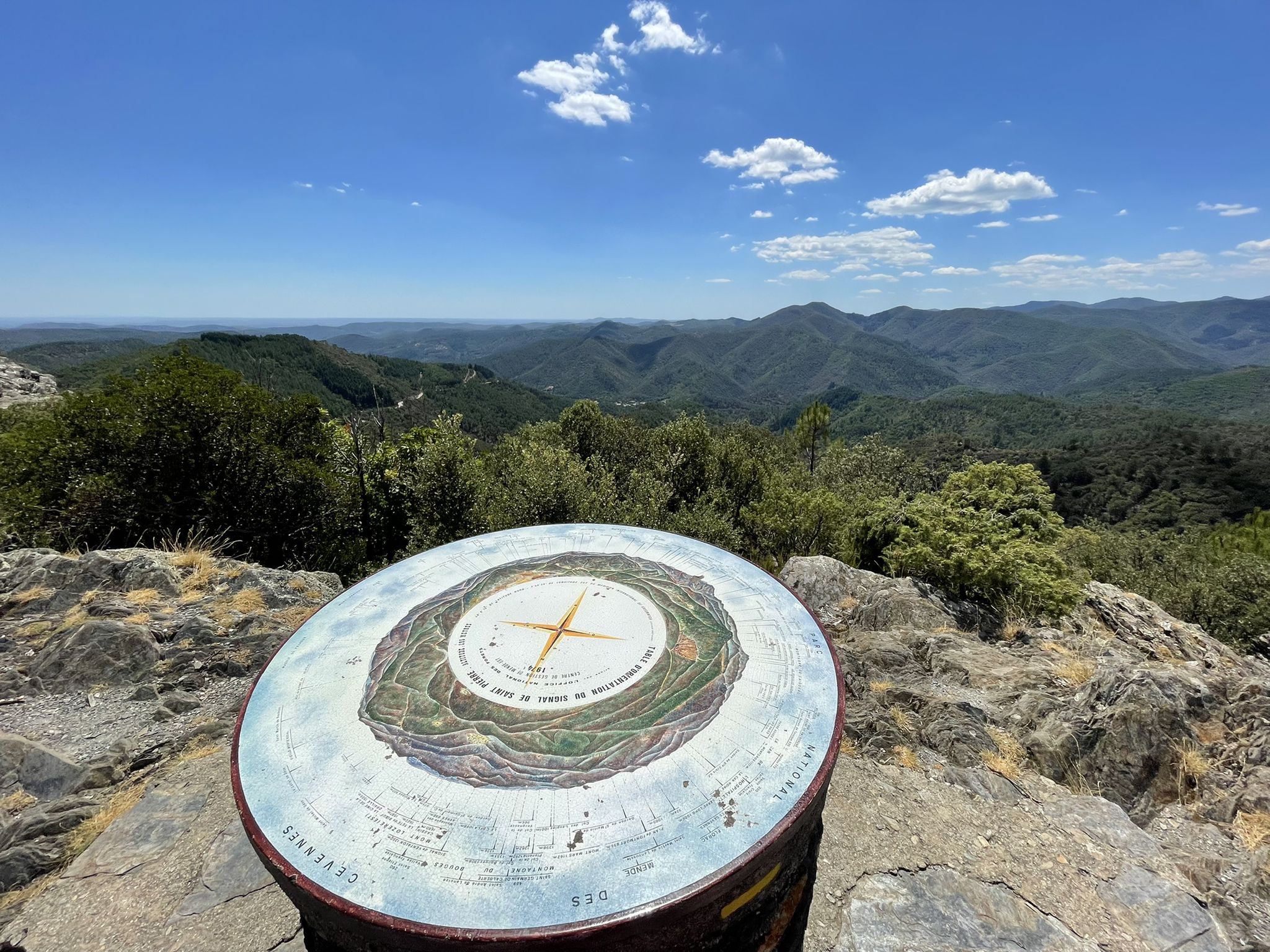
The region is rich in natural beauty and historical sites. You can discover unique natural monuments like the Chaos de l'Amous or enjoy panoramic views from viewpoints such as the Signal de Saint-Pierre Orientation Table. The area also features mountain peaks like Arbousse Peak and the historic Abarines Bridge.
When is the best time of year to go gravel biking in Saint-Étienne-Vallée-Française?
The region benefits from a gentle Mediterranean climate. Spring and autumn are generally ideal, offering pleasant temperatures and vibrant landscapes. Summer can be hot, especially in the valleys, so early morning rides are recommended. Winter can bring colder temperatures and potentially snow at higher elevations, making some routes more challenging or inaccessible.
How accessible are the starting points for these no-traffic gravel trails by public transport or car?
Saint-Étienne-Vallée-Française is a rural area within the Cévennes National Park. While car access is generally straightforward with parking available in villages, public transport options might be limited. It's advisable to check local bus schedules if you plan to rely on public transport to reach trailheads. Many routes, like the View from Saint-Jean-du-Pin – Col de Mayelle loop, start from small villages.
Which no-traffic gravel routes offer the best panoramic views?
Many routes in the Cévennes offer stunning vistas due to the varied elevation. The Saint-Étienne-Vallée-Française – Viewpoint loop from Saint-Étienne-Vallée-Française is specifically named for its viewpoints, providing expansive panoramas of the surrounding valleys and peaks. Passes like Col d'Uglas and Col de l'Asclier also offer exceptional views.
Are there opportunities to see waterfalls or rivers along these routes?
Yes, the Gardon river winds through the valleys, offering picturesque settings and opportunities for refreshing breaks. The Martinet waterfall, known for its clear waters, is a notable natural feature in the area and can be accessed from various points, providing a beautiful spot to relax during or after a ride.
What do other gravel bikers enjoy the most about gravel biking in Saint-Étienne-Vallée-Française?
The area is highly rated by the komoot community, with an average score of 3.75 stars. Reviewers often praise the serene, traffic-free nature of the trails, the challenging yet rewarding climbs, and the stunning natural beauty of the Cévennes National Park. The sense of immersion in nature and the diverse landscapes are frequently highlighted.
Are there any particularly challenging no-traffic gravel routes for experienced riders?
Absolutely. The region is known for its demanding terrain. The Gadilhe tunnel – Viaduc du Doulovy loop from Sainte-Cécile-d'Andorge is a particularly long and challenging route, covering over 130 km with more than 2500 meters of elevation gain. This route is designed for experienced gravel bikers seeking a significant endurance test.
Most popular routes around Saint-Étienne-Vallée-Française
Most popular attractions around Saint-Étienne-Vallée-Française

Get inspired with the komoot mobile app


Explore more
Browse the best Gravel rides in other regions.
