The best dog-friendly hikes and walks in Presidential Range-Dry River Wilderness
4.5
(232)
4,518
hikers
6
hikes
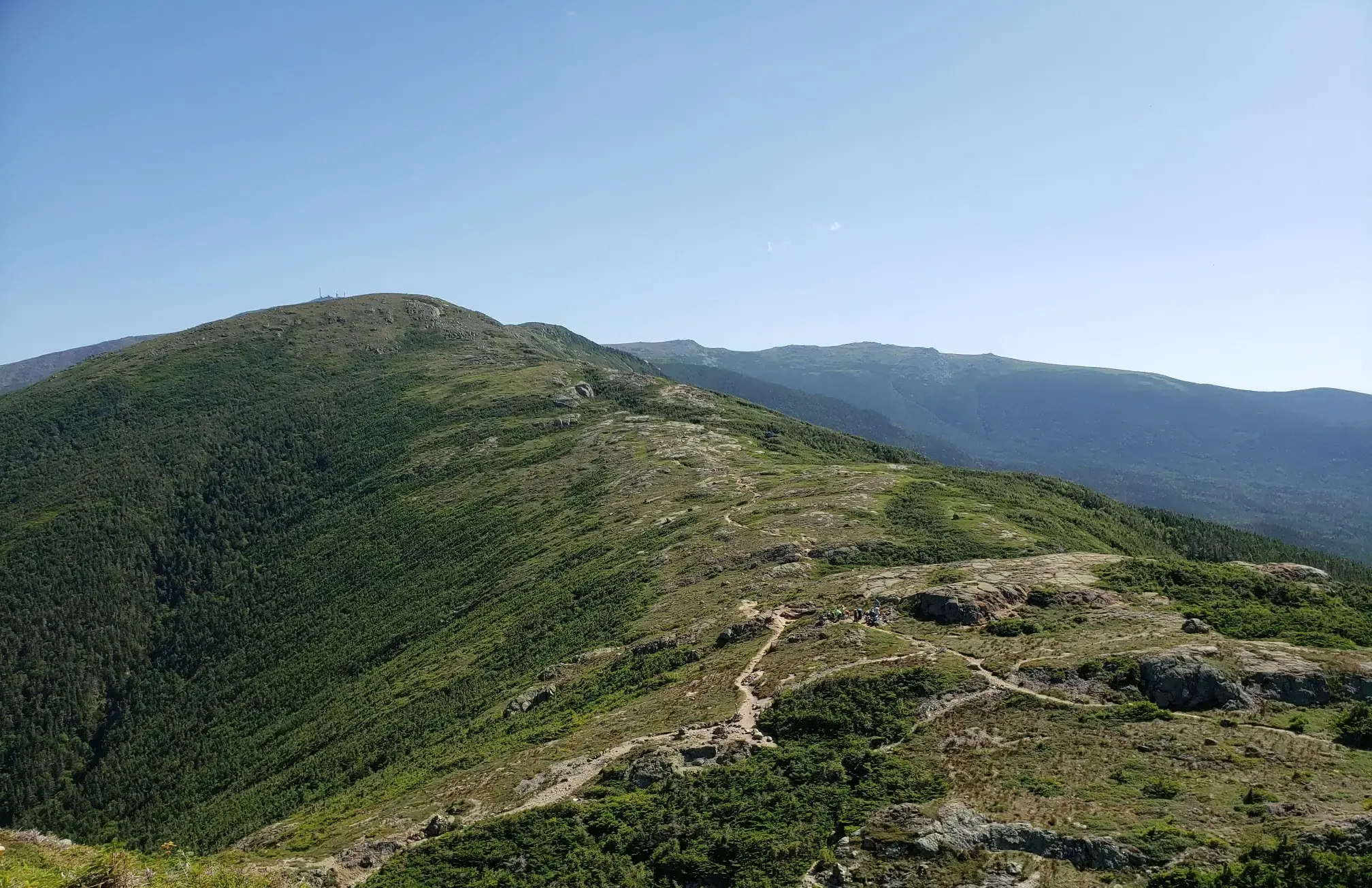
Dog friendly hiking trails in Presidential Range-Dry River Wilderness traverse a rugged landscape characterized by diverse ecosystems. The region features northern hardwood forests, spruce-fir forests, and the largest expanse of alpine tundra east of the Mississippi River. Numerous mountains, including nine peaks over 4,000 feet, define the terrain, alongside the Dry River Valley with its swift, clear waters and waterfalls. Long ridgelines and deep river valleys offer varied elevation changes for hikers.
Best dog friendly hiking trails in Presidential Range-Dry…
Last updated: July 9, 2026
3
hikers
11.8km
03:54
490m
500m
Embark on the Ripley Falls and Frankenstein Cliffs Loop for a moderate hiking adventure through varied terrain in Crawford Notch State Park. This route spans 7.3 miles (11.8 km) and…
4.7
(29)
277
hikers
4.59km
01:32
240m
240m
Hike the easy 2.9-mile Arethusa Falls and Bemis Brook Trail in Crawford Notch State Park to see New Hampshire's tallest waterfall.

Sign up for free
4.7
(25)
168
hikers
7.41km
02:35
410m
410m
Hike the Arethusa Falls and Frankenstein Cliff Loop Trail for dramatic waterfalls, panoramic mountain views, and challenging terrain in Craw
4.0
(2)
6
hikers
18.3km
06:38
1,100m
1,100m
Hike the challenging Arethusa Falls and Frankenstein Cliff Loop in Crawford Notch State Park, featuring New Hampshire's tallest waterfall an
5.0
(1)
15
hikers
1.90km
00:40
120m
120m
Hike the easy 1.2-mile Ripley Falls Trail in Crawford Notch State Park to see a unique 100-foot waterfall.
Our route recommendations are based on thousands of hikes, rides, and runs completed by other people on komoot.
Start today with a free account
Your next adventure awaits.
Login or Signup
Popular around Presidential Range-Dry River Wilderness
Other adventures in Presidential Range-Dry River Wilderness

Tips from the Community

This is an old rail bridge that is part of the Conway Scenic Railroad, which still operates today, offering train trips through the White Mountains. The bridge spans the trail, providing an interesting contrast to the natural surroundings.
0
0

The 'Fawn Pool' is located below the 'Coliseum Falls'. The water flows over a long, flat granite slab in the valley floor down into the pool and then drops steeply again. https://www.newenglandwaterfalls.com/nh-arethusafalls.html
2
0
The ‘Ripley Falls’ can be reached after a short hike on the forest path ‘Arethusa-Ripley Falls Trail’ from the parking lot on the ‘Wiley House Station Road’. The 30-meter high waterfall flows over a smooth rock wall at an angle of about 60 degrees in the valley of the ‘Avalanche Brook’.
2
0
The 'Coliseum Falls' are located below the 'Bemis Brook Falls' on the trail of the same name, a less frequented alternative to the 'Arethusa Falls'. The water falls down a low granite step and flows over a long, flat granite slab in the valley floor down into the 'Fawn Pool'. In dry times you can walk from the waterfall to the pool on the granite slab. https://www.newenglandwaterfalls.com/nh-arethusafalls.html
2
0
The 'Bemis Brook Falls' are located below the 'Arethusa Falls' and can be reached on the 'Bemis Brook Waterfalls Trail'. This alternative route to the 'Arethusa Falls' runs along the valley floor and climbs steeply up to the main route at the lower waterfall. Only a few hikers visit the smaller waterfall, which falls over four steps of granite rock. https://www.newenglandwaterfalls.com/nh-arethusafalls.html
2
0
Arethusa Falls on Bemis Brook are considered the highest single-stage waterfall accessible by hiking trail in New England. The hike to Arethusa Falls on the trail of the same name is one of the most popular day hikes in White Mountain National Forest. There is a large parking lot at the trailhead on Crawford Notch Road - US Route 302; park admission costs $5 per vehicle. https://www.newenglandwaterfalls.com/nh-arethusafalls.html
4
0

Ripley Falls is a waterfall in Crawford Notch State Park. It is a beautiful 100-foot waterfall flowing over a smooth rock wall. It is definitely worth a stop during your run to check this out.
1
0
Along with Arethusa Falls, Coliseum Falls is a popular waterfall in the White Mountain National Forest. It is normally a busy spot, but it is worth a stop for the great looking falls.
1
0
Frequently Asked Questions
How many dog-friendly hiking trails are available in the Presidential Range-Dry River Wilderness?
There are 7 dog-friendly hiking trails available in the Presidential Range-Dry River Wilderness, ranging from easy strolls to more challenging ascents. These routes are curated to ensure a great experience for you and your canine companion.
What kind of terrain can I expect on dog-friendly trails in the Presidential Range-Dry River Wilderness?
The terrain varies significantly, offering a diverse experience for you and your dog. You'll find paths through northern hardwood forests, spruce-fir forests, and even sections of alpine tundra at higher elevations. Many trails are rugged, featuring rocks, roots, and challenging stream crossings, especially along the Dry River. Be prepared for varied conditions and ensure your dog is accustomed to such environments.
Are there easy dog-friendly trails suitable for all fitness levels or smaller dogs?
Yes, there are 2 easy dog-friendly trails in the area. A great option is the Arethusa Falls and Bemis Brook Trail, which offers a relatively gentle path to beautiful waterfalls, making it suitable for a more relaxed outing with your dog.
Are there more challenging dog-friendly hikes for experienced hikers and their dogs?
Absolutely. For those seeking a more strenuous adventure, there is 1 difficult dog-friendly trail available. The wilderness is known for its rugged, remote nature, with trails that can be steep and require good route-finding skills. These routes often lead to higher elevations with panoramic views, perfect for well-conditioned dogs and their owners.
Can I find dog-friendly loop trails in the Presidential Range-Dry River Wilderness?
Yes, several dog-friendly loop trails are available. For example, the Bemis Brook Waterfalls Trail – Arethusa Falls loop from Hart's Location offers a moderate, scenic loop that includes impressive waterfalls. Another option is the Ripley Falls and Frankenstein Cliffs Loop, providing varied terrain and rewarding views.
Are there dog-friendly trails that feature waterfalls?
Yes, the Presidential Range-Dry River Wilderness is home to several beautiful waterfalls accessible via dog-friendly trails. You can explore routes like the Arethusa Falls and Frankenstein Cliff Loop Trail, which leads to the magnificent Arethusa Falls. Dry River Falls is another tranquil attraction found along the challenging Dry River Trail.
What natural landmarks or viewpoints can I and my dog explore in the Presidential Range-Dry River Wilderness?
The wilderness offers stunning natural landmarks and viewpoints. You and your dog can enjoy panoramic views from various summits, including Mount Jackson Summit, Mount Isolation, and Mount Crawford Summit View. The region also features the largest expanse of alpine tundra east of the Mississippi, offering a unique landscape. The Lake of the Clouds Hut and Lakes View provides iconic alpine scenery, though dogs may have restrictions in the immediate hut area.
What is the best time of year to go hiking with my dog in the Presidential Range-Dry River Wilderness?
The best time to hike with your dog is generally from late spring through early autumn. Spring offers vibrant greenery and flowing waterfalls from snowmelt, while autumn provides spectacular foliage. Summer is popular but can be warm at lower elevations. Be aware that higher elevations, especially on the Presidential Range, can experience extreme weather year-round. Winter hiking is possible but requires specialized gear and experience due to snow, ice, and harsh conditions.
What should I pack for a dog-friendly hike in this wilderness area?
When hiking with your dog, always pack essentials like plenty of water for both of you, a collapsible bowl, dog food/treats, a leash, waste bags, and a first-aid kit for pets. Given the rugged terrain and potential for stream crossings, consider dog booties to protect paws. For longer hikes, a dog pack can help your companion carry their own supplies. Always check weather forecasts and pack appropriate layers for yourself and consider a dog coat for colder conditions.
What do other hikers enjoy the most about hiking in Presidential Range-Dry River Wilderness with their dogs?
The area is highly rated by the komoot community, with an average score of 4.5 stars. Reviewers often praise the stunning natural beauty, the challenging yet rewarding trails, and the opportunity for a true wilderness experience. Many highlight the diverse landscapes, from lush forests to alpine vistas, and the chance to share these memorable adventures with their canine companions.
Are there any specific regulations or etiquette for dogs in the Presidential Range-Dry River Wilderness?
While dogs are generally welcome, it's crucial to practice Leave No Trace principles. Always keep your dog on a leash to protect wildlife and ensure the safety of other hikers. Pack out all waste, and be mindful of sensitive alpine environments where dogs can cause damage. Some areas, particularly around huts or very high-traffic zones, might have specific restrictions, so always check local signage.
Most popular routes in Presidential Range-Dry River Wilderness
Most popular attractions in Presidential Range-Dry River Wilderness

Get inspired with the komoot mobile app


