The best traffic-free bike rides around Hariksee
4.5
(8159)
33,468
riders
550
rides
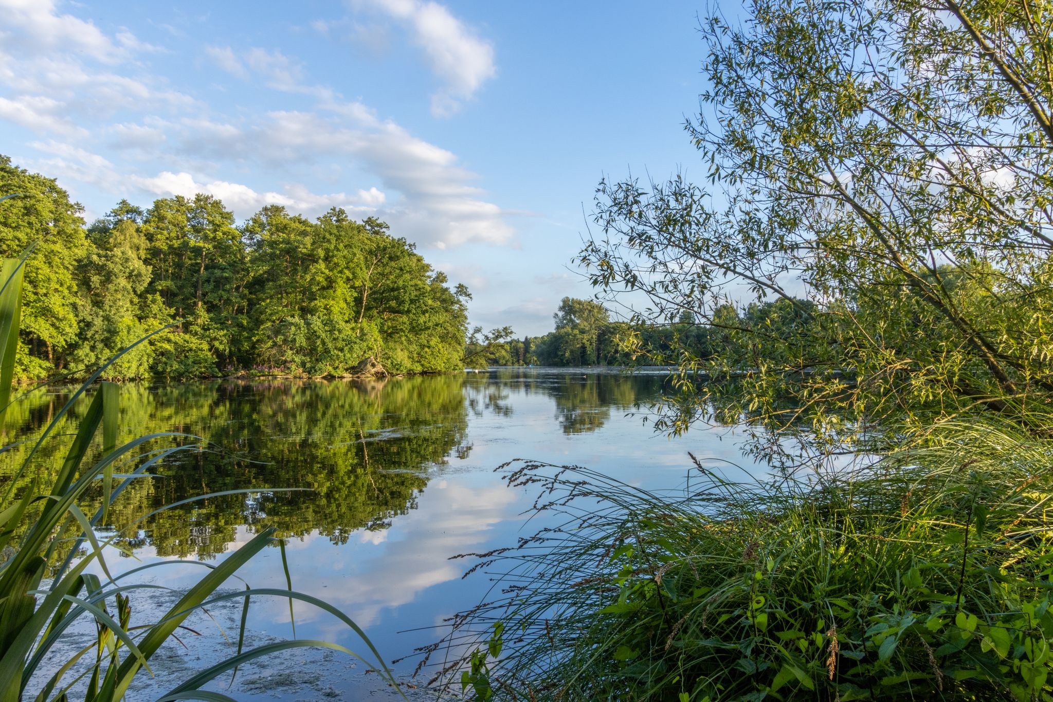
No traffic touring cycling routes around Hariksee are characterized by a flat, water-rich landscape within the Schwalm-Nette Nature Park. The region features an extensive network of wetlands, including rivers, streams, and lakes, with Hariksee itself being a central attraction. Riparian forests and bogs contribute to the diverse ecosystems, offering varied terrain for cyclists. The area's generally low elevation makes it suitable for touring cycling, with routes often passing through natural reserves and alongside water features.
Best no traffic touring cycling routes around Hariksee
- The most popular no traffic touring cycling route is Cycle Path Along the Schwalm – View of the Hariksee (Lake Harik) loop from Mühlrather Mühle, a 27.5 miles (44.3 km) trail that takes 2 hours 51 minutes to complete. This difficult route offers views of Hariksee and the surrounding wetlands.
- Another top favourite among local touring cyclists is Elmpter Swalmbruch Marshes – Cycle Path Along the Schwalm loop from Niederkrüchten, an easy 17.3 miles (27.9 km) path. This route winds through marshlands and along the Schwalm river.
- Local touring cyclists also love the Borner See viewpoint – Ferkensbruch Nature Reserve loop from Mühlrather Mühle, a 29.2 miles (47.0 km) trail leading through the Borner See viewpoint and Ferkensbruch Nature Reserve, often completed in about 2 hours 54 minutes.
- Touring cycling around Hariksee is defined by its water-rich landscape, riparian forests, and wetlands. The network offers options for different ability levels, from easy rides to more challenging routes.
- The routes in Hariksee are highly rated by the komoot community with an average score of 4.5 stars from over 7000 reviews. More than 32000 touring cyclists have used komoot to explore Hariksee's varied terrain.
Last updated: October 2, 2026
4.7
(100)
305
riders
Easy bike ride. Great for any fitness level. Mostly paved surfaces. Suitable for all skill levels.
4.7
(27)
75
riders
Moderate bike ride. Good fitness required. Mostly paved surfaces. Suitable for all skill levels.

3.8
(5)
11
riders
Easy bike ride. Great for any fitness level. Mostly paved surfaces. Suitable for all skill levels.
4.6
(5)
13
riders
61.2km
03:46
230m
230m
Moderate bike ride. Good fitness required. Mostly paved surfaces. Suitable for all skill levels.
4.6
(296)
930
riders
34.1km
02:08
140m
140m
Moderate bike ride. Good fitness required. Mostly paved surfaces. Suitable for all skill levels.
Get access to more routes and recommendations from other explorers.
Already have an account?
Our route recommendations are based on thousands of hikes, rides, and runs completed by other people on komoot.
Start today with a free account
Your next adventure awaits.

Other adventures around Hariksee

Tips from the Community

Haus Bey today belongs to the golf course and can also be used for weddings. One of the oldest buildings in Nettetal is the manor house of Haus Bey in Hinsbeck, built around 1450, also called "Schlösschen" by many. The estate was a secondary property of Krickenbeck, precisely a "Beij-Gut". The first evidence is an inheritance contract from 1521, in which the owner of Krickenbeck Castle, Reiner von Holthausen, bequeathed Haus Bey to his son Wilhelm. He subsequently lived on the estate. It was not until 1682 that the new owners of Krickenbeck Castle, the Freiherren von Schaesberg, acquired the knight's estate back.
8
0

The west side of the Nettebruch is a picturesque nature reserve and a renowned viewpoint located in the Nette River Lakes region (Netteseen) in North Rhine-Westphalia, Germany, near Nettetal and Viersen. Originally formed as a low moor (Niedermoor), the Nettebruch is today a popular destination for outdoor enthusiasts. Its western side is particularly famous as a scenic stopover or viewpoint on numerous cycling, hiking, and running routes mapped on platforms like Komoot.
1
1

In the center of the golf course
0
1

Redesigned square with nice benches.
1
0

beautiful hiking and cycling path between Nette and Nettebruch a great piece of nature
4
0
Fast route from Oberkrüchten to Herkenbosch.
9
1

This square has recently been completely redesigned. See picture two.
1
0

Frequently Asked Questions
How many no-traffic touring cycling routes are available around Hariksee?
There are over 550 no-traffic touring cycling routes around Hariksee, offering a wide variety of options for all skill levels. This includes more than 340 easy routes, 150 moderate routes, and 50 difficult routes, ensuring there's something for everyone.
What is the typical terrain and difficulty level of no-traffic touring cycling routes around Hariksee?
The Hariksee region, part of the Schwalm-Nette Nature Park, is characterized by its generally flat Lower Rhine landscape, making it ideal for touring cyclists. While most routes are easy to moderate, with minimal elevation gain, some longer routes may be classified as difficult due to distance. You'll find a mix of paved and unpaved surfaces, winding through wetlands, forests, and along the lake shores. For example, the Cycle Path Along the Schwalm – View of the Hariksee (Lake Harik) loop from Mühlrather Mühle is a longer, more challenging option, while the Mühlrather Mill – Borner Lake loop from Niederkrüchten offers an easier ride.
What natural features and attractions can I expect to see along these routes?
The no-traffic routes around Hariksee offer a rich tapestry of natural beauty and historical sights. You can expect to cycle through extensive wetlands, riparian forests, and past numerous lakes and streams. Key attractions include the picturesque Hariksee (Harik Lake) itself, the historic Mühlrather Mühle — Watermill and Restaurant, and unique natural monuments like the 'Tangle of roots'. Many routes also pass through the vast Schwalm-Nette Nature Park, offering diverse flora and fauna.
Are the no-traffic touring cycling routes around Hariksee suitable for families?
Yes, many no-traffic touring cycling routes around Hariksee are very family-friendly. The generally flat terrain and well-marked paths make them accessible for cyclists of all ages and skill levels. There are numerous easy tours available, perfect for a leisurely family outing. You can also find attractions like the Boat rental at Hariksee for additional family fun.
Can I bring my dog on these no-traffic touring cycling routes?
While specific regulations can vary, generally, dogs are welcome on leashes on most public cycling paths in the Hariksee region, especially within the Schwalm-Nette Nature Park. Given the natural environment, it's a great area for cycling with your canine companion. Always ensure your dog is well-behaved and that you clean up after them to maintain the natural beauty for everyone.
When is the best time of year to enjoy no-traffic touring cycling around Hariksee?
The Hariksee region is beautiful year-round, but the best time for no-traffic touring cycling is typically from spring to early autumn (April to October). During these months, the weather is generally mild, and the natural landscape, with its water features and forests, is at its most vibrant. Spring brings blooming flora, while autumn offers stunning foliage. Summer provides longer daylight hours, perfect for extended tours.
Are there any circular no-traffic touring cycling routes around Hariksee?
Yes, the Hariksee area offers several excellent circular no-traffic touring cycling routes. These loops allow you to start and end at the same point, making planning easier. An example is the Borner See viewpoint – Ferkensbruch Nature Reserve loop from Mühlrather Mühle, which provides a scenic round trip through diverse landscapes.
Is parking available for these no-traffic routes, and can I access them via public transport?
Parking is generally available at various starting points for routes around Hariksee, often near popular attractions like the Mühlrather Mühle or in nearby villages. The region's cycling infrastructure connects idyllic villages and towns, which may offer public transport links, though specific bus or train connections directly to trailheads might require local research. The flat landscape makes it easy to cycle to a starting point from a nearby public transport hub.
What do other touring cyclists enjoy the most about touring cycling in Hariksee?
The Hariksee region is highly rated by the komoot community, with an average score of 4.5 stars. Reviewers often praise the tranquil, water-rich landscape, the well-maintained no-traffic paths, and the opportunity to explore the diverse ecosystems of the Schwalm-Nette Nature Park. The blend of natural beauty, historical mills, and peaceful cycling experiences makes it a favorite among touring cyclists.
Are there places to eat or rest along the no-traffic touring cycling routes?
Yes, you'll find several opportunities for refreshments and rest stops along the routes. The Mühlrather Mühle — Watermill and Restaurant is a popular spot, offering both historical charm and dining. Additionally, Notre's Restaurant & Lakeside Terrace on Lake Hariksee provides a scenic place to relax by the water. Many routes pass through small villages where you can find cafes or local eateries.
What is the longest no-traffic touring cycling route around Hariksee?
Among the no-traffic touring cycling routes, one of the longer options is the Borner See viewpoint – Ferkensbruch Nature Reserve loop from Mühlrather Mühle, which spans approximately 47 kilometers. This route offers an extensive exploration of the region's diverse landscapes and natural reserves.
Most popular routes around Hariksee
Most popular attractions around Hariksee

Get inspired with the komoot mobile app


Explore more
Browse the best Cycling routes in other regions.
