The best family-friendly hikes and walks in the San Franciso Peaks
4.4
(132)
1,832
hikers
43
hikes
Family friendly hiking trails in the San Francisco Peaks traverse a landscape shaped by volcanic activity, featuring diverse ecosystems across significant elevation changes. The region is characterized by vast ponderosa pine forests on lower slopes, transitioning to mixed conifer and subalpine forests at higher altitudes. Hikers can experience unique features such as aspen groves and the expansive Inner Basin, a U-shaped valley surrounded by the peaks.
Best family friendly hiking trails in the San Francisco Peaks
- The most popular family friendly hiking route is Humphreys Peak Trail, a 4.8 miles (7.8 km) trail that takes 2 hours 31 minutes to complete. This moderate route offers views of the surrounding volcanic terrain.
- Another top favourite among local hikers is Mars Hill and Tunnel Springs Loop, a moderate 5.3 miles (8.5 km) path. This trail winds through forested areas, providing varied scenery.
- Local hikers also love the Sunset Trail, a 5.3 miles (8.4 km) trail leading through diverse forest types, often completed in about 2 hours 55 minutes.
- Hiking in the San Francisco Peaks is defined by volcanic terrain, extensive pine and aspen forests, and significant elevation changes. The network offers options for various ability levels, including many family friendly routes.
- The routes in San Francisco Peaks are highly rated by the komoot community with an average score of 4.4 stars from more than 80 reviews. More than 1,300 hikers have used komoot to explore San Francisco Peaks's varied terrain.
Last updated: July 8, 2026
5.0
(6)
35
hikers
7.81km
02:31
0m
980m
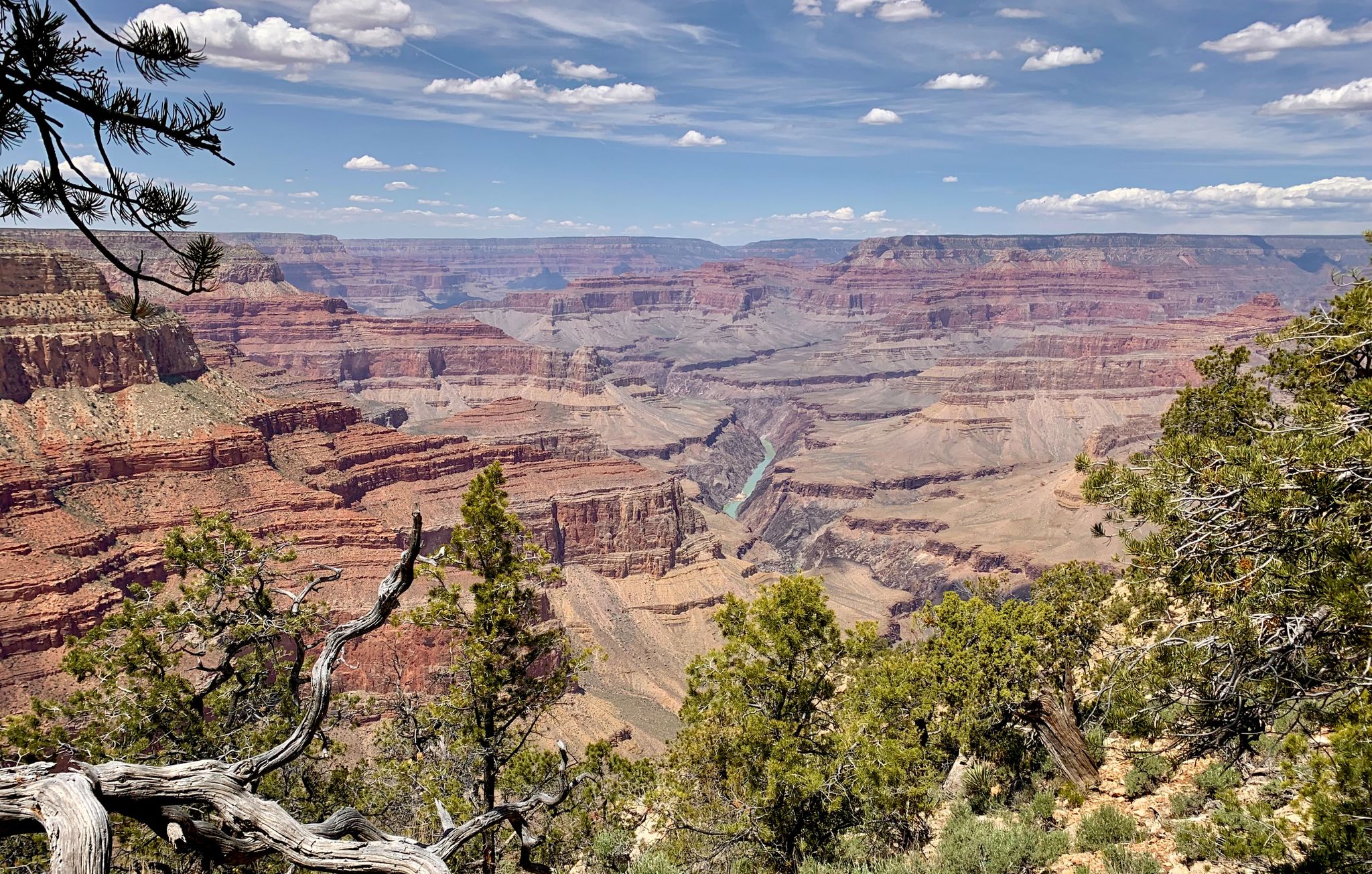
Embark on the Humphreys Peak Trail, a moderate hike covering 4.9 miles (7.8 km) with an estimated duration of 2 hours and 30 minutes. You'll start your journey through a beautiful forest filled with ponderosa pines and aspens, providing welcome shade as you ascend. As you climb, the path gradually opens up, revealing expansive views of the surrounding landscape. From the saddle, you can catch a glimpse into the inner basin of the ancient volcano that shaped the San Francisco Peaks. The summit offers a truly impressive 360-degree panoramic view of Northern Arizona, where on a clear day, you might even spot the distant Grand Canyon. Notably, this specific route has 0 feet (0 metres) of elevation gain, making it a unique and accessible high-altitude experience.
When planning your visit, be aware that the trailhead begins at a high elevation, so the thinner air can be a factor for some hikers. Weather conditions can change rapidly, especially once you are above the treeline, so expect potential for high winds and exposure. Always check the forecast before you go and be prepared for varying conditions to ensure a safe and enjoyable outing. Consider starting early in the day to avoid afternoon storms and to secure parking, as this popular trail can get busy.
This trail is situated within the Kachina Peaks Wilderness, an area known for its unique geology as part of an ancient volcanic field. The San Francisco Peaks, where Humphreys Peak is located, are the remnants of a stratovolcano that erupted millions of years ago. The diverse ecosystem you encounter, from the shaded forest to the exposed alpine tundra, supports a variety of wildlife. This route offers a distinct opportunity to experience a high-altitude environment with minimal elevation gain, providing a different perspective on the region's natural beauty.
5
hikers
30.1km
09:22
1,120m
1,110m
Embark on the Humphreys Peak, Weatherford and Kachina Trail Loop for a truly demanding high-mountain adventure. This difficult 18.7-mile (30.1 km) hiking route challenges you with a significant elevation gain of 3689 feet (1124 metres), requiring an estimated 9 hours and 22 minutes to complete. As you traverse this strenuous loop, you will experience diverse terrain, from dense forests and majestic aspen groves to the open expanse of high alpine tundra. Keep an eye out for ancient limber pines and giant ferns along the Kachina Trail, and enjoy panoramic vistas of the Inner Basin and the San Francisco Peaks. On clear days, you might even catch a glimpse of the Grand Canyon's North Rim from certain viewpoints, making the effort worthwhile.
Planning your visit requires careful consideration for this expert-level route. You should be prepared for significant elevation changes and the potential for altitude sickness; acclimatizing in Flagstaff beforehand is highly recommended. The Humphreys Peak Trailhead serves as the convenient starting point for this challenging loop, and you can find parking available there. Always check local conditions before you go, especially regarding weather and trail accessibility, to ensure a safe and enjoyable experience.
This loop combines three prominent trails within the Kachina Peaks Wilderness, offering a unique opportunity to explore the diverse ecosystems of the San Francisco Peaks. The route is known for its rocky sections, particularly at higher elevations, which add to the challenge and the rugged beauty of the landscape. You will encounter the distinct flora of the region, from the ancient trees to the varied plant life of the alpine tundra. This trail stands out as a comprehensive high-mountain experience for experienced hikers seeking a strenuous and rewarding journey.

Sign up for free
5
hikers
8.56km
02:25
230m
100m
Embark on the Mars Hill and Tunnel Springs Loop for a moderate hiking adventure that takes you through a serene ponderosa pine forest. This 5.3-mile (8.6 km) route features a mix of dirt and gravel surfaces, offering a steady climb through a steep draw on the Mars Hill section. You will gain 769 feet (234 metres) in elevation, and the abundant shade makes it a pleasant option even on warmer days. As you hike, you will weave through the pines, eventually reaching rewarding viewpoints that offer expansive vistas over the city of Flagstaff.
Planning your visit is straightforward, as the loop is easily accessible within Flagstaff, making it a popular choice for a quick escape into nature. Parking is generally available near the trailhead, and the navigation is simple, so you won't need advanced route-finding skills. While the trail is enjoyable year-round, be aware that conditions can change, and you should be mindful of potential ice on the trail during colder months.
This loop is nestled within the Observatory Mesa Natural Area, providing a refreshing break from urban life. The experience of hiking here connects you directly with the natural landscape surrounding Flagstaff. It is a great option if you are looking for a solid workout and a chance to immerse yourself in a picturesque setting without venturing far from the city.
4
hikers
20.2km
06:58
1,030m
1,240m
Embark on the Humphrey’s Peak - Weatherford - Inner Basin Loop, a difficult 12.5-mile (20.2 km) hike that challenges you with 3392 feet (1034 metres) of elevation gain. This route typically takes around 6 hours and 57 minutes to complete. As you ascend, you'll pass through varied terrain, from shaded forest paths to more exposed sections offering expansive views. The trail eventually leads you into the unique Inner Basin, a striking natural amphitheater that feels remote and wild.
Before you set out, consider spending a day or two in Flagstaff to help your body adjust to the high altitude, which can be a factor on this trail. It's also important to check current conditions, as snow can linger in the Inner Basin well into the summer months. Planning your visit carefully will ensure a more comfortable and enjoyable experience on this demanding route.
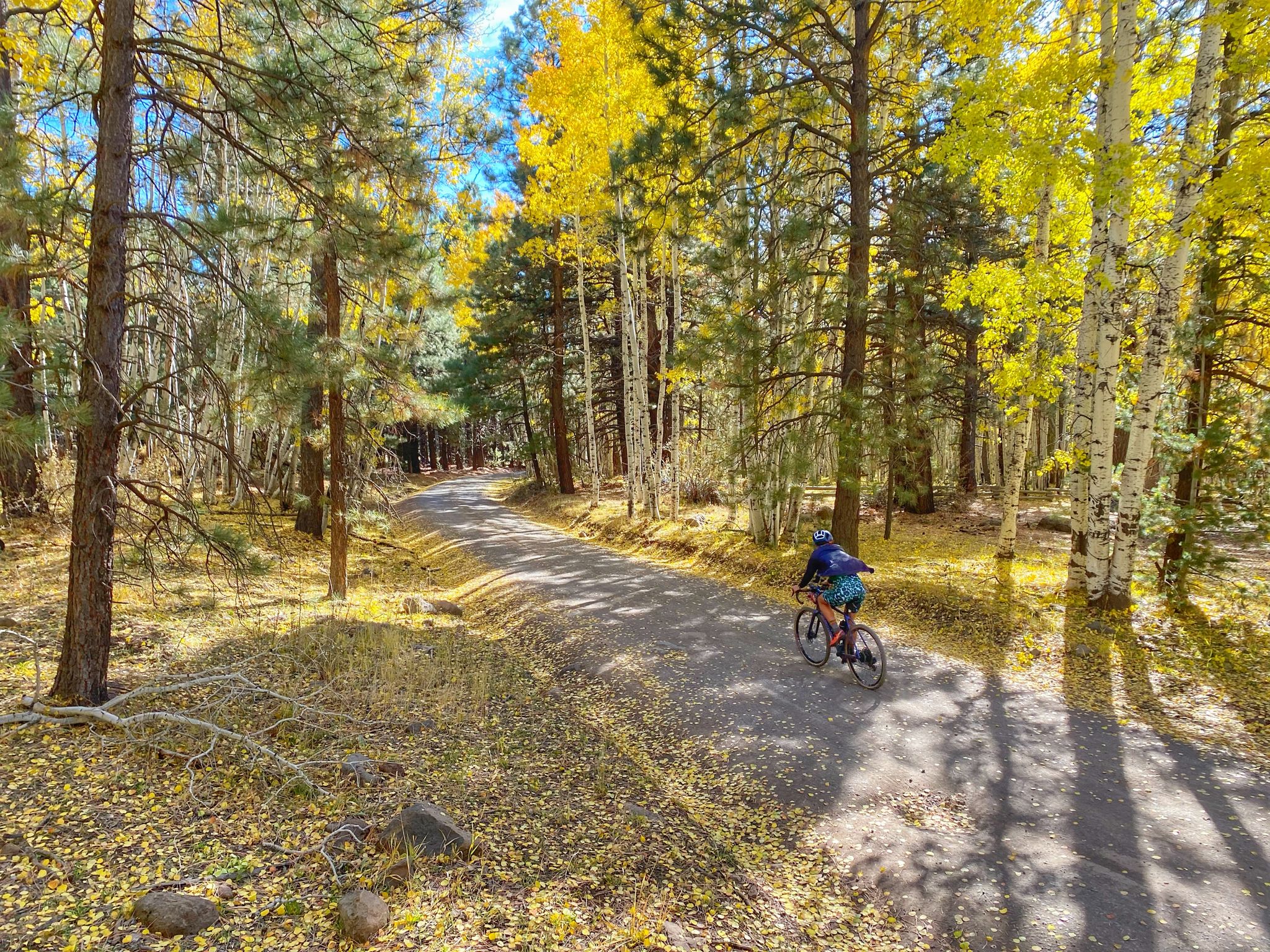
This loop takes you through the Kachina Peaks Wilderness, showcasing a remarkable transition of ecosystems. You'll witness areas recovering from past fires, alongside lush forests and high alpine tundra. The Inner Basin is particularly notable for its extensive aspen groves, which create a spectacular display of color, especially if you hike in early fall.
8.50km
02:55
470m
120m
Embark on the Sunset Trail for a moderate hike through the varied terrain of Coconino National Forest. You will experience a steady ascent, covering 5.3 miles (8.5 km) and gaining 1550 feet (472 metres) in elevation. The route culminates at the Elden Mountain Lookout Tower, where you can enjoy expansive panoramic views of the Arizona landscape. This journey, estimated to take around 2 hours and 55 minutes, offers a rewarding outdoor experience as you climb towards the scenic overlook.
Accessing the Sunset Trail is straightforward, with parking usually available close to the trailhead. Before you set out, it is always wise to check current local conditions. This is especially important for seasonal factors, such as potential snow in winter or extreme heat during summer months. Being prepared ensures you have a safe and pleasant hiking experience on the route.
This trail is a great option if you are looking for a solid workout while exploring the diverse natural beauty of Coconino National Forest. The effort of the climb is well rewarded with the sweeping vistas from the Elden Mountain Lookout Tower. It provides a fantastic opportunity to immerse yourself in the vast Arizona scenery and appreciate the unique ecosystem of the area.
Get access to more routes and recommendations from other explorers.
Sign up for free
Already have an account?
Our route recommendations are based on thousands of hikes, rides, and runs completed by other people on komoot.
Start today with a free account
Your next adventure awaits.
Login or Signup
Popular around San Franciso Peaks



Other adventures in the San Franciso Peaks


Tips from the Community

Park your car at this location and you will be right at the trailhead for Humphreys Peak Trail. Come early, especially on a weekend as the parking lot fills up quickly – and so does the trail. There are pit toilets at the trailhead.
2
0
A faint social trail with cairns leads to the wreckage of a B-24 Bomber that crashed into the mountain in September 1944 during a night test flight. Eight passengers from the army died in that tragic accident. There are still numerous parts of the plane scattered on a boulder field, so be careful if you try to get to this memorial.
4
0

As you ascend toward Snow Bowl or make your way back down, this is a fantastic spot to pause and enjoy the view of Kendrick Peak. It's one of the highest peaks in the San Francisco volcanic field.
1
0

With its highest point reaching 9,288 feet, it is a formidable challenge for cyclists. The most popular route, Elden Lookout Road, is a 12.5-mile climb with an elevation gain of over 3,500 feet, testing your endurance and legs. As you ascend, you'll be rewarded with breathtaking panoramic views of the San Francisco Peaks, the city of Flagstaff, and the surrounding valleys, making the effort truly worthwhile.
1
0

The steep trail up Elden Mountain challenges runners with its punishing incline, but those who persevere are rewarded with breathtaking 360-degree views of northern Arizona's landscape from the 9,300-foot summit. Remember to pack plenty of water for a well-deserved break at the top to take in the stunning vistas.
0
0

From Fremont Saddle, you will get views of Fremont Peak to the east and Agassiz Peak to the west. This spot on the trail is still nestled between some trees, but be prepared for more extreme weather conditions just a bit further up the mountain, as this spot sits right at treeline.
0
0
There is a reason that the Kachina Trail is one of the most popular trails outside of Flagstaff. This particular point on the trail offers an array of beautiful views. To be fair, this entire route is worthy of a camera.
1
0
Elden Mountain (also known as Mount Elden) is Flagstaff's local mountain, towering over 2,000 feet above the city. Climbing this peak will take you through aspen groves, rocky outcrops, and the remains of a burned forest. The tower at the top is not to be climbed, but you are still exposed to 360 views from the peak and saddle.
1
0
Frequently Asked Questions
How many family-friendly hiking trails are available in the San Francisco Peaks?
There are over 40 hiking routes in the San Francisco Peaks, with 14 specifically rated as easy and suitable for families. These trails offer a range of experiences, from gentle forest walks to more adventurous paths.
What makes the San Francisco Peaks a good destination for family hiking?
The San Francisco Peaks offer a unique blend of diverse ecosystems, from vast ponderosa pine forests to stunning aspen groves, making for varied and engaging family hikes. The region's volcanic history also provides interesting geological features to explore, and many trails offer beautiful views and opportunities for wildlife spotting.
Are there any easy loop trails suitable for families?
Yes, there are several loop trails that are great for families. For a moderate option, consider the Mars Hill and Tunnel Springs Loop, which offers a pleasant walk through varied terrain. These loops are excellent for keeping younger hikers engaged.
Can we bring our dog on these family-friendly trails?
Many trails in the San Francisco Peaks are dog-friendly, but it's always best to check specific trail regulations before you go. Generally, dogs should be kept on a leash to protect wildlife and ensure a pleasant experience for all hikers. Always remember to pack out any waste.
What kind of natural features or landmarks can we expect to see on family hikes?
You'll find a variety of natural wonders. Many trails wind through beautiful ponderosa pine and aspen forests. You might also encounter volcanic features, such as those near Sunset Crater or the unique Red Mountain Amphitheater. Higher elevation trails offer views of the surrounding landscape, including distant peaks like Humphreys Peak.
When is the best time of year to go hiking with family in the San Francisco Peaks?
The San Francisco Peaks are beautiful year-round, but for family hiking, late spring through early fall is ideal. Summer offers pleasant temperatures and lush greenery, while autumn is spectacular with the vibrant golden colors of the aspen groves. Always be prepared for changing weather conditions, especially at higher elevations.
Are there any shorter, beginner-friendly options for families with young children?
Yes, there are several easy and shorter trails perfect for beginners and young children. These often feature gentle grades and well-maintained paths through the lower elevation forests. Look for trails specifically marked as 'easy' in the guide for the most suitable options.
Where can we find parking for family-friendly trailheads?
Most popular trailheads in the San Francisco Peaks area have designated parking lots. However, during peak seasons, especially on weekends or during the fall color change, these can fill up quickly. Arriving early in the morning is recommended to secure a spot. Some areas may require a recreation pass.
Is public transport available from Flagstaff to the trailheads?
Public transportation options directly to many of the remote trailheads from Flagstaff are limited. While Flagstaff itself has public transit, reaching the more secluded hiking areas in the San Francisco Peaks typically requires a personal vehicle. Some shuttle services might operate seasonally to specific popular spots like Snowbowl, but it's best to check local Flagstaff visitor information for current options.
What do other hikers say about the family-friendly trails in the San Francisco Peaks?
The family-friendly trails in the San Francisco Peaks are highly rated by the komoot community, with an average score of 4.4 stars. Reviewers often praise the stunning natural beauty, the well-maintained paths, and the peaceful atmosphere, making them perfect for a day out with the family.
Are there any specific trails that showcase the famous fall aspen colors?
Absolutely! The San Francisco Peaks are renowned for their spectacular fall foliage, especially the golden aspens. While many trails offer glimpses, areas like Aspen Corner and trails that traverse the Inner Basin are particularly breathtaking during the autumn months. The Sunset Trail also provides beautiful views of the changing leaves.
What wildlife might we encounter on family hikes in the San Francisco Peaks?
The diverse ecosystems of the San Francisco Peaks support a variety of wildlife. Hikers might spot deer, elk, various bird species, and smaller mammals like squirrels and chipmunks. Keep an eye out for tracks and listen for bird calls. Remember to observe wildlife from a distance and never feed animals.
Are there any unique geological features we can explore with kids?
Yes, the volcanic origins of the San Francisco Peaks offer fascinating geological exploration. The San Francisco Peaks themselves are the eroded remnants of a stratovolcano. You can explore cinder cones and ancient lava flows, providing a unique educational experience for children about the Earth's natural processes.
Most popular routes in the San Franciso Peaks
Most popular attractions in the San Franciso Peaks

Get inspired with the komoot mobile app


Explore more
Browse the best Hikes in other regions.
