The best family-friendly hikes and walks around Bad Brückenau
4.6
(1462)
6,119
hikers
156
hikes
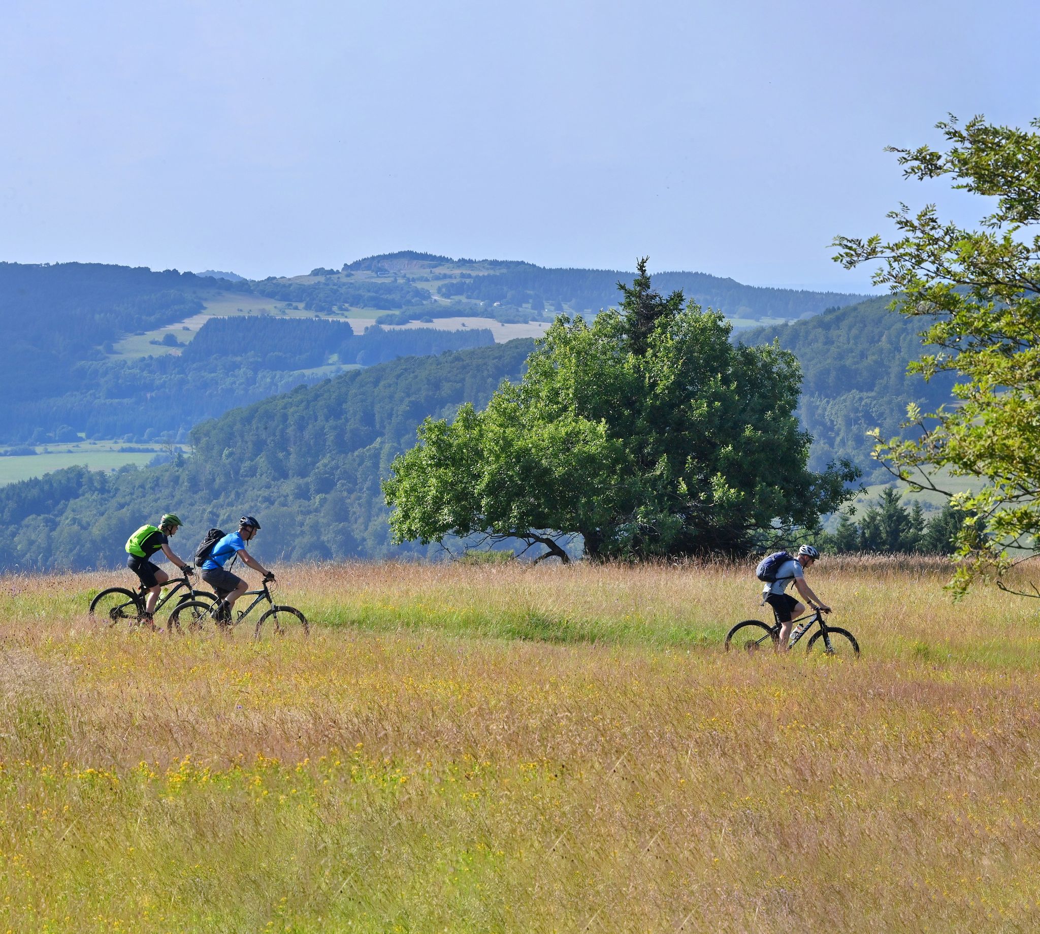
Family friendly hiking trails around Bad Brückenau are situated within the picturesque Sinn Valley, part of the Bavarian Rhön Nature Park and UNESCO Rhön Biosphere Reserve. This region features a diverse landscape of low mountain ranges with volcanic origins, characterized by dome-shaped summits and expansive open plateaus. Trails often follow the Sinn River through dense woodlands, rolling hills, and varied terrains including meadows and unique basalt rock formations. The area offers a well-developed network of signposted routes suitable for various…
Last updated: May 15, 2026
4.5
(212)
679
hikers
9.14km
02:44
260m
270m
Moderate hike. Good fitness required. Easily-accessible paths. Suitable for all skill levels.
4.5
(110)
533
hikers
Easy hike. Great for any fitness level. Easily-accessible paths. Suitable for all skill levels.

Sign up for free
4.5
(73)
294
hikers
7.04km
02:13
170m
170m
Moderate hike. Good fitness required. Mostly accessible paths. Sure-footedness required.
4.7
(54)
208
hikers
Moderate hike. Good fitness required. Mostly accessible paths. Sure-footedness required.
4.1
(46)
235
hikers
Easy hike. Great for any fitness level. Easily-accessible paths. Suitable for all skill levels.
Get access to more routes and recommendations from other explorers.
Sign up for free
Already have an account?
Our route recommendations are based on thousands of hikes, rides, and runs completed by other people on komoot.
Start today with a free account
Your next adventure awaits.
Login or Signup


Other adventures around Bad Brückenau


Tips from the Community

The approximately 70 km long Sinn is the largest tributary of the Fränkische Saale in the German states of Bavaria and Hesse. It rises in the Rhön and flows predominantly southwards. Its confluence with the Fränkische Saale is shortly before its confluence with the Main. Source: Wikipedia
1
0
The Sinn, approximately 70 km long, is the largest tributary of the Fränkische Saale in the German states of Bavaria and Hesse. It originates in the Rhön and flows predominantly southwards. Its confluence with the Fränkische Saale is shortly before its confluence with the Main. Source: Wikipedia
1
0

The Kursaal building, dating from 1830, is one of the most important buildings in the state spa of Brückenau.
6
0
This pergola has grown beautifully.
6
0

Beautiful view of the Rhön and surrounding area.
0
0
Short steep climb, especially at the beginning.
0
0


Frequently Asked Questions
How many family-friendly hiking trails are available around Bad Brückenau?
Bad Brückenau offers a wide selection of family-friendly hiking trails. You'll find over 150 routes suitable for various skill levels, with 69 classified as easy and 82 as moderate, ensuring there's something for every family.
What are some easy, short hikes suitable for families with young children?
For an easy and engaging walk, consider the Beaver Water World on the Sinn – Beaver Platform Sinnaue loop from Staatsbad Brückenau. This 4.2-kilometer path along the Sinn River is perfect for observing local wildlife and the river ecosystem. Another short option is the Beaver Water World on the Sinn – Beaver Platform Sinnaue loop from Züntersbach, which is just over 3 kilometers.
Are there any circular routes that are good for families?
Yes, many of the trails around Bad Brückenau are circular, making them convenient for families. The Extratour Königsweg - Bad Brückenau - Rhön is a popular 9.1-kilometer premium circular trail known for its scenic views. For a longer option, the Sinntal circular trail, starting from the spa park, follows the Sinn River through forests and hills.
What kind of natural landscapes can we expect to see on family hikes in Bad Brückenau?
The region, nestled within the Rhön Mountains and a UNESCO Biosphere Reserve, offers incredibly diverse landscapes. You'll encounter dense woodlands, rolling hills, expansive meadows, and picturesque river valleys along the Sinn River. The area is often called the 'Land of Open Vistas' due to its panoramic views from largely wood-free mountain tops.
Are there any specific landmarks or points of interest along the family-friendly trails?
Absolutely! Many trails incorporate interesting sights. The Elisabethenhof, Bad Brückenau – Bad Brückenau Spa Park loop takes you through the historic Spa Park, a natural monument with ancient trees and historical buildings. You might also encounter unique rock formations, historic mills, and vantage points offering stunning views. The nearby Basalt Lake Tintenfass is another interesting natural feature.
What do other hikers enjoy most about hiking in Bad Brückenau?
The komoot community highly rates the trails around Bad Brückenau, with an average score of 4.6 out of 5 stars from over 1,400 ratings. Hikers frequently praise the well-maintained paths, the stunning panoramic views from the 'Land of Open Vistas,' and the peaceful, diverse natural environment of the Rhön Biosphere Reserve.
Are there any trails suitable for strollers or buggies?
While many trails are natural paths, some sections, particularly within the Bad Brückenau Spa Park and along the Sinn River, are generally flat and well-maintained, making them more accessible for strollers. For specific stroller-friendly routes, look for trails explicitly marked as accessible or paved, often found closer to the town center or along river promenades.
Can we access hiking trails in Bad Brückenau using public transport?
Yes, Bad Brückenau has public transport connections that can help you reach various starting points for hikes. The town itself is a hub, and local bus services often connect to surrounding villages and trailheads within the Rhön region. It's advisable to check local bus schedules for specific routes and timings to plan your trip effectively.
What is the best time of year for family hikes in Bad Brückenau?
The spring, summer, and autumn months generally offer the most pleasant conditions for family hiking in Bad Brückenau. Spring brings blooming wildflowers, summer provides lush green landscapes, and autumn showcases vibrant foliage. The 'Land of Open Vistas' is beautiful year-round, but these seasons offer comfortable temperatures and optimal trail conditions.
Are there any moderate family hikes with good viewpoints?
For families looking for a bit more challenge and rewarding views, the Ruheforst Rhön – Beaver Platform Sinnaue loop from Züntersbach offers moderate terrain and scenic sections. Additionally, the Dreistelz (Dreistelzkopf) and Platzer Kuppe summits, accessible via various paths, are known for providing excellent panoramic views across the Rhön landscape.
Most popular routes around Bad Brückenau
Most popular attractions around Bad Brückenau

Get inspired with the komoot mobile app


Explore more
Browse the best Hikes in other regions.
