Top 17 Natural Monuments around Goulier
Best natural monuments around Goulier are located within the commune of Val-de-Sos in the Ariège department of southwestern France. This region is characterized by a rich natural landscape, featuring diverse geological formations and significant biodiversity. The area offers a range of natural features, from high-altitude plateaus to extensive cave systems and mountain peaks.
Best natural monuments around Goulier
- The most popular natural monuments is Agnès Pass, a mountain pass that offers scenic views of the Etang de Lers. The…
Last updated: July 5, 2026
Agnès Pass
Highlight • Mountain Pass
Translated by Google •
Tip by

Lers Pass
Highlight • Mountain Pass
Translated by Google •
Tip by

Sign up now to discover places like this
Get recommendations on the best single tracks, peaks, & plenty of other exciting outdoor places.
Sign up for free
Tristaina Solar Viewpoint
Highlight • Viewpoint
Translated by Google •
Tip by

Montcalm Peak
Highlight • Summit
Translated by Google •
Tip by

Saleix Pass
Highlight • Summit
Translated by Google •
Tip by

Sign up for free to discover even more natural monuments around Goulier.
Sign up for free
Already have an account?
Start today with a free account
Your next adventure awaits.
Login or Signup
Tips from the Community

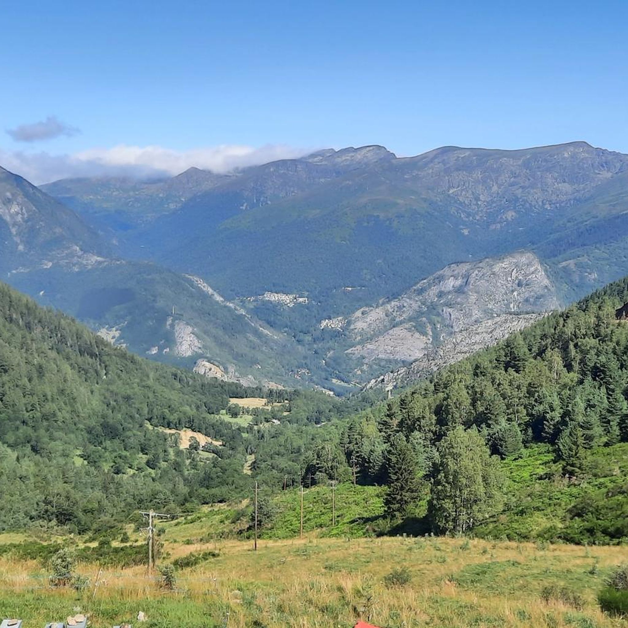
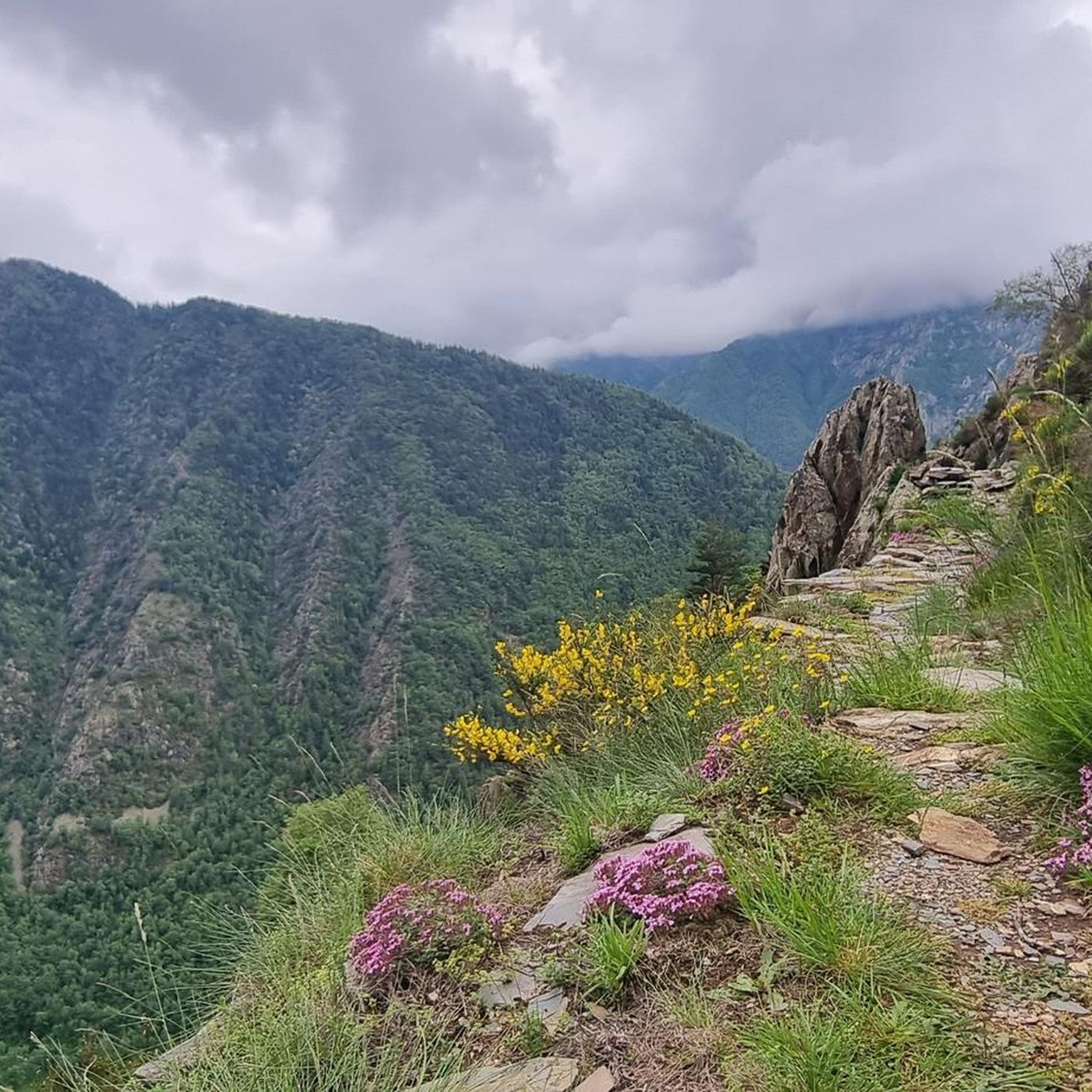
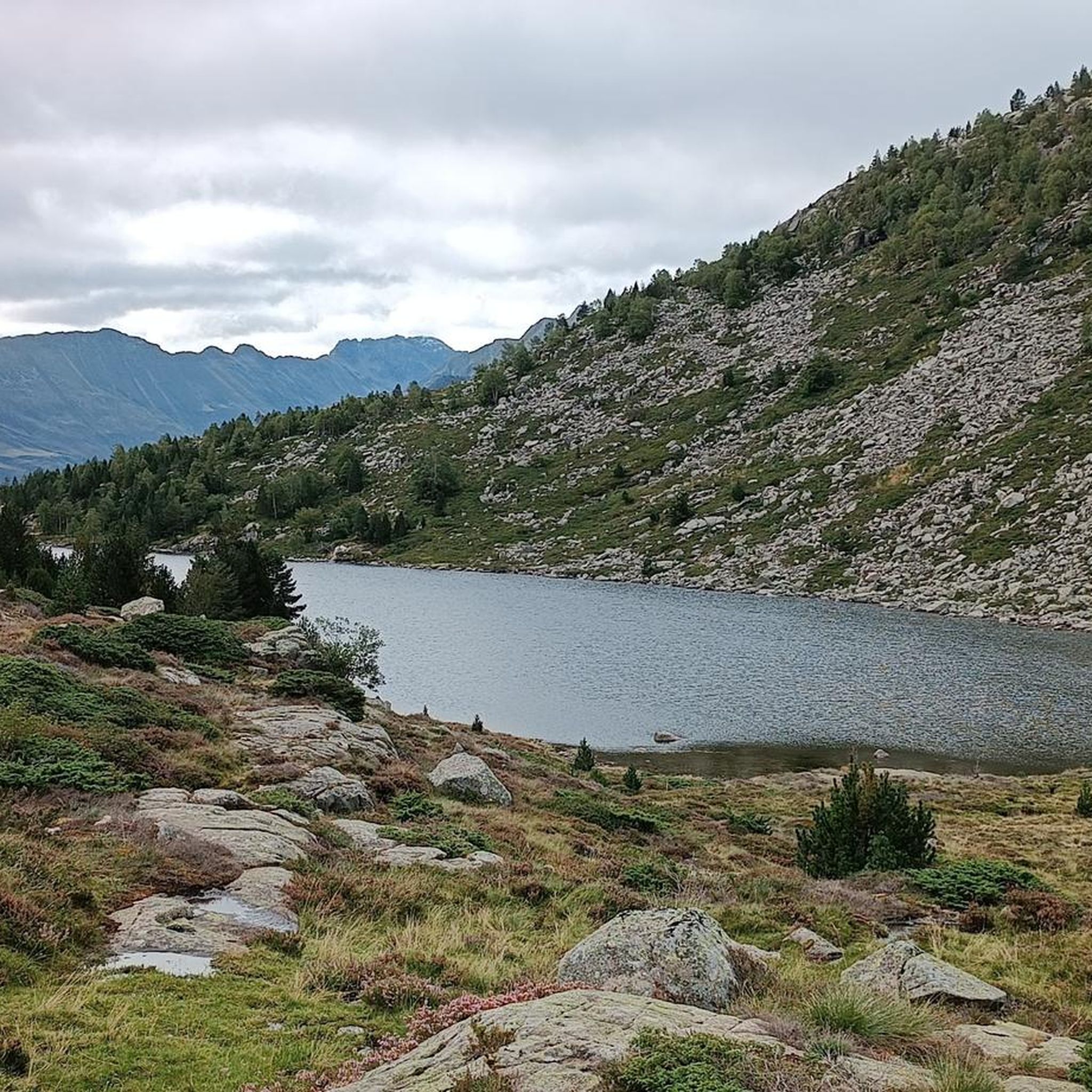
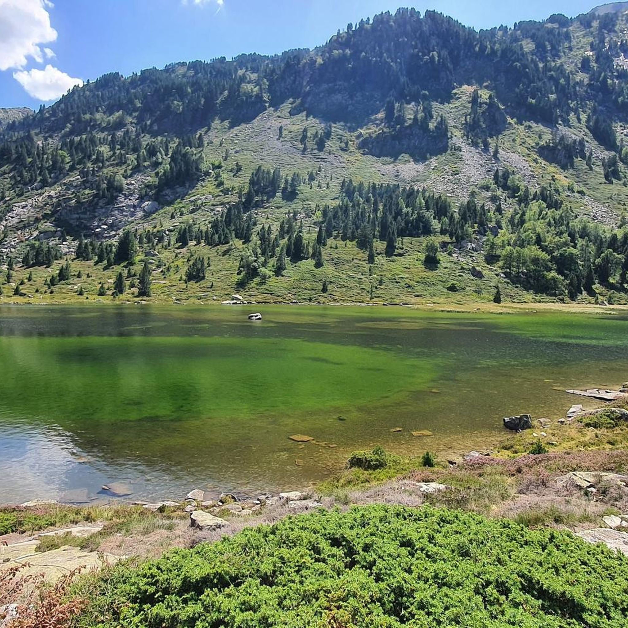
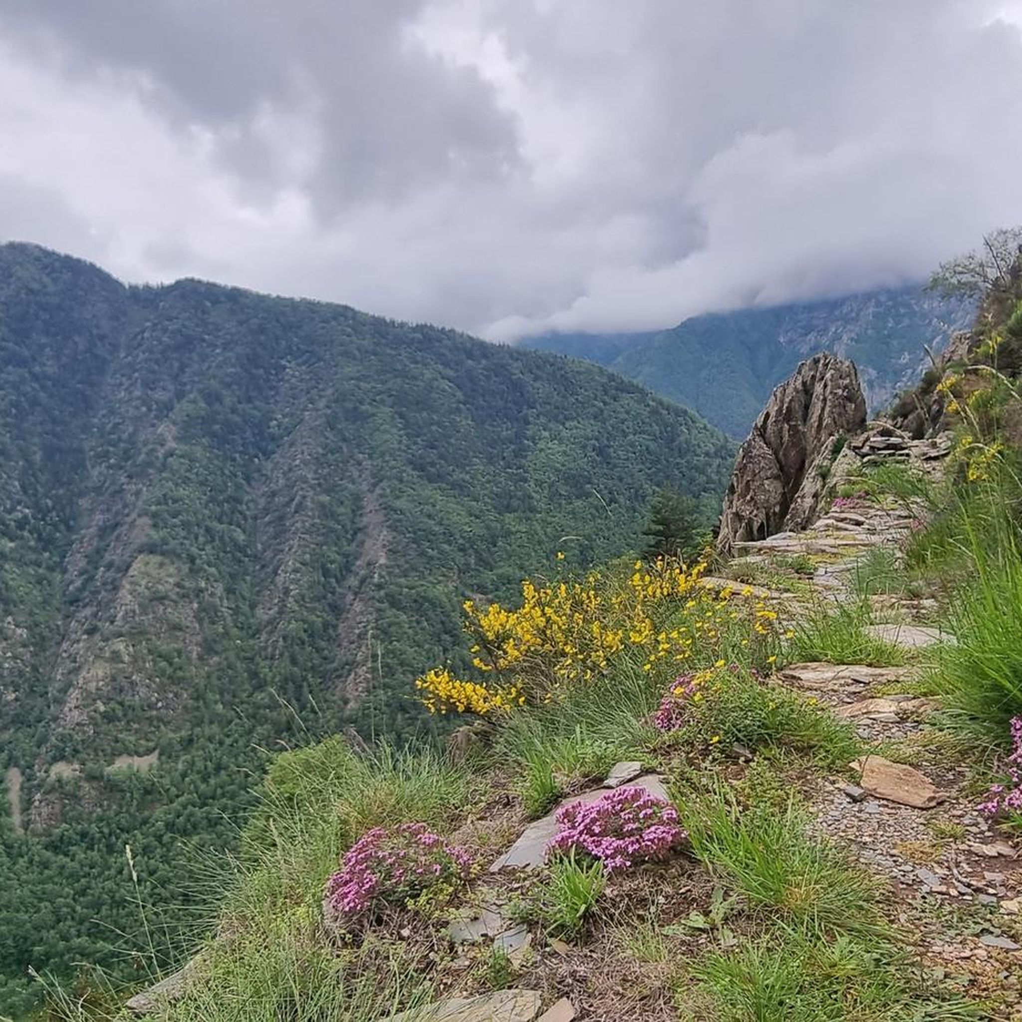
It is a MUST of the Pyrenees, without a doubt, that should be included in any route that crosses the Pyrenees from side to side. Any of its slopes 2 is spectacular and tough. The views from its summit are wonderful, feeling the wild side of the Pyrenees. Of course, once at the summit of this pass... you have to descend to the Étang de Lers and enjoy a quiet rest on the shores of the lake. It is a pass that has been part of the Tour de France route on several occasions, although always far from the finish line. The first professional rider to crest it in the lead was the unforgettable Marco Pantani in 1995.
0
0

I liked the climb from the north side (from Massat), very scenic and alpine landscapes towards the end at the étang de Lers
0
0

Solar viewpoint on the Peyraguils pass or summit, a metal structure that allows a 360° view of the valleys of the Andorran Pyrenees and the Aran Valley, with views of Aneto.
2
0

I think making this peak a highlight of my run is quite a challenge. Taking the easiest route via the Refuge de Pinet would be at least challenging mountain trail running. Inexperienced runners should definitely be aware of the altitude and terrain.
0
0
Here again: Someone is rating ALL photos of highlights in this region (Northwest Pyrenees) "not accurate," even though they accurately depict the location? Why does anyone need to do that? Is it jealousy? Does someone want to drag down others' "expert" ratings? How pathetic.
1
1
A well-known 3000-meter peak entirely on the French side, with a flat summit (and bivouac stone walls). There are four ascent routes: -from the east from the Étang de Soulcem (T4) -from the north via the Refuge du Pinet (T3+) -from the northeast (steep T4+ gully, dangerous in icy conditions) -from the Spanish side (south) with an easy intermediate descent (T3+) Designed as a "mountain hiking" highlight, as some tours go beyond simple "hiking." I combined the tour with the Sotllo (T4+).
2
0
I created the summit myself as a "highlight" for mountain hiking, as my chosen long loop, including the Pic de Sotllo, was a bit more challenging. The "normal route" via the Refuge de Pinet is technically easier and lacks any real climbing. However, I find the mountain hiking category more appropriate due to the altitude and terrain. Unfortunately, Komoot makes my highlight invisible to others on the map. As has happened with several of my previous highlights in other regions, where I marked the only point.
0
0
This 3000-meter peak on the French side of the Pyrenees' main ridge is relatively easy to reach via the Refuge de Pinet, but requires a significant elevation gain from the parking lot. Therefore, using the hut is recommended; it also has a room open in winter (€8 unattended). Another ascent from the northeast allows for a "crossing," but it has a steep gully (which, when icy, almost caused me a nasty fall in October 2014). A third ascent option leads from the east, from the reservoir, over the shared pass with the Pica d'Estats. Needless to say, there's a fantastic view from the summit. Only the view to the south is limited by the slightly higher Pica d'Estats, which is why hikers with good fitness and surefootedness are recommended to climb the latter from the shared pass.
1
0
Frequently Asked Questions
What are some of the most popular natural monuments to visit around Goulier?
Visitors to the Goulier area frequently enjoy the stunning views from Agnès Pass, known for its beautiful western approach and panoramic vistas. Another favorite is the Tristaina Solar Viewpoint, which features a unique sundial and offers impressive views of the Arcalís Valley and the Pyrenees from 2701 meters.
Are there any significant historical or geological natural monuments in the Goulier region?
Yes, the region is rich in both historical and geological wonders. The Lombrives Cave, often called Europe's largest cave, is a remarkable subterranean system formed over 20 million years, with historical ties to Neolithic humans, Cathars, and Huguenots. Another significant site is the Niaux Cave, internationally renowned for its exceptionally well-preserved Paleolithic cave paintings dating back 14,000 to 17,000 years.
What kind of natural features can I expect to see around Goulier?
The Goulier area, nestled within the Parc naturel régional des Pyrénées Ariégeoises, offers a diverse range of natural features. You can explore high-altitude plateaus like the Plateau de Beille, extensive cave systems such as Lombrives and Niaux, and numerous mountain passes and summits. Expect to see varied landscapes from limestone foothills to high mountain peaks, along with unique geological formations and rich biodiversity.
What outdoor activities can I do near the natural monuments around Goulier?
The natural monuments around Goulier are excellent starting points for various outdoor activities. You can find numerous mountain hikes, running trails, and mountain biking routes. For example, there are challenging mountain hikes like the Pic Verdaguer – Pica d'Estats Summit loop or the Pic des Trois Seigneurs loop. For more options, explore the dedicated guides for Mountain Hikes around Goulier, Running Trails around Goulier, and MTB Trails around Goulier.
Are there any family-friendly natural monuments or activities in the Goulier area?
While some natural monuments involve challenging terrain, many offer accessible experiences. Exploring the vast chambers of Lombrives Cave can be a fascinating adventure for families, offering a glimpse into geological formations and history. The Parc naturel régional des Pyrénées Ariégeoises also provides numerous opportunities for gentle walks and appreciating nature, though specific family-friendly trails should be checked for difficulty.
What is the best time of year to visit the natural monuments around Goulier?
The best time to visit largely depends on the type of natural monument you wish to explore. For high-altitude plateaus and mountain passes like Agnès Pass or Lers Pass, late spring to early autumn (May to October) offers the most favorable weather for hiking and scenic drives. Caves like Lombrives and Niaux can be visited year-round, though tour availability might vary by season. Winter transforms the Plateau de Beille into a cross-country skiing resort.
Can I find impressive panoramic views from any natural monuments near Goulier?
Absolutely. The region is known for its breathtaking viewpoints. Tristaina Solar Viewpoint offers spectacular panoramic views of the Arcalís Valley and the Pyrenees. Similarly, Agnès Pass and Lers Pass provide impressive vistas of the surrounding Pyrenees and the Etang de Lers. For a truly high-altitude experience, Montcalm Peak, at 3,077 meters, offers an expansive view of the French side.
What makes the Plateau de Beille a significant natural monument?
The Plateau de Beille is recognized as a 'Natural Zone of Ecological Interest, Fauna and Flora (ZNIEFF)' due to its diverse habitats, including short lawns, forests, moorland, and bogs. It's home to rare and protected plant species like oblong-leaved sundew. Beyond its ecological importance, it offers stunning panoramic views of the Pyrenees and is a crossing point for the GR 10 hiking trail, also serving as a cross-country skiing resort in winter.
What do visitors say about the natural monuments around Goulier?
Visitors frequently praise the scenic beauty and tranquility of the area. For instance, the western approach to Agnès Pass is often described as a 'feast for the eyes,' offering wonderful views. The Lers Pass is appreciated for its pleasant road, low traffic, and impressive views through old oak stands. Many find the views from high points like Tristaina Solar Viewpoint to be 'incredible' and 'spectacular'.
Are there any challenging natural monuments for experienced hikers or climbers?
Yes, for those seeking a challenge, Montcalm Peak is a prominent 3,077-meter summit, one of the largest in Ariège, offering several challenging ascent routes. The Saleix Pass also presents a significant climb with magnificent views, often described as a 'dream for lowlanders to hike up here'.
What is the Parc naturel régional des Pyrénées Ariégeoises and its significance to the Goulier area?
The Parc naturel régional des Pyrénées Ariégeoises is a vast protected area covering nearly 2,500 square kilometers, encompassing the Goulier and Val-de-Sos region. It safeguards an exceptional natural heritage, from limestone foothills to high mountain peaks, and is a sanctuary for diverse flora and fauna, including endemic and threatened species. The park's presence ensures the preservation of the unique natural monuments and landscapes found here.
Most popular attractions around Goulier

Get inspired with the komoot mobile app


Explore more
Extend your search for the best caves by checking out these guides of the top ones around Goulier:
