Easy hikes and walks around Area E (Saint Mary/Skookumchuck)
4.3
(15)
148
hikers
20
hikes
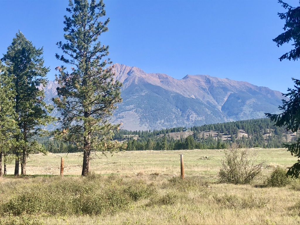
Hiking around Area E (Saint Mary/Skookumchuck) offers a variety of easy trails within the Canadian Rockies, characterized by its position in the Rocky Mountain Trench. The landscape features a mix of forested areas, river valleys, and access to several provincial parks known for their lakes and diverse ecosystems. This region provides opportunities to explore natural features such as the St. Marys River and various emerald green lakes. The terrain is generally accessible, making it suitable for easy hiking.
Best easy…
Last updated: November 15, 2026
5.0
(1)
6
hikers
2.42km
00:42
60m
60m
Easy hike. Easily walkable paths.
3
hikers
926m
00:15
10m
10m
Easy hike. Easily walkable paths.

5.56km
01:35
150m
80m
Easy hike. Easily walkable paths.
1.03km
00:18
30m
30m
Easy hike. Easily walkable paths.
4.8
(5)
31
hikers
6.46km
01:51
150m
150m
Easy hike. Easily walkable paths.
Get access to more routes and recommendations from other explorers.
Already have an account?
Our route recommendations are based on thousands of hikes, rides, and runs completed by other people on komoot.
Start today with a free account
Your next adventure awaits.
Popular around Area E (Saint Mary/Skookumchuck)

Other adventures around Area E (Saint Mary/Skookumchuck)


Tips from the Community

While the waterfall is the main attraction, the boardwalk out to the falls isn't something to rush through. Though only 300 metres long, this path goes through stunning scenery that you'll want to savour instead of rushing out to Marysville Falls.
0
0
This stunning 30-metre high waterfall is easily accessible from Marysville. The water cascades over the rock while surrounded by cedar and fir trees, making this one of the most picturesque locations in the region.
0
0

At the end of the Perry Creek Trail in East Kootenay, you reach Perry Creek Falls, where the creek drops over a rugged rock face into a narrow gorge. The viewpoint is set slightly back, so you’re looking across at the falls rather than right beside them, but you still get a clear view of the cascade and the surrounding forest. After following the creek the whole way, this feels like a natural turnaround point and the highlight of the hike.
0
0
The Perry Creek Trail in East Kootenay is a short out-and-back route that follows the creek through dense forest toward a waterfall. The path is easy to follow for most of the way, with a mix of dirt trail and a few rougher sections where the ground can be uneven or washed out. You stay close to the water as you walk, with the sound of the creek alongside you, before reaching a viewpoint at Perry Creek Falls.
0
0

Findlay Falls Trail follows Findlay Creek and ends at Findlay Falls. This trail offers elevated views of the creek rushing through a small gorge below and passes through a beautiful forest.
0
0
Findlay Falls is best seen in the spring, when the water is running at its strongest. The falls are easy to access and incredibly scenic, but can dry up to a trickle mid-summer.
0
0

The Ram Creek Hot Springs Trail starts by heading west out of the parking area on a Forest Service Road that climbs gently through the forest. You will exit the tree cover where the road then becomes more of a trail; continue on until you reach a small clearing. From there, you should start to hear the water. Go just uphill to the right to reach the springs.
0
0
Ram Creek Hot Springs is a set of remote, undeveloped, natural hot springs located within the Ram Creek Ecological Reserve. The pools offer great views of the surrounding mountains and forest.
0
0
Frequently Asked Questions
How many easy hiking trails are available in Area E (Saint Mary/Skookumchuck)?
There are 7 easy hiking trails specifically identified in Area E (Saint Mary/Skookumchuck). In total, the region offers 15 routes for various difficulty levels.
Are there any easy loop trails in Area E (Saint Mary/Skookumchuck)?
Yes, several easy loop trails are available. For instance, the Canuck Lake – Yankee Lake loop from Premier Lake Provincial Park offers scenic views of both lakes. Another option is the View of Mount Fisher – Scenic Hillside Trail loop from Kimberley Riverside Campground, which provides pleasant hillside terrain.
What kind of views can I expect on easy hikes in Area E (Saint Mary/Skookumchuck)?
Easy hikes in this region offer diverse scenery, from the majestic Canadian Rockies and the Rocky Mountain Trench to serene emerald green lakes like those in Premier Lake Provincial Park. You can also expect forested areas, river valleys, and panoramic viewpoints, such as those found along the St. Marys River Forest Service Road.
Are there family-friendly hiking options in Area E (Saint Mary/Skookumchuck)?
Yes, the easy trails are generally suitable for families. Wasa Lake Provincial Park, located south of Skookumchuck, offers easy lakeside trails perfect for all ages, along with swimming and nature viewing. The Butte loop from Butte is another shorter, easy option.
Can I bring my dog on the easy hiking trails in Area E (Saint Mary/Skookumchuck)?
Many trails in the region are dog-friendly, but it's always best to check specific park regulations before heading out. Provincial parks like Premier Lake and Wasa Lake often have designated areas or rules for pets. Always keep your dog on a leash and clean up after them.
What are some notable natural attractions to see while hiking in the area?
The region is rich in natural beauty. You can explore emerald green lakes such as Canuck, Yankee, Cats Eye, and Quartz. The Lussier and Skookumchuck Rivers converge with the Kootenay River, offering scenic waterways. The Ram Creek Hot Springs — Ram Creek Ecological Reserve trail leads to a unique natural feature.
What is the best season for easy hiking in Area E (Saint Mary/Skookumchuck)?
The warmer months, typically late spring through early autumn, are ideal for easy hiking in Area E. During this time, trails are generally clear of snow, and the weather is pleasant for exploring the diverse landscapes and enjoying the lakes and rivers.
Are there any easy trails that lead to hot springs?
Yes, the Ram Creek Hot Springs — Ram Creek Ecological Reserve is an easy 5.6 km trail that takes you towards the ecological reserve, known for its hot springs. It's a popular choice for those looking to combine a gentle hike with a natural thermal experience.
What do other hikers say about the easy trails in Area E (Saint Mary/Skookumchuck)?
The easy trails in Area E (Saint Mary/Skookumchuck) are highly regarded by the komoot community, with an average rating of 4.5 out of 5 stars from 8 reviews. Hikers often praise the accessible terrain, scenic lake views, and the opportunity to experience the Canadian Rockies' natural beauty.
Are there any easy trails near Kimberley or Cranbrook?
Yes, the region offers easy trails accessible from nearby towns. For example, the View of Mount Fisher – Scenic Hillside Trail loop from Kimberley Riverside Campground is a popular easy route near Kimberley. Another option close to Kimberley is the Eimers Lake loop from Kimberley.
Are there any trails with unique ecosystems to explore?
Yes, Wasa Lake Provincial Park, located south of Skookumchuck, features a unique ecosystem of wheatgrass and ponderosa pines. It offers easy lakeside trails and a self-guided interpretation trail, providing a different natural experience for visitors.
What is the typical duration for an easy hike in this area?
The easy hikes in Area E (Saint Mary/Skookumchuck) vary in length and duration. For example, the Ram Creek Hot Springs — Ram Creek Ecological Reserve trail typically takes about 1 hour and 35 minutes, while the View of Mount Fisher – Scenic Hillside Trail loop can be completed in about 1 hour and 14 minutes. Shorter options like the Butte loop from Butte take around an hour.
Most popular routes around Area E (Saint Mary/Skookumchuck)
Most popular attractions around Area E (Saint Mary/Skookumchuck)

Get inspired with the komoot mobile app


Explore more
Browse the best Hikes in other regions.
