Routes

Planner

Features

Updates

App

Login or Signup

Get the App

Login or Signup

Login or Signup

Routes
Hikes
United States
New York
Suffolk County

Rocky Point Pine Barrens State Forest

Routes
Hikes
United States
New York
Suffolk County

Rocky Point Pine Barrens State Forest

The best walks and hikes in Rocky Point Pine Barrens State Forest

5.0

(5)

39

hikers

21

hikes

Hiking in Rocky Point Pine Barrens State Forest offers routes through a large, protected woodland area in Suffolk County. The landscape is defined by its pine barrens ecosystem, with sandy, relatively flat trails winding through the forest. This area was formerly the site of a large RCA radio transmitting center, and remnants of its history can be found along some of the paths.

Best hiking trails in Rocky Point Pine Barrens State Forest

  • The most popular hiking route is Paumanok Path loop — Rocky Point Pine Barrens State Forest, a 9.9 mile (15.9 km) trail that takes about 4 hours to complete. This moderate hike follows a section of the long-distance Paumanok Path.
  • Another top favourite among local hiking enthusiasts is Panamoka Pine Barrens State Forest to Otis Pike Preserve West via Paumanok Path, a moderate 6.5 mile (10.4 km) path. The route connects two distinct forest preserves on well-marked trails.
  • Local hiking enthusiasts also love the Tarkill Pond Complex loop from Brookhaven State Park, a 5.1 mile (8.1 km) trail leading through mixed woodland, often completed in about 2 hours.
  • Hiking in Rocky Point Pine Barrens State Forest is defined by sandy tracks, extensive pine woodlands, and flat terrain. The network of trails offers options for different ability levels, though most routes are considered moderate due to their length.
  • The routes in Rocky Point Pine Barrens State Forest are highly rated by the komoot community with an average score of 5.0 stars from a number of reviews. More than 20 hikers have used komoot to explore Rocky Point Pine Barrens State Forest's varied terrain.

Last updated: May 12, 2026

#1.

Raymond P. Corwin Trail

3.22km

00:49

10m

20m

Explore the easy Raymond P. Corwin Trail, a 2.0-mile (3.2 km) hiking route through the Rocky Point Pine Barrens State Forest. You will experience a gentle journey with only 31 feet (10 metres) of elevation gain, taking approximately 49 minutes to complete. The northern sections offer engaging views of the unique Pine Barrens landscape, while other parts follow doubletrack paths, making it a straightforward walk perfect for a quick outdoor escape.

When planning your hike on the Raymond P. Corwin Trail, be aware that certain sections can become overgrown, particularly during late summer. This might make the path a bit challenging to follow at times, so paying attention to your route is important. It is also worth noting that the total length of the trail can vary depending on the specific section you choose to explore. Confirming your intended route beforehand will help ensure a smooth experience.

This trail serves as a key access point to larger networks, including the Paumanok Trail, allowing you to extend your adventure into Suffolk County's natural areas. It is a family-friendly route, and dogs are welcome to join you on your hike. The trail offers a glimpse into the distinctive Pine Barrens ecosystem, providing a peaceful natural setting.

Navigate with device

Send to Phone

Save

Easy

Embark on a difficult 18.2 miles (29.3 km) hiking adventure along the Paumanok Path, stretching from Rocky Point to Manorville. This route immerses you in Long Island's unique Pine Barrens, featuring rolling terrain, pitch pines, ferns, and blueberries. You will experience a total elevation gain of 305 feet (93 metres), with the journey typically taking around 7 hours and 28 minutes to complete. Keep an eye out for the distinctive Wooden Footbridge crossing a branch of the Peconic River, and the serene Sandy and Grassy Ponds.

When planning your visit, note that the trail is well-marked with white blazes, making navigation simple. While parking is generally available at trailheads, it is wise to confirm specific details for the Rocky Point or Manorville ends before you set out. Given the significant distance and duration, an early start is recommended to comfortably complete this challenging hike. Remember to assess your endurance for this long section of the path.

This segment of the Paumanok Path offers a deep exploration of the region's natural environment. As you hike, you will climb across the Ronkonkoma Moraine, reaching some of the highest points and descending into interesting kettle holes. The trail provides a unique opportunity to witness the diverse ecosystems of Long Island's Pine Barrens, showcasing its ecological significance and distinct landscape features.

Hard
guide_signup
Let us show you the way with the komoot mobile app
With a free komoot account, you can easily find, customize, and navigate endless outdoor adventures.

Sign up for free

5.0

(1)

4

hikers

Embark on the Paumanok Path and Red Trail Loop for a moderate hike through the distinctive pine barrens of Rocky Point Pine Barrens State Forest. This route covers 9.9 miles (15.9 km) with a gentle elevation gain of 134 feet (41 metres), typically taking around 4 hours and 1 minute to complete. You will navigate varied terrain, including rolling hills and intriguing kettle holes, passing by features like the "Junction to sandpits" as you explore the diverse ecosystems.

For an optimal experience, consider hiking this loop during the shoulder seasons of spring or autumn, particularly after the first frost, to minimize encounters with ticks and chiggers. Cooler temperatures also simplify water management, as on-trail refilling options are limited, so plan to carry enough water for your journey. Convenient parking is usually available at the trailhead for day use, making access straightforward.

This trail offers a deep dive into Long Island's unique natural heritage, showcasing a landscape shaped by glacial activity. You will discover a blend of pine forests, glacial kettles, and erratic rocks, all contributing to the area's distinct ecological character. The route provides an excellent opportunity to appreciate the specific beauty and geological history of the region's pine barrens.

Moderate

3

hikers

8.11km

02:04

30m

20m

The Green Trail offers a moderate hiking experience, guiding you through natural woodlands on well-maintained paths. This route is generally flat, making it a comfortable journey where you can enjoy the park's scenery without significant challenges. You will cover 5.0 miles (8.1 km) and gain 84 feet (26 metres) in elevation, typically taking about 2 hours and 4 minutes to complete.

When planning your visit, remember that the Green Trail is a multi-use path, so you might encounter other outdoor enthusiasts enjoying the area. It's always a good idea to check for trailhead parking information before you head out to ensure a smooth start to your hike. Make sure to carry enough water, as amenities can be limited along certain sections of the route.

This trail is an excellent choice if you are new to hiking or looking for a family-friendly option that provides a gentle introduction to nature. Its manageable distance and minimal elevation gain make it accessible for many, offering a refreshing escape into the natural environment of Brookhaven State Park.

Moderate

2

hikers

Step into the serene Prosser Pines Loop Trail, an easy hike that takes you through a unique preserve dominated by towering white pines. You will find yourself surrounded by these impressive trees, some reaching nearly 100 feet high, creating a peaceful, almost hushed atmosphere. The path itself is a soft carpet of pine needles, making for a pleasant walk over its 1.5 miles (2.4 km) distance, with a gentle elevation gain of just 62 feet (19 metres). This route is designed for a quick escape into nature, typically taking around 36 minutes to complete.

Planning your visit is straightforward, as the trail is accessible year-round, offering a convenient option whenever you need a nature break. Free parking is available on site, making it easy to start your adventure. If you have a canine companion, they are welcome to join you, provided they remain on a leash. Keep in mind that there are no restrooms or benches along the trail, so plan accordingly for your comfort.

What makes this trail particularly notable is the distinct environment created by the dense stand of white pines, which is quite unique for the region. As you walk, you might spot some makeshift teepees constructed from large logs, adding a playful element that families often enjoy. This specific ecosystem offers a tranquil experience, allowing you to feel far removed from the everyday world, even for a short duration.

Easy
Sign up for free to see 17 more hikes in Rocky Point Pine Barrens State Forest.

Get access to more routes and recommendations from other explorers.

Sign up for free

Already have an account?

Our route recommendations are based on thousands of hikes, rides, and runs completed by other people on komoot.

Start today with a free account

Your next adventure awaits.

Login or Signup

Popular around Rocky Point Pine Barrens State Forest
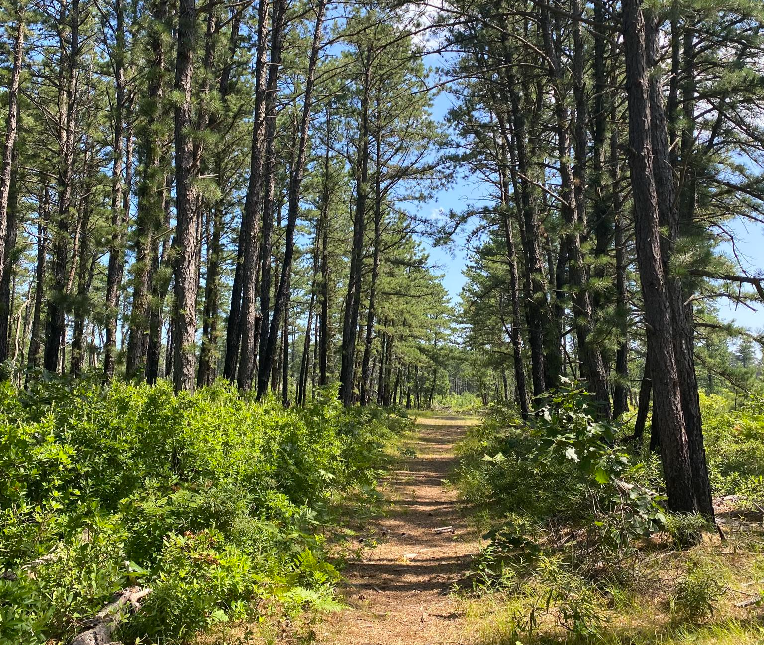
The Paumanok Path — Exploring Long Island's beachside pine barrens

MTB Trails in Rocky Point Pine Barrens State Forest
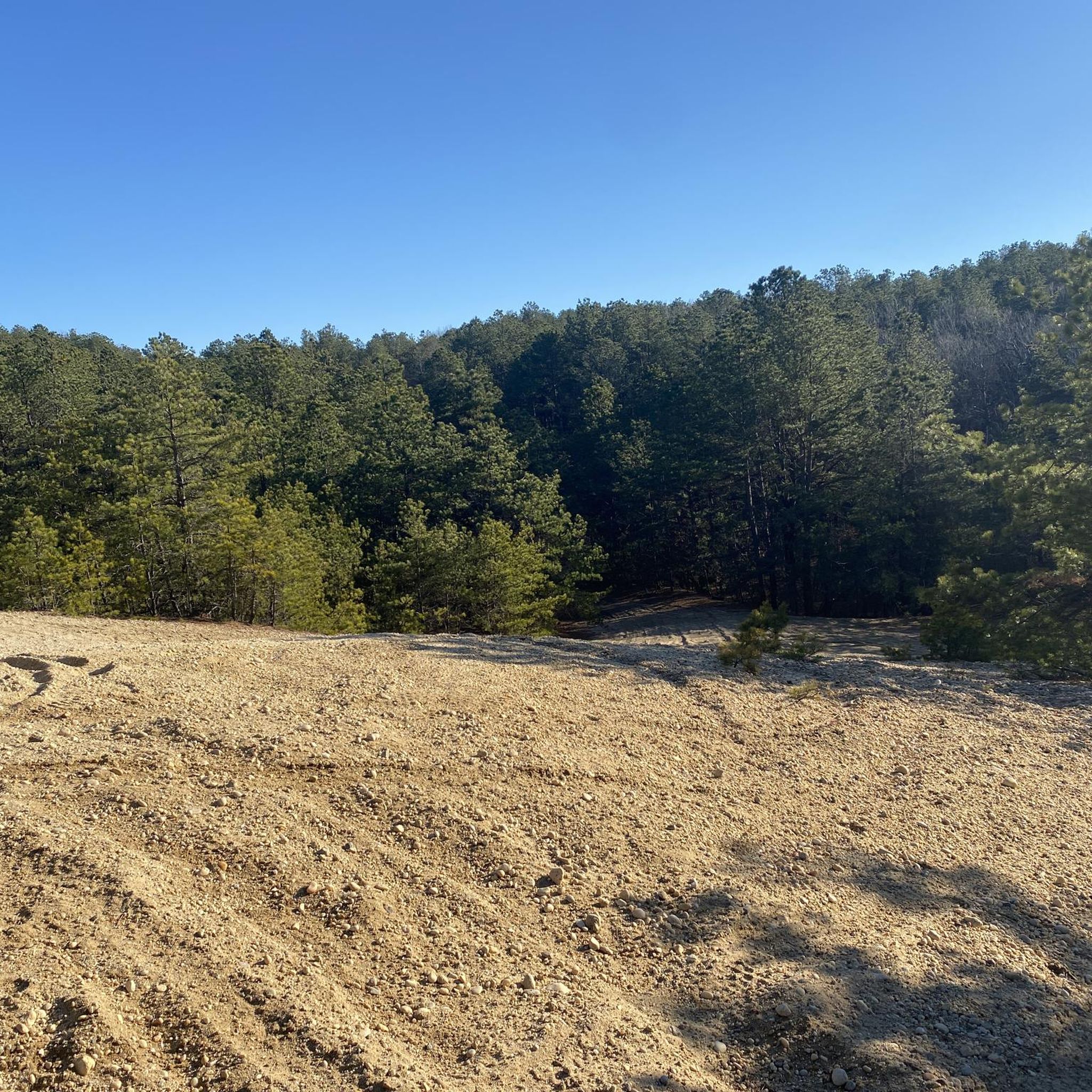
Cycling in Rocky Point Pine Barrens State Forest

Road Cycling Routes in Rocky Point Pine Barrens State Forest

Running Trails in Rocky Point Pine Barrens State Forest

Other adventures in Rocky Point Pine Barrens State Forest

The Paumanok Path — Exploring Long Island's beachside pine barrens

Hiking Collection by

Zachary

Tips from the Community

oliviakellis
May 27, 2024, Wooden Footbridge on Paumanok Path

Along the Paumanok Path, hikers encounter a charming wooden footbridge that helps in crossing the creek. Despite its modest size, the bridge exudes a rustic charm that complements the natural surroundings.

0

0

This trail junction offers two distinct experiences at Rocky Point Pine Barrens State Park. Take the southeast turn that leads to the sandpits, where daring bikers perform thrilling tricks amid the sandy terrain, providing an adrenaline-fueled spectacle. Or continue on the Paumanok Path and immerse yourself in nature's tranquility.

0

0

Rocky Point Pine Barrens State Forest offers a unique glimpse into Long Island's history as the former site of RCA's massive radio transmitting center. While most structures have been dismantled, remnants such as concrete tower foundations, old utility poles, and piles of cables serve as reminders of the area's past. The forest itself is crisscrossed with a network of flat trails, some recently created and others dating back to when the site was actively serviced. These well-maintained paths make the area ideal for hiking, biking, and even cross-country skiing during snowy winters.

0

0

Great singletrack, but watch out for hairpin trees, and spiderwebs.

0

0

Leads to the Manorville Main Loop that is a blast to ride! Lots of climbs but never very long, a good workout.

0

0

Frequently Asked Questions

Are dogs allowed in Rocky Point Pine Barrens State Forest?

Yes, dogs are permitted in the state forest, but they must be kept on a leash at all times. The sandy, wide trails are great for walking with your canine companion, but please be mindful of other users like mountain bikers and horseback riders.

Is Rocky Point Pine Barrens State Forest suitable for beginner hikers?

The terrain is mostly flat and the trails are generally wide, which makes it accessible for beginners. However, many of the marked loops are quite long. If you're new to hiking, it's a good idea to start with a shorter out-and-back walk and use a navigation app to track your distance, as the trail network can be confusing.

What are the trail conditions like?

The trails are predominantly sandy and can be loose in some sections, which is characteristic of the pine barrens ecosystem. The terrain is relatively flat with very little elevation change. After heavy rain, some areas can become muddy or have standing water, but the sandy soil allows for quick drainage.

How long are the hiking trails?

Trail lengths vary significantly. You can find shorter walks of just a few miles or combine trails for much longer hikes. For example, the Cathedral Pines County Park loop is a moderate route of about 5.1 miles (8.3 km). Many hikers create their own routes using the extensive network of numbered trails.

Are the trails better for hiking or mountain biking?

The trails are popular for both hiking and mountain biking. The relatively flat, sandy terrain offers a fast ride for bikers, while the extensive network provides hikers with miles of peaceful woodland to explore. Both groups share the trails, so it's important to be aware of your surroundings.

What is the history of the Rocky Point Pine Barrens?

The area has a unique history as the former site of the RCA Radio Central transmitting station, which was once the largest in the world. While hiking, you can still see some historical remnants, such as the large concrete foundations where the radio towers once stood.

What kind of wildlife might I see?

The pine barrens ecosystem supports a variety of wildlife. You may encounter white-tailed deer, various bird species including pine warblers and eastern towhees, and reptiles like the eastern box turtle. The area is a designated Bird Conservation Area, making it a great spot for birdwatching.

What are the numbered signs along the trails for?

The numbered signs are emergency trail rescue markers. In case of an emergency, you can give the number of the nearest sign to 911 dispatchers, which helps them pinpoint your exact location within the vast trail network.

How does hiking here compare to Brookhaven State Park?

Both parks are part of the Long Island Pine Barrens and share a similar landscape of pine and oak forests with sandy trails. Rocky Point is significantly larger and has a more extensive and complex trail network, making it popular for longer hikes and mountain biking. Brookhaven offers a more compact trail system but connects directly to other preserves.

What should I bring for a hike in the Pine Barrens?

It's essential to bring plenty of water, especially in the summer, as the trails are often exposed to the sun. Good footwear is recommended for the sandy paths. Since the trail network is extensive, a reliable GPS device or a map and compass are crucial for navigation. Insect repellent is also advisable during warmer months.

Are there any other activities besides hiking and biking?

Yes, the preserve is a multi-use area. Besides hiking and mountain biking, horseback riding is popular on the designated trails. Seasonal hunting and trapping are also permitted in certain areas, so it's a good idea to wear bright colors during hunting season for safety.

What do other hikers think of the trails here?

The area is highly rated by the komoot community. Reviewers often praise the peacefulness of the vast woodlands and the well-maintained, wide trails that are perfect for both leisurely walks and more strenuous, long-distance hikes.

Most popular routes in Rocky Point Pine Barrens State Forest

Easy hikes in Rocky Point Pine Barrens State Forest

Store rating

Get inspired with the komoot mobile app

With a free komoot account, you can easily find, customize, and navigate endless outdoor adventures.

or

Join komoot Now

Store rating

Explore more

Browse the best Hikes in other regions.

Mount SinaiBaiting HollowLongwood Pine Barrens State ForestManorvilleSaint JamesMasticLake RonkonkomaRiverheadRiversideNorth Bay ShoreNesconsetVillage of IslandiaEastportEastport Pine Barrens State ForestTerryvilleGordon HeightsBrentwoodPoquottRocky PointCoramVillage of ShorehamEast Bartlett Pine Barrens State ForestBrookhaven Pine Barrens State ForestRonkonkomaArthur Kunz County ParkNissequogue River State ParkMiller PlaceCathedral Pines County ParkCentral IslipNissequogueKings ParkHolbrookSpringsHauppaugeCommackMorichesCenter MorichesLake GroveEast QuogueWesthamptonFlandersShirleyStony Brook UniversityMontaukRemsenburg-SpeonkCalverton Pine Barrens State ForestNorthamptonSoutholdSound BeachSeldenYaphankShelter IslandIslip TerraceBayard Cutting Arboretum State ParkSeatuck National Wildlife RefugeConnetquot River State Park PreserveNorth Great RiverSag HarborMiddle IslandRidgeRobert Cushman Murphy County ParkEast NorthportAsharokenAmagansettSmithtownVillage Of The BranchNorth AmityvilleStony BrookWest IslipCalvertonPort JeffersonPort Jefferson StationBelle TerreWest BabylonOrient Beach State ParkOrientEast MarionHead Of The HarborMedfordBay ShoreMontauk County ParkKatherine Ordway Wildlife RefugeWading RiverSunken Meadow State ParkEast ShorehamBrookhaven State ParkPanamoka Pine Barrens State ForestNorth HavenQuogue Wildlife RefugeBridgehamptonNoyackSagaponackFarmingvilleJamesportAquebogueCentereachDeer ParkSayville National Wildlife RefugeHeckscher State ParkEast IslipGreat RiverOakdaleNorth BellportIslipHampton BaysBohemiaNorthwest HarborWainscottEast Hampton NorthEast HamptonElwoodBayportNorthportWest Bay ShoreFire IslandSuffolk County ParkCaleb Smith State ParkCold Spring HarborCold Spring Harbor State ParkEast SetauketWheatley HeightsMontauk Point State ParkCamp Hero State ParkWildwood State ParkBrightwatersPatriot'S Hollow State ForestOld FieldSetauketWest HillsSouth HuntingtonTarget Rock National Wildlife RefugeHenry'S Hollow Pine Barrens State ForestShelter Island HeightsFort SalongaGreenport WestVillage of GreenportWest SayvilleWyandanchEast PatchogueTerrell River County ParkHuntington BayGreenlawnSayvilleEatons NeckHoltsvilleCenterportCarmans River Pine Barrens State ForestBaywoodEast MorichesFishers IslandCaptreeCaptree State ParkOak BeachGilgo State ParkShadmoor State ParkRheinstein Estate ParkEast FarmingdaleNorth LindenhurstAmityvilleCopiagueLindenhurstHither Hills State ParkGilgoHuntington StationLloyd HarborQuogueWertheim National Wildlife RefugeDering HarborHalesiteHuntingtonWesthampton BeachQuiogueFire Island National SeashoreMelvilleElizabeth A. Morton National Wildlife RefugeNapeagueDix HillsMastic BeachTuckahoeBelmont Lake State ParkNorth BabylonBabylonShinnecock HillsSaltaireNorthvilleLaurelRobert Moses State Park (Long Island)PeconicCutchogueNapeague State ParkWest Hampton DunesBrookhavenNorth SeaSans Souci County ParkAmagansett National Wildlife RefugeConscience Point National Wildlife RefugeWater MillNew SuffolkBellportSouthamptonNorth PatchogueBlue Point

Nearby adventure guides

Things to Do around Rocky Point

background

Get ready to conquer new peaks

Sign up for Free

Explore
RoutesRoute plannerFeaturesHikesMTB TrailsRoad cycling routesBikepackingSitemap
Download the app
Follow Us on Socials

© komoot GmbH

Privacy Policy

