The best waterfall hikes and walks in the Deister
4.6
(12866)
50,096
hikers
17
hikes
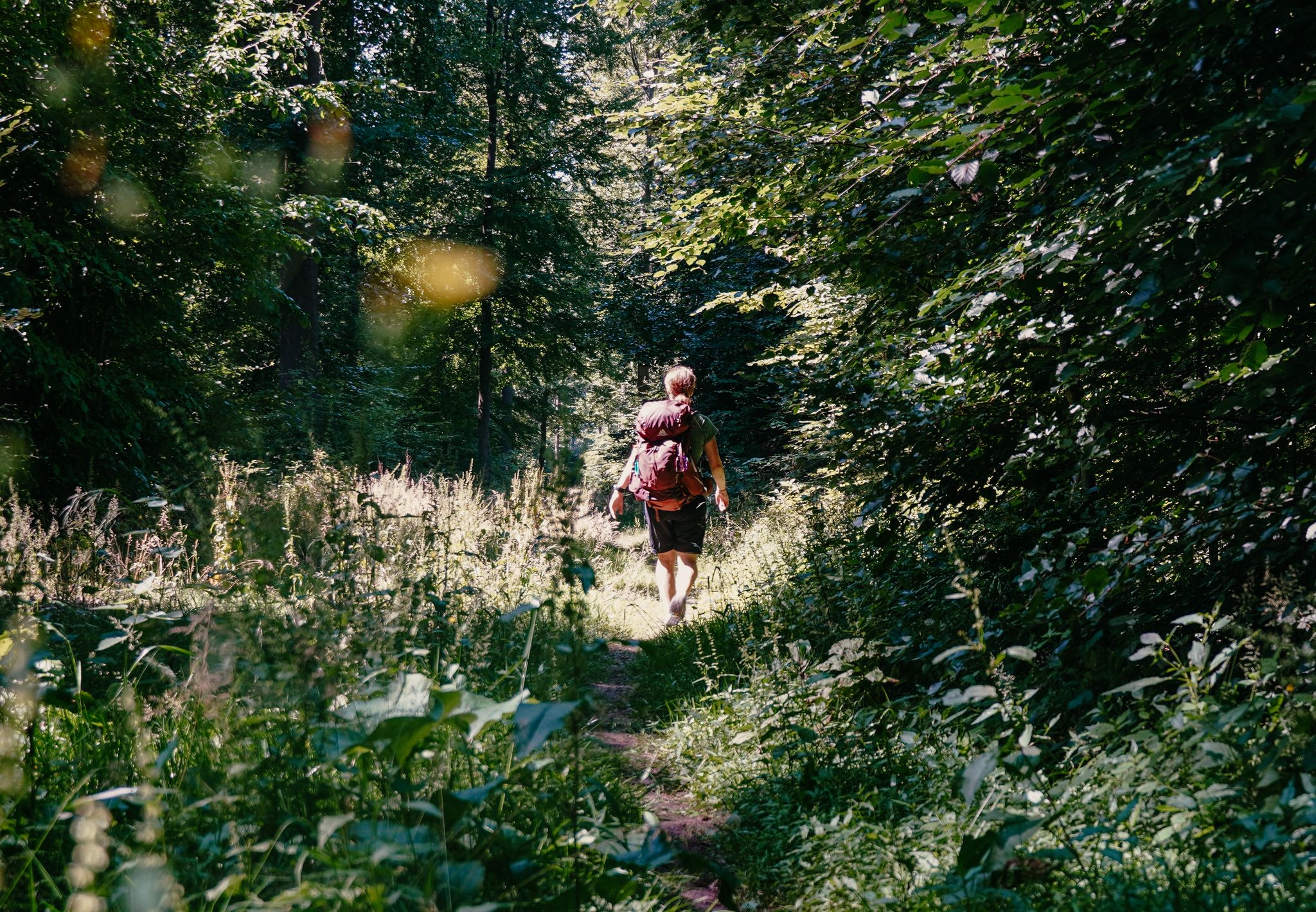
Waterfall hiking trails in the Deister traverse a forested mountain range southwest of Hanover, Germany, offering diverse landscapes for outdoor enthusiasts. The region is characterized by dense forests, varied terrain with hills, streams, and ponds, and notable rock formations. Hikers can explore a network of well-signposted paths that wind through this green paradise, revealing natural features like the rare Süntel beech trees and expansive views over the surrounding lowlands.
Best waterfall hiking trails in the Deister
- The most popular waterfall hiking route is Langenfeld Waterfall – Höllenmühle and Pond loop from Hohenstein, a 2.5 miles (4.1 km) trail that takes 1 hour 7 minutes to complete. This easy route offers a pleasant walk through the natural surroundings.
- Another top favourite among local hikers is Höllenmühle and Pond – Blutbach Spring loop from Hattendorf, a moderate 7.0 miles (11.3 km) path. This trail leads through varied terrain, passing by ponds and streams.
- Local hikers also love the Höllenbachtal Forest Path – Höllenbach Valley loop from Hattendorf, a 8.9 miles (14.3 km) trail leading through dense forest, often completed in about 3 hours 58 minutes.
- Hiking in the Deister is defined by dense forests, varied terrain with hills and streams, and impressive rock formations. The network offers options for different ability levels, from easy walks to more challenging ascents.
- The routes in Deister are highly rated by the komoot community with an average score of 4.6 stars from more than 11,000 reviews. More than 46,000 hikers have used komoot to explore Deister's varied terrain.
Last updated: May 13, 2026
4.5
(17)
64
hikers
4.11km
01:08
70m
70m
Easy hike. Great for any fitness level. Easily-accessible paths. Suitable for all skill levels.
4.7
(26)
87
hikers
28.2km
07:59
590m
600m
Hard hike. Very good fitness required. Mostly accessible paths. Sure-footedness required.

Sign up for free
5.0
(3)
8
hikers
11.0km
03:00
150m
150m
Moderate hike. Good fitness required. Easily-accessible paths. Suitable for all skill levels.
5.0
(3)
4
hikers
14.4km
03:59
260m
260m
Moderate hike. Good fitness required. Easily-accessible paths. Suitable for all skill levels.
6
hikers
2.51km
00:39
20m
20m
Easy hike. Great for any fitness level. Easily-accessible paths. Suitable for all skill levels.
Get access to more routes and recommendations from other explorers.
Sign up for free
Already have an account?
Our route recommendations are based on thousands of hikes, rides, and runs completed by other people on komoot.
Start today with a free account
Your next adventure awaits.
Login or Signup



Other adventures in the Deister


Tips from the Community

The Blutbach spring is a quiet, little-known natural spot in the Süntel hills, distinguished by its unique atmosphere and unusual name. Hidden in the forest, the Blutbach stream rises here, its source appearing unassuming yet blending harmoniously into the surrounding landscape. Moss-covered stones, damp forest floor, and shady beech trees characterize the scene, lending the place a tranquil, almost secluded ambiance. The name of the Blutbach spring has always captured the imagination. It likely derives from the reddish hue of the water or the soil, which can result from iron-rich deposits in the rock. In combination with light, foliage, and shadows, the spring water can take on a dark, sometimes rust-colored tone, which may have given rise to mythical interpretations and folk tales in the past. What is certain, however, is not so much a specific story as the effect of the place itself. Hydrologically, the Blutbach spring is part of the complex spring and stream system of the Süntel hills. The water emerging here collects to form a small stream that meanders through the wooded terrain, contributing to the region's ecological diversity. Springs like this are delicate habitats where specialized plants, mosses, and small animals find refuge.
2
0
The Langenfeld hiking parking area is a central and easily accessible starting point for hikes in the Süntel hills, uniquely connecting open countryside with the transition to the dense forests of this low mountain range. Situated on the edge of the Süntel, it offers convenient access to a diverse network of trails, making it a popular starting point for short strolls as well as extended day hikes. From here, the trails lead into tranquil woodlands with ancient beech trees, as well as up to striking hilltops and viewpoints. The interplay of open meadows, field edges, and shady forest paths is what makes many hikes from Langenfeld so appealing. This contrast is precisely what highlights the scenic diversity of the Süntel and ensures varied hiking experiences in every season.
1
0

The Schneegrund near Hessisch Oldendorf is a tranquil, impressive nature reserve that opens like a hidden valley nestled among ancient deciduous forests. A narrow path accompanies the clear stream as it winds its way through damp ravines and along mossy rocks. Especially in spring, a delicate display of blossoms unfolds, including snowdrops and wood anemones, covering the forest floor like a pale blanket. The approximately 7.7-kilometer-long Schneegrund route leads past steep slopes, shady sections of forest, and even a small waterfall near Langenfeld, showcasing the many facets of this landscape. Hikers here experience a harmonious interplay of water, forest, and rock that is both calming and invigorating.
0
0
The Springsteine in the Weserbergland region are a striking rock formation of ancient sandstone and limestone, rising jagged and bizarre from the wooded ridge near Deckbergen. Between narrow crevices, small caves, and steep rock outcrops, an impressive piece of geological history is revealed, providing a habitat for bats, among other creatures. The name "Springsteine" derives from their once prominent location, visible from afar, when they stood like prominent landmarks above the valley. Today, narrow paths wind through them, making the Springsteine a particularly attractive destination for hikers who appreciate geological features, tranquility, and unusual natural formations.
0
0

Beautiful path through a beautiful beech forest.
0
0

Beautiful hiking trail through the Höllenbach valley and above the cliffs.
0
0
Beautiful ravine at the beginning of the hike!
0
0

The quarry is very impressive. It is part of the cave tour.
0
0
Frequently Asked Questions
How many waterfall hiking trails are available in the Deister region?
The Deister region offers a good selection of waterfall hiking trails, with 17 routes specifically featuring waterfalls. These range from easy strolls to more challenging hikes, ensuring there's something for every ability level.
Are there easy waterfall hikes suitable for beginners or families with children?
Yes, the Deister has several easy waterfall hikes perfect for beginners or families. One excellent option is the Langenfeld Waterfall – Höllenmühle and Pond loop from Hohenstein, which is a pleasant 2.5-mile (4.1 km) route that takes just over an hour to complete.
What kind of natural features can I expect to see along the waterfall trails, besides the waterfalls themselves?
Beyond the beautiful waterfalls, you'll discover a rich natural landscape. The Deister is characterized by dense forests, varied terrain with hills, streams, and ponds, and impressive rock formations. Keep an eye out for the rare and gnarled Süntel beech trees, which add a unique, mystical touch to the forest.
Are there any circular routes that include waterfalls in the Deister?
Many of the waterfall trails in the Deister are designed as loops, offering a complete scenic experience. For example, the Höllenmühle and Pond – Blutbach Spring loop from Hattendorf is a moderate 7.0-mile (11.3 km) circular path that takes you through varied terrain, passing by ponds and streams.
How can I reach the waterfall trails in the Deister using public transport?
The Deister is well-connected by public transport. S-Bahn lines from Hanover reach the foot of the Deister, and bus lines can take you directly to the Deister ridge, where many hiking trails begin. This makes it convenient to access the waterfall routes without a car.
What are some notable landmarks or attractions near the waterfall hiking trails?
While exploring the waterfall trails, you can also visit several interesting landmarks. The Nordmannsturm and forest restaurant offers magnificent views from its 19-meter-high observation tower. You might also encounter the Kreuzbuche Memorial and Shelter, providing a historical resting spot.
What is the best time of year to hike to the waterfalls in the Deister?
The waterfalls in the Deister are beautiful year-round. Spring offers lush greenery and increased water flow from snowmelt, while autumn provides stunning foliage. Even in winter, a hike can be magical, with the possibility of frozen cascades, though conditions may require appropriate gear.
Are there places to eat or rest near the waterfall trails?
Yes, you'll find several welcoming spots to eat and rest. The Mooshütte Forest Inn and the Devil's Bridge Forest Inn are popular choices. The Nordmannsturm also has a forest restaurant at its base, perfect for a break with a view.
What do other hikers say about the waterfall trails in the Deister?
The waterfall trails in the Deister are highly regarded by the komoot community, boasting an average rating of 4.6 out of 5 stars from over 11,000 reviews. Hikers frequently praise the dense forests, varied terrain, and well-signposted paths that make for an enjoyable outdoor experience.
Are there any longer or more challenging waterfall hikes in the Deister?
For those seeking a longer and more challenging adventure, the Deister offers routes like the Höllenbach Valley – View of Schaumburg Castle loop from Hohenstein. This difficult 17.6-mile (28.3 km) trail involves significant elevation changes and takes approximately 8 hours to complete, offering expansive views and a rewarding experience.
Can I bring my dog on the waterfall hiking trails in the Deister?
Generally, dogs are welcome on the hiking trails in the Deister. It's always a good idea to keep your dog on a leash, especially in forested areas and near wildlife, and to be mindful of other hikers. Always check local signage for any specific restrictions.
Where can I find parking when visiting the waterfall trails?
Parking is typically available at various access points and trailheads around the Deister. Specific parking information can often be found on individual route pages or local tourism websites. Many trails are also accessible via public transport, offering an alternative to driving.
Are there any hidden gems or less-known waterfall spots in the Deister?
While specific 'hidden' waterfalls are often discovered by local exploration, the Deister's varied terrain means many smaller streams and cascades might be found off the main paths, especially after heavy rainfall. Exploring routes like the Höllenbachtal Forest Path – Höllenbach Valley loop from Hattendorf can lead you through dense forest where such natural features are more likely to be encountered.
Most popular routes in the Deister
Most popular attractions in the Deister

Get inspired with the komoot mobile app


Explore more
Browse the best Hikes in other regions.
