Attractions and Places To See in Garland Ranch Regional Park - Top 6
Best attractions and places to see in Garland Ranch Regional Park include a 4,462-acre expanse featuring diverse natural landscapes and cultural sites. The park's elevation ranges from 200 to 2,000 feet, encompassing redwood canyons, oak savannas, and chaparral-covered slopes. Visitors can explore the banks of the Carmel River and Garzas Creek, as well as historic buildings and indigenous habitation sites. This region offers a variety of environments supporting a wide array of flora and fauna.
Best attractions and places to see in Garland Ranch Regional Park
- The most popular attractions is Buckeye Trail, a trail that features mystic Buckeye trees and informative signs. It offers glimpses of views within the park.
- Another must-see spot is Carmel Valley Road, a trail and cycle way. This route follows the gentle turns of Carmel Creek through vineyards, natural areas, and small hamlets.
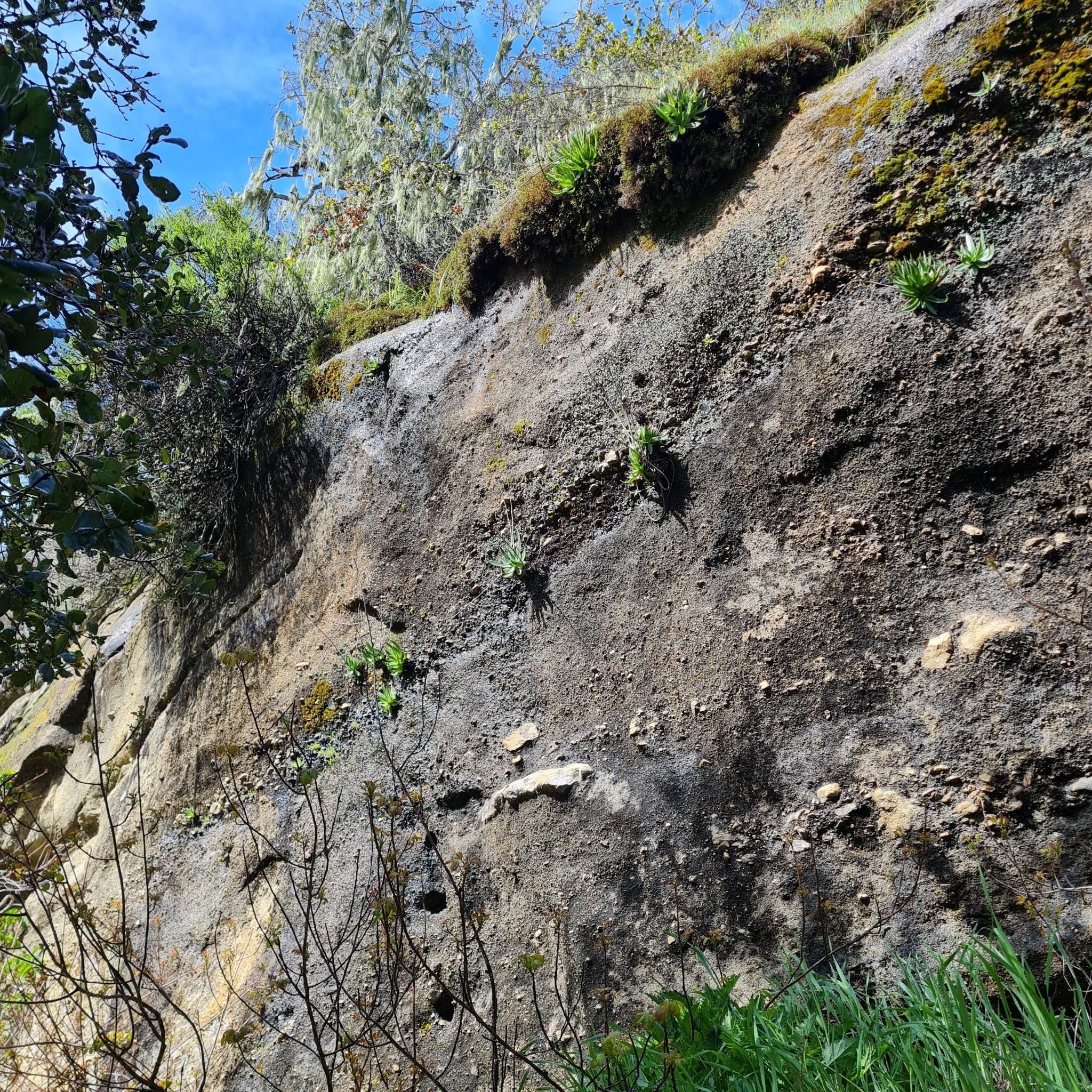
- Visitors also love Waterfall Trail, a trail that winds through the park and passes by a waterfall. The trail is well-marked and not technical, making the walk to the falls accessible.
- Garland Ranch Regional Park is known for its diverse trails, natural features like waterfalls and canyons, and historical landmarks. The park offers a variety of attractions to see and explore, from easy walks to challenging climbs.
- The attractions in Garland Ranch Regional Park are appreciated by the komoot community, with 4 photos and 2 upvotes from visitors.
Last updated: July 2, 2026
Waterfall Trail
Highlight • Trail
Tip by

Buckeye Trail
Highlight (Segment) • Trail
Tip by

Sign up now to discover places like this
Get recommendations on the best single tracks, peaks, & plenty of other exciting outdoor places.
Sign up for free
Garland Ranch Regional Park
Highlight • Forest
Tip by

Carmel Valley Road
Highlight (Segment) • Trail
Tip by

Snively's Ridge Trail
Highlight (Segment) • Trail
Tip by
Sign up for free to discover even more attractions in Garland Ranch Regional Park.
Sign up for free
Already have an account?
Start today with a free account
Your next adventure awaits.
Login or Signup

Tips from the Community

Great waterfall in Garland Ranch Regional Park. The trail to get to the waterfall is well-marked and not technical, so the walk to get to the falls is definitely worth it.
0
0
The Waterfall Trail is a beautiful trail that winds through the Garland Ranch Regional Park. As the name suggests, it passes by a wonderful waterfall.
0
0

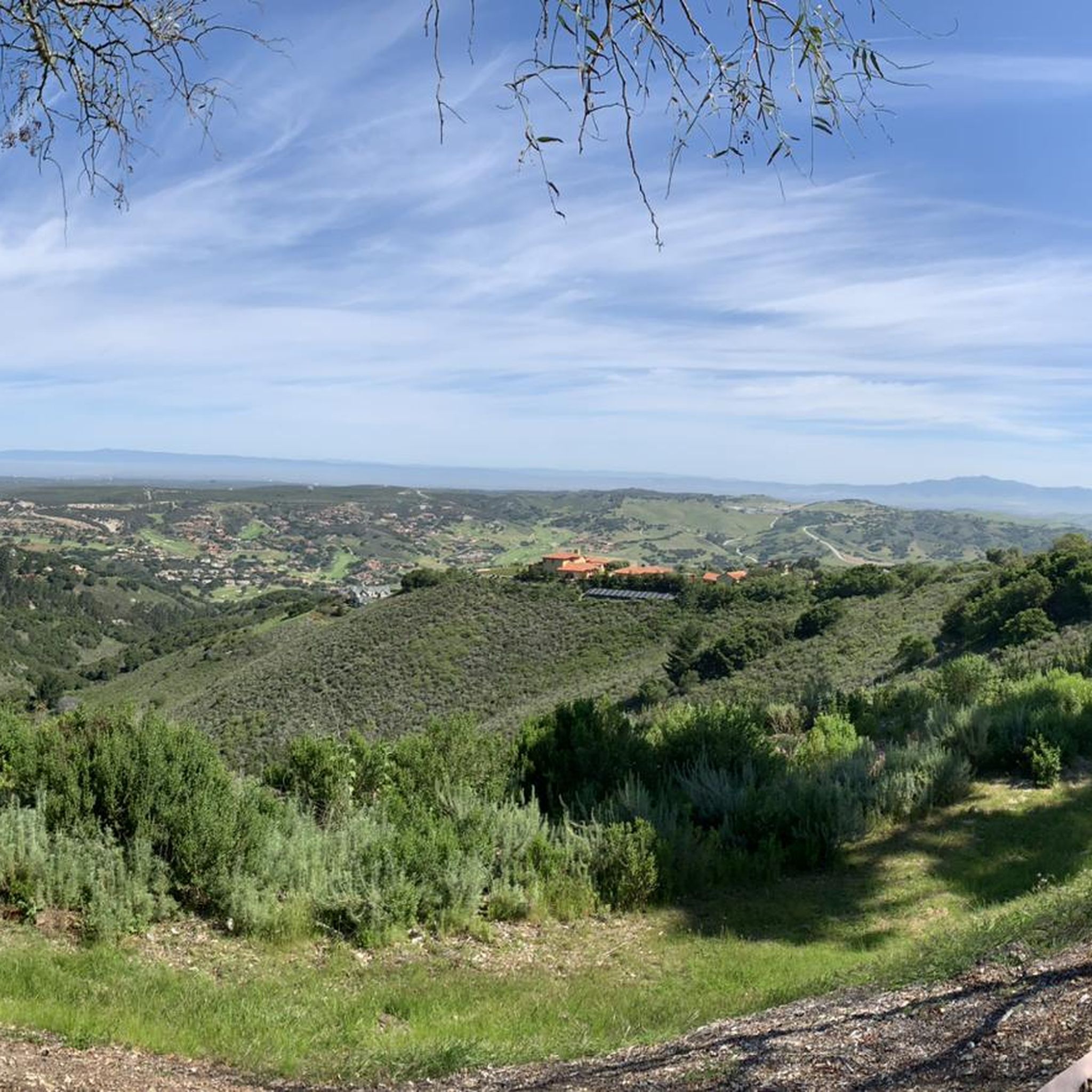
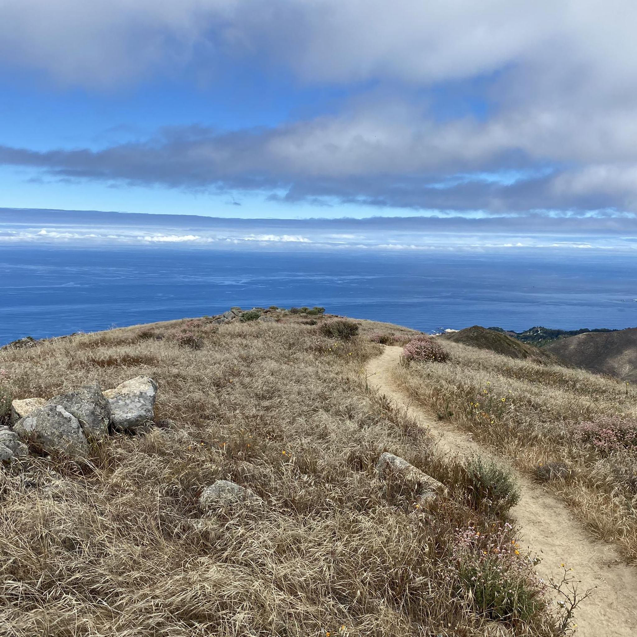
Snively's Ridge Trail is a challenging trail with over 1,950 feet in elevation gain. The trail offers views of the Monterey Peninsula and takes visitors to the highest point in Garland Ranch Regional Park, Vasquez Knob.
1
0
Garland Ranch Regional Park is a 3,464-acre public recreational area that is managed by the Monterey Peninsula Regional Park District. The area has over 50 miles of hiking and biking trails as well as a diverse series of ecosystems that exist within its boundaries.
0
0

Beautiful trail in Garland Ranch Regional Park. Mystic looking Buckeye trees, informative signs and glimpses of views.
0
0

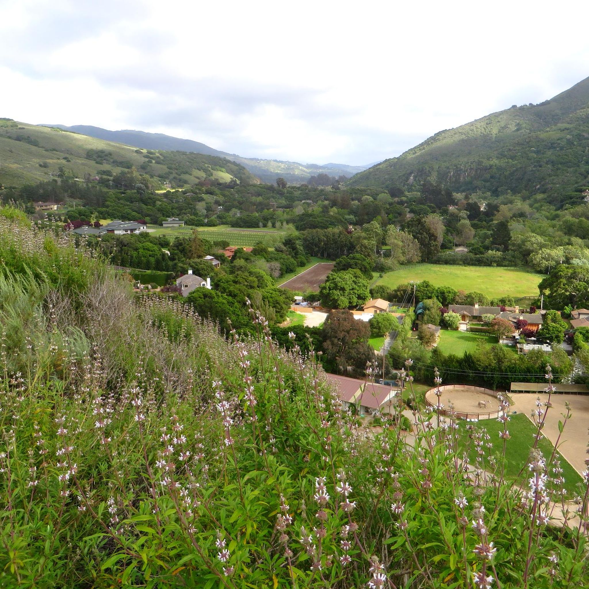
Delightful valley through vineyards, nature and small hamlets, with the moderately traveled road following the gentle turns of Carmel Creek
0
0
Frequently Asked Questions
What types of trails can I find in Garland Ranch Regional Park?
Garland Ranch Regional Park offers a wide variety of trails, from easy, nearly level paths to steep, challenging inclines. You can explore trails like the Buckeye Trail, known for its mystic trees and informative signs, or the Waterfall Trail, which leads to a seasonal waterfall. For more challenging hikes with panoramic views, consider the Snively's Ridge Trail, which climbs over 1,950 feet to Vasquez Knob.
Are there any easy or family-friendly trails in the park?
Yes, the park features several easy and family-friendly options. The Buckeye Trail is a great choice, offering informative signs and glimpses of views. The Buckeye Nature Trail, which runs along Garzas Creek, is another easy path with educational signs. The Waterfall Trail is also considered well-marked and not technical, making the walk to the falls accessible for many.
What natural features can I expect to see in Garland Ranch Regional Park?
The park boasts diverse natural features, including the willow-covered banks of the Carmel River and the peaceful trails along Garzas Creek. You can find redwood canyons, seasonal waterfalls, and varied landscapes such as cottonwood-sycamore stands, open oak savannas, and chaparral-covered slopes. High-elevation trails, like Snively's Ridge Trail, offer spectacular views of Carmel Valley and the Ventana Wilderness.
Are there any historical or cultural sites within the park?
Yes, Garland Ranch Regional Park preserves reminders of Carmel Valley's past. Visitors can explore historic buildings, including the Tomasini/Cooper Historic Barn. The park also contains Rumsen Indian habitation sites, nineteenth-century homesteading and logging settlements, and remnants of Rancho Don Juan, offering a glimpse into the region's rich history.
What outdoor activities are popular in Garland Ranch Regional Park besides hiking?
Beyond hiking, the park is popular for horseback riding (on most trails), birdwatching, photography, 'plein air' painting, jogging, walking, and geocaching. Limited mountain biking is permitted on the Cooper Ranch Loop. The park's diverse ecosystems make it an excellent spot for wildlife spotting.
Is Garland Ranch Regional Park dog-friendly?
Yes, Garland Ranch Regional Park is notably dog-friendly. Many areas allow dogs off-leash, and the park even provides specially designed water fountains for pets, making it a great destination for you and your canine companion.
What is the best time to visit Garland Ranch Regional Park?
The park can be enjoyed year-round, but seasonal considerations apply. The waterfalls, for example, are seasonal, so visiting after winter rains might offer the best chance to see them in full flow. The diverse landscapes provide beauty in every season, from lush spring growth to vibrant autumn colors.
Where can I find information about specific hiking or cycling routes near the attractions?
For detailed information on hiking routes, you can explore the Hiking in Garland Ranch Regional Park guide, which includes routes like the 'Cottonwood, Maple Canyon, and Lupine Loop'. If you're interested in cycling, the Cycling in Garland Ranch Regional Park guide offers options such as the 'Monterey State Beach – Fishermans Wharf loop'. For gravel biking, check the Gravel biking in Garland Ranch Regional Park guide.
What are some notable viewpoints in the park?
High-elevation trails throughout the park offer spectacular vistas. The Snively's Ridge Trail, for instance, provides panoramic views of Carmel Valley and the Ventana Wilderness, reaching the highest point in the park at Vasquez Knob. The Buckeye Trail also offers glimpses of scenic views within the park.
Is there a visitor center or a good starting point for exploring the park?
Yes, the Garland Ranch Visitors Center is an excellent starting point for any visit. It provides trail maps, information on park activities, and species lists for local birds, mammals, and plants, helping you plan your exploration effectively.
What kind of wildlife can I spot in Garland Ranch Regional Park?
The park's diverse environments, including cottonwood-sycamore stands, oak savannas, and chaparral-covered slopes, support a wide array of insects, birds, plants, and animals. Birdwatching is particularly popular, with Mesa Pond along the Mesa Pond Trail being a prime location for spotting various bird species.
How long does it take to hike some of the trails?
Hiking times vary greatly depending on the trail's length and difficulty. Easy trails like the Buckeye Nature Trail might take an hour or two, while more challenging routes such as the Snively's Ridge Trail, with its significant elevation gain, could take several hours to complete. The park features over 50 to 60 miles of trails, so you can choose a route that fits your desired duration.
Are there any specific trails that feature waterfalls?
Yes, the Waterfall Trail is specifically designed to lead you to a beautiful seasonal waterfall. While the waterfall's flow depends on recent rainfall, the trail itself is a pleasant walk through the park's scenery.
Most popular routes in Garland Ranch Regional Park

Get inspired with the komoot mobile app


Explore more
Still not found the Highlight you’re looking for? See guides of the top attractions in other regions:
