The best road cycling routes in Ridgefield National Wildlife Refuge
4.4
(10)
209
riders
18
rides
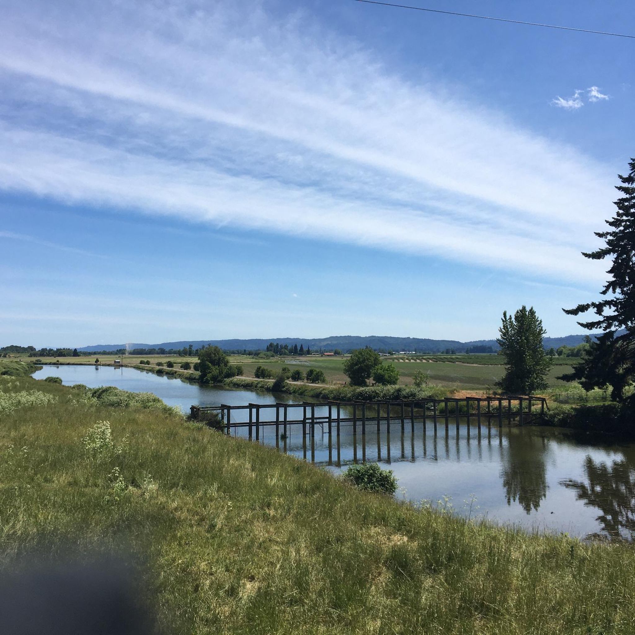
Road cycling routes in Ridgefield National Wildlife Refuge navigate the surrounding landscape, characterized by its proximity to the Columbia River floodplain, wetlands, and oak woodlands. While cycling is generally restricted within the refuge's designated trails, the broader region offers diverse terrain for road cyclists. The area features a mix of flat sections near the rivers and wetlands, alongside routes that include more significant elevation gains through the surrounding countryside. Road cyclists can experience varied scenery, from open agricultural lands to areas bordering natural habitats.
Best road cycling routes in Ridgefield National Wildlife Refuge
- The most popular road cycling route is Roadbike loop from McNulty, a 57.8 miles (93.1 km) trail that takes 4 hours 39 minutes to complete. This difficult route features over 3,800 feet (1,100 meters) of elevation gain.
- Another top favourite among local road cyclists is Grant Street Pier – Waterfront Park loop from Felida, an easy 17.7 miles (28.6 km) path. This route offers a relatively flat ride with less than 600 feet (200 meters) of climbing, often completed in about 1 hour 15 minutes.
- Local road cyclists also love the Frenchman Bar – Vancouver Lake loop from Shillapoo South Wildlife Area, a 18.9 miles (30.5 km) trail leading through riverine landscapes, often completed in about 1 hour 23 minutes.
- Road cycling in Ridgefield National Wildlife Refuge is defined by routes near the Columbia River floodplain, wetlands, and surrounding oak woodlands. The network offers options for different ability levels, from easy loops to more challenging rides with significant climbs.
- The routes in Ridgefield National Wildlife Refuge are highly rated by the komoot community with an average score of 4.5 stars from 9 reviews. More than 100 road cyclists have used komoot to explore Ridgefield National Wildlife Refuge's varied terrain.
Last updated: August 24, 2026
5.0
(3)
83
riders
28.7km
01:06
50m
50m
Easy road ride. Great for any fitness level. Mostly well-paved surfaces and easy to ride.
5.0
(1)
6
riders
28.5km
01:15
180m
180m
Easy road ride. Great for any fitness level. Mostly well-paved surfaces and easy to ride.

Sign up for free
4
riders
112km
05:06
1,290m
1,290m
Hard road ride. Very good fitness required. Mostly well-paved surfaces and easy to ride.
4.0
(1)
2
riders
Moderate road ride. Good fitness required. Some segments of this route may be unpaved and difficult to ride.
13
riders
93.1km
04:39
1,180m
1,180m
Hard road ride. Very good fitness required. Some segments of this route may be unpaved and difficult to ride.
Get access to more routes and recommendations from other explorers.
Sign up for free
Already have an account?
Our route recommendations are based on thousands of hikes, rides, and runs completed by other people on komoot.
Start today with a free account
Your next adventure awaits.
Login or Signup
Popular around Ridgefield National Wildlife Refuge


Tips from the Community

Stay off the waterfront trails when biking. Bikes are allowed but, there are too many people walking.
0
0

Here you can view Burnt Bridge Creek as it flows west to Vancouver Lake, which drains into Lake River and eventually feeds into the Columbia River.
0
0

Burnt Bridge Creek is a 13-mile stream starting near Orchards and ending in Vancouver Lake. For the first 8 miles, the creek travels through natural and artificial waterways before joining a small canyon. The creek's lower section is home to coho salmon, rainbow trout, and steelhead. The 8-mile Burnt Bridge Creek Greenway Trail, a popular path for walking, biking, and jogging, runs along the creek as well.
0
0
Run along the scenic Waterfront Park and enjoy great views of the Columbia River and local mountains. Located along the Columbia Riverfront Renaissance Trail, Waterfront Park has benches, restrooms, cafés, bars, and restaurants. The Grant Street Pier extends over the water to give visitors a nice view of the river.
0
0

The Wayne Naillon Memorial Rest Area is a small picnic area on the Crown Zellerbach Trail. It was created in memory of Wayne Naillon, an integral member of the team that helped to set up the Crown Zellerbach Trail. There is a commemorative sign for Wayne at this spot as well.
0
0

The Eastside Viewing Platform in the Sauvie Island Wildlife Area looks out over the waters of Sturgeon Lake. You have to bike about a hundred yards down an extension of the main paved road to get here.
0
0

This bell tower is located at one end of Esther Short Park. At its base, it features the art installation 'Spiraling Salmon' by Jim Demetro. In addition to the tower, you can observe other nearby works of art in this park, such as 'A Gift to You', also by Jim Demetro, or 'The Pioneer Mother Memorial'.
1
0
Next to the Columbia Riverfront Renaissance Trail, you'll come across this incredible waterfront, where you'll find an ideal spot to gaze at the Columbia River. In addition to various benches for sitting and restrooms, this area also offers plenty of cafés, bars, restaurants…
1
0
Frequently Asked Questions
Are bicycles allowed on the trails within Ridgefield National Wildlife Refuge?
No, road cycling is generally not permitted on the refuge's designated trails. Official rules explicitly state that bicycles are prohibited, with exceptions only for accessibility reasons. Visitors who bike to the refuge are asked to chain their bicycles at the entrance before proceeding onto the trails. For detailed rules, you can visit the FWS website.
Where can I find road cycling routes near Ridgefield National Wildlife Refuge?
While cycling is restricted within the refuge, the broader region offers diverse terrain for road cyclists. komoot provides over 19 road cycling routes in the surrounding area. These routes navigate the landscape characterized by its proximity to the Columbia River floodplain, wetlands, and oak woodlands.
What kind of terrain can I expect on road cycling routes near Ridgefield National Wildlife Refuge?
The road cycling routes in the region offer a mix of terrain. You'll find flat sections near the rivers and wetlands, alongside routes that include more significant elevation gains through the surrounding countryside. This allows for varied scenery, from open agricultural lands to areas bordering natural habitats.
Are there any family-friendly road cycling routes in the Ridgefield area?
Yes, there are several easy routes suitable for families. For example, the Grant Street Pier – Waterfront Park loop from Felida is an easy 17.7-mile path with less than 600 feet of climbing, often completed in about 1 hour 15 minutes. Another option is the Frenchman Bar – Vancouver Lake loop from Shillapoo South Wildlife Area, an 18.9-mile trail through riverine landscapes.
What is the best time of year for road cycling near Ridgefield National Wildlife Refuge?
The region offers good cycling conditions for much of the year. While specific recommendations depend on personal preference, spring and fall often provide pleasant temperatures and beautiful scenery. Winter cycling is also possible, though conditions may vary.
What do other road cyclists enjoy most about the routes near Ridgefield National Wildlife Refuge?
The area is highly rated by the komoot community, with an average score of 4.5 stars from 9 reviews. Road cyclists often praise the varied terrain, from flat riverine landscapes to routes with significant climbs, and the scenic views of the surrounding countryside.
Are there any challenging road cycling routes for experienced riders?
Yes, for experienced riders seeking a challenge, routes with significant elevation gain are available. The Roadbike loop from McNulty is a difficult 57.8-mile route featuring over 3,800 feet of elevation gain. Another challenging option is the South Royle Road loop from Pioneer St & S 47th Ave, which covers 112.1 miles with over 4,200 feet of climbing.
Can I spot wildlife while road cycling in the Ridgefield area?
While direct access to the refuge's interior for cycling is prohibited, the roads surrounding the refuge and the broader Columbia River floodplain area are rich in natural habitats. You may spot various bird species, deer, and other local wildlife from the road, especially in quieter sections. For dedicated wildlife observation, consider visiting the refuge on foot after your ride.
Are there any places to eat or stay near the road cycling routes?
The city of Ridgefield and nearby Vancouver, WA, offer various cafes, pubs, and accommodation options. These towns provide convenient stops for refreshments or overnight stays before or after your road cycling adventures in the region.
Where can I park when planning a road cycling trip near Ridgefield National Wildlife Refuge?
Parking is generally available in the towns and communities surrounding the refuge, such as Ridgefield or Vancouver, where many of the komoot routes begin. Always check local parking regulations and availability at your chosen starting point.
What are some natural features or landmarks I might see on road cycling routes in the area?
Road cycling routes in the region often pass through or offer views of the Columbia River floodplain, wetlands, and oak woodlands. While cycling within the refuge is restricted, you can experience the natural beauty of the surrounding landscape. The Cathlapotle Plankhouse, located in the Carty Unit of the refuge, is a notable cultural landmark that can be visited on foot.
Most popular routes in Ridgefield National Wildlife Refuge

Get inspired with the komoot mobile app


Explore more
Browse the best Road cycling routes in other regions.
