Attractions and Places To See in Burnaby Mountain Conservation Area - Top 8
Attractions and places to see in Burnaby Mountain Conservation Area encompass 576 hectares, offering panoramic views of Vancouver, Burrard Inlet, and the North Shore Mountains. This area blends natural landscapes with cultural significance and recreational opportunities. Visitors can explore 8 distinct places to see, ranging from significant cultural sites to expansive viewpoints. The conservation area features diverse ecosystems and an extensive trail network.
Best attractions and places to see in Burnaby Mountain Conservation Area
- The most popular attractions is Kamui Mintara (Playground of the Gods) Sculpture, a man-made monument that commemorates the 25-year partnership between Burnaby and Kushiro, Japan. This significant cultural site features intricately carved wooden poles based on the animistic traditions of the Ainu people.
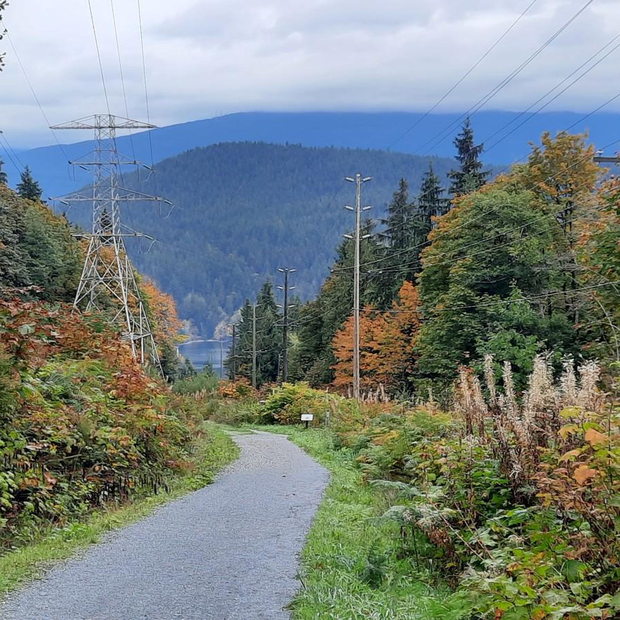
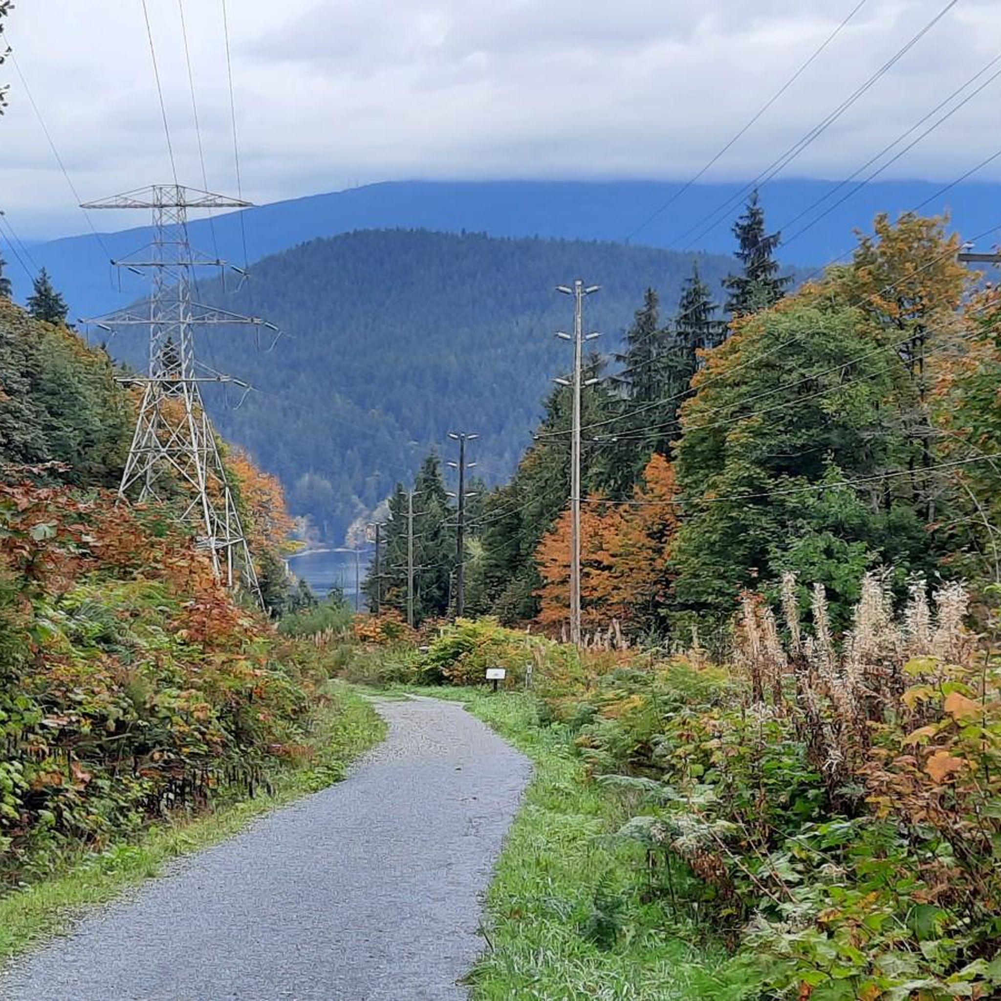
- Another must-see spot is View of Indian Arm and Burrard Inlet, a viewpoint offering vistas of the eastern part of Burrard Inlet, including the Indian Arm fjord. Visitors can observe the natural landscape where the Port Moody Arm also extends.
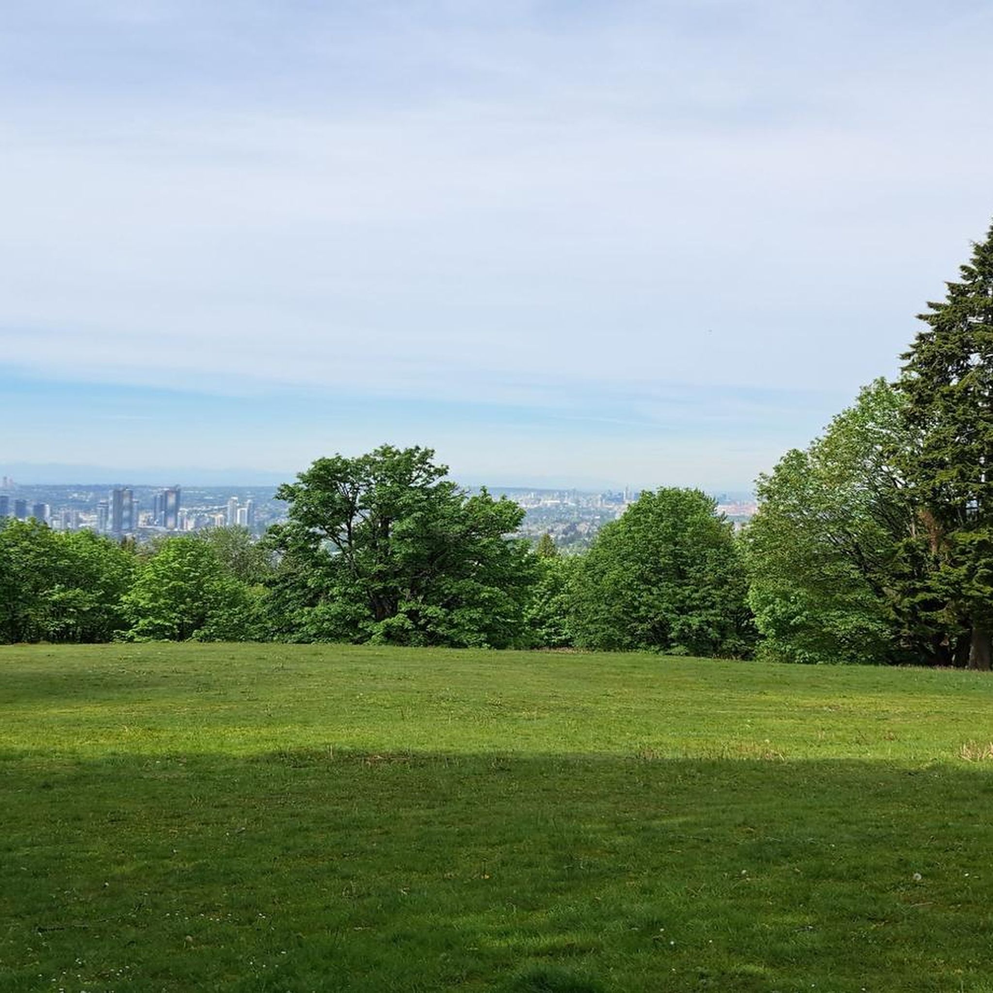
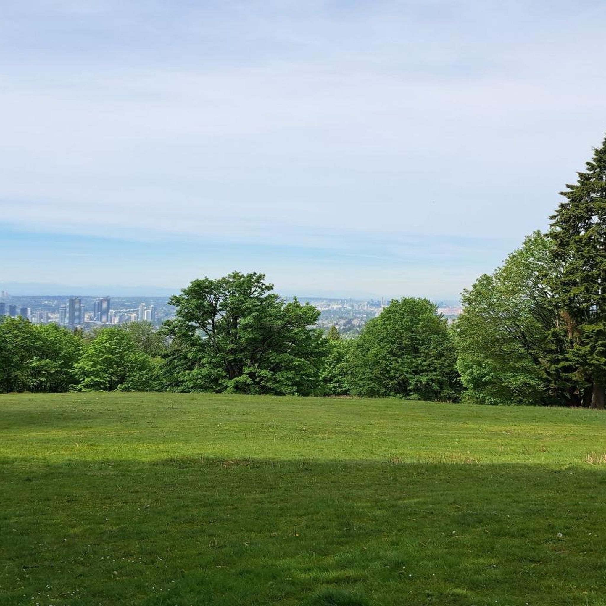
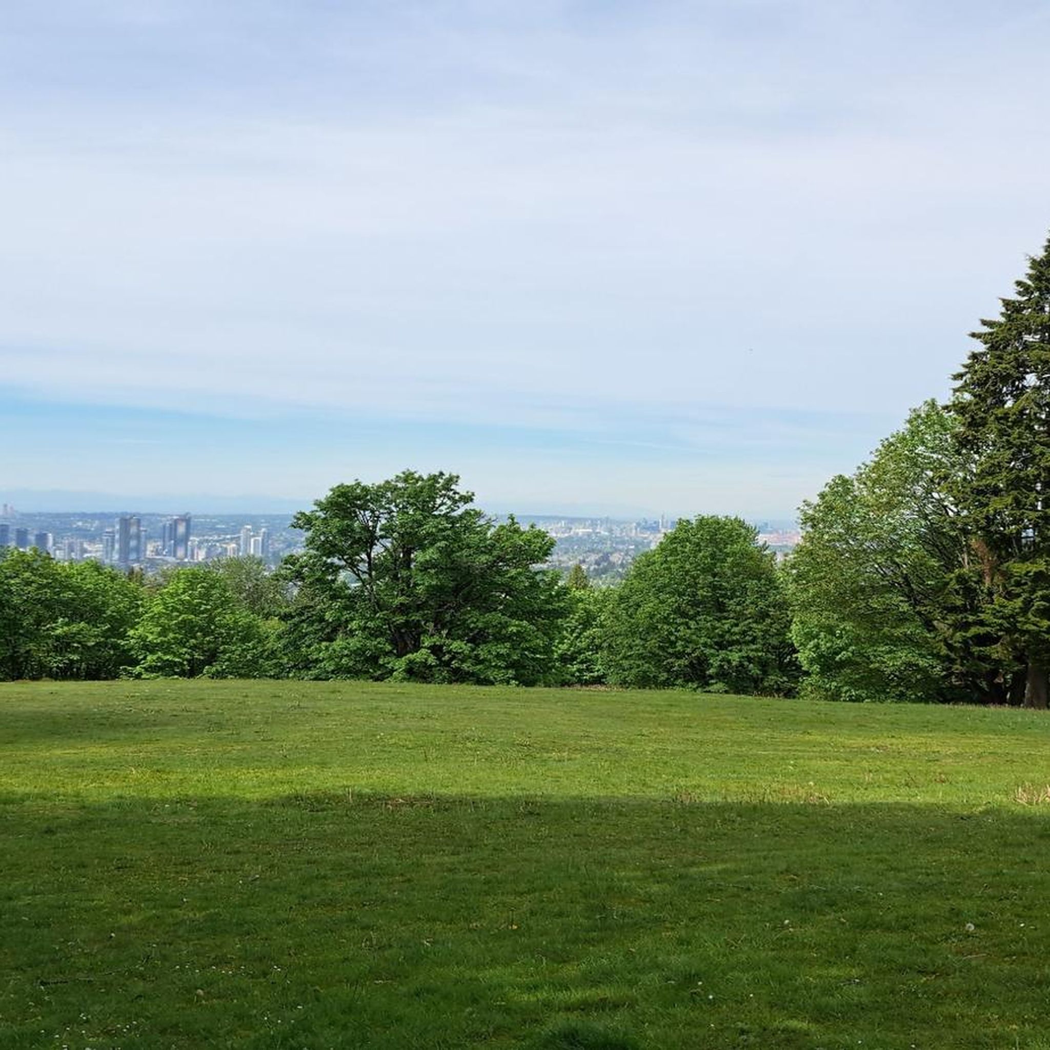
- Visitors also love View of Vancouver from Burnaby Mountain Conservation Area, a viewpoint providing excellent perspectives of downtown Vancouver. This west-facing slope offers clear views of the city skyline.
- Burnaby Mountain Conservation Area is known for its cultural landmarks, extensive viewpoints, and diverse natural features. The area offers a variety of attractions to see and explore, from sculptures to panoramic vistas.
- The attractions in Burnaby Mountain Conservation Area are appreciated by the komoot community, with 11 upvotes and 9 photos shared by visitors.
Last updated: October 9, 2026
Kamui Mintara (Playground of the Gods) Sculpture
Highlight • Monument
collections.burnabyartgallery.ca/ListDetail?q=creator_txt%3A%22Toko%2C+Nuburi%22&p=1&ps=1
atlasobscura.com/places/playground-of-the-gods
Translated by Google •
Tip by

View of Indian Arm and Burrard Inlet
Highlight • Viewpoint
In Legends of Vancouver, poet Pauline Johnson tells a legend about the lost island in the Indian Arm of Burrard Inlet and the search for what was lost.
legendsofvancouver.net/indian-arm-deep-cove-vancouver
Translated by Google •
Tip by
Sign up now to discover places like this
Get recommendations on the best single tracks, peaks, & plenty of other exciting outdoor places.
View of Vancouver from Burnaby Mountain Conservation Area
Highlight • Viewpoint
en.wikipedia.org/wiki/Burnaby_Mountain
burnaby.ca/explore-outdoors/parks/burnaby-mountain-conservation-area
Translated by Google •
Tip by
Jim's Jungle Trail
Highlight (Segment) • Trail
walkbc.ca/trail/jims-jungle-trail
Translated by Google •
Tip by
Burnaby Mountain Water Tower Murals
Highlight • Monument
mdmurals.ca/projects/the-watertower
Translated by Google •
Tip by
Sign up for free to discover even more attractions in Burnaby Mountain Conservation Area.
Already have an account?
Start today with a free account
Your next adventure awaits.
Popular around Burnaby Mountain Conservation Area

Tips from the Community

The 'Jim's Jungle Trail' meanders through a wetland at the south-eastern foot of 'Burnaby Mountain' near 'Stoney Creek' for a distance of approx. 1.5 km. Some of the path has been developed as a wooden plank path and is easy to walk on at any time of the year. https://walkbc.ca/trail/jims-jungle-trail
2
0
The colorful 'Octopus Mural' is located on a water tower tucked away in the forest of the 'Burnaby Mountain Conservation Area', along the 'Trans Canada Trail'. https://mdmurals.ca/projects/the-watertower/
2
0
On the north slope of 'Burnaby Mountain' there is a beautiful view of the eastern part of 'Burrard Inlet', in particular the 'Indian Arm' of the fjord, which runs north-south, but also the 'Port Moody Arm' , in an east-west direction. In Legends of Vancouver, poet Pauline Johnson tells a legend about the lost island in the Indian Arm of Burrard Inlet and the search for what was lost. https://www.legendsofvancouver.net/indian-arm-deep-cove-vancouver
2
0
The 1990 Kamui Mintara - 'Playground of the Gods' monument by Ainu sculptor Nuburi Toko and his son Shusei Toko commemorates the 25-year partnership between the cities of Kushiro in Japan and Burnaby in Canada. The work is based on the animistic tradition of the Ainu, an indigenous people in northern Japan. https://collections.burnabyartgallery.ca/ListDetail?q=creator_txt%3A%22Toko%2C+Nuburi%22&p=1&ps=1 https://www.atlasobscura.com/places/playground-of-the-gods
2
0
The city of Burnaby is east of Vancouver and is easily accessible by public transport. Northeast of the city on the 'Port Moody Arm' of 'Burrard Inlet' is 'Burnaby Mountain' with the campus of 'Simon Fraser University' at the summit. The forested hillsides are protected as the 'Burnaby Mountain Conservation Area'. The area is known for the numerous hiking trails and trails for mountain bikers. From the west slope there is an excellent view of downtown Vancouver. https://en.wikipedia.org/wiki/Burnaby_Mountain https://www.burnaby.ca/explore-outdoors/parks/burnaby-mountain-conservation-area
2
0
Frequently Asked Questions
What cultural landmarks can I explore in Burnaby Mountain Conservation Area?
The area is home to significant cultural sites, including the Kamui Mintara (Playground of the Gods) Sculpture. This monument features intricately carved wooden poles by Ainu sculptors, commemorating the partnership between Burnaby and Kushiro, Japan. You can also find the colorful Burnaby Mountain Water Tower Murals along the Trans Canada Trail.
Where can I find the best panoramic views of Vancouver and the surrounding area?
For stunning vistas, visit the View of Vancouver from Burnaby Mountain Conservation Area, which offers excellent perspectives of the city skyline. Additionally, the View of Indian Arm and Burrard Inlet provides beautiful sights of the eastern part of Burrard Inlet, including the fjord and Port Moody Arm. The open grassy slopes in the Centennial Way area are also known for spectacular sunset views.
Are there family-friendly activities or trails in the Conservation Area?
Yes, many attractions are suitable for families. The Kamui Mintara Sculpture and the Burnaby Mountain Water Tower Murals are interesting for all ages. For walks, Jim's Jungle Trail is a 1.5 km path through a wetland, with sections developed as a wooden plank path, making it easy to walk. The Centennial Rose Garden is also a peaceful spot for a family picnic.
What kind of hiking trails are available in Burnaby Mountain Conservation Area?
The conservation area features an extensive network of over 28 kilometers of multi-use trails. You can find challenging ascents like the Velodrome Trail (though its stair section is currently closed) or more leisurely options. For easy hikes, consider routes like the 'Kamui Mintara Sculpture via Velodrome and Pandora Trail loop' or a 'Hiking loop from Simon Fraser University'. You can find more details on these and other easy hikes at Easy hikes in Burnaby Mountain Conservation Area.
Can I go mountain biking in Burnaby Mountain Conservation Area?
Yes, the area has trails suitable for mountain biking. The Mountain Air Bike Skills Park on the north side of Burnaby Mountain offers obstacles for various skill levels, though it was undergoing redesign as of a 2023 update. The extensive trail network is multi-use, accommodating both hikers and mountain bikers.
What natural features and wildlife can I expect to see?
Burnaby Mountain Conservation Area boasts diverse natural features, including forested slopes with deciduous and coniferous trees, and numerous streams. The area is home to blacktail deer, coyotes, and bald eagles. Black bears and cougars are occasional visitors, so it's important to be aware on the trails. You can also discover various eco-sculptures made of plants throughout the area.
Is there a specific time of year that is best to visit Burnaby Mountain Conservation Area?
The conservation area offers beauty year-round. The Centennial Rose Garden is particularly vibrant in autumn with rich fall colors. Panoramic views are spectacular at sunset regardless of the season. For hiking, spring and fall offer pleasant temperatures, while summer is great for longer days. Winter can be beautiful, but some trails might have seasonal considerations.
Are there any restaurants or cafes within the Conservation Area?
Yes, the Mintara Restaurant is located on Burnaby Mountain and offers a fusion of global flavors along with fine views of the Lower Mainland. This provides a convenient dining option right within the area.
How can I get to Burnaby Mountain Conservation Area by public transport?
Burnaby Mountain Conservation Area is easily accessible by public transport, as it is located northeast of Burnaby city, which is east of Vancouver. Simon Fraser University (SFU) is situated at the top of Burnaby Mountain, and public transit routes serve the university campus, providing access to the conservation area.
Where can I park when visiting Burnaby Mountain Conservation Area?
There are parking options available within the conservation area. The Centennial Rose Garden, for example, is easily accessible from the main parking lot. Visitors can typically find parking near key attractions and trailheads, especially around the Simon Fraser University campus area at the summit.
Are there any challenging trails for experienced hikers or runners?
While the Velodrome Trail's stair section is currently closed, the conservation area's extensive network includes trails with varying terrain and elevation changes that can be challenging. For runners, there are routes like the 'Running loop from Simon Fraser University' or the 'Burnaby Lake loop from UniverCity' which offer moderate to difficult options. More running trails can be found at Running Trails in Burnaby Mountain Conservation Area.
What is the significance of the Kamui Mintara Sculpture?
The Kamui Mintara (Playground of the Gods) Sculpture is a significant cultural monument created by Ainu sculptors Nuburi and Shusei Toko. Erected in 1990, it commemorates the 25-year partnership between Burnaby and its sister city, Kushiro, Japan, and is based on the animistic traditions of the Ainu people, an indigenous group from northern Japan.
Most popular routes in Burnaby Mountain Conservation Area

Get inspired with the komoot mobile app


Explore more
Still not found the Highlight you’re looking for? See guides of the top attractions in other regions:
