The best road cycling routes in Vía Parque Isla De Salamanca
5.0
(12)
192
riders
7
rides
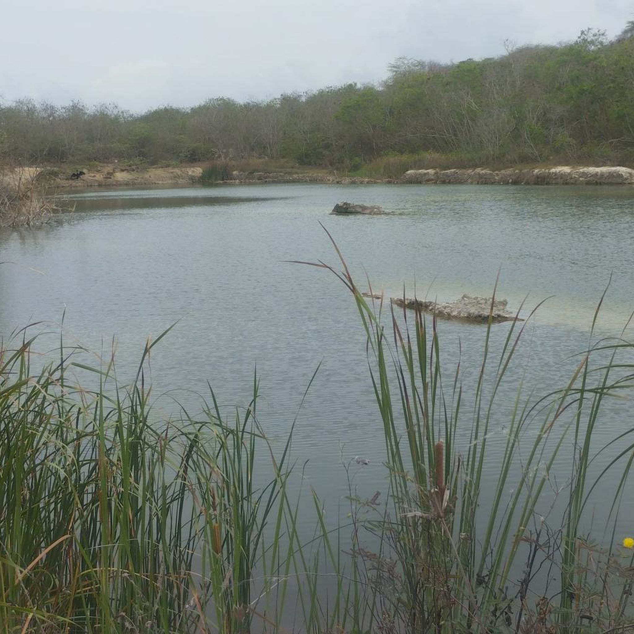
Road cycling in Vía Parque Isla De Salamanca offers routes through a unique landscape where the freshwater of the Magdalena River meets the Caribbean Sea. The region is characterized by extensive mangrove ecosystems, lacustrine scenery, and coastal views. The Vía Parque, a highway traversing the park, provides a mostly flat and accessible route for cyclists. This area is a UNESCO Biosphere Reserve and Ramsar Site, highlighting its ecological significance.
Best road cycling routes in Vía Parque Isla De Salamanca
- The…
Last updated: July 4, 2026
5.0
(9)
103
riders
91.7km
04:21
920m
920m
Hard road ride. Very good fitness required. Some segments of this route may be unpaved and difficult to ride.
46
riders
81.8km
03:56
890m
900m
Moderate road ride. Good fitness required. Mostly well-paved surfaces and easy to ride.

Sign up for free
5.0
(1)
15
riders
100km
04:44
1,110m
1,110m
Hard road ride. Very good fitness required. Some segments of this route may be unpaved and difficult to ride.
9
riders
79.4km
03:14
250m
250m
Moderate road ride. Good fitness required. Mostly well-paved surfaces and easy to ride.
5.0
(1)
5
riders
29.6km
01:22
230m
230m
Easy road ride. Great for any fitness level. Mostly well-paved surfaces and easy to ride.
Get access to more routes and recommendations from other explorers.
Sign up for free
Already have an account?
Our route recommendations are based on thousands of hikes, rides, and runs completed by other people on komoot.
Start today with a free account
Your next adventure awaits.
Login or Signup
Popular around Vía Parque Isla De Salamanca

Tips from the Community


It is a reference and return point for many cyclists who leave from Barranquilla. The place is called Puerto de Montaña, but it really is a hill 😅
0
0
Milestone to get there from Barranquilla and return.
0
0
This segment is a beautiful pass between Juan de Acosta and Baranoa. It is a quiet road to connect between the Vía al Mar and the old Barranquilla - Cartagena road
0
0

Excellent section surrounded by beautiful landscape and trees, keep in good physical condition as it is a long climb
0
0

A place where you can get to rest and eat something, they sell very good healthy food, there I ate a couple of sandwiches with pure orange juice, there is also fruit salad, you can find them on their instagram as @puerto_montana
0
0
Frequently Asked Questions
How many road cycling routes are available in Vía Parque Isla De Salamanca?
There are 9 road cycling routes available in Vía Parque Isla De Salamanca. These routes cater to various skill levels, including easy, moderate, and difficult options.
What is the typical terrain for road cycling in Vía Parque Isla De Salamanca?
The Vía Parque Isla De Salamanca is characterized by a low-lying plain, offering generally flat terrain that is ideal for road cycling. The routes traverse the main road, providing a less strenuous experience and allowing cyclists to enjoy the scenic environment of mangroves, forests, and coastal views.
What kind of wildlife can I expect to see while cycling in the park?
Vía Parque Isla De Salamanca is a UNESCO Biosphere Reserve and Ramsar Site, teeming with biodiversity. While cycling, you can observe abundant birdlife, with 199 recorded species, many of which are migratory. The park is also home to 33 species of mammals, 35 species of reptiles, and various fish and invertebrate species within its diverse ecosystems of mangrove forests, lagoons, and riparian areas.
Are there any family-friendly road cycling options in Vía Parque Isla De Salamanca?
Yes, there are options suitable for families. For an easier ride, consider the Uvito – Palmar de Varela loop from Simón Bolívar, which is a moderate 49.3-mile (79.4 km) route with minimal elevation gain, making it more accessible for a family outing. The park's generally flat terrain also contributes to a more relaxed cycling experience.
What are the best times of year to go road cycling in Vía Parque Isla De Salamanca?
The Caribbean region generally experiences a tropical climate. While specific seasonal considerations for cycling can vary, the low-lying topography makes it suitable for cycling year-round. It's always advisable to check local weather forecasts for the Barranquilla and Santa Marta areas before planning your ride, especially regarding rainfall and humidity.
Are there circular road cycling routes available in the park?
Yes, several routes are designed as loops, allowing you to start and end at the same point. Examples include the Lake in Barranquilla – Tubará – La Negra Ascent loop from Barranquilla and the Guaimaral Viewpoint – Tubará – La Negra Ascent loop from Barranquilla. These circular routes offer varied distances and difficulty levels.
Where can I park my car when visiting the park for cycling?
The Vía Parque Isla De Salamanca is traversed by a main road connecting Santa Marta and Barranquilla. While specific designated cyclist parking areas within the park are not detailed, visitors typically access the park from these larger cities. It is recommended to check parking availability in Barranquilla or Santa Marta, or at specific access points along the highway, before your trip.
What are some notable natural features or viewpoints along the routes?
The park is defined by its unique confluence of the Magdalena River's freshwater and the Caribbean Sea's saline water, creating extensive mangrove forests. Cyclists can enjoy views of these mangroves, tropical dry forests, riparian forests, lagoons, and beaches. The 'Guaimaral Viewpoint' mentioned in routes like the Tubará – La Negra Ascent – Guaimaral Viewpoint loop from Universidad del Norte suggests specific scenic spots.
What do other cyclists say about road cycling in Vía Parque Isla De Salamanca?
The road cycling routes in Vía Parque Isla De Salamanca are highly rated by the komoot community, with an average score of 5.0 stars from more than 10 reviews. Cyclists often praise the unique natural environment, the accessibility of the main road, and the opportunity to experience the diverse ecosystems of this UNESCO Biosphere Reserve.
Are there options for different difficulty levels for road cycling?
Yes, the routes in Vía Parque Isla De Salamanca cater to various difficulty levels. You can find easy routes, such as the Uvito – Palmar de Varela loop from Simón Bolívar, as well as moderate and difficult options like the Lake in Barranquilla – Tubará – La Negra Ascent loop from Barranquilla, which features significant elevation gain.
Can I bring my dog on the cycling routes in Vía Parque Isla De Salamanca?
As a protected area and UNESCO Biosphere Reserve, Vía Parque Isla De Salamanca has specific regulations regarding pets to protect its delicate ecosystems and wildlife. It is generally advisable to check the official park policies regarding pets before planning your visit. You can find more information on the official website of the National Natural Parks of Colombia: parquesnacionales.gov.co.
Are there places to eat or stay near the cycling routes?
The Vía Parque Isla De Salamanca is located between the major cities of Barranquilla and Santa Marta. While amenities directly within the park along the cycling routes may be limited, both cities offer a wide range of accommodation, cafes, and restaurants. Cyclists often start their tours from these cities, making them convenient bases for pre- and post-ride refreshments and lodging.
Most popular routes in Vía Parque Isla De Salamanca

Get inspired with the komoot mobile app


Explore more
Browse the best Road cycling routes in other regions.
