The best MTB trails in Mt Coot-Tha Reserve
4.7
(21)
1,009
riders
36
rides
Mountain biking in Mt Coot-Tha Reserve offers an extensive and varied trail network within 1,600 hectares of natural bushland, located a short distance from Brisbane's CBD. The reserve features open eucalypt forests, lush rainforest pockets, and winding creek lines, providing diverse terrain for riders. Dedicated mountain biking trails span approximately 15.5 miles (25 km), complemented by over 19 miles (31 km) of shared-use paths. The trails are graded from easy to very difficult, catering to various skill levels.
Best mountain bike trails in Mt Coot-Tha Reserve
- The most popular mountain bike trail is Rocket Frog Trail, Gap Creek loop from Nine Entertainment Co Brisbane, an 11.2 miles (18.1 km) trail that takes 2 hours 18 minutes to complete. This route offers a challenging experience through varied terrain.
- Another top favourite among local mountain bikers is Rocket Frog Trail, Gap Creek loop from Mount Coot-tha, a difficult 30.2 miles (48.7 km) path. This longer option provides an extended ride with significant elevation gain.
- Local mountain bikers also love the Enoggera Reservoir – Enoggera Dam loop from Nine Entertainment Co Brisbane, a 16.1 miles (26.0 km) trail leading through varied landscapes, often completed in about 2 hours 32 minutes.
- Mountain biking in Mt Coot-Tha Reserve is defined by open eucalypt forests, lush rainforest pockets, and winding creek lines. The network offers options for different ability levels, from beginner-friendly paths to advanced technical challenges.
- The routes in Mt Coot-Tha Reserve are highly rated by the komoot community with an average score of 4.75 stars from over 20 reviews. More than 1300 mountain bikers have used komoot to explore Mt Coot-Tha Reserve's varied terrain.
Last updated: July 4, 2026
82
riders
Hard mountain bike ride. Good fitness required. Advanced riding skills necessary. Some portions of the route may require you to push your bike.
4.5
(2)
48
riders
48.9km
05:01
1,190m
1,190m
Hard mountain bike ride. Very good fitness required. Advanced riding skills necessary.

Sign up for free
4
riders
Moderate mountain bike ride. Good fitness required. Advanced riding skills necessary.
5
riders
7.62km
00:46
190m
190m
Hard mountain bike ride. Great for any fitness level. Advanced riding skills necessary. Some portions of the route may require you to push your bike.
5.0
(3)
76
riders
Moderate mountain bike ride. Good fitness required. Advanced riding skills necessary.
Get access to more routes and recommendations from other explorers.
Sign up for free
Already have an account?
Our route recommendations are based on thousands of hikes, rides, and runs completed by other people on komoot.
Start today with a free account
Your next adventure awaits.
Login or Signup
Tips from the Community

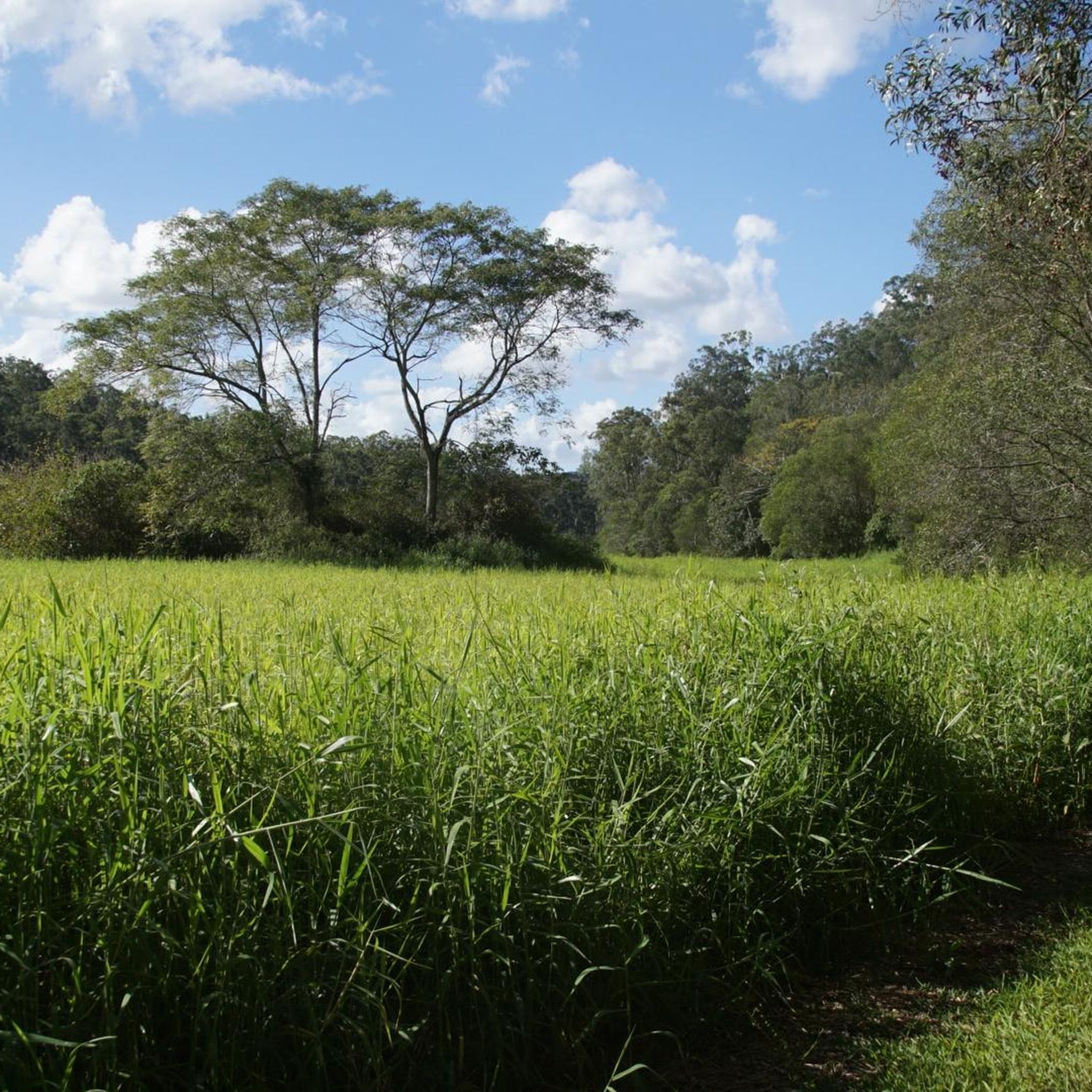
Grey Gums Picnic Area is one of the quieter picnic spots in Mt Coot-tha Reserve, surrounded by tall eucalyptus forest and walking tracks leading deeper into the bushland. Picnic tables, open grassy space, toilets, and nearby trail access make it a common starting point for walks like the Eugenia Circuit and West Ithaca Creek trails. The surrounding forest canopy also provides more shade here than many of the exposed ridgeline areas elsewhere in the reserve.
0
0
The Brisbane River, known traditionally as Maiwar by the Turrbal people, is the main waterway running through Brisbane before emptying into Moreton Bay. The river is a tidal estuary through much of the city, giving it the wide, brown, winding appearance that led locals to nickname it the “Brown Snake.” Its curves shape many of Brisbane’s neighbourhoods and riverside parks, with ferries, bridges, and walking paths following the water through the city.
0
0
The Indooroopilly Riverwalk is a suspended riverside walkway and cycleway running above the Brisbane River beneath the Walter Taylor Bridge area. Opened in 2021, the structure was built as part of Brisbane’s active transport network, linking the Jack Pesch Bridge, Indooroopilly Station, and surrounding bikeways. The riverwalk includes separated pedestrian and cycling lanes, viewing platforms, and long stretches built directly over the water, giving uninterrupted views along the river and toward the surrounding bridges.
0
0

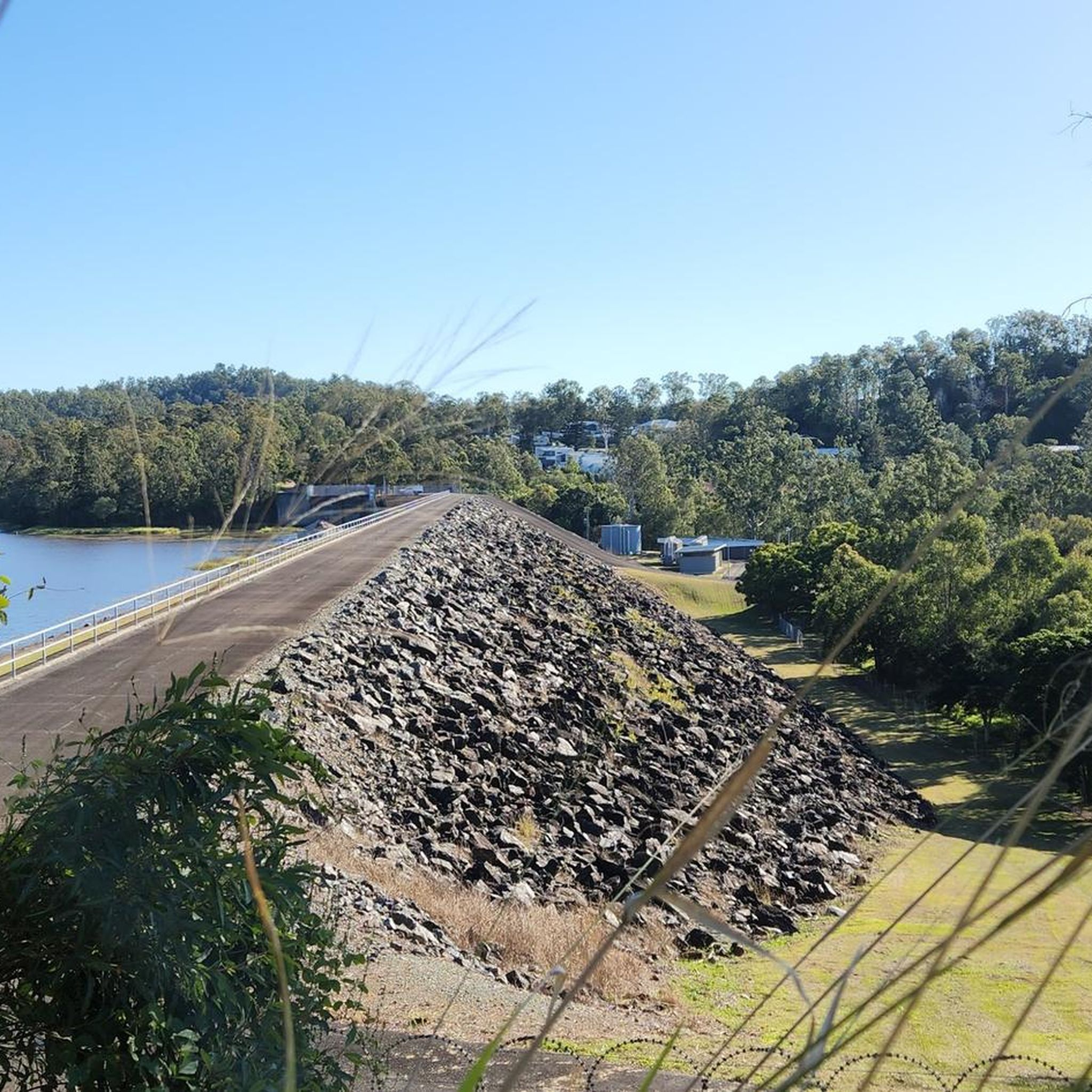
Enoggera Dam is a heritage-listed concrete gravity dam that was completed in 1866. It is Queensland's oldest dam and was originally a major source of drinking water for the city before it became a popular recreational hub. Today, the dam wall and the surrounding reserve are valued for their historical significance, natural beauty, and access to walking trails and water activities.
1
0


Lovely little recreation reserve- there's a wildlife centre you can enter for a small admission, wander the grounds (kids can"dig for dinosaur bones"), or do a bit of kayaking or swimming. Starting point for the Enoggera Reservoir Circuit (hike or bike).
1
1
Frequently Asked Questions
What are the different difficulty levels for mountain biking in Mt Coot-Tha Reserve?
Mt Coot-Tha Reserve offers a wide range of trails, catering to all skill levels. Trails are graded from easy (green) for beginners to very difficult (black) for experienced riders. You'll find over 50 routes in total, with 16 easy, 22 moderate, and 15 difficult options.
Are there any beginner-friendly mountain bike trails in Mt Coot-Tha Reserve?
Yes, there are several beginner-friendly options. The reserve features trails graded as easy (green), perfect for those new to mountain biking or looking for a relaxed ride. An example of an easy route is the Riverside Park Pathway loop from Taringa, which is 18.5 km long.
Where can I find challenging mountain bike trails in Mt Coot-Tha Reserve?
For experienced riders seeking a challenge, Mt Coot-Tha Reserve has 15 difficult-graded trails. Routes like the Rocket Frog Trail, Gap Creek loop from Mount Coot-tha offer an extended ride with significant elevation gain over 48.7 km. The 'Pipeline Trail' is also known for technical features like wall-ride berms and drop-offs.
Are there any loop mountain bike trails in Mt Coot-Tha Reserve?
Yes, many of the mountain bike trails in Mt Coot-Tha Reserve are designed as loops, allowing you to start and finish at the same point. Popular loop options include the Rocket Frog Trail, Gap Creek loop from Brookfield and the Gold Creek Reserve loop from Gold Creek Reserve.
What natural attractions can I see while mountain biking in Mt Coot-Tha Reserve?
The reserve is rich in natural beauty. You can encounter open eucalypt forests, lush rainforest pockets, and winding creek lines. After rainfall, seasonal waterfalls like Simpson Falls become particularly vibrant. The area is also home to approximately 370 wildlife species and 450 native plant species.
Are there any cultural landmarks or viewpoints along the mountain bike trails?
Absolutely. The Mt Coot-Tha Summit Lookout offers iconic panoramic views of the Brisbane skyline and Moreton Bay. You might also pass by historical sites such as an Abandoned Gold Mine, accessible via walking tracks that sometimes intersect with shared-use paths.
Is there parking available for mountain bikers at Mt Coot-Tha Reserve?
Yes, there are various parking areas around Mt Coot-Tha Reserve, especially near popular trailheads and attractions like the Mt Coot-Tha Summit Lookout and the Brisbane Botanic Gardens. Specific parking details can often be found on local council websites or within individual route descriptions.
How can I get to Mt Coot-Tha Reserve using public transport for mountain biking?
Mt Coot-Tha Reserve is accessible by public transport from Brisbane's CBD. Bus services operate to areas around the reserve, including stops near the Brisbane Botanic Gardens and the Mt Coot-Tha Summit. It's advisable to check current bus routes and schedules with TransLink for the most up-to-date information on reaching specific trail access points.
What is the best time of year for mountain biking in Mt Coot-Tha Reserve?
The best time for mountain biking in Mt Coot-Tha Reserve is generally during the cooler, drier months, typically from autumn to spring (March to November). This avoids the intense heat and humidity of summer, and trails are less likely to be muddy from heavy rainfall. Always check local weather and trail conditions before heading out.
What do other mountain bikers enjoy most about Mt Coot-Tha Reserve?
The area is highly rated by the komoot community, with an average score of 4.75 stars from over 20 reviews. Riders frequently praise the diverse terrain, from open eucalypt forests to lush rainforest pockets, and the well-maintained trails that cater to all ability levels. The scenic views, especially from the summit, are also a highlight.
Are there cafes or food options near the mountain bike trails?
Yes, you'll find amenities near the reserve. The Mt Coot-Tha Summit Lookout features a café and restaurant, perfect for a post-ride refuel or a scenic break. Additionally, the Brisbane Botanic Gardens, located at the mountain's base, may have nearby options.
Are there any family-friendly mountain bike trails in Mt Coot-Tha Reserve?
Yes, Mt Coot-Tha Reserve offers several easy-graded trails suitable for families. These trails provide a gentler experience, allowing riders of varying ages and skill levels to enjoy the natural environment together. The 'Rocket Frog Trail' is often mentioned as a good starting point for honing basic skills.
Most popular routes in Mt Coot-Tha Reserve
Most popular attractions in Mt Coot-Tha Reserve

Get inspired with the komoot mobile app


Explore more
Browse the best MTB trails in other regions.
