The best running trails in Seal Bay Regional Nature Park
4.0
(3)
221
runners
25
runs
Jogging in Seal Bay Regional Nature Park offers routes through varied terrain, including coastal sections and forested paths. The region features gentle elevation changes, making it suitable for different fitness levels. Paths often provide views of the surrounding natural landscape, including the coastline. The park's environment supports a range of running experiences, from short loops to longer trails.
Best jogging routes in Seal Bay Regional Nature Park
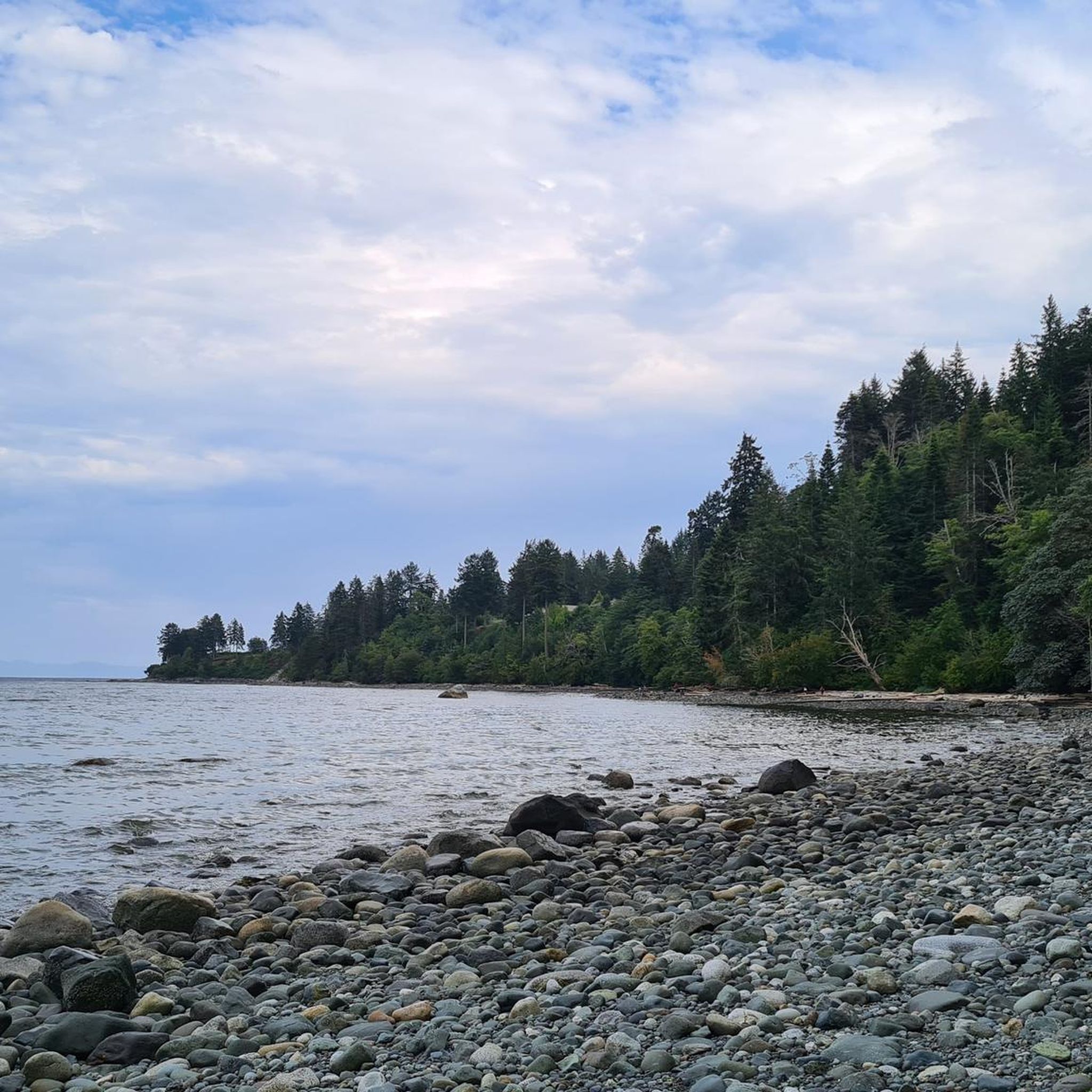
- The most popular jogging route is View of the Rocky Coastline loop from Seal Bay Regional Nature Park, a 9.9 miles (15.9 km) trail that takes 1 hour 46 minutes to complete. This route offers views of the rocky coastline.
- Another top favourite among local runners is Running loop from Huband Park Elementary School, a moderate 7.5 miles (12.0 km) path. This route navigates through the park's natural surroundings.
- Local runners also love the Running loop from Seal Bay Regional Nature Park, a 1.9 miles (3.1 km) trail leading through forested areas, often completed in about 19 minutes.
- Jogging in Seal Bay Regional Nature Park is defined by coastal paths, forested trails, and gentle inclines. The network offers options for different ability levels, from easy loops to more challenging routes.
- The routes in Seal Bay Regional Nature Park are highly rated by the komoot community with an average score of 4.0 stars from over 1 review. More than 300 runners have used komoot to explore Seal Bay Regional Nature Park's varied terrain.
Last updated: September 1, 2026
4.0
(1)
28
runners
Hard run. Very good fitness required. Mostly accessible paths. Some sure footedness required.
6
runners
3.06km
00:19
40m
40m
Easy run. Great for any fitness level. Mostly paved surfaces. Suitable for all skill levels.

Sign up for free
3
runners
8.64km
00:57
80m
80m
Moderate run. Good fitness required. Mostly paved surfaces. Suitable for all skill levels.
10
runners
16.5km
01:45
80m
80m
Hard run. Very good fitness required. Mostly paved surfaces. Suitable for all skill levels.
3
runners
9.86km
01:04
50m
50m
Moderate run. Good fitness required. Mostly paved surfaces. Suitable for all skill levels.
Get access to more routes and recommendations from other explorers.
Sign up for free
Already have an account?
Our route recommendations are based on thousands of hikes, rides, and runs completed by other people on komoot.
Start today with a free account
Your next adventure awaits.
Login or Signup
Tips from the Community

The trail is an easy packed dirt and pine needle path wide enough to walk two abreast. All the trails in Seal Bay Regional Nature Park are very well maintained, and the signage is very clear at every junction.
0
0
New trail signs have been installed that use the Coast Salish language of the K’ómoks First Nation, called aýaĵuθəm. In aýaĵuθəm, the forest loop is called ʔayigən, pronounced "eye-eee-gin".
0
0

Extended Horse Bike Trail is one of the multi-use routes through the west side of Seal Bay Regional Nature Park, where wider paths and gentler terrain make it suitable for walking, mountain biking, and horseback riding. Unlike the steeper beach access trails on the east side of Bates Road, this route stays mostly level as it winds through open forest and connects with other horse and bike trails in the park.
0
0
This path takes you through Courtenay's urban area, partially sheltered on either side by strips of greenery, between downtown and the riverfront. You share the path with cyclists, but the trail is paved and divided to ease multi-use traffic.
0
0
Totem poles by the K’ómoks First Nation have been installed in Courtenay over the past decade to bring greater recognition to indigenous culture. This one overlooks the salt marsh and the banks of the Courtenay River.
0
0
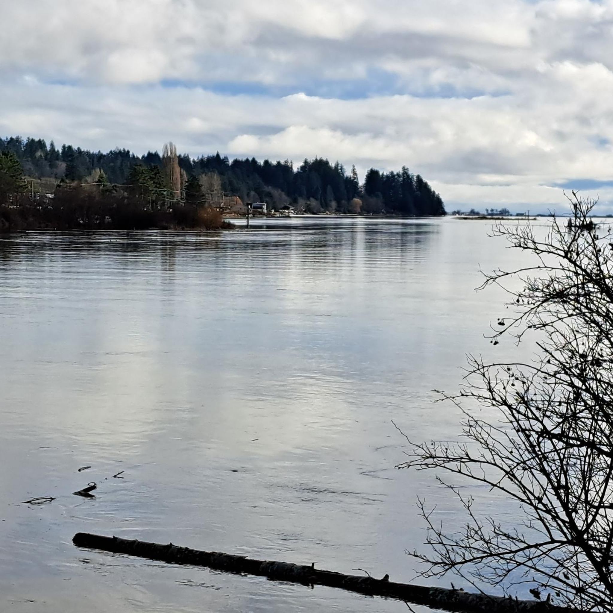
Comox Harbour is a sheltered inlet on the east coast of Vancouver Island, opening into the Strait of Georgia. The water is generally calm, shaped by tides that expose mudflats and sandbars along the shoreline. Backed by distant mountains and coastal communities, it forms a wide, open marine landscape that changes noticeably throughout the day.
0
0
Royston Seaside Trail follows the shoreline of Comox Harbour, and is a flat, gravel path between the water and a narrow strip of coastal vegetation. The trail is short, with driftwood, tidal flats, and small beaches lining the edge of the harbour. With constant ocean views and minimal elevation change, it's a great route for a quick scenic stroll along the waterfront.
0
0
Frequently Asked Questions
How many running routes are available in Seal Bay Regional Nature Park?
There are over 30 dedicated running routes mapped in Seal Bay Regional Nature Park on komoot. These routes offer a variety of experiences, from easy loops to more challenging trails.
Are there any easy running trails suitable for beginners in Seal Bay Regional Nature Park?
Yes, Seal Bay Regional Nature Park offers several easy running trails perfect for beginners or those looking for a relaxed jog. For example, the Running loop from Seal Bay Regional Nature Park is an easy 3.1 km (1.9 miles) route that takes you through forested areas.
What are some longer running routes in Seal Bay Regional Nature Park?
For those seeking a longer run, the park has several options. The View of the Rocky Coastline loop from Seal Bay Regional Nature Park is a challenging 15.9 km (9.9 miles) route, while the Running loop from Huband Park Elementary School offers a moderate 12.0 km (7.5 miles) path through the park's natural surroundings.
Are there any circular running paths in Seal Bay Regional Nature Park?
Yes, many of the running routes in Seal Bay Regional Nature Park are circular, allowing you to start and finish at the same point. The Seal Bay Regional Nature Park loop from Seal Bay Regional Nature Park is a popular 8.6 km (5.3 miles) circular route.
What kind of terrain can I expect on the running trails in Seal Bay Regional Nature Park?
The running trails in Seal Bay Regional Nature Park feature varied terrain, including coastal sections with views of the rocky coastline and forested paths. You'll find gentle elevation changes, making the park suitable for different fitness levels.
What do other runners enjoy about jogging in Seal Bay Regional Nature Park?
The komoot community highly rates the running experience in Seal Bay Regional Nature Park, with an average score of 4.0 stars. Over 300 runners have explored the park's varied terrain, often praising the scenic coastal views and the peaceful forested trails.
Are there any running routes that offer scenic views?
Absolutely. Many routes provide picturesque views of the surrounding natural landscape. The View of the Rocky Coastline loop from Seal Bay Regional Nature Park is specifically known for its stunning vistas of the rocky coastline.
How long does it typically take to complete a running trail in Seal Bay Regional Nature Park?
The duration varies greatly depending on the route's length and your pace. For instance, an easy 3.1 km (1.9 miles) loop like the Running loop from Seal Bay Regional Nature Park can be completed in about 19 minutes, while longer routes can take over an hour.
Are there any running routes that start near Courtenay?
Yes, there are routes that are accessible from nearby areas. The Running loop from Courtenay is a moderate 7.8 km (4.8 miles) route that allows you to start your run directly from Courtenay and explore the park's surroundings.
What are the difficulty levels of the running routes in Seal Bay Regional Nature Park?
The park offers a range of difficulty levels. You'll find 4 easy routes, 24 moderate routes, and 3 difficult routes, ensuring options for runners of all experience levels.
Can I expect to see any wildlife while running in Seal Bay Regional Nature Park?
Seal Bay Regional Nature Park is known for its diverse natural environment. While specific sightings are never guaranteed, runners often have the chance to observe local wildlife, especially along the quieter forested paths and coastal areas. Keep an eye out for marine birds and other native species.
What is the best time of year to go running in Seal Bay Regional Nature Park?
The park is generally accessible year-round. Spring and fall offer mild temperatures and vibrant scenery, making them ideal for running. Summer provides longer daylight hours, while winter runs can be beautiful, though some trails might be wet or muddy depending on recent weather.
Most popular routes in Seal Bay Regional Nature Park
Most popular attractions in Seal Bay Regional Nature Park

Get inspired with the komoot mobile app


Explore more
Browse the best Running Trails & Routes in other regions.
