The best walks and hikes in Seal Bay Regional Nature Park
5.0
(12)
143
hikers
17
hikes
Hiking in Seal Bay Regional Nature Park features a diverse landscape of regenerated second-growth forests, steep ravines, and wetlands. The park encompasses 1,585.6 acres (642 hectares) with varied terrain, including nearly one kilometer of beachfront along the Strait of Georgia. Trails wind through forests, wetlands, and meadows, offering views from the Seal Bay Lookout. The park's elevation changes range from 57 to 291 meters.
Best hiking trails in Seal Bay Regional Nature Park
- The most popular hiking route is Seal Bay – Seal Bay Regional Nature Park loop from Seal Bay Regional Nature Park, a 5.5 miles (8.8 km) trail that takes 2 hours 23 minutes to complete. This moderate route explores the varied forest and coastal sections of the park.
- Another top favourite among local hikers is Seal Bay Regional Nature Park loop from Huband Park Elementary School, a moderate 6.6 miles (10.7 km) path. This trail offers a longer exploration of the park's natural features and surrounding areas.
- Local hikers also love the Seal Bay Regional Nature Park loop from Seal Bay Regional Nature Park, a 4.0 miles (6.5 km) trail leading through diverse forest and wetland areas, often completed in about 1 hour 44 minutes.
- Hiking in Seal Bay Regional Nature Park is defined by dense forests, scenic ravines, and coastal paths with ocean views. The extensive trail network offers options for different ability levels, from easy strolls to more challenging hikes.
- The routes in Seal Bay Regional Nature Park are highly rated by the komoot community with an average score of 4.9 stars from over 15 reviews. More than 130 hikers have used komoot to explore Seal Bay Regional Nature Park's varied terrain.
Last updated: August 30, 2026
5.0
(2)
36
hikers
9.80km
02:34
80m
80m
Moderate hike. Good fitness required. Easily-accessible paths. Suitable for all skill levels.
6.11km
01:36
50m
50m
Easy hike. Great for any fitness level. Easily-accessible paths. Suitable for all skill levels.

Sign up for free
5.0
(5)
18
hikers
3.69km
01:01
60m
60m
Easy hike. Great for any fitness level. Easily-accessible paths. Suitable for all skill levels.
5.0
(1)
22
hikers
6.55km
01:44
70m
70m
Easy hike. Great for any fitness level. Easily-accessible paths. Suitable for all skill levels.
5.0
(1)
4
hikers
8.02km
02:10
100m
100m
Moderate hike. Good fitness required. Easily-accessible paths. Suitable for all skill levels.
Get access to more routes and recommendations from other explorers.
Sign up for free
Already have an account?
Our route recommendations are based on thousands of hikes, rides, and runs completed by other people on komoot.
Start today with a free account
Your next adventure awaits.
Login or Signup
Tips from the Community

This easy packed dirt path takes you through a spacious woodland of matchstick fir trees. The uniform size of the firs is strong visual evidence that the area was logged in the recent past.
0
0
The trail is an easy packed dirt and pine needle path wide enough to walk two abreast. All the trails in Seal Bay Regional Nature Park are very well maintained, and the signage is very clear at every junction.
0
0
New trail signs have been installed that use the Coast Salish language of the K’ómoks First Nation, called aýaĵuθəm. In aýaĵuθəm, the forest loop is called ʔayigən, pronounced "eye-eee-gin".
0
0

Extended Horse Bike Trail is one of the multi-use routes through the west side of Seal Bay Regional Nature Park, where wider paths and gentler terrain make it suitable for walking, mountain biking, and horseback riding. Unlike the steeper beach access trails on the east side of Bates Road, this route stays mostly level as it winds through open forest and connects with other horse and bike trails in the park.
0
0
Catch Up Loop is a short connector trail that curves through gently rolling terrain, and can be an easy addition to longer walks through the park. It connects to several nearby trails, perfect for creating shorter or more flexible loop options. The trail sees lighter traffic than some of the others in this section of the park, making it a great choice for a quieter stretch away from the main beach-bound routes.
0
0
Seal Bay Regional Nature Park is a large protected coastal forest north of Courtenay, with over 14 kilometres of trails that wind through second-growth woodland, wetlands, and shoreline along the Salish Sea. Known for its mix of quiet forest trails and beach access, the park includes stands of Douglas fir, western red cedar, and hemlock, with opportunities to spot birds, seals, and other wildlife along the coast. The park is an ideal place for walking, trail running, and enjoying spending time outdoors in a beautiful, peaceful setting.
0
0

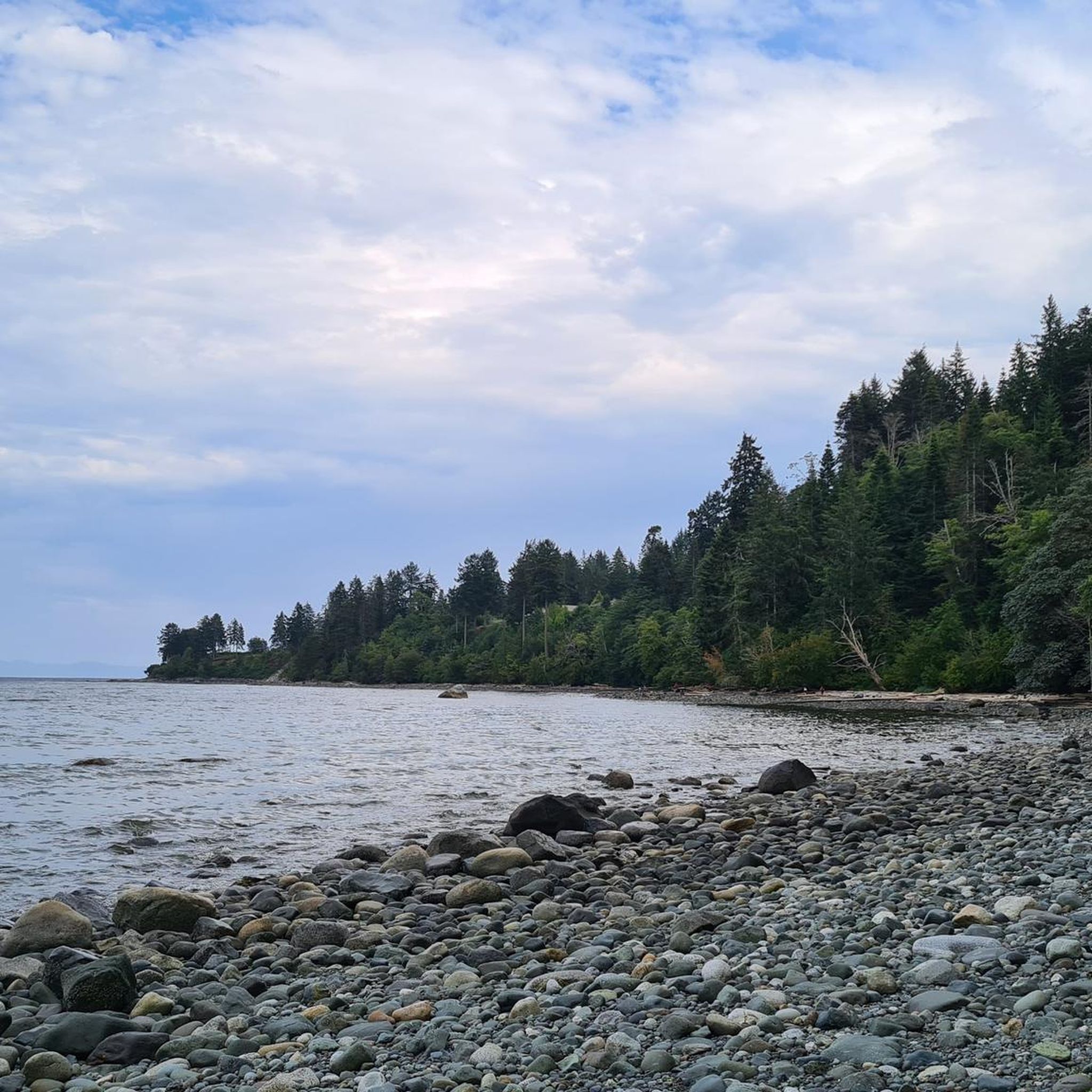
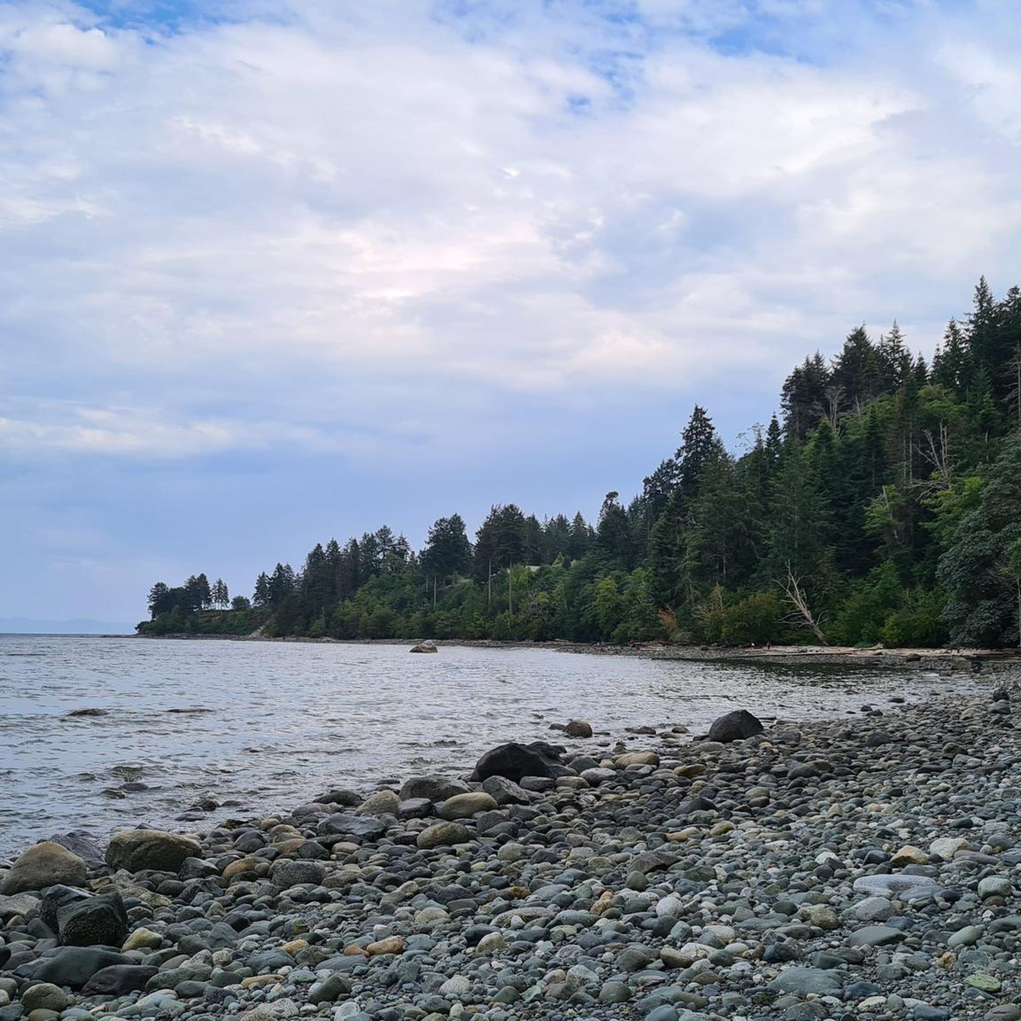
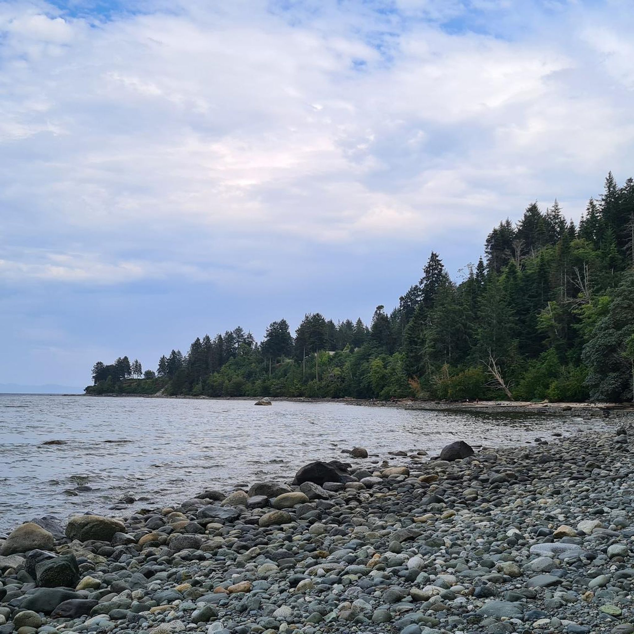
There are several access roads and parking options to reach Seal Bay Nature Park. We are traveling in mid-May 2025 and park the vehicle on Hardy Road in the northwest of the park. Access is from the North Island Highway. As recently as the early 20th century, the area was systematically logged. Today, the value of Seal Bay Nature Park lies in its regeneration of secondary forest. Culturally and historically, the region is of great significance to the K'ómoks First Nation. To honor this, the new signposts list the names of the Coast Salish people in their traditional language. The history of the park is described in detail on the Comox Valley Regional District website: https://www.comoxvalleyrd.ca/parks-recreation/comox-valley-parks-trails/seal-bay-nature-park We walk through the mixed forest of Douglas firs, maples, and alders and descend the embankment in the narrow ravine (saʔpɛt) to the beach. It's low tide; the beach is littered with large stones. In the distance, we see individual seals lying on the rocks. Several bald eagles circle above us and perch in trees within sight - a magnificent spectacle.
2
0

Nice bridge, make sure no one is coming from opposite direction. Bridge is narrow.
0
0
Frequently Asked Questions
How many hiking trails are available in Seal Bay Regional Nature Park?
Seal Bay Regional Nature Park offers a comprehensive network of over 24 km of trails. Komoot lists 16 distinct hiking routes within the park, catering to various skill levels.
Are there any easy or accessible hiking options in the park?
Yes, the park is very accommodating for easy walks. Komoot identifies 13 easy routes, and the park also features a dedicated 2 km wheelchair-accessible loop. The west side of the park, divided by Bates Road, generally offers more level and accessible paths.
What kind of natural features and landmarks can I expect to see while hiking?
Hikers can explore diverse landscapes including regenerated second-growth forests with Douglas fir and big-leaf maple, steep ravines, and even a seasonal waterfall. Notable natural features include Melda's Marsh, an ecologically rich wetland perfect for birdwatching, and nearly one kilometer of beachfront along the Strait of Georgia. Don't miss the Seal Bay Lookout for panoramic ocean views.
Are dogs allowed on the trails in Seal Bay Regional Nature Park?
Yes, dogs are generally welcome in Seal Bay Regional Nature Park. However, specific trails like the Melda's Marsh Loop on the west side of the park have a leashing-mandatory policy to protect wildlife and ensure a pleasant experience for all visitors.
Are there any loop trails suitable for a longer hike?
Absolutely. For a longer exploration, consider the Seal Bay Regional Nature Park loop from Huband Park Elementary School. This moderate 10.7 km (6.6 miles) path offers an extensive journey through the park's natural features and surrounding areas.
What wildlife might I encounter during my hike?
Seal Bay Regional Nature Park is a haven for wildlife. You might spot harbour seals along the bay, and a wide variety of bird species including bald eagles, great blue herons, and various woodpeckers, especially around Melda's Marsh. Deer, owls, ducks, squirrels, and beavers are also common, with occasional sightings of cougars and bears.
What do other hikers enjoy most about Seal Bay Regional Nature Park?
The park is highly rated by the komoot community, with an average score of 4.9 stars from over 15 reviews. Reviewers often praise the diverse terrain, from dense forests and scenic ravines to coastal paths with ocean views, and the well-maintained trail network suitable for all abilities.
Are there any trails that lead to the waterfront or offer ocean views?
Yes, several trails on the eastern side of the park, such as the Ravine/saʔpɛt, Don Apps, and Eagle/q̓ayk̓ʷ trails, lead down to the waterfront. The Don Apps Trail specifically guides hikers past fern-laden ravines directly to the beach, offering stunning views of the Strait of Georgia.
Are there any family-friendly hiking options in Seal Bay Regional Nature Park?
The park offers many family-friendly options, including 13 easy routes. A good choice for families looking for a moderate walk is the Seal Bay Nature Park loop from Seal Bay Regional Nature Park, which is 3.7 km (2.3 miles) and can be completed in about an hour.
What is the best time of year to visit Seal Bay Regional Nature Park for hiking?
Seal Bay Regional Nature Park is enjoyable year-round due to its diverse ecosystems. Spring brings lush greenery and active birdlife, while summer offers pleasant weather for coastal walks. Autumn showcases beautiful fall foliage, and even winter provides tranquil, uncrowded trails, though some areas might be muddy after rain.
Are there amenities like restrooms or picnic areas available?
Yes, for visitor comfort, Seal Bay Regional Nature Park provides amenities such as benches, picnic tables, and outhouses at various points throughout the park.
Can I find a trail that combines forest and coastal scenery?
Many trails in the park offer a mix of environments. For a route that beautifully combines varied forest sections with coastal views, consider the Seal Bay – Seal Bay Regional Nature Park loop from Seal Bay Regional Nature Park. This moderate 8.8 km (5.5 miles) trail takes about 2 hours 23 minutes to complete.
Most popular routes in Seal Bay Regional Nature Park
Most popular attractions in Seal Bay Regional Nature Park

Get inspired with the komoot mobile app


Explore more
Browse the best Hikes in other regions.
