The 11 Most Amazing Peaks around Emeryville
Best mountain peaks around Emeryville are found in the broader San Francisco Bay Area, as the city itself is low-lying and situated on the San Francisco Bay. While Emeryville offers views of the Berkeley Hills, actual peaks are located further inland. The region provides diverse natural features, including prominent summits in Alameda County. These areas offer extensive hiking opportunities and panoramic vistas for visitors.
Best mountain peaks around Emeryville
- The most popular mountain peaks is Mount Caroline Livermore summit,…
Last updated: June 24, 2026
Grizzly Peak Vista Point
Highlight • Viewpoint
Tip by

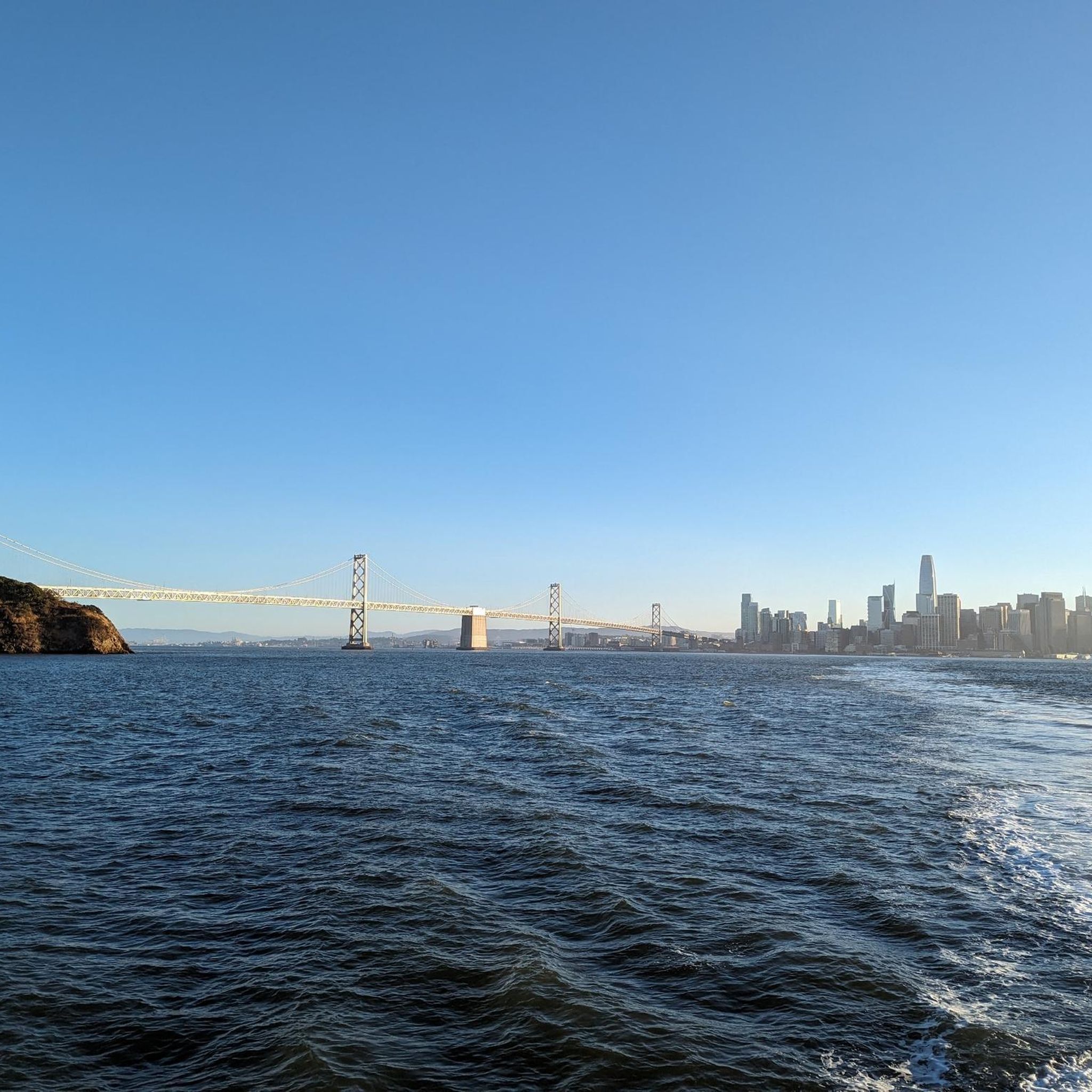
Summit of Yerba Buena Island
Highlight • Summit
Tip by
Sign up now to discover places like this
Get recommendations on the best single tracks, peaks, & plenty of other exciting outdoor places.
Sign up for free
Wildcat Peak
Highlight • Viewpoint
Tip by
Mount Caroline Livermore summit
Highlight • Summit
Tip by
Piedmont reservoir 🌳
Highlight • Structure
Tip by
Sign up for free to discover even more peaks around Emeryville.
Sign up for free
Already have an account?
Start today with a free account
Your next adventure awaits.
Login or Signup

Tips from the Community

One of the wonderfull view from the park. Please discover this park. You will not regret it
0
0

Easy and fun hike for kids and adults, with spectacular views over the entire SF Bay, Golden Gate, Marin, Carquinez Straight, San Pablo Reservoir, and Briones Park.
0
0

The switchbacks of Centennial Drive open out to a parking lot and overlook. You are treated to sweeping views out across Berkely and San Francisco Bay all the way to the Golden Gate Bridge.
1
0

lbeautiful view of the island and the Bay Bridge
1
1

Gorgeous views of Berkeley and the SF Bay area from Wildcat Peak.
0
0
Incredible views over Berkeley and San Francisco Bay from the Grizzly Peak viewpoint.
0
0

Lovely trail climbing up to the Lawrence Hall of Science with several spectacular vista points of Berkeley and the whole SF Bay.
1
0
For a few years while the roads accessing the Treasure Island residential housing development are being rebuilt, this steep hill will be part of the only bike route connecting Treasure Island and its SF Muni bus & Ferry stop with the bike trail to the East Bay. At least it offers an elevated panoramic view of the island. Beware: due to construction activities the trail access may only be open on weekends!
2
0
Frequently Asked Questions
What are some prominent mountain peaks and viewpoints near Emeryville?
While Emeryville itself is low-lying, the broader San Francisco Bay Area offers several notable peaks and viewpoints. You can visit Mount Caroline Livermore summit, which provides sweeping bay and San Francisco skyline views. Another excellent spot is Grizzly Peak Vista Point, offering panoramic views across Berkeley, San Francisco Bay, and the Golden Gate Bridge. For an elevated perspective of Yerba Buena Island and the Bay Bridge, consider the Summit of Yerba Buena Island.
What kind of views can I expect from the peaks near Emeryville?
The peaks and viewpoints near Emeryville offer diverse and breathtaking vistas. From spots like Mount Caroline Livermore summit and Grizzly Peak Vista Point, you can expect sweeping views of the San Francisco Bay, the iconic San Francisco skyline, and the Golden Gate Bridge. The Summit of Yerba Buena Island provides an elevated panoramic view of the island itself and the Bay Bridge.
Are there family-friendly mountain peaks or viewpoints around Emeryville?
Yes, Grizzly Peak Vista Point is considered family-friendly and offers spectacular views across Berkeley and San Francisco Bay. While not a traditional peak, the area around Piedmont reservoir is also noted as family-friendly, offering a wooded buffer and open space for recreation.
What are the difficulty levels of hikes to peaks near Emeryville?
Many of the highlighted peaks and viewpoints, such as Mount Caroline Livermore summit, Summit of Yerba Buena Island, and Grizzly Peak Vista Point, are generally rated as intermediate difficulty. This means they involve moderate climbs and can be enjoyed by those with a reasonable level of fitness. The broader Bay Area also offers a range of trails from easy to challenging.
What outdoor activities can I do near the mountain peaks around Emeryville?
The region around Emeryville's peaks is excellent for various outdoor activities. You can find extensive opportunities for hiking, gravel biking, road cycling, and mountain biking. For detailed routes, explore the Gravel biking around Emeryville, Road Cycling Routes around Emeryville, and MTB Trails around Emeryville guides.
Are there specific trails for mountain biking near Emeryville's peaks?
Yes, the East Bay offers numerous mountain biking trails. You can find routes like the 'Inspiration Point Overlook – Wildcat Creek Trail loop' or the 'Wildcat Creek Trail – Bay Overlook - San Pablo Ridge loop'. For more options and details, refer to the MTB Trails around Emeryville guide.
Can I find road cycling routes that offer views of the peaks?
Absolutely. The area provides several road cycling routes that offer scenic views. The 'San Francisco Bay Trail' is a popular option, and you can also find routes like the 'Emeryville Bayfront Bridge – Albany Bulb loop'. Discover more routes in the Road Cycling Routes around Emeryville guide.
What is the best time to visit the peaks near Emeryville?
The San Francisco Bay Area generally enjoys mild weather year-round, making most seasons suitable for visiting the peaks. Spring and fall often offer clear skies and comfortable temperatures, ideal for hiking and outdoor activities. Summer can be pleasant, though coastal fog might occasionally obscure distant views. Winter is typically mild but can bring rain, so check weather conditions before heading out.
Are there any historical or natural features associated with these peaks?
Yes, Mount Caroline Livermore summit is named after Caroline Sealy Livermore, a significant American conservationist whose work led to the protection of several areas in Marin County. The Piedmont reservoir site, while now decommissioned, has historical significance as a former water storage facility for Piedmont and Oakland, now serving as a wooded buffer.
Where can I find parking for trails leading to these peaks?
Parking is available at several locations. For instance, Grizzly Peak Vista Point features a parking lot directly at the overlook, making it easily accessible. For other trails and parks in the East Bay, parking facilities are generally provided at trailheads and visitor centers.
Are dogs allowed on trails near Emeryville's peaks?
Many trails in the East Bay Regional Parks, which encompass several peaks and natural areas, are dog-friendly. However, specific rules regarding leashes and restricted areas may apply. It's always best to check the regulations for the particular park or trail you plan to visit beforehand to ensure a pleasant experience for you and your dog.
What should I wear for hiking near Emeryville mountains?
Given the varied terrain and potential for changing weather in the Bay Area, it's advisable to wear layers. Comfortable hiking shoes with good grip are essential. Depending on the season, bring sun protection (hat, sunscreen) and plenty of water. Even on mild days, conditions can change, especially at higher elevations or exposed viewpoints.
Most popular routes around Emeryville
Most popular attractions around Emeryville

Get inspired with the komoot mobile app


Explore more
See even more amazing summits around Emeryville with these guides:
