The best walks and hikes in Prescott National Forest
4.4
(221)
1,255
hikers
123
hikes
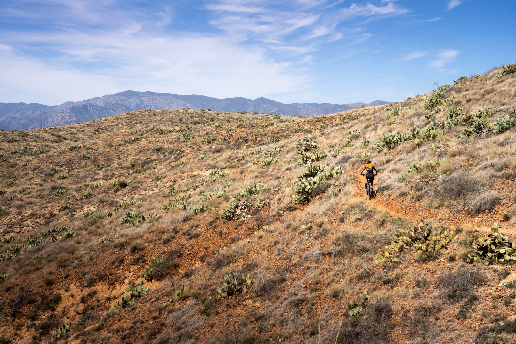
Hiking in Prescott National Forest navigates a diverse landscape characterized by pine forests, prominent granite formations, and high desert terrain. The region's varied elevation, ranging from 3,000 to 8,000 feet, creates a wide array of environments, from cactus-studded lowlands to cool Ponderosa pine mountains. This allows for comfortable outdoor recreation year-round, with extensive hiking trails in Prescott National Forest catering to different preferences. The forest features a network of trails that range from lakeside paths to routes ascending local peaks like Spruce Mountain.
Best hiking trails in Prescott National Forest
- The most popular hiking route is Thumb Butte Trail Loop— Prescott National Forest, a 2.1 miles (3.5 km) trail that takes 1 hour 10 minutes to complete. This easy loop features interpretive signs detailing the area's geology and ecology.
- Another top favourite among local hikers is Granite Mountain Trail — Granite Mountain Wilderness, a moderate 8.2 miles (13.2 km) path. The trail leads through the Granite Mountain Wilderness, featuring notable rock formations and expansive views.
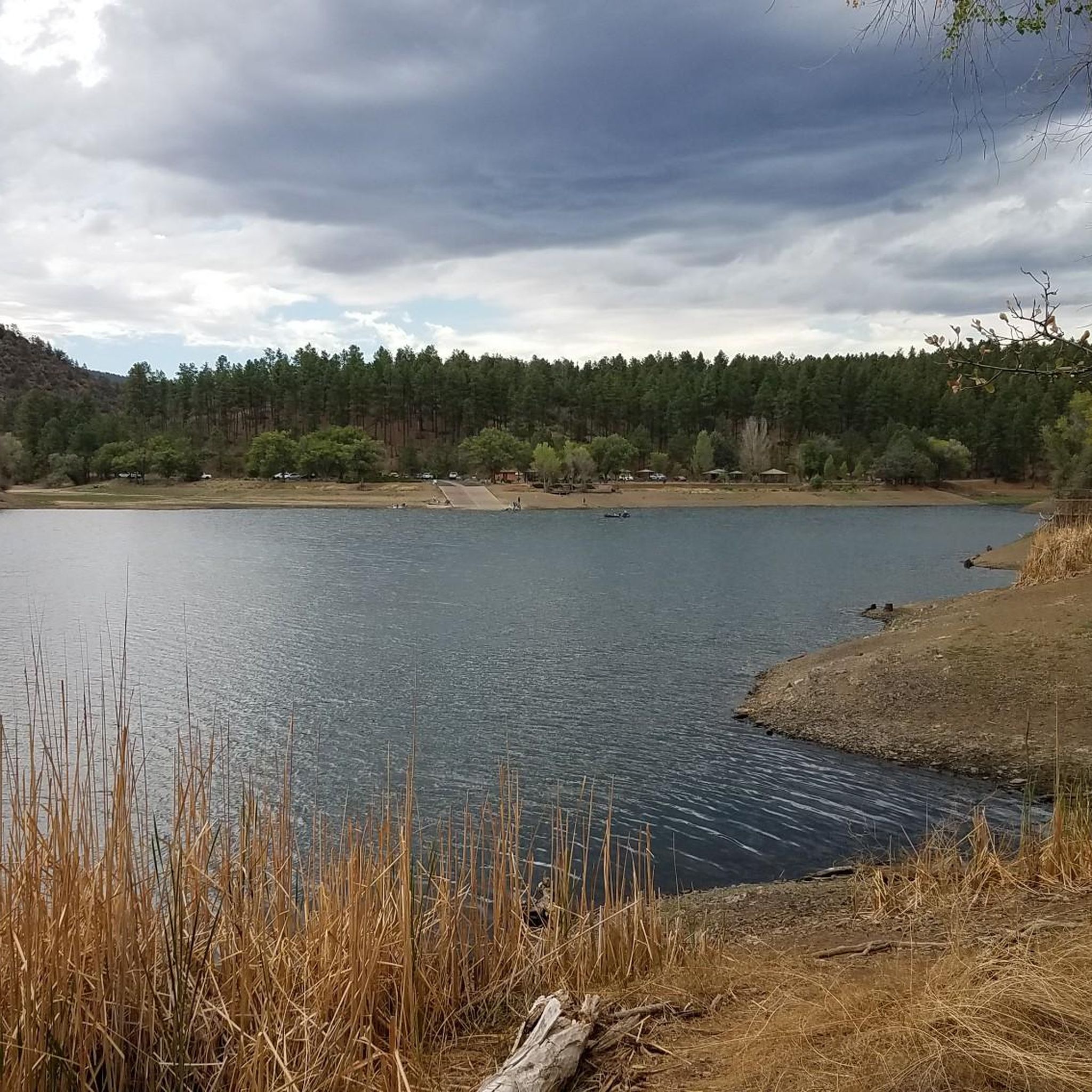
- Local hikers also love the Lynx Lake Trail loop — Prescott National Forest, a 2.8 miles (4.6 km) trail leading around the perimeter of Lynx Lake, often completed in about 1 hour 10 minutes.
- Hiking in Prescott National Forest is defined by its pine-shaded forests, prominent granite outcrops, and picturesque lakeside paths. The trail network offers routes suitable for different ability levels, from easy family-friendly hikes to more challenging ascents.
- The routes in Prescott National Forest are highly rated by the komoot community with an average score of 4.4 stars from over 210 reviews. More than 1000 hikers have used komoot to explore Prescott National Forest's varied terrain.
Last updated: October 10, 2026
9
hikers
3.85km
01:04
70m
70m
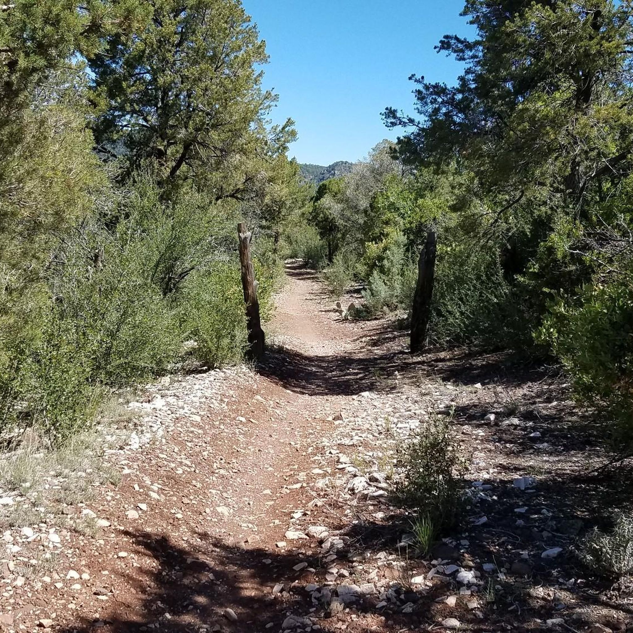
Embark on the White Spar Short Loop, an easy hiking route that takes you through a refreshing ponderosa pine forest. You'll find welcome shade and a mix of oak trees, manzanita, and pinyon-juniper woodland along the way. This pleasant 2.4-mile (3.9 km) loop offers a straightforward outdoor experience, gaining 241 feet (74 metres) in elevation. From higher points, you can enjoy panoramic views of iconic landmarks such as Thumb Butte and Granite Mountain. Expect to complete this scenic hike in about 1 hour and 4 minutes.
Accessing the White Spar Short Loop is simple, as the trailhead is conveniently situated just outside the White Spar Campground. You will find ample parking available right at the trailhead, making your arrival hassle-free. Additionally, the campground area provides amenities like pit toilets for your convenience before or after your hike. This route is generally accessible year-round, but checking local conditions is always a good idea.
This trail is nestled within the expansive Prescott National Forest, offering a classic example of the region's diverse ecosystems. The blend of ponderosa pines with pinyon-juniper woodland showcases the transition zones common in Arizona's higher elevations. It's a great option for those looking for a gentle introduction to the area's natural beauty without committing to a longer or more strenuous trek. The loop provides a peaceful escape into nature, close to local amenities.
5
hikers
4.28km
01:10
70m
70m
Discover the Pine Lakes #316 and Watertower #315 Loop, an easy hike that guides you through diverse forest environments near Prescott, Arizona. As you follow the path, you will encounter a mix of manzanita, ponderosa pine, and alligator juniper trees, with some areas offering welcome shade. The route includes rock faces and, if you visit during the right season, splashes of colorful wildflowers. This pleasant loop covers 2.7 miles (4.3 km) with a gentle elevation gain of 224 feet (68 metres), typically taking about 1 hour and 10 minutes to complete.
You can often begin your adventure on this loop from the popular Thumb Butte trailhead, a well-known starting point for several trails in the area. If you plan to bring your canine companion, you will be pleased to know that dogs are permitted on the Watertower Trail #315 section of the loop. Always check local conditions before heading out, but this trail generally offers straightforward access for a relaxing outdoor experience.
This trail is a great way to experience the natural beauty of the Prescott National Forest, offering glimpses of Granite Mountain as you climb to a ridge. The area is known for its interconnected trail system, giving you the flexibility to combine this loop with other nearby paths if you wish to extend your hike. It provides a tranquil escape into nature, showcasing the unique flora and geology of the region.

4.5
(2)
4
hikers
7.81km
02:14
240m
100m
Embark on the Prescott Circle Trail: Segment 01, a moderate hiking route that introduces you to the diverse landscapes of Prescott National Forest. This segment spans 4.9 miles (7.8 km) and involves an elevation gain of 779 feet (237 metres), typically taking about 2 hours and 13 minutes to complete. As you hike, you will experience scenic viewpoints, starting near the picturesque Watson Lake and its unique Granite Dells, before continuing along the south shore of Willow Lake. Expect broad, well-maintained paths through chaparral and grasslands, offering a pleasant outdoor experience.
For your visit, you will find this segment to be easily accessible, making it a popular choice for day hikers. Parking is conveniently available at the Peavine Trailhead, which also marks mile 0 for the entire Prescott Circle Trail. The route is clearly marked with Prescott Circle Trail emblems, ensuring straightforward navigation throughout your hike. This segment is suitable for a wide range of hikers looking for a manageable yet rewarding outing.
This particular segment offers a fantastic introduction to the much longer Prescott Circle Trail, showcasing some of the region's distinctive natural features. The unique Granite Dells, with their low granite domes, provide a striking visual element, while the proximity to Willow Lake offers opportunities for birdwatching. The trail's well-maintained nature and varied scenery make it a great option for those wanting to explore the natural beauty of the area without committing to a full-day excursion.
4.5
(2)
4
hikers
10.1km
02:51
250m
140m
Embark on a moderate hike along Prescott Circle Trail: Segment 3, a 6.3-mile (10.1 km) route that offers a pleasant outdoor experience. You'll gain 810 feet (247 metres) in elevation, typically taking around 2 hours and 50 minutes to complete. As you traverse the varied terrain, you can enjoy distant views stretching towards the San Francisco Peaks. The trail also guides you near the Cottonwood Peninsula, providing opportunities for birdwatching along Willow Lake. This segment is known for its accessible paths and diverse landscapes, making it a rewarding journey for many.
Planning your visit to this segment is straightforward, as the route is generally well-maintained and easy to navigate. You can find parking typically available at trailheads along the Prescott Circle Trail, including convenient spots near Pioneer Park. Before heading out, always make sure to check local conditions to ensure a smooth and enjoyable hike. This segment is accessible for most hikers, offering a pleasant stroll without overly challenging sections.
This particular segment of the Prescott Circle Trail is often considered one of the easier parts, making it a family-friendly option. Beyond the natural beauty, the route takes you through Pioneer Park and features a unique passage under Pioneer Parkway via a tunnel. The varied scenery, from distant mountain views to lakeside birdwatching opportunities, highlights the diverse natural environment surrounding Prescott.
2
hikers
11.5km
03:39
470m
460m
Embark on the Spruce Mountain via Groom Creek Loop Trail #307 for a rewarding hike through a diverse forest landscape. You will trek among Ponderosa pine, Gambel oak, and Douglas fir, experiencing the changing atmosphere as you ascend. This moderate route covers 7.1 miles (11.5 km) and involves a significant elevation gain of 1528 feet (466 metres). As you climb, the tree cover gives way to expansive views, culminating in panoramic 360-degree vistas from the summit. Plan for approximately 3 hours and 39 minutes to complete this journey, which offers stunning long-range sights of Prescott's lakes and even the distant San Francisco Peaks on a clear day.
The trail is easily accessible, situated just a short drive from Prescott within the Groom Creek recreation area. This area provides additional amenities, including campgrounds, making it convenient for a longer stay. At the summit, you will find picnic tables and restrooms, offering a perfect spot to rest and refuel while enjoying the views. Be aware that this is a multi-use trail, so you might encounter mountain bikers and horseback riders during your hike.
Historically, the mountain's name comes from early settlers who mistook white firs for spruce trees, despite the abundance of other conifer species. The true highlight at the summit is the Spruce Mountain Fire Lookout tower, which you might be able to climb for an even more elevated perspective when it is staffed. This trail offers a unique opportunity to experience both the natural beauty and a piece of local history, providing a memorable outdoor adventure in the Prescott National Forest.
Get access to more routes and recommendations from other explorers.
Already have an account?
Our route recommendations are based on thousands of hikes, rides, and runs completed by other people on komoot.
Start today with a free account
Your next adventure awaits.


Other adventures in Prescott National Forest

Tips from the Community

Also check out: "This Site Listed on the AMERICAN RESOURCES NATIONAL HISTORIC LOOKOUT REGISTER: A national register recognizing a fire lookout sites, structures and towers with historic and cultural significance to forest fire detection in order to promote their protection. Maintained in cooperation with federal, state, and private forestry agencies and landowners throughout the United States. www.firelookout.net "
0
0
Excellent views and good training exercise. Hike from Smith Ravine Trail 297 or Groom Creek Trail 307. 🌲👍🏻🙂
0
0

Spruce Mountain has a fire lookout at the summit. It is one of four fire lookouts in the Bradshaw Mountains. It is staffed during peak wildfire season and visitors are encouraged to climb the 55 feet to the lookout to talk to the volunteer and learn about fire prevention.
0
0
Spruce Mountain has a fire lookout at the summit. It is one of four fire lookouts in the Bradshaw Mountains. It is staffed during peak wildfire season and visitors are encouraged to climb the 55 feet to the lookout to talk to the volunteer and learn about fire prevention.
1
0
The trail 738 goes on farther. So, this is a good historic landmark, by which to mark it's current, official end.
7
0
Frequently Asked Questions
What is the best time of year to hike in Prescott National Forest?
Thanks to its mild climate, Prescott National Forest offers excellent hiking opportunities year-round. Spring and fall provide the most comfortable temperatures. Summer is also popular, but it's best to start hikes early in the day to avoid the afternoon heat. Winter can bring snow to higher elevations, offering a different kind of scenic beauty, but be sure to check trail conditions for ice or closures.
Are there any easy, family-friendly hikes available?
Yes, the forest has many options suitable for families. A great choice is the Lynx Lake Trail loop, a mostly flat and paved path around the picturesque Lynx Lake. It's perfect for a leisurely stroll with children and offers beautiful water views in a pine-shaded setting.
I'm looking for a more challenging hike. What do you recommend?
For a strenuous but rewarding experience, consider the Granite Mountain Trail. This route takes you through the Granite Mountain Wilderness, featuring a significant climb that leads to stunning rock formations and expansive views from the top.
Are dogs allowed on the trails in Prescott National Forest?
Yes, dogs are generally welcome on most trails in Prescott National Forest, but they must be kept on a leash at all times. It's also important to pack enough water for your pet and to clean up after them to help preserve the natural environment.
What kind of scenery can I expect on the trails?
The scenery is incredibly diverse. You'll find trails that wind through dense pine forests, routes that cross high desert terrain, and paths that navigate the iconic, weathered granite formations known as the Granite Dells. Many trails also offer panoramic views of the surrounding mountains and the city of Prescott.
Do I need to pay a fee or get a permit to hike?
While many trails in the forest are free to access, some developed recreation sites, such as Lynx Lake and Thumb Butte, require a day-use fee for parking and amenities. It's best to have cash or a credit card on hand. For overnight backpacking in designated Wilderness Areas, special regulations may apply, but permits are not typically required for day hiking.
Are there any good circular or loop hikes?
The forest has numerous loop trails so you don't have to retrace your steps. A popular option is the Thumb Butte Trail Loop, which circles the base of this prominent landmark and includes interpretive signs about the local geology and history.
What do other hikers think about the trails in Prescott National Forest?
The trails are highly regarded by the komoot community. Reviewers often praise the variety of terrain, from easy lakeside paths to challenging mountain ascents, and the well-maintained condition of many popular routes. The stunning views and unique granite landscapes are frequently mentioned as highlights.
How many hiking trails are in Prescott National Forest?
There are over 100 distinct hiking routes mapped in Prescott National Forest, covering approximately 450 miles of non-motorized trails. This extensive network includes 46 easy trails, 47 moderate routes, and 8 difficult trails, offering something for every skill level.
Where can I find a hike with great views that isn't too crowded?
For a moderately challenging hike that rewards with beautiful forest scenery and a summit view, try the Groom Creek Trail loop to Spruce Mountain Peak. While popular, it's generally less congested than the trails immediately surrounding the city, offering a greater sense of solitude.
What are the trail conditions like? Are there any hazards to be aware of?
Trail conditions vary by season and location. Many paths are well-maintained, but you can encounter loose rock, uneven surfaces, and steep sections, especially on more rugged mountain trails. In summer, be aware of monsoon storms and flash floods in canyons. In winter, higher elevation trails can have snow and ice. Always check the weather forecast before you go.
Most popular routes in Prescott National Forest
Most popular attractions in Prescott National Forest

Get inspired with the komoot mobile app


Explore more
Browse the best Hikes in other regions.
