The best walks and hikes around Area C (Moyie/Bull River)
4.5
(32)
472
hikers
15
hikes
Hiking around Area C (Moyie/Bull River) offers diverse terrain, characterized by the deep blue waters of Moyie Lake, the clear Bull River carving through scenic canyons, and the surrounding Purcell and Rocky Mountains. The region features a mix of forests, valleys, and wetlands, providing varied landscapes for outdoor exploration. Elevation gains range from gentle slopes around lakes to significant ascents in the mountain ranges. This area is known for its natural beauty and varied ecosystems, supporting a range of hiking experiences.
Best hiking trails around Area C (Moyie/Bull River)
- The most popular hiking route is Mount Fisher Trail, a 4.3 miles (6.9 km) trail that takes 4 hours 34 minutes to complete, rewarding hikers with panoramic summit views.
- Another top favourite among local hikers is Mount Baker via Mount Baker Downhill — Cranbrook, a difficult 8.0 miles (12.8 km) path offering extensive views of Cranbrook, the Purcell Mountains, and the Rocky Mountains.
- Local hikers also love the Bear Lake Trail, a 3.0 miles (4.8 km) trail leading through the East Kootenay region to the picturesque Bear Lake, often completed in about 2 hours 12 minutes.
- Hiking around Area C (Moyie/Bull River) is defined by mountain ranges, serene lakes, and winding rivers. The network offers options for different ability levels, from easy walks to challenging mountain ascents.
- The routes in Area C (Moyie/Bull River) are highly rated by the komoot community with an average score of 4.6 stars from over 27 reviews. More than 400 hikers have used komoot to explore Area C (Moyie/Bull River)'s varied terrain.
Last updated: September 30, 2026
7
hikers
6.94km
04:34
1,230m
1,230m
Hard hike. Very good fitness required. Easily-accessible paths. Suitable for all skill levels.
9
hikers
4.78km
02:12
470m
470m
Moderate hike. Good fitness required. Easily-accessible paths. Suitable for all skill levels.

5.0
(1)
9
hikers
3.74km
01:36
330m
330m
Moderate hike. Good fitness required. Easily-accessible paths. Suitable for all skill levels.
5.0
(1)
6
hikers
2.42km
00:42
60m
60m
Easy hike. Great for any fitness level. Easily-accessible paths. Suitable for all skill levels.
5
hikers
8.10km
02:29
240m
240m
Moderate hike. Good fitness required. Easily-accessible paths. Suitable for all skill levels.
Get access to more routes and recommendations from other explorers.
Already have an account?
Our route recommendations are based on thousands of hikes, rides, and runs completed by other people on komoot.
Start today with a free account
Your next adventure awaits.

Tips from the Community

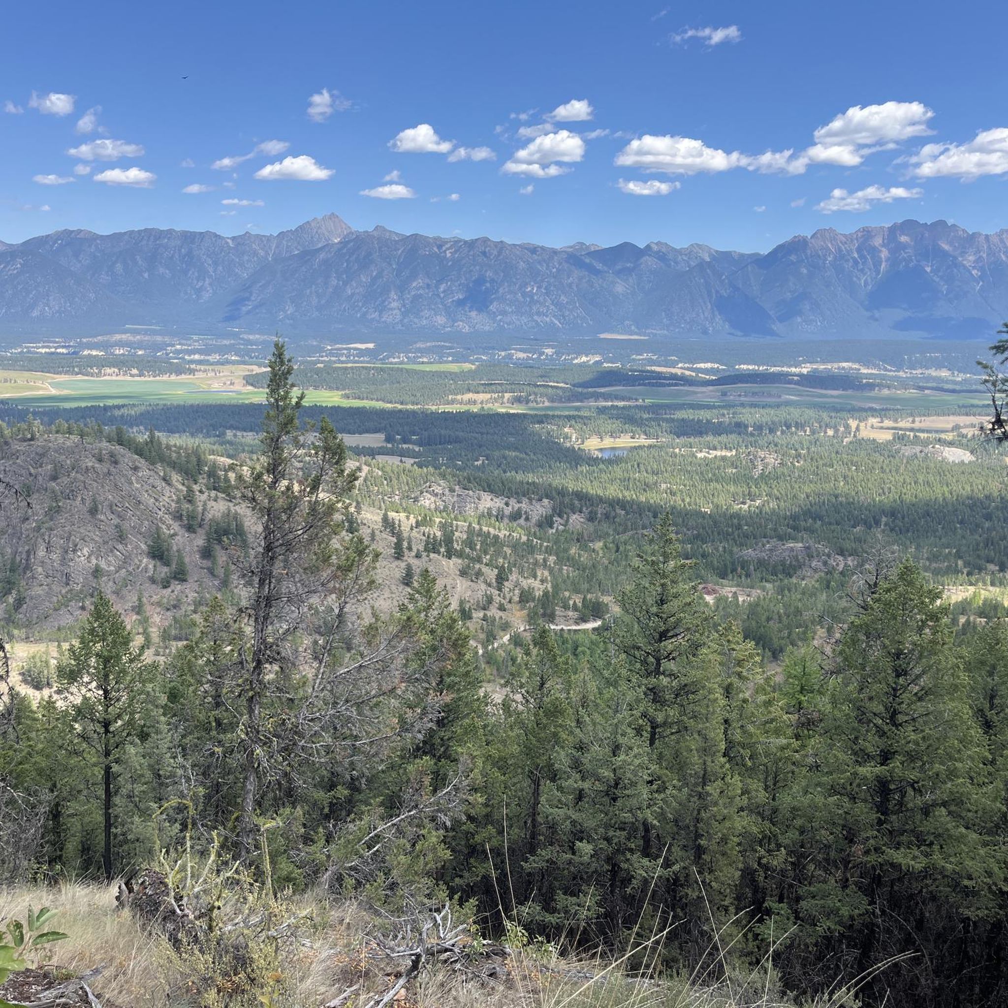
Lakit Lookout sits at around 2,346 metres and has a replica fire lookout that offers free overnight stays on a first-come, first-served basis, with a small wood stove, desk, and cot inside. From here, you can look across the Purcell Mountains to the west and the Rockies to the east, with the Kootenay River winding through the valley in between. On a clear day, you can also see Fort Steele, St. Eugene Mission, Cranbrook and the ski runs at Kimberley Alpine Resort. There is also a picnic table here, making it a perfect spot to take your time and enjoy the scenery over lunch.
0
0
This trail is short but relatively steep, climbing about 480 meters over a distance of around two kilometres to reach Lakit Lookout and cabin. It begins in a forested area before transitioning to more open, rocky terrain, and as you approach the ridge, there are stunning views of the surrounding mountains and the Rocky Mountain Trench. Some sections of the trail can be dry and loose underfoot, so it’s a good idea to wear sturdy footwear and carry plenty of water, especially on warm days.
0
0
This trailhead has a small parking area and a pit toilet, but reaching it requires driving several kilometres along a rough forest service road. The final section is narrow, uneven and rocky, so a high-clearance 4WD vehicle is strongly recommended. If your vehicle isn’t suitable for the roughest section, there is a wide pullout about ½ kilometre before the trailhead where you can park and walk the rest of the way.
0
0

Bisaro Cave is one of the main highlights along Heiko’s Trail, tucked into the mountainside after a steady climb through the forest. When you reach it, you can step inside and explore a short distance, with the cave opening up just enough to feel immersive without needing any special equipment. The rock formations and cool air inside make it a unique stop compared to the rest of the hike. Just be mindful of your footing, as it can be damp and uneven underfoot, especially near the entrance.
0
0
You can drive all the way up to the Heiko Trailhead and park here if your vehicle is high clearance and suitable for rough forest service roads. From here, the trail heads straight into dense forest and quickly begins to climb, with ladders, wooden bridges, and sections that feel more adventurous than your typical hike. Along the way, you’ll pass small waterfalls and openings to mountain views, with Bisaro Cave and a canyon further along. It’s a beautiful trail from the very start and feels like an adventure right away.
0
0
Along Heiko's Trail Access Road, you’ll find a lower parking area that’s suitable for most vehicles. If your car isn’t high clearance or four-wheel drive, it’s best to park here. If you’re confident driving rough forest service roads and have the right vehicle, you can continue for about two kilometres further up to reach the main Heiko's Trail trailhead and park there instead.
0
0
At the end of the Perry Creek Trail in East Kootenay, you reach Perry Creek Falls, where the creek drops over a rugged rock face into a narrow gorge. The viewpoint is set slightly back, so you’re looking across at the falls rather than right beside them, but you still get a clear view of the cascade and the surrounding forest. After following the creek the whole way, this feels like a natural turnaround point and the highlight of the hike.
0
0
The Perry Creek Trail in East Kootenay is a short out-and-back route that follows the creek through dense forest toward a waterfall. The path is easy to follow for most of the way, with a mix of dirt trail and a few rougher sections where the ground can be uneven or washed out. You stay close to the water as you walk, with the sound of the creek alongside you, before reaching a viewpoint at Perry Creek Falls.
0
0
Frequently Asked Questions
What kind of terrain and difficulty levels can I expect on hikes in Area C (Moyie/Bull River)?
Area C offers a diverse range of terrain, from gentle paths around lakes and rivers to challenging mountain ascents. You'll find trails like the easy 2.1 km Moyie Falls hike, moderate routes such as the 4.8 km Bear Lake Trail with significant elevation gain, and difficult climbs like the 6.9 km Mount Fisher Trail which rewards with panoramic summit views. The region features forests, valleys, wetlands, and rugged mountain landscapes.
Are there any family-friendly hiking options in Area C (Moyie/Bull River)?
Yes, there are several family-friendly options. The Moyie Falls hike is an easy 2.1 km trail, perfect for a shorter outing. Additionally, Moyie Lake Provincial Park offers two nature trails, the 'Kettle Pond' Trail and the 'Meadow Trail,' which are easy walks with interpretive signage, ideal for families to explore the local forest community.
Can I bring my dog on the hiking trails in Area C (Moyie/Bull River)?
Many trails in Area C are dog-friendly, but it's always best to check specific trail regulations before you go. Generally, dogs are welcome on leash in most provincial parks and on many hiking trails. For example, the Bull River Trail is popular for walking with dogs, offering scenic views along the river.
Are there any hikes that feature waterfalls in Area C (Moyie/Bull River)?
Yes, the Moyie Falls hike is an easy 2.1 km trail that leads to the picturesque Moyie Falls, offering a rewarding natural feature for a shorter walk.
Are there any scenic loop trails in Area C (Moyie/Bull River)?
The Bull River Trail offers a scenic loop option that follows the clear, cold mountain river. This easy 4.64 km loop provides frequent views of the river, its gravel bars, and the surrounding mountains, making it a popular choice for hikers, bikers, and horseback riders.
What natural features or viewpoints can I expect to see while hiking in Area C (Moyie/Bull River)?
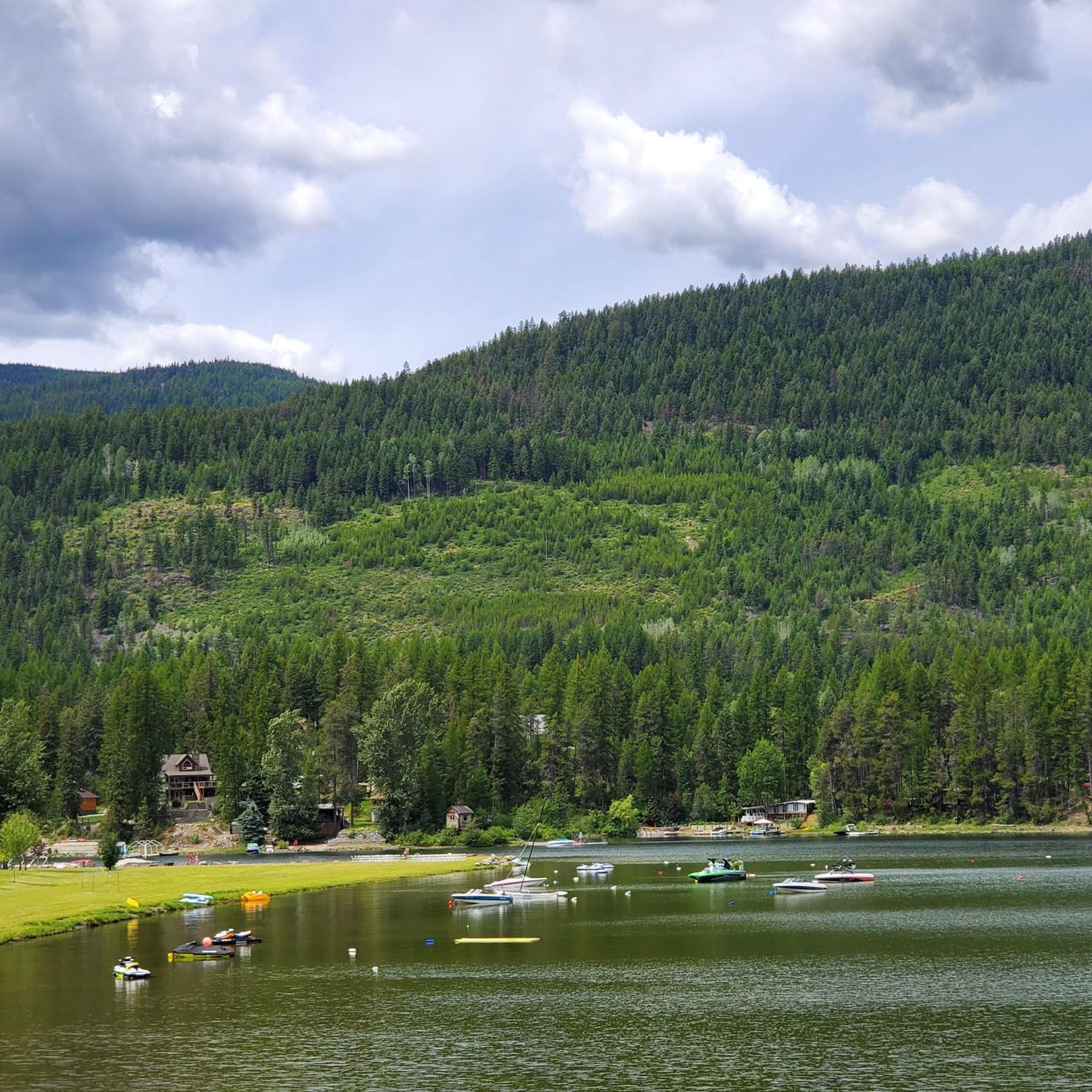
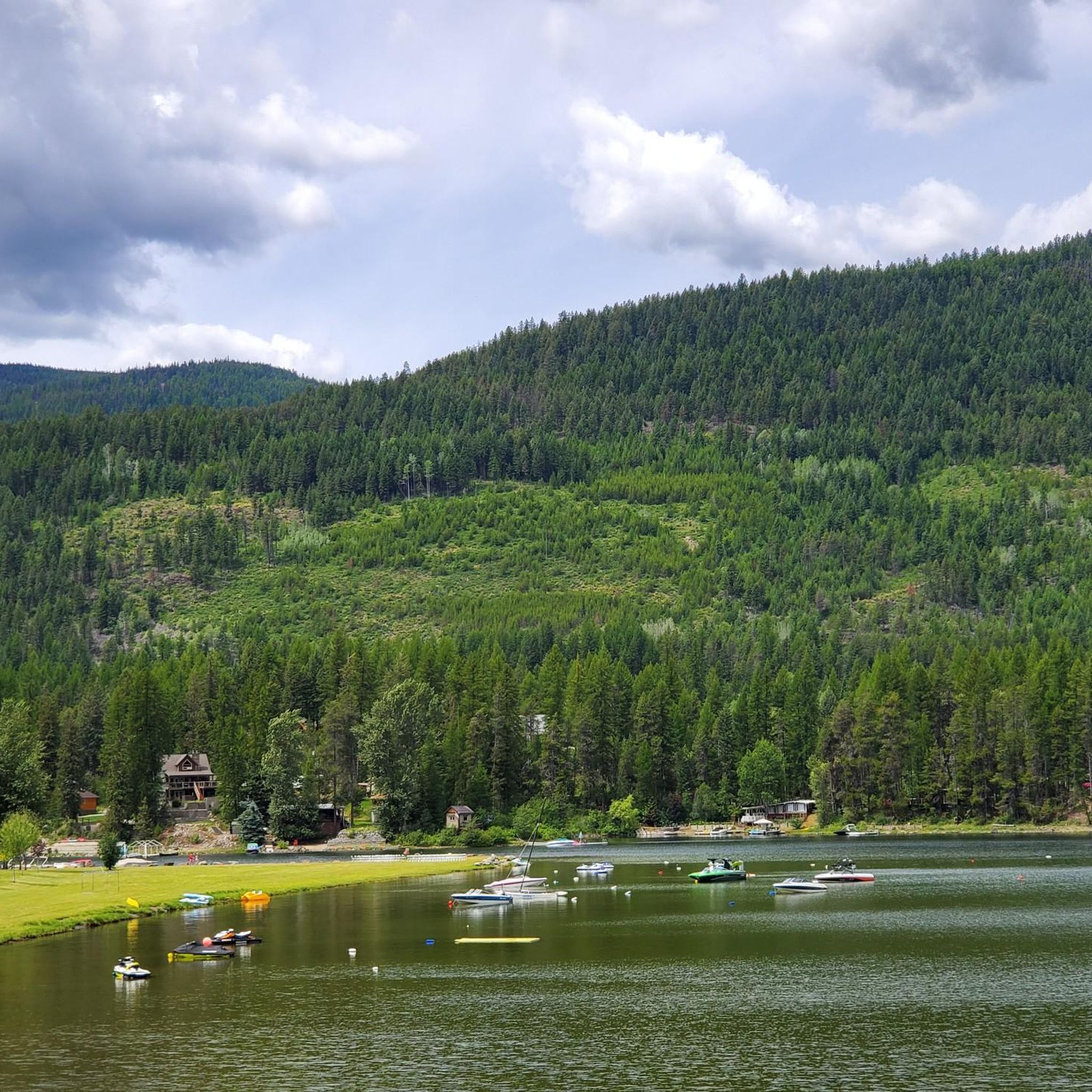
Hikers can expect stunning views of the Purcell Mountains to the west and the Rocky Mountains to the east, especially from higher elevation trails like the Mount Baker Trail. You'll also encounter the deep blue waters of Moyie Lake, the scenic canyon carved by the Bull River, and diverse landscapes including forests, valleys, and wetlands.
Is Area C (Moyie/Bull River) a good place for wildlife viewing during a hike?
Yes, Area C is an excellent location for wildlife viewing. The Bull River Conservation Complex, in particular, is an important winter range for elk, mule deer, white-tailed deer, and Rocky Mountain Bighorn Sheep. The diverse habitats throughout the region, including forests and wetlands, also support a variety of bird species and other animals, offering good opportunities for wildlife photography.
What is the best time of year to go hiking in Area C (Moyie/Bull River)?
The best time for hiking in Area C is generally from late spring through early fall (May to October), when trails are clear of snow and weather conditions are most favorable. Summer offers warm temperatures for lake activities, while fall provides vibrant foliage. Some lower elevation trails may be accessible earlier or later in the season.
Is parking readily available at trailheads in Area C (Moyie/Bull River)?
Parking is generally available at popular trailheads and access points, especially within Moyie Lake Provincial Park and at the start of well-known trails. It's always advisable to check specific trail information or local park websites for details on parking facilities and any potential fees before your visit.
How many hiking trails are available in Area C (Moyie/Bull River)?
There are over 10 hiking trails available in Area C (Moyie/Bull River), offering a range of experiences from easy walks to challenging mountain ascents. These routes have been explored by over 400 hikers using komoot.
What do other hikers enjoy most about the trails in Area C (Moyie/Bull River)?
The trails in Area C (Moyie/Bull River) are highly rated by the komoot community, with an average score of 4.6 stars from over 27 reviews. Reviewers often praise the stunning natural beauty, diverse landscapes ranging from serene lakes to rugged mountains, and the variety of trails suitable for different skill levels.
Can I hike around Moyie Lake?
Yes, Moyie Lake Provincial Park, located on the eastern fringe of the Purcell Mountains, offers public access to the lake and features two dedicated nature trails: the 'Kettle Pond' Trail and the 'Meadow Trail.' These trails provide an opportunity to explore the local forest community and enjoy views of the deep blue waters of Moyie Lake.
Most popular routes around Area C (Moyie/Bull River)
Most popular attractions around Area C (Moyie/Bull River)

Get inspired with the komoot mobile app


Explore more
Browse the best Hikes in other regions.
