The best walks and hikes around Étang De Llat
4.6
(2058)
22,099
hikers
177
hikes
Hiking around Étang De Llat offers routes through a landscape characterized by high-altitude lakes, mountainous terrain, and the influence of the Pyrénées Catalanes Natural Regional Park. The region features prominent peaks and a network of trails connecting various bodies of water. This environment provides diverse hiking opportunities, from lakeside paths to more challenging mountain ascents.
Best hiking trails around Étang De Llat
- The most popular hiking route is Viver Lake – Lake Vallell loop from Les Angles, a difficult…
Last updated: August 18, 2026
1
hikers
5.95km
01:54
120m
120m
Moderate hike. Great for any fitness level. Mostly accessible paths. Sure-footedness required.
4.7
(25)
323
hikers
29.2km
11:17
1,190m
1,190m
Hard hike. Very good fitness required. Mostly accessible paths. Sure-footedness required.

Sign up for free
19
hikers
8.27km
04:17
630m
630m
Hard hike. Good fitness required. Sure-footedness, sturdy shoes and alpine experience required.
18
hikers
4.33km
02:53
490m
490m
Hard hike. Good fitness required. Sure-footedness, sturdy shoes and alpine experience required.
26
hikers
19.4km
09:50
1,460m
1,460m
Hard hike. Very good fitness required. Sure-footedness, sturdy shoes and alpine experience required.
Get access to more routes and recommendations from other explorers.
Sign up for free
Already have an account?
Our route recommendations are based on thousands of hikes, rides, and runs completed by other people on komoot.
Start today with a free account
Your next adventure awaits.
Login or Signup
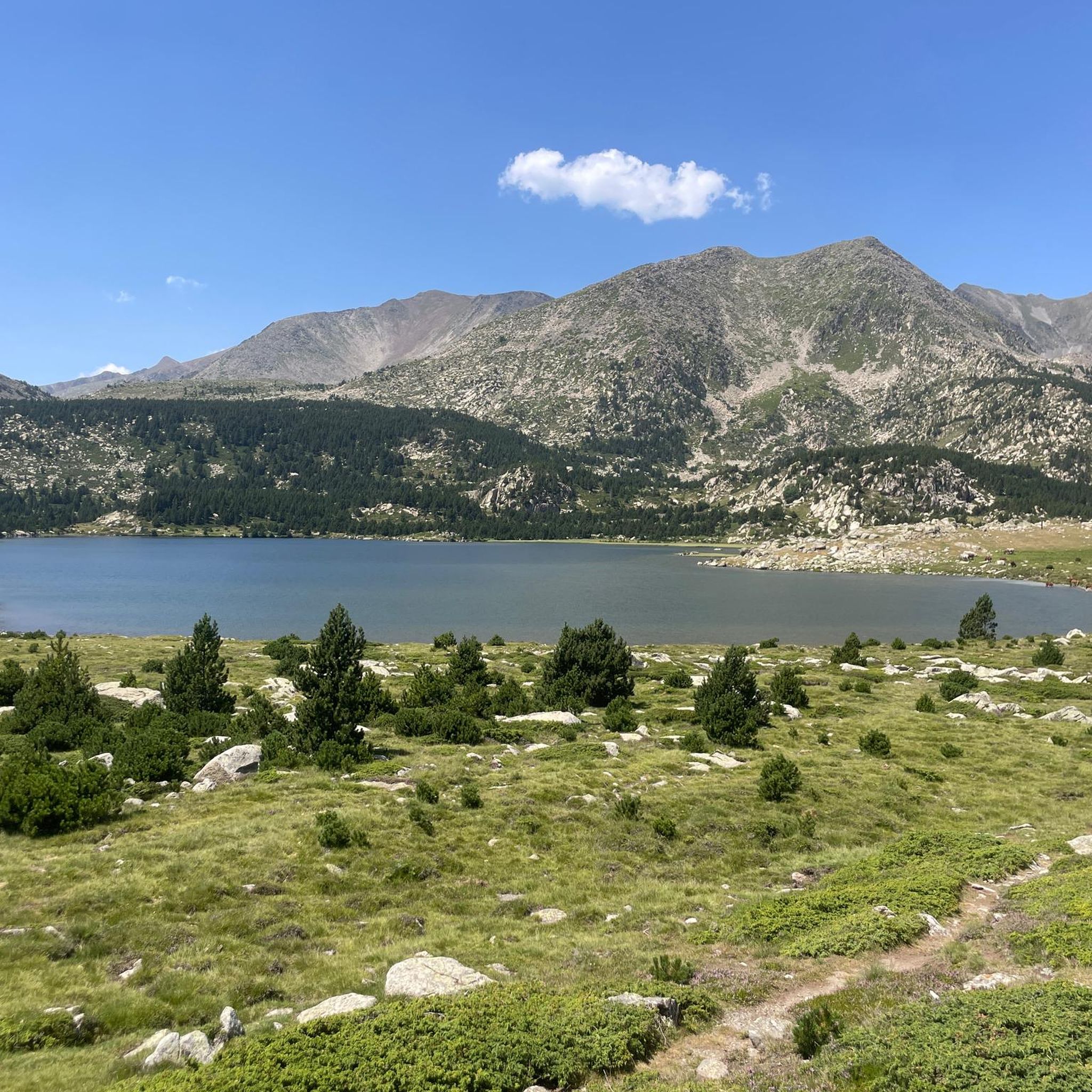
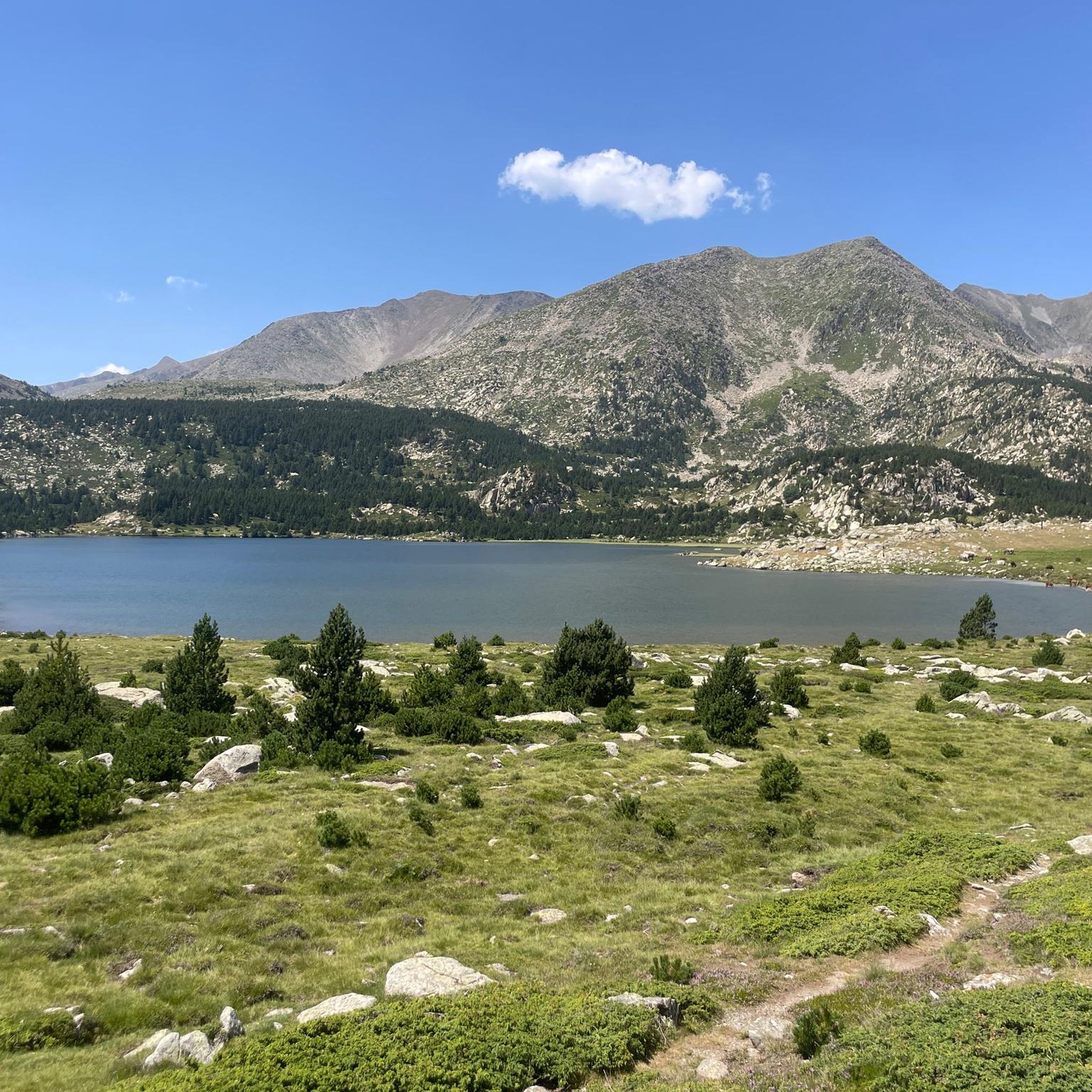
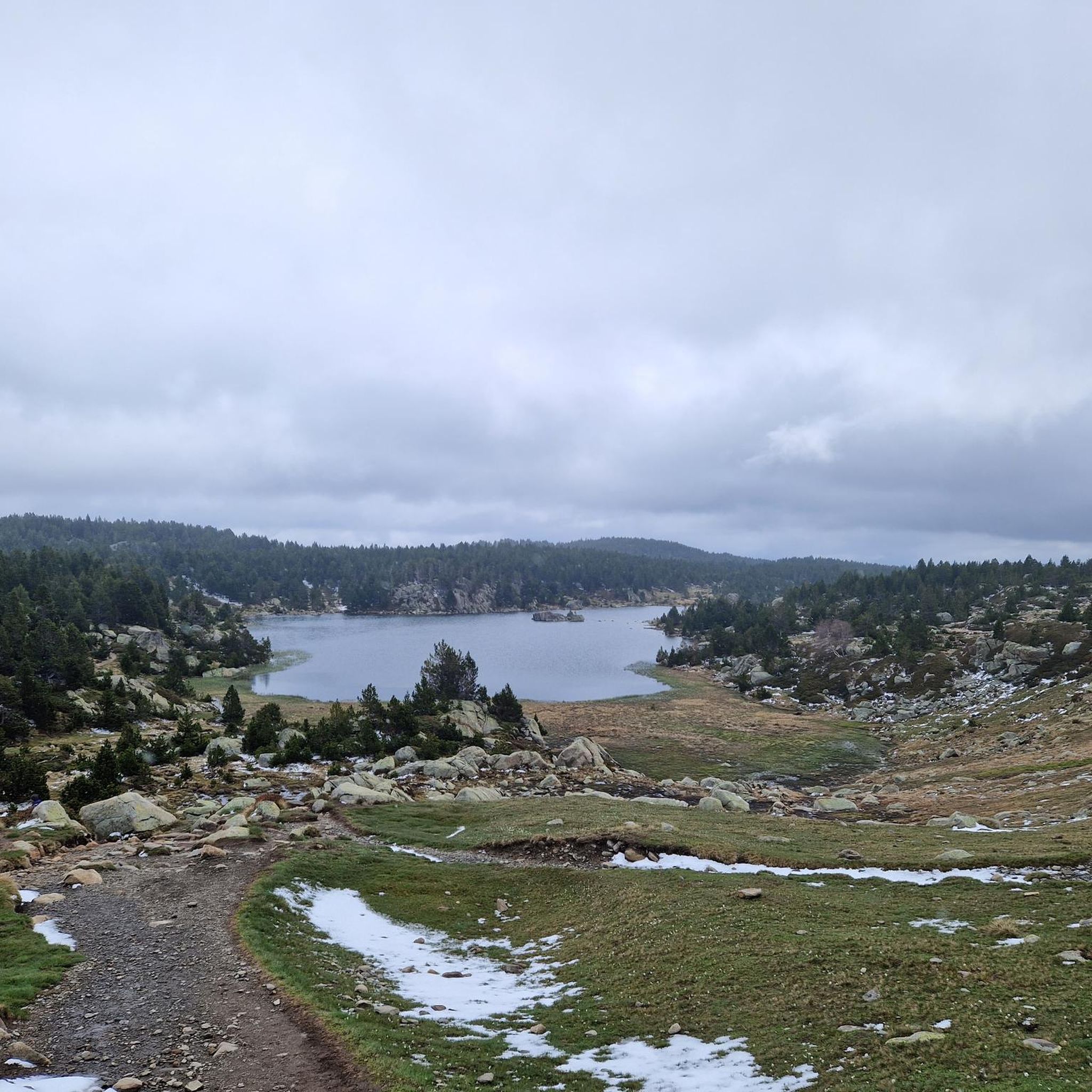
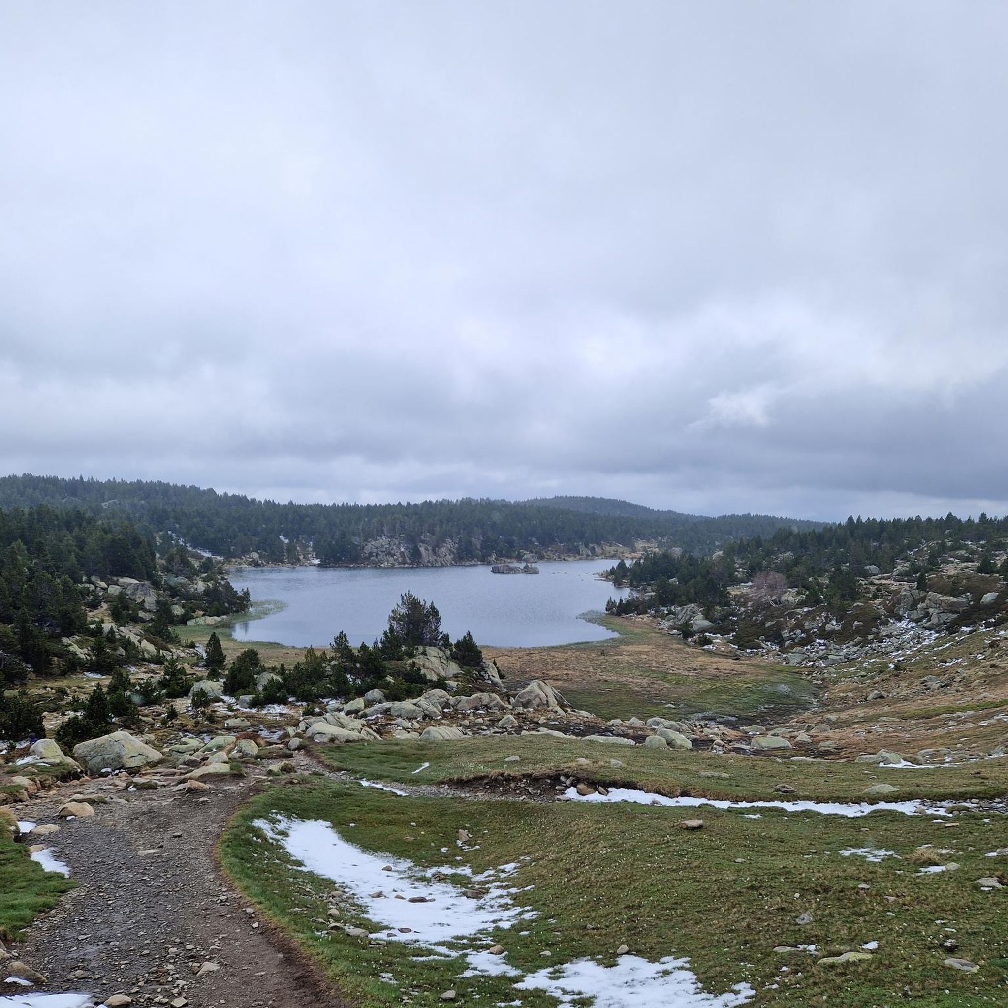

Tips from the Community

More "high mountain" atmosphere than the other lakes in Carlit
0
0

A superb lake reflecting the neighboring peaks. The morning light amplifies this mirror effect.
1
0
The ascent via the "chimney" requires handholding, but it's very gradual and features easy holds. The one-way descent is much simpler.
0
0

Snowshoeing itinerary in the Bulloses area https://www.youtube.com/watch?v=esdackshECU
0
0

At an altitude of 2,330 metres, this lake is located in a dreamlike mountain environment. From there you can see the Carlit peak, the highest point of the massif.
0
0

Nestled in a glacial basin, this small lake often lies dry in summer, revealing an impressive mineral setting, surrounded by meadows and imposing peaks. The trails leading to the lake offer magnificent views of the surrounding mountains and allow you to enjoy the tranquility of this timeless place.
1
0
Frequently Asked Questions
How many hiking trails are available around Étang De Llat?
There are over 180 hiking routes documented on komoot for the Étang De Llat region, offering a wide range of options for different skill levels and preferences. These include 42 easy, 100 moderate, and 45 difficult trails.
What are the best times of year to hike around Étang De Llat?
The best time to hike around Étang De Llat is typically from late spring through early autumn (June to September). During these months, the weather is generally more stable, and the high-altitude trails are free of snow. Always check local weather forecasts and trail conditions before heading out, especially in the shoulder seasons.
Are there any easy or family-friendly hiking options in Étang De Llat?
While many routes in Étang De Llat are challenging, there are 42 easy trails suitable for beginners or families. These often involve less elevation gain and shorter distances, focusing on the beautiful lakeside paths or lower mountain slopes. Look for routes marked as 'easy' on komoot for suitable options.
Are dogs allowed on the hiking trails around Étang De Llat?
Yes, dogs are generally allowed on hiking trails around Étang De Llat, but it's crucial to keep them on a leash, especially within the Pyrénées Catalanes Natural Regional Park. This protects local wildlife and ensures a pleasant experience for all hikers. Always carry water for your dog and clean up after them.
What kind of terrain can I expect on hikes in Étang De Llat?
Hikes in Étang De Llat feature diverse terrain, from well-trodden paths around high-altitude lakes to rocky, steep ascents towards prominent peaks like Pic Carlit. You can expect a mix of forest trails, open alpine meadows, and rugged mountain paths, often with significant elevation changes.
Are there circular hiking routes available around Étang De Llat?
Yes, many of the most rewarding hikes in Étang De Llat are circular routes. For example, the difficult Viver Lake – Lake Vallell loop from Les Angles offers extensive views around two significant lakes. Another challenging option is the Lake Vallell – Summit of Pic Carlit loop from Estany de les Dugues, which includes a challenging ascent to a major summit.
Where can I park for hiking trails near Étang De Llat?
Parking is available at various trailheads around Étang De Llat. A common starting point for many routes, including the challenging Pic Carlit hike, is the parking lot of Lac des Bouillouses. It's advisable to arrive early, especially during peak season, as parking can fill up quickly.
What should I wear for hiking in Étang De Llat during summer?
Even in summer, mountain weather can be unpredictable. It's recommended to wear layers, including moisture-wicking base layers, a fleece or insulated mid-layer, and a waterproof/windproof outer shell. Sturdy hiking boots are essential due to the varied terrain. Don't forget sun protection (hat, sunglasses, sunscreen) and plenty of water.
What do other hikers enjoy most about hiking in Étang De Llat?
The hiking trails around Étang De Llat are highly rated by the komoot community, with an average score of 4.6 stars from over 1,500 reviews. Hikers frequently praise the stunning high-altitude lakes, the panoramic views from mountain summits, and the diverse, challenging terrain within the Pyrénées Catalanes Natural Regional Park.
Are there opportunities for wild swimming after a hike in Étang De Llat?
The Étang De Llat region is dotted with numerous high-altitude lakes, offering refreshing opportunities for wild swimming after a hike. While many lakes are suitable, always exercise caution, check water temperatures, and be mindful of environmental regulations within the natural park. The clear, cool waters are a popular way to cool down after a strenuous ascent.
How long do hiking routes around Étang De Llat typically take?
Hiking durations around Étang De Llat vary significantly based on the trail's difficulty and length. Easy routes might take 1-2 hours, while moderate trails can range from 3-5 hours. More difficult routes, such as the Lake Vallell – Viver Lake loop from Pic Carlit, can take over 9 hours to complete due to their distance and significant elevation gain.
Most popular routes around Étang De Llat

Get inspired with the komoot mobile app


Explore more
Browse the best Hikes in other regions.
