The best walks and hikes around Santa Brígida
4.2
(3997)
14,936
hikers
42
hikes
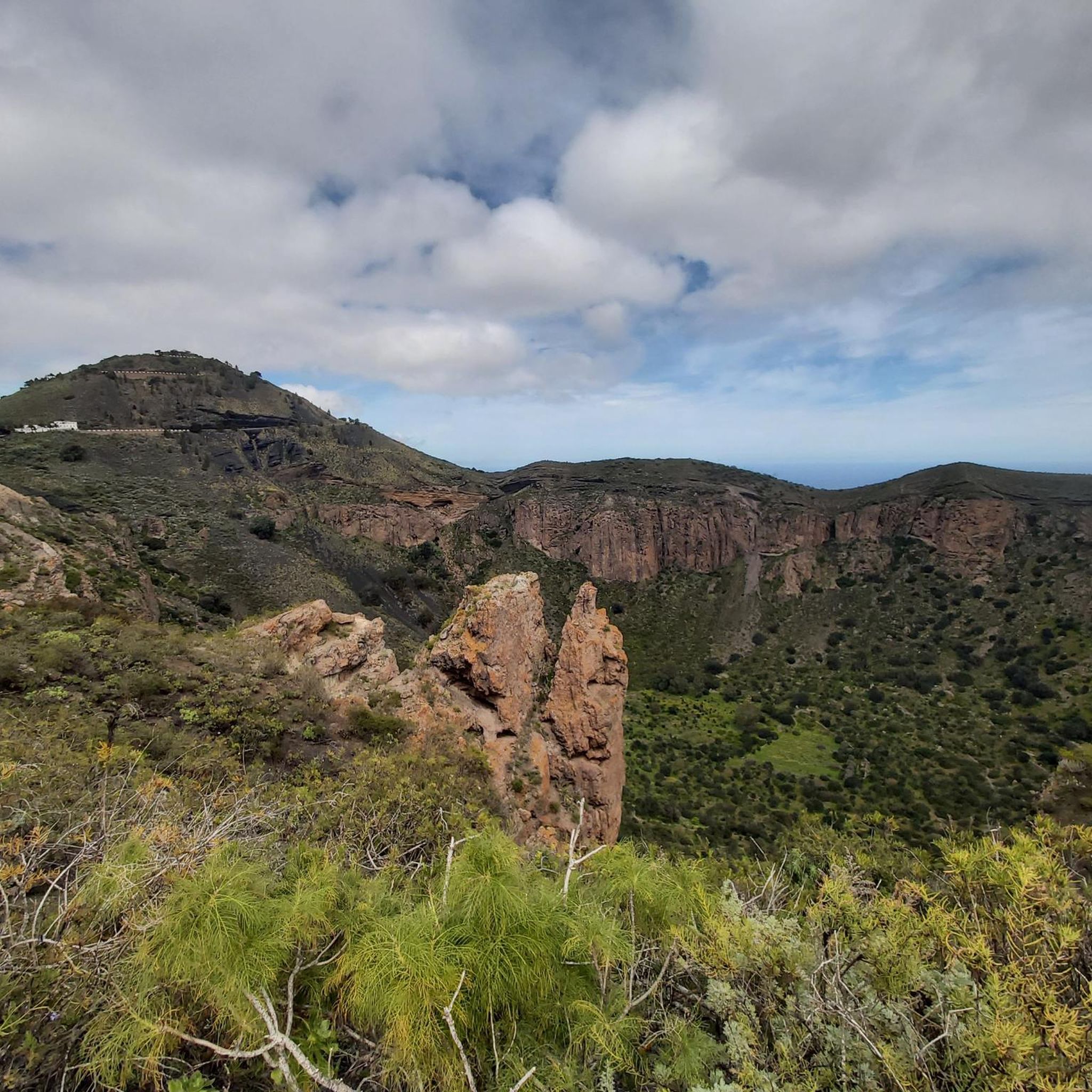
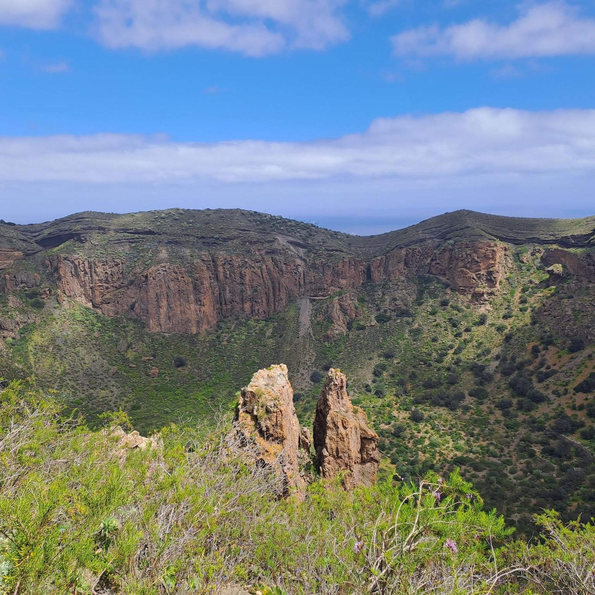
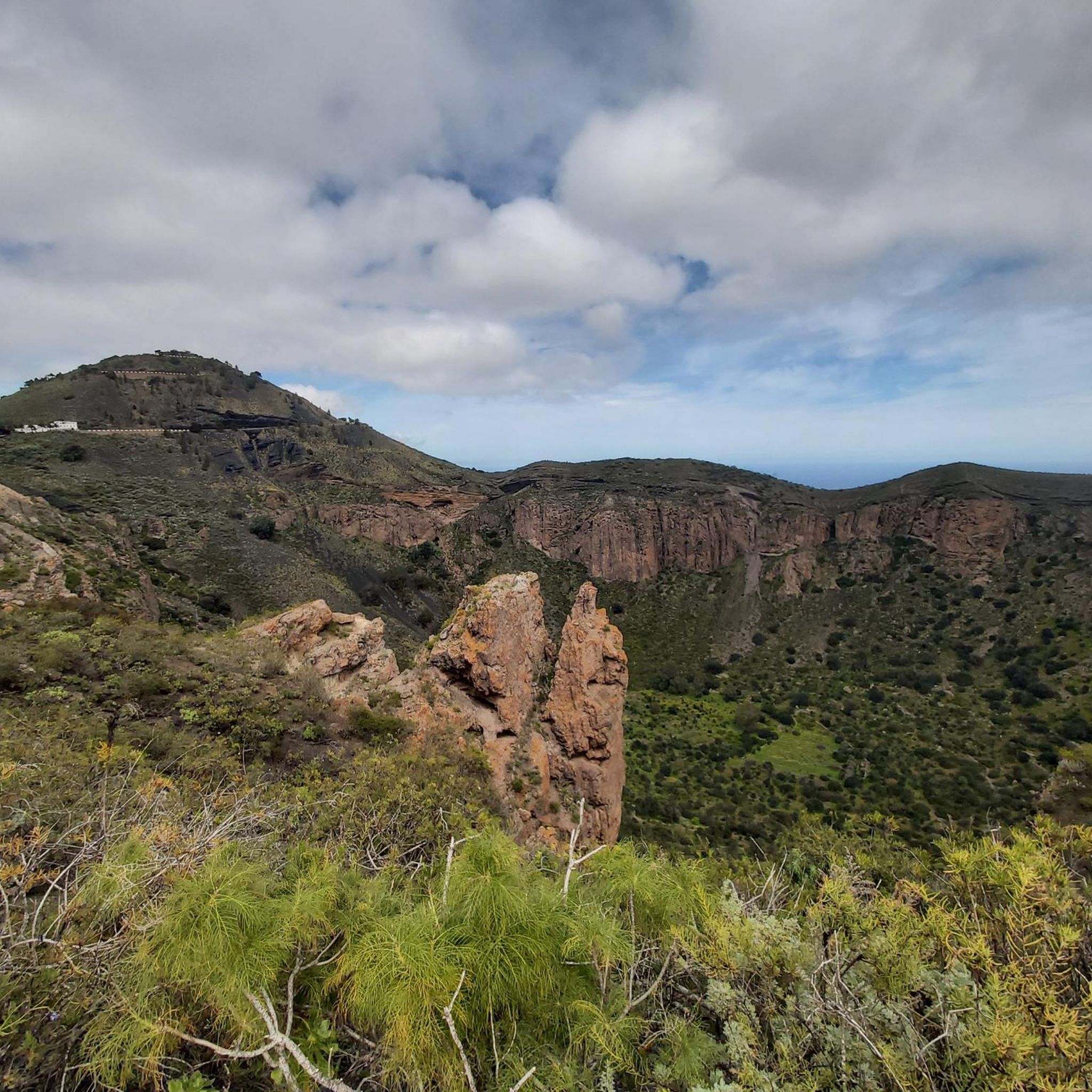
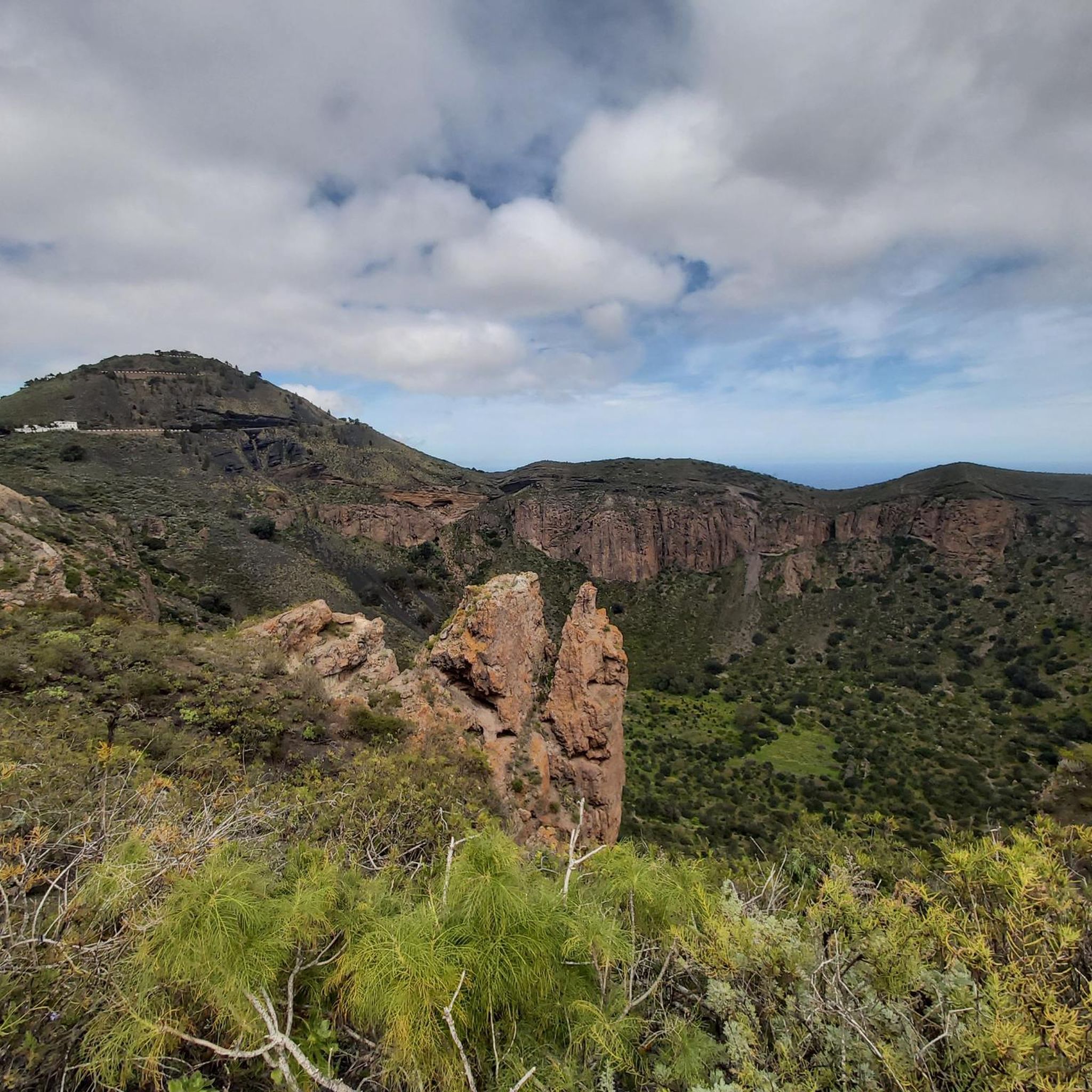
Hiking around Santa Brígida, Gran Canaria, offers routes through a landscape shaped by volcanic activity, featuring calderas, deep ravines (barrancos), and fertile valleys. The region is characterized by its varied topography, from the rim of the Bandama Caldera to lush barrancos and fertile plains adorned with vineyards and palm groves. These diverse natural features provide a range of hiking experiences year-round.
Best hiking trails around Santa Brígida
- The most popular hiking route is View of Pico de Bandama – Bandama Ridge Trail loop from Pico de Bandama, a 13.2 miles (21.3 km) trail that takes 6 hours 38 minutes to complete. This challenging route offers panoramic views from the Bandama Ridge.
- Another top favourite among local hikers is Pathway Through the Barranco – View of Santa Brígida loop from Santa Brígida, an easy 2.7 miles (4.3 km) path. This trail leads through a barranco, providing views of Santa Brígida.
- Local hikers also love the Bandama Caldera – Bandama Caldera loop from Pico de Bandama, a 3.1 miles (5.0 km) trail leading through the unique volcanic landscape of the Bandama Caldera, often completed in about 1 hour 45 minutes.
- Hiking around Santa Brígida is defined by volcanic calderas, deep barrancos, and scenic ridge trails. The network offers options for easy, moderate, and challenging hikes.
- The routes in Santa Brígida are highly rated by the komoot community with an average score of 4.2 stars from over 3,700 reviews. More than 13,900 hikers have used komoot to explore Santa Brígida's varied terrain.
Last updated: August 18, 2026
4.1
(55)
199
hikers
Easy hike. Great for any fitness level. Easily-accessible paths. Suitable for all skill levels.
4.5
(28)
102
hikers
6.13km
02:02
280m
280m
Moderate hike. Good fitness required. Easily-accessible paths. Suitable for all skill levels.

Sign up for free
4.7
(223)
945
hikers
4.96km
01:44
270m
270m
Easy hike. Great for any fitness level. Easily-accessible paths. Suitable for all skill levels.
4.3
(27)
81
hikers
10.3km
03:02
290m
290m
Moderate hike. Good fitness required. Easily-accessible paths. Suitable for all skill levels.
4.5
(27)
98
hikers
6.30km
02:04
280m
270m
Moderate hike. Good fitness required. Easily-accessible paths. Suitable for all skill levels.
Get access to more routes and recommendations from other explorers.
Sign up for free
Already have an account?
Our route recommendations are based on thousands of hikes, rides, and runs completed by other people on komoot.
Start today with a free account
Your next adventure awaits.
Login or Signup

Tips from the Community

It's hard to believe that wine was already grown here in the 16th century.
0
0

This stream valley is no longer suitable for hiking. Unfortunately, we did not translate the warning from the local police and walked a bit along the stream valley. The water stinks horribly of manure or chemicals. As mentioned, there is a warning at the entrance of the valley: do not walk here!!! It is disgusting!!!
0
0
The dragon tree is great, the path to it is not! You hike along a small stream, sometimes even in the streambed. Unfortunately, the water stinks quite disgustingly. 🤮 and indeed at the beginning of the valley there is a warning sign from the local police. Apparently, chemicals or slurry are being discharged. This path can no longer be walked!!!
0
0

Wanted to walk this round. It had rained heavily the night before, so the route was blocked halfway by a heavy, fast-flowing waterfall on the path we had to walk over. So back.
0
0

Nice rest area
1
0

Old farmstead with a still preserved old wine press in front of it.
1
0
You should definitely descend into the crater and then walk the circular trail. The path down is very slippery due to the fine scree, so you'll need to wear proper footwear. At the bottom, you'll find fantastic views of the steep crater walls. A must-visit is the Casa de Augustin.
1
0
Old farmstead with an old wine press, as wine was once grown in the crater.
1
0
Frequently Asked Questions
How many hiking trails are available in Santa Brígida?
There are over 35 hiking trails around Santa Brígida, offering a diverse range of experiences through volcanic landscapes, barrancos, and fertile valleys. These routes cater to various fitness levels, from easy strolls to more challenging treks.
Are there easy hiking options in Santa Brígida?
Yes, Santa Brígida offers several easy hiking options. For example, the Pathway Through the Barranco – View of Santa Brígida loop from Santa Brígida is an easy 2.7-mile (4.3 km) path that provides scenic views. Another accessible option is the Bandama Caldera – Bandama Caldera loop from Pico de Bandama, which is 3.1 miles (5.0 km) and explores the unique volcanic crater.
What kind of landscapes can I expect to see on hikes in Santa Brígida?
Hiking in Santa Brígida offers a varied landscape shaped by volcanic activity. You'll encounter dramatic calderas like the Bandama Caldera, deep ravines known as barrancos, and lush, fertile valleys. Trails often wind through agricultural terraces and past traditional Canarian architecture, providing a rich blend of natural beauty and cultural insight.
Are there any waterfalls to see while hiking near Santa Brígida?
Yes, the area around Santa Brígida features several waterfalls, especially after rainfall. You can find highlights such as the Small Waterfall and the Large Waterfall. There's also a Double Waterfall and the natural pool of El Charco de la Paloma, offering refreshing sights along your hike.
What is the best time of year to go hiking in Santa Brígida?
Santa Brígida enjoys a mild climate year-round, making it suitable for hiking in most seasons. However, the cooler months from October to May are generally preferred, as temperatures are more comfortable for extended walks. During summer, it's best to hike early in the morning or late afternoon to avoid the midday heat.
Is it possible to hike in Santa Brígida during winter?
Yes, winter is an excellent time for hiking in Santa Brígida. The temperatures are pleasantly mild, typically ranging from 15-20°C (59-68°F), and the landscape is often greener due to seasonal rains. This makes for very comfortable hiking conditions without the intense heat of summer.
Are there any family-friendly hiking trails in Santa Brígida?
Many of the easier routes in Santa Brígida are suitable for families. The Pathway Through the Barranco – View of Santa Brígida loop from Santa Brígida is a relatively short and easy option. The Bandama Caldera – Bandama Caldera loop from Pico de Bandama is also a good choice, offering an engaging exploration of a volcanic crater that can be enjoyed by children.
Are dogs allowed on the hiking trails in Santa Brígida?
Generally, dogs are welcome on many of the hiking trails in Santa Brígida, especially in natural areas. However, it's always advisable to keep them on a leash, particularly in protected areas or near livestock, and to clean up after them. Check specific trail regulations if you plan to visit a nature reserve.
Can I find circular hiking routes in Santa Brígida?
Yes, many of the trails around Santa Brígida are designed as circular routes, allowing you to start and end at the same point. Examples include the popular View of Pico de Bandama – Bandama Ridge Trail loop from Pico de Bandama and the Dragon Tree in Barranco Alonso – View of the Valley and Caves loop from Santa Brígida.
What are some more challenging hikes around Santa Brígida?
For those seeking a challenge, Santa Brígida offers routes with more significant elevation changes and longer distances. While specific 'difficult' routes are fewer, moderate trails like the View of Pico de Bandama – Bandama Ridge Trail loop from Pico de Bandama (3.6 miles, 2 hours) or the Dragon Tree in Barranco Alonso – View of the Valley and Caves loop from Santa Brígida (6.4 miles, 3 hours) provide a good workout with rewarding views.
How can I reach the trailheads using public transport in Santa Brígida?
Santa Brígida is served by local bus routes (guaguas) from Las Palmas de Gran Canaria, making some trailheads accessible. For routes starting directly from Santa Brígida town, public transport is a viable option. For more remote starting points, it's recommended to check local bus schedules for specific routes or consider a taxi.
Is parking available at the trailheads in Santa Brígida?
Parking availability varies by trailhead. In Santa Brígida town, you can usually find street parking or designated areas. For popular spots like Pico de Bandama, there is often parking near the viewpoint. For less frequented trails, roadside parking might be an option, but it's always good to plan ahead and check the starting point on a map.
What do other hikers say about the trails in Santa Brígida?
The hiking trails in Santa Brígida are highly rated by the komoot community, with an average score of 4.2 stars from over 3,700 reviews. Reviewers often praise the stunning panoramic views, the unique volcanic landscapes, and the peaceful atmosphere of the barrancos. Many appreciate the variety of routes available for different skill levels.
Are there any interesting natural landmarks or attractions near the hiking routes?
Absolutely. Beyond the trails themselves, you can explore significant landmarks. The Crest Trail – Bandama Caldera offers incredible views into the caldera. Further afield, but still within reach, are the iconic Pico de las Nieves summit and the famous Roque Nublo Trail, both offering spectacular vistas of Gran Canaria.
Most popular routes around Santa Brígida
Most popular attractions around Santa Brígida

Get inspired with the komoot mobile app


Explore more
Browse the best Hikes in other regions.
