The best walks and hikes around Saint-Martin-Du-Frêne
4.4
(732)
4,624
hikers
146
hikes
Hiking around Saint-Martin-Du-Frêne, located in the Ain department of the Auvergne-Rhône-Alpes region in eastern France, offers a diverse landscape. The area features the Oignin plain, Colléjard mountain, Chamoise plateau, and the Monts d'Ain. Elevations range from approximately 476 meters to 1,125 meters, providing varied terrain for hikers. Notable natural features include the glacial Lac de Nantua and panoramic viewpoints from the Monts d'Ain.
Best hiking trails around Saint-Martin-Du-Frêne
- The most popular hiking route is Tour des Fècles, a 6.1…
Last updated: June 27, 2026
4.3
(41)
325
hikers
9.85km
03:52
440m
440m
Moderate hike. Good fitness required. Mostly accessible paths. Sure-footedness required.
4.8
(21)
161
hikers
14.7km
05:06
550m
550m
Hard hike. Very good fitness required. Sure-footedness, sturdy shoes and alpine experience required.

Sign up for free
4.6
(54)
406
hikers
6.93km
01:50
70m
70m
Easy hike. Great for any fitness level. Easily-accessible paths. Suitable for all skill levels.
4.4
(18)
143
hikers
13.9km
04:40
630m
630m
Moderate hike. Good fitness required. Mostly accessible paths. Sure-footedness required.
4.4
(10)
82
hikers
22.6km
07:01
740m
740m
Hard hike. Very good fitness required. Mostly accessible paths. Sure-footedness required.
Get access to more routes and recommendations from other explorers.
Sign up for free
Already have an account?
Our route recommendations are based on thousands of hikes, rides, and runs completed by other people on komoot.
Start today with a free account
Your next adventure awaits.
Login or Signup

Tips from the Community

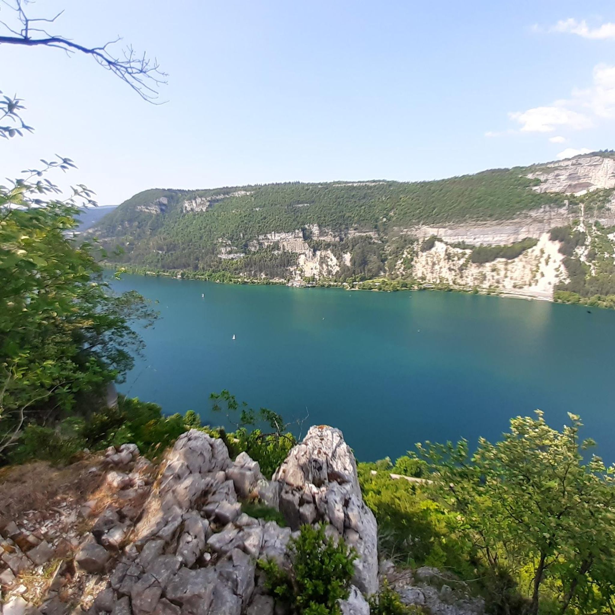
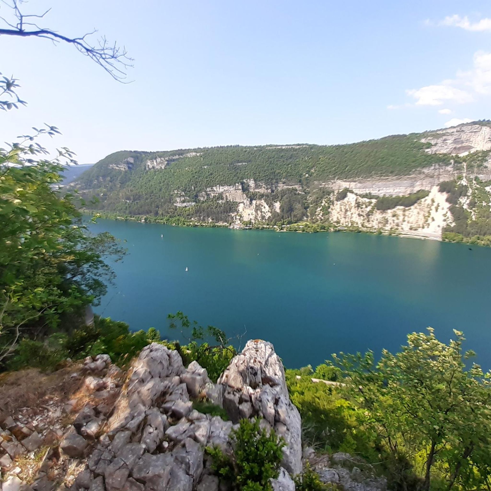
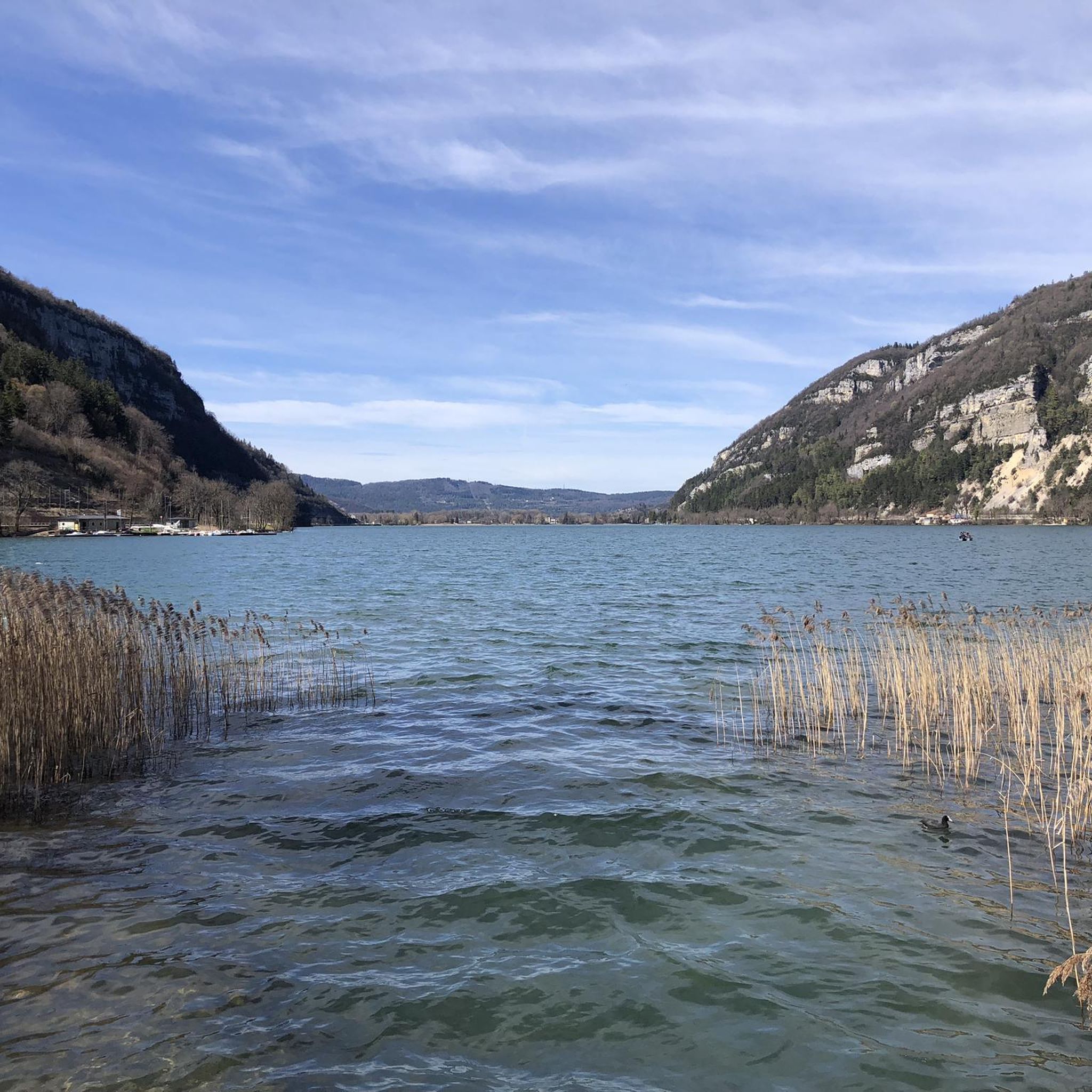
The Lac de Nantua is a superb body of water of 141 hectares. In the heart of the Jura, it offers an ideal setting for practicing a multitude of sports. It is even possible to swim in its waters.
1
0

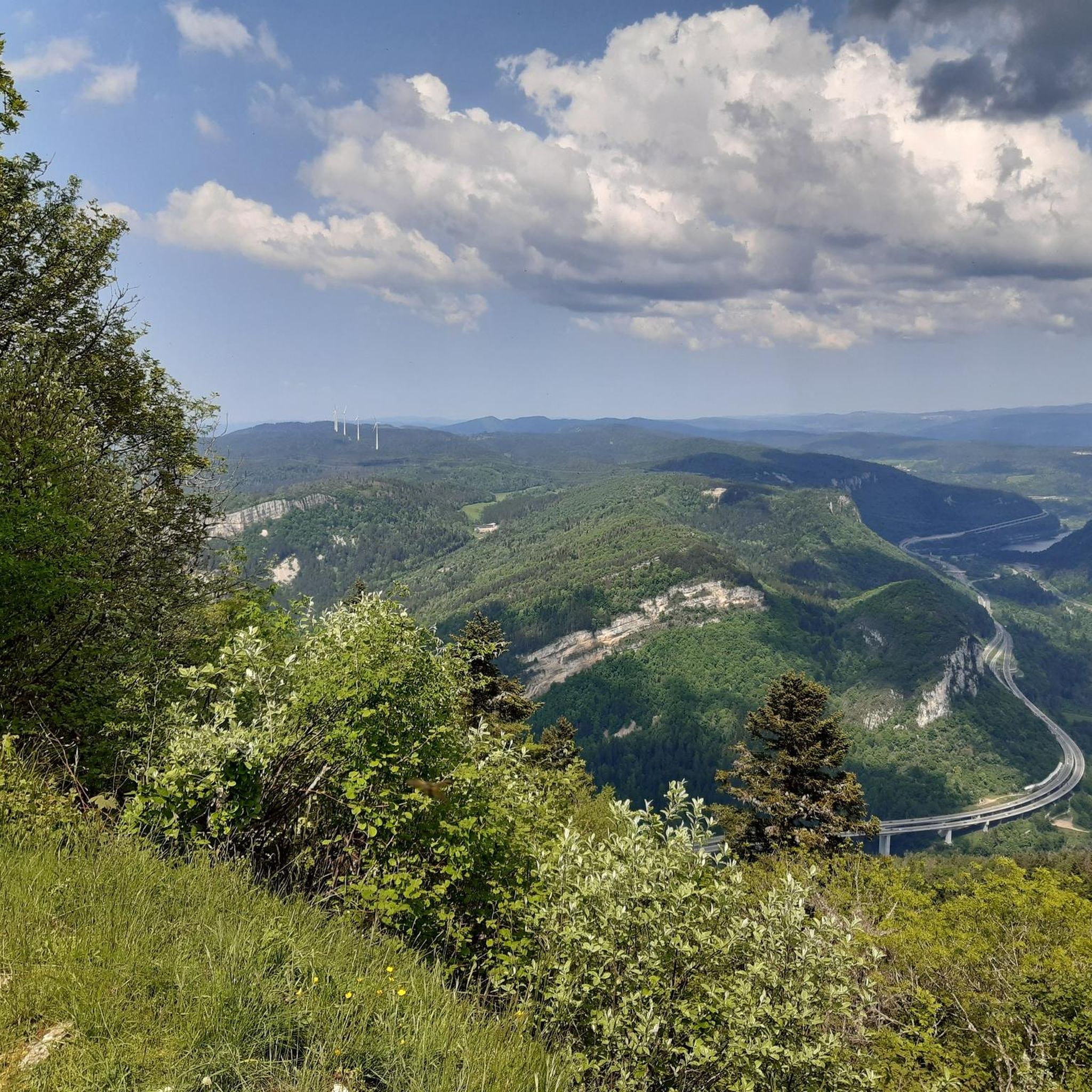
Beautiful varied hike, with 4 viewpoints from different directions.
0
0

Beautiful, simple, easy walk; lots of traffic noise on the "road" section, a bit of a shame, but the color of the water is magical
1
0


The Chemin des Fècles offers a superb route. As you follow this path which passes from deep woods to steep cliffs, be extremely careful not to go too far to the edge of the void. Above all, respect the safety instructions.
1
0

Impressive rock above Mantua
0
0

Natural jewel, sapphire blue or emerald green waters, nautical activities.
1
0
Frequently Asked Questions
How many hiking trails are available in Saint-Martin-Du-Frêne?
There are over 140 hiking trails around Saint-Martin-Du-Frêne, offering a wide variety of options for different skill levels and preferences. The komoot community has rated these routes with an average of 4.5 stars.
What kind of landscapes can I expect to see while hiking in Saint-Martin-Du-Frêne?
The region offers a diverse landscape, from the Oignin plain to the Colléjard mountain, and the Chamoise plateau leading up to the Monts d'Ain. You'll encounter varied terrain, including forests, plateaus, and the serene glacial Lac de Nantua.
Are there easy hiking routes suitable for beginners or families in Saint-Martin-Du-Frêne?
Yes, Saint-Martin-Du-Frêne offers nearly 50 easy hiking routes, perfect for beginners or families. Many of these trails are less strenuous and provide enjoyable walks, such as the Lake Nantua – Lake Nantua loop from Port, which offers pleasant lakeside views.
Can I find challenging hikes for experienced trekkers in the area?
Absolutely. For experienced trekkers, there are 7 difficult routes available. These often involve more significant elevation changes and longer distances, such as The wonderful rock and lake of Nantua - loop, which covers nearly 15 km with substantial ascents.
Are there any hikes with panoramic viewpoints in Saint-Martin-Du-Frêne?
Yes, the region is known for its stunning viewpoints. Hikes on the Chamoise plateau and Monts d'Ain, particularly towards "Le Signal" (1127m), can offer remarkable 180-degree panoramic views, including the Alpine chain and Mont Blanc on clear days. The Roche d'au delà also provides stunning views over Nantua and its glacial lake.
Are there any waterfalls to see on the trails around Saint-Martin-Du-Frêne?
Yes, you can find waterfalls in the vicinity. The Cascade de la Pisse Vache is one such natural monument that hikers can explore near Saint-Martin-Du-Frêne.
What natural attractions can I explore near the hiking trails?
Beyond the trails themselves, you can visit the beautiful glacial Lake Nantua, explore the fascinating Cerdon Caves, or even discover the Dinosaur Footprints of Villette. These sites offer unique experiences to complement your hiking adventures.
What is the best time of year to go hiking in Saint-Martin-Du-Frêne?
The region is generally pleasant for hiking from spring through autumn. Spring brings lush greenery and blooming wildflowers, while autumn offers vibrant foliage. Summer is also popular, but be prepared for warmer temperatures, especially on exposed trails. Winter hiking is possible but may require appropriate gear for snow and ice at higher elevations.
Are there any circular walks available in Saint-Martin-Du-Frêne?
Many of the trails in Saint-Martin-Du-Frêne are designed as circular routes, allowing you to start and end at the same point. An example is the Lake Nantua – View of the Lake loop from Le Chateau, which provides a scenic circuit around the glacial lake.
What do other hikers enjoy most about hiking in Saint-Martin-Du-Frêne?
The komoot community highly rates the hiking experience in Saint-Martin-Du-Frêne, with an average score of 4.5 stars from over 600 reviews. Hikers often praise the diverse terrain, the stunning panoramic views from the Monts d'Ain, and the serene beauty of Lac de Nantua.
Are there any specific geological features to look out for?
Yes, the area boasts distinctive geological formations. Keep an eye out for the "Doigts du Diable" (Devil's Fingers) near the Roche d'au delà, which offer unique rock formations and impressive views over the Nantua valley.
Is there parking available at the trailheads?
While specific parking details vary by trailhead, many popular hiking areas and attractions in Saint-Martin-Du-Frêne and its surroundings offer designated parking facilities. It's advisable to check the starting point of your chosen route for specific parking information.
Most popular routes around Saint-Martin-Du-Frêne
Most popular attractions around Saint-Martin-Du-Frêne

Get inspired with the komoot mobile app


Explore more
Browse the best Hikes in other regions.
