The best walks and hikes at the Αποκεντρωμένη Διοίκηση Αιγαίου
4.4
(19411)
98,807
hikers
2,403
hikes
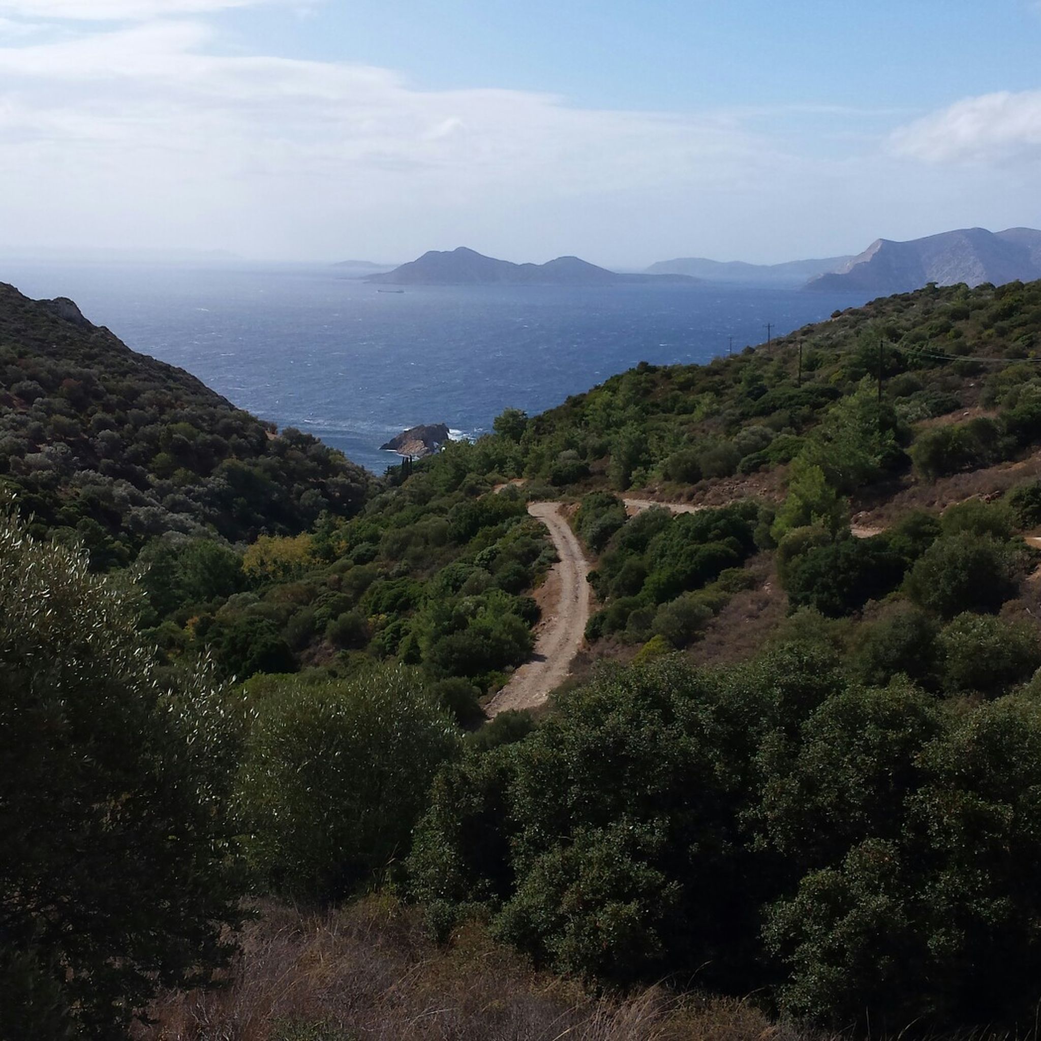
Hiking at the Αποκεντρωμένη Διοίκηση Αιγαίου offers diverse landscapes across its numerous islands. The region features dramatic volcanic terrains, such as those found on Santorini, alongside mountainous islands like Samothrace with challenging trails. Coastal paths provide routes overlooking the Aegean Sea, while islands such as Andros are characterized by lush green valleys and ancient pathways. Many islands are crisscrossed with ancient "kalderimia" paths, connecting villages and historical sites.
Best hiking trails at the Αποκεντρωμένη Διοίκηση Αιγαίου
- The most popular hiking…
Last updated: October 27, 2026
4.8
(548)
4,327
hikers
Moderate hike. Good fitness required. Easily walkable paths.
4.8
(523)
4,180
hikers
16.6km
05:10
660m
660m
Hard hike. Very good fitness required. Easily walkable paths.

4.8
(349)
2,861
hikers
16.0km
05:00
630m
630m
Hard hike. Very good fitness required. Easily walkable paths.
4.8
(514)
1,956
hikers
8.13km
03:28
480m
480m
Hard hike. Good fitness required. Sure-footedness, sturdy shoes and alpine experience required.
4.7
(163)
1,396
hikers
Easy hike. Easily walkable paths.
4.7
(228)
1,177
hikers
9.53km
02:30
80m
80m
Moderate hike. Good fitness required. Easily walkable paths.
4.9
(298)
1,030
hikers
10.8km
04:24
610m
620m
Hard hike. Good fitness required. Sure-footedness, sturdy shoes and alpine experience required.
4.7
(202)
948
hikers
10.00km
04:18
630m
640m
Hard hike. Good fitness required. Sure-footedness, sturdy shoes and alpine experience required.
4.8
(204)
649
hikers
7.98km
02:52
200m
200m
Hard hike. Good fitness required. Sure-footedness, sturdy shoes and alpine experience required.
4.4
(135)
430
hikers
Moderate hike. Good fitness required. Mostly walkable paths. Sure-footedness required.
Get access to more routes and recommendations from other explorers.
Already have an account?
Our route recommendations are based on thousands of hikes, rides, and runs completed by other people on komoot.
Start today with a free account
Your next adventure awaits.
Popular around Αποκεντρωμένη Διοίκηση Αιγαίου
Hiking in Samos

Hiking in Φάρος Ακρωτηρίου-Οίας (Θήρας Θέση Καλντέρας)

Hiking around Milos

Hiking in Φανάρι (Φιλοτίου Νάξου)

Hiking in Ασφενδιού - Πυλίου Δήμου Δικαίου Νήσου Κω

Hiking around Mykonos

Hiking in Lesbos

Hiking around Tinos

Hiking in Αγ. Φωκάς - Ψαλίδι - Καστέλο - Ηρακλής Νήσου Κω

Hiking in Κάστρο, Τσαγκάρη, Τσαμπί, Σαμπέη, Αέρας Δήμου Ηρακλειδών Νήσου Κω
Tips from the Community

Von der Uferpromenade hat der Betrachter einen guten Überblick auf historische- und neuen Hafenanlagen der Stadt Rhodos.
5
0

The Church of the Annunciation of the Holy Virgin Mary (Ekklisia Evangelismou) is the main church (Cathedral) of the city of Rhodes and is located directly on Mandraki harbor at Platia Eleftherias. Architecture: The building was constructed in the 1920s during the Italian rule. The exterior follows a Gothic style and is a reconstruction of the medieval Knights Hospitaller church San Giovanni, which was destroyed in 1856 by a gunpowder explosion. Interior: In contrast to the Gothic exterior, the interior is richly decorated in the Byzantine style with colorful murals, frescoes, and magnificent chandeliers. History: Originally built as a Catholic church for the Italian occupiers, the place of worship was converted into a Greek Orthodox cathedral in 1948 after the Dodecanese was annexed to Greece.
2
0
The Valley of the Butterflies (Petaloudes) on Rhodes is a shady forest valley where millions of butterflies (species: Russian Bear) live from June to September. The moths are attracted by the scent of the rare storax trees. An idyllic hiking trail leads over wooden bridges along small streams and waterfalls through the biotope.
1
0
There are butterflies and freshwater crayfish to see
1
0
The Moni Kamiri Monastery (also known as the Monastery of Archangel Michael Kamiri) is an idyllic, uninhabited monastery in the interior of Rhodes. It is located on a hill about 4 kilometers northwest of the village of Masari and around 40 kilometers from Rhodes City. The monastery complex was founded as early as the 12th century. The charming, small main chapel, dedicated to the Archangel Michael, dates from the 15th century in its current form (over 500 years old).
0
0
The Skoutouljaris gorge is a pristine gorge on Rhodes near Archangelos and Malonas, characterized by steep rock faces, a narrow rock gate, and lush vegetation along a mostly dry riverbed. It offers habitat for local animal species such as turtles and dragonflies and can be explored via moderately difficult hiking routes, often in combination with the Kamiri Monastery.
0
0
The Skoutouljaris gorge is a natural gorge on Rhodes near Archangelos and Malonas, characterized by steep rock faces, a narrow rock gate, and lush vegetation along a mostly dry riverbed. It offers habitat for local animal species such as turtles and dragonflies and can be explored via medium-difficulty hiking routes, often in combination with the Kamiri Monastery.
0
0
The Skoutouljaris Gorge is a natural gorge on Rhodes near Archangelos and Malonas, characterized by steep rock faces, a narrow rock gate, and lush vegetation along a mostly dry riverbed. It provides habitat for local animal species such as turtles and dragonflies and can be explored via moderately difficult hiking routes – often in combination with the Kamiri Monastery.
0
0
Frequently Asked Questions
How many hiking trails are available in the Αποκεντρωμένη Διοίκηση Αιγαίου region?
The Αποκεντρωμένη Διοίκηση Αιγαίου region offers a vast network of over 2,400 hiking trails. These routes cater to various preferences, with approximately 1,100 easy, 1,100 moderate, and over 200 difficult trails.
What kind of terrain can I expect when hiking in the Aegean islands?
Hiking in the Aegean islands offers incredibly diverse terrain. You'll find dramatic volcanic landscapes on islands like Santorini and Nisyros, challenging mountainous regions such as Samothrace's Saos Mountain, and lush green valleys on islands like Andros. Many routes also feature stunning coastal paths with sea views and ancient 'kalderimia' (cobbled paths) connecting villages.
Are there easy hiking routes suitable for beginners or families in the Aegean islands?
Yes, the region has over 1,100 easy routes perfect for beginners and families. For instance, the coastal trail on Koufonisia offers an easy walk past secluded beaches. Another option is the Butterfly Valley (Rhodes) loop from Petaloudes, which is an easy 3 km hike.
Can I find challenging hikes in the Αποκεντρωμένη Διοίκηση Αιγαίου?
Absolutely. The region features over 200 difficult trails for experienced hikers. Islands like Samothrace with Saos Mountain offer demanding ascents. You could also try the View of Oia – Skaros Rock loop from Oia, a challenging 16.6 km route with extensive views, or the Summit of Mount Dikeos – Trail to Dikeos loop from Zia on Kos.
Are there circular hiking routes available in the Aegean islands?
Yes, many routes in the Aegean islands are circular, allowing you to start and end in the same location. Examples include the Skaros Rock – View of Oia loop from Faros Akrotiriou-Oias on Santorini, or the Old Town of Rhodes – Mandraki Harbour, Rhodes loop from Rhodes, which combines historical sights with coastal views.
What are some natural features or landmarks I can see along the hiking trails?
The Aegean islands are rich in natural features and historical landmarks. You can explore volcanic craters like Stefanos on Nisyros, ancient pathways on Kea linking its four ancient city-states, or the unique mini-desert of Pachies Ammoudies on Lemnos. Many trails also lead to stunning viewpoints, secluded beaches, and historical sites.
Are there any waterfalls or caves to explore while hiking?
Yes, the region offers opportunities to discover waterfalls and caves. On Rhodes, you can visit the Waterfalls in Butterfly Valley. For caves, consider exploring the Zoodochos Pigi Cave and Chapel, or the Panagia Spiliani Cave Church.
What do other hikers enjoy the most about hiking in the Αποκεντρωμένη Διοίκηση Αιγαίου?
The area is highly rated by the komoot community, with an average score of 4.5 stars from over 16,000 reviews. Hikers often praise the breathtaking sea views, the unique blend of volcanic and coastal landscapes, and the opportunity to explore ancient pathways and historical sites. The diversity of trails, from easy walks to challenging ascents, is also frequently highlighted.
What is the best time of year to hike in the Aegean islands?
The best time for hiking in the Aegean islands is typically spring (April to early June) and autumn (September to October). During these periods, the weather is pleasantly mild, and the landscapes are at their most vibrant, with wildflowers in spring and comfortable temperatures for longer treks in autumn. Summers can be very hot, especially for more strenuous routes.
Are there any hikes that offer panoramic views of the caldera or the sea?
Many hikes in the Aegean islands are renowned for their stunning panoramic views. The famous Caldera Trail on Santorini, for example, offers breathtaking vistas of the Aegean Sea and iconic whitewashed villages. The View of Oia – Fira to Oia Caldera Trail loop from Imerovigli is a prime example, providing expansive caldera views.
Can I hike to the highest points of the islands for rewarding views?
Yes, several islands offer trails to their highest peaks, providing incredibly rewarding views. For instance, you can hike to the Mount Zas Summit (Naxos), which is the highest point in the Cyclades. Similarly, the Summit of Mount Dikeos – Trail to Dikeos loop from Palio Pyli on Kos offers impressive vistas.
Most popular routes at the Αποκεντρωμένη Διοίκηση Αιγαίου
Most popular attractions at the Αποκεντρωμένη Διοίκηση Αιγαίου

Get inspired with the komoot mobile app


Didn’t find what you were looking for?
Check out more Hikes throughout Αποκεντρωμένη Διοίκηση Αιγαίου below and find the perfect route in your destination.
Explore more
Browse the best Hikes in other regions.
